Looking Back at 2015 and Ahead at 2016

I have a lot to look back on this year. Personally, in 2015 I saw major changes in my workplace and my family grew from a pair to a trio. On the web, the blog has been covering a good balance of currently under construction projects as well as ones in the planning phases.

I’ve found that transit and developments are my go-to topics. I enjoy following the downtown eats scene as well. I want to try and share a little more history in 2016 and not just old photos. Trends are important to point out and with Raleigh changing so fast, important facts from history as recent as a decade ago could be relevant.

Let’s recap on a few things we talked about this year and how it’ll lead into the next.

Transit

Moore Square Transit Station

2016 could be the year that Wake County gets more serious about mass transit. With a new plan in place, created through an extensive public feedback process in 2015, we have our strongest proposal yet to ask residents of the county to tax themselves in order to pay for this new transit plan. It is expected that our county commissioners will propose a half-cent sales tax increase, dedicated to transit, to be added to the November 2016 ballot.

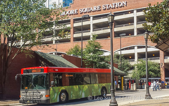
According to the plan, downtown Raleigh is a major hub of higher-frequency buses. New and improved routes would be set in place as well as an increase in destinations compared to our current network. The Moore Square Transit Station should be quite busy.

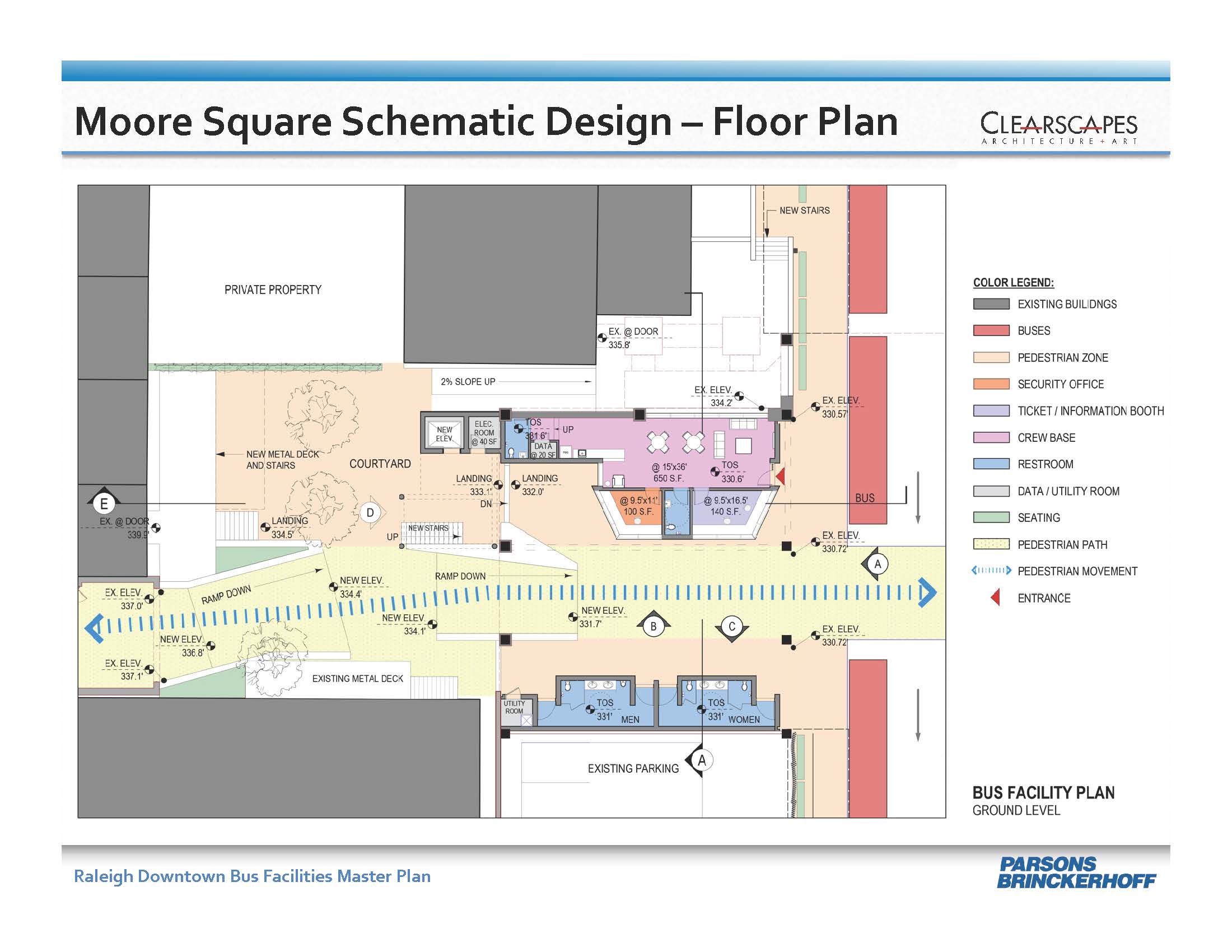
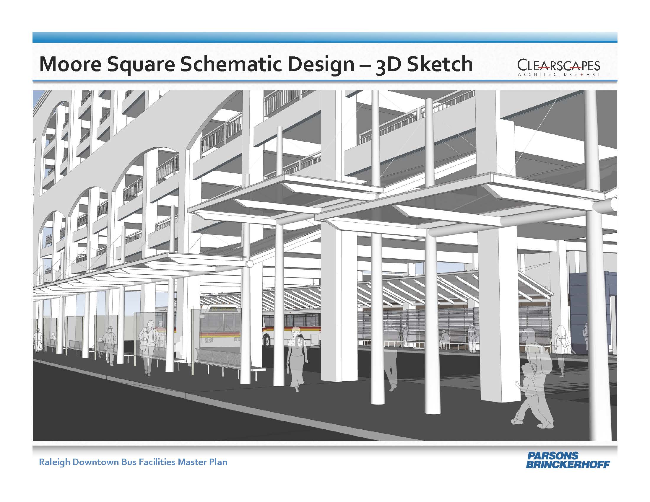
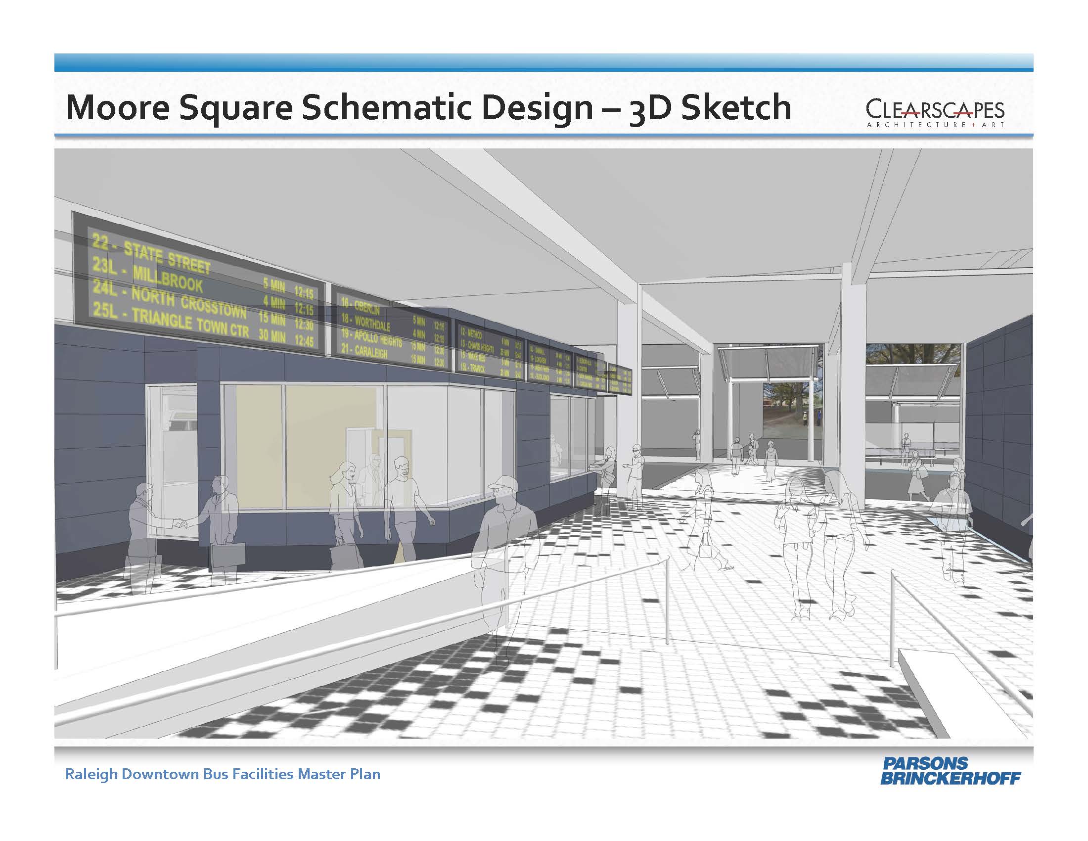
Speaking of Moore Square, the bus facility there should be getting a major face lift. Still in the planning stages, the upgrade of Raleigh’s busiest bus terminal will hopefully move forward in 2016.

Along with Moore Square, Raleigh Union Station should begin construction in 2016. Not only is the expansion of the train station needed for Amtrak but also for the proposed commuter rail line that may happen as part of the previously mentioned transit plan.

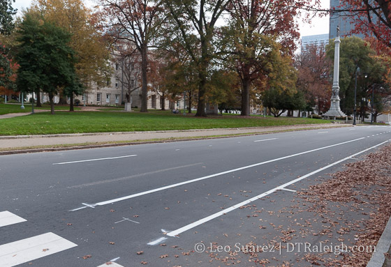
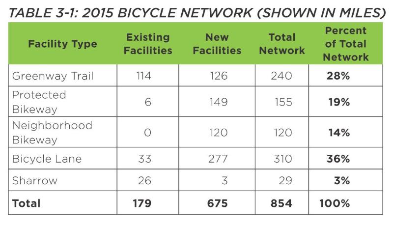
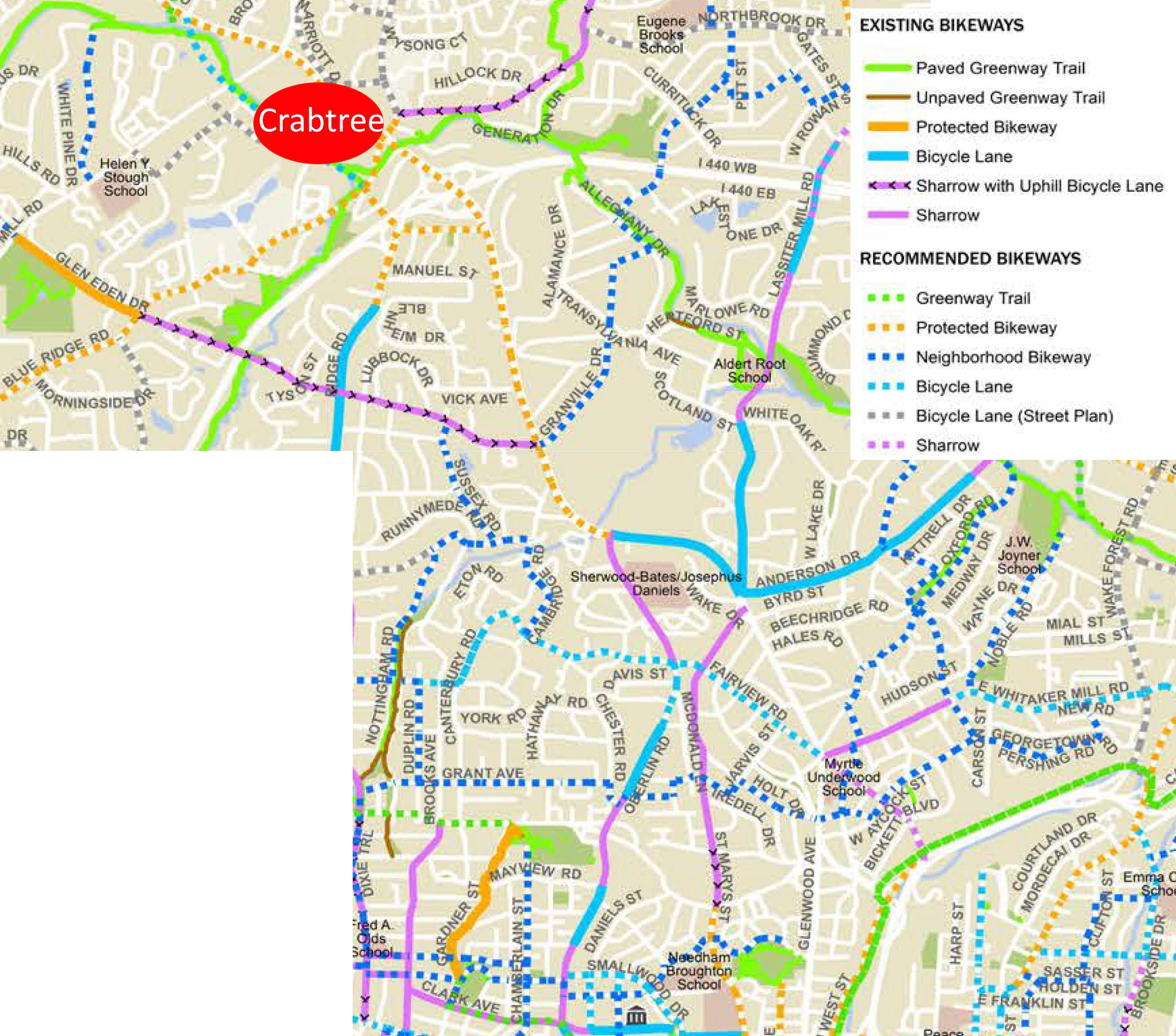
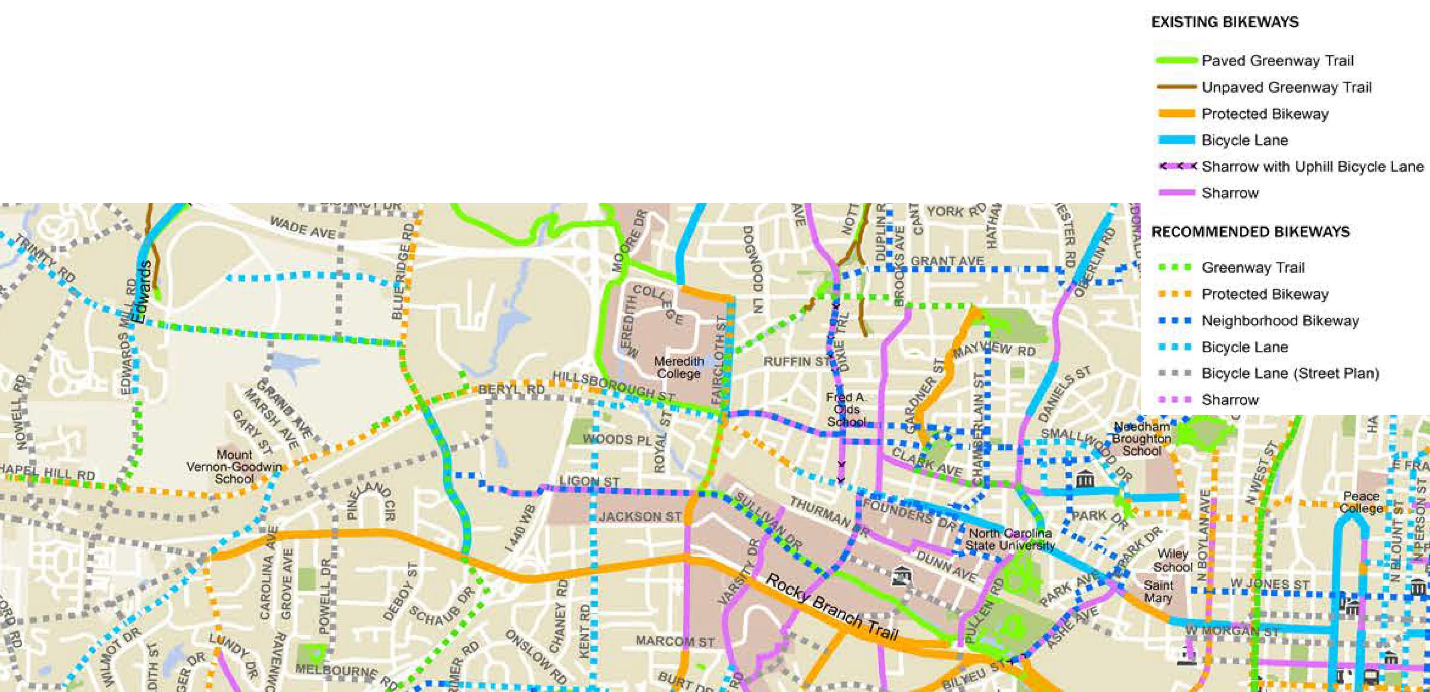
All of this will take place with more planning for bicycle facilities throughout the city. The 2009 Bicycle Plan is getting an update. (more on this soon)

Expect this blog to be very pro-transit in 2016.

Cranes are a-coming

Apartments in downtown Raleigh

2015 had a few developments in the works but there were also some new ones to follow that worked their way through the approval process. In 2016, we may see cranes in the air for these new buildings.

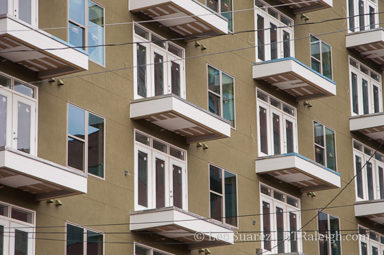
The Lincoln, Skyhouse Raleigh, Elan City Center, and The L were all completed in 2015. These buildings add several hundred new apartment units to the downtown supply. That’s not all though as we have plenty coming down the pipe.

  • The Link Apartments should have residents moving in sometime in early 2016.
  • The Edison Apartments are coming along and should be done in the first half of 2016.
  • The townhomes at Blount Street Commons are mostly finished and should have residents moving in throughout 2016.
  • The Gramercy is mostly built out and I see no reason it’s not up and running in 2016.

That’s several hundred more apartments being built and ready to be opened next year. In the planning phases are apartments as part of The Dillon, Greyhound Apartments, and the north tower of Charter Square.

Outside of residential developments, some taller structures containing offices or hotels may be breaking ground in 2016. Those to look out for is the main structure of The Dillon, a 17-story tower in the warehouse district. Charter Square North is planned to be a 22-story mixed-use building with offices and residential. Maybe it will break ground in 2016?

Other notable projects are The Edison Office tower and Narsi Hotel, a 12-story building for the corner of Lenoir and Wilmington Streets. In 2015, these projects worked their way through the planning process so we’ll continue to follow them into 2016.

As mentioned recently, construction on the Residence Inn hotel near the convention center has started.

Personally, I’ll be interested to see what comes out of the work being put into the 301 Hillsborough site and the N&O block. I expect to see lots of planning take place in 2016 for these sites.

One last mention, kind of long shot but perhaps something interesting could happen, is Project Phoenix, the North Carolina governor’s plans for bringing development to the state government complex. Nothing sounds concrete yet from what I’ve read but the idea of turning the expansive complex into a more mixed-use environment would be a fantastic benefit to downtown Raleigh, essentially growing the footprint of interactive space.

Reader Favorites

They may not be favorites but they at least got the most web traffic. Here are the top five posts of 2015.

  1. Rendering of The Dillon, Office and Residential in the Warehouse District
  2. 12-Story Hotel Planned for Wilmington Street Moves Forward
  3. Multiple Rezoning Requests on the Table
  4. Pic of the Week for February 3, 2015
  5. Hilton Garden Inn on Davie Street Rendering, Shows Glass and Curves

Readers shattered my single day page view record this year. It was on the topic of the sidewalk seating ordinance, an emotionally charged and even political topic of the year.

The elections of 2015 can only be described as DrunkTown. I hope to look back on this debate years from now and just laugh.

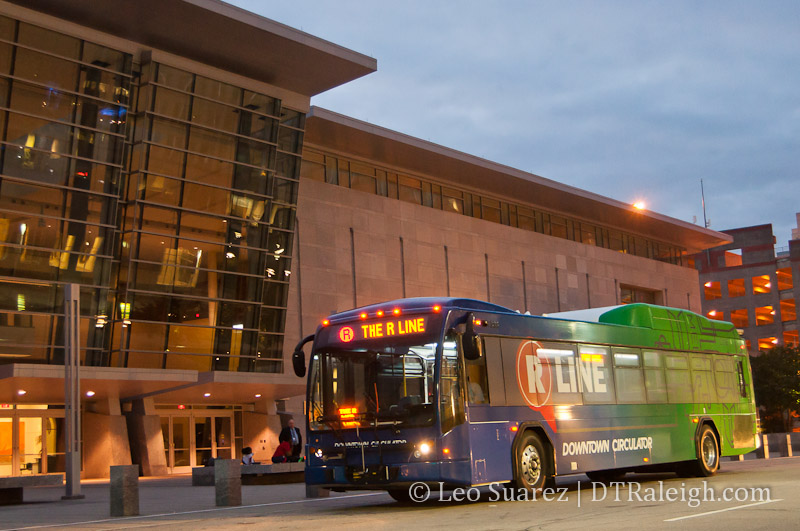
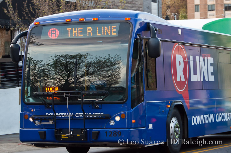
To close, I end with one bold prediction for 2016: The R-Line makes it’s last loop around downtown Raleigh.

Happy New Year! ;)

Raleigh Bike Plan Update Shows Us The Network

New bike lane on Hillsborough Street

Fresh paint on Hillsborough Street.

In mid 2014, I did a post about the evolution of Raleigh’s bicycle network. It’s been years, it feels slow-moving, but the pieces may be starting to connect and create this thing called a “Network”. I got really into looking at the maps in the latest draft chapter of the Raleigh Bike Plan Update. The complete document should be done before the end of the year and some of the material is available now.

Dive in to the Raleigh Bike Plan Update.

Looking at Chapter 3 shows the recommended network. It includes 126 new miles of greenway, 149 miles of new protected bikeways, and 277 miles of new bike lanes. The full breakdown is in the below table.

Table 3-1

It’s great to see so little sharrows being planned as, in my opinion, they don’t do very much. The recommendation is for more than three times more miles of bike facilities versus what we currently have. That’s a big ramp up in expanding the “Network.”

Protected bikeways are a huge step in the right direction to get riders on to the network. A protected bikeway is described as such:

This plan update defines a protected bikeway as a bicycle facility that is physically separated from motor vehicle traffic within a street corridor. For this Plan, this includes cycle tracks and buffered bike lanes, in addition to the City’s shared-use path and greenway network. The on-road physical separation can be achieved through parked cars, curbs, medians, bollards/traffic posts, planters, or marked buffered space between the bike lane and adjacent travel lane.

The one catch that I don’t like about greenways is that they have, historically, been seen as recreational paths versus effective transit routes. In only a certain amount of cases does a greenway help someone get from point A to B faster than a street.

Speaking of Point A to B, the chapter shows us the recommended network on a map of Raleigh. I decided to take a look at five possible routes starting from downtown Raleigh and seeing how the bicycle network of the future would accommodate versus today.

I have a deep hope that the Raleigh of the near future can make all of inside-the-beltline a bikeable haven for residents to easily zip around on. The network should get folks from their homes to any major destination easily.

I’ve included a doctored-up screenshot of those maps with each route.

Downtown Raleigh to North Hills
From one urban center to another, getting to North Hills and back by bicycle would be a fantastic way to move around. Today, the greenways are just too far away and don’t provide a direct enough route. With Capital Boulevard being a huge east/west barrier, getting to St. Mary’s Street is the best option. Heading North, the ride should cross over to Lassiter Mill Road where it will take you to North Hills.

Recommended route to North Hills from downtown Raleigh

Click for larger

Currently, both of these roads have bike lanes and sharrows for almost the entire route with some sections unmarked. According to the draft plan, a new protected bikeway would go in starting north of Peace Street but wouldn’t be that long. (up to Wade) Along with some new sharrows on Lassiter Mill Road, there’s not much improvement on this route.

Downtown Raleigh to Five Points

The closest two destinations in this list, getting to Five Points is pretty much a ride up Glenwood Avenue. Today, there are no bicycle facilities between Five Points and Glenwood South. The two-lane road isn’t so difficult but that does mean you need to be comfortable riding in traffic.

Sadly, the recommended network has nothing planned for Glenwood Avenue here. Instead, a new route will go in along West Street. A protected bikeway/greenway trail, which we’ve covered before, is recommended form the Warehouse District all the way to Wade Avenue. The route will split with a greenway going northeast along Capital and sharrows along Fairview Road. That will lead you straight into Five Points.

Recommended route to Five Points from downtown Raleigh

Click for larger

This will be a great north/south connection and I’m interested to see if it’s possible to add a connection, somehow, to this greenway along Capital Boulevard from the eastern neighborhoods, like Mordecai and Oakwood.

Downtown Raleigh to Crabtree Valley Mall

Ride to the mall? It’s probably better to just take the bus. Route 6 is a direct shot from downtown Raleigh to Crabtree Valley Mall. You can’t get more convenient then that. Still, riding your bike adds a little freedom. I’ve done this once with the intent to get some exercise and do some shopping. It’s not for every day though but maybe it is for some.

Today, Glenwood Avenue towards Crabtree is pretty hectic and there are some bike lanes but only for a small portion of the route. The recommended network adds protected bike lanes north of Glenwood/Oberlin. Taking the route to Five Points would be how you start. You then would most likely continue north on Fairview, get to Oberlin where bike lanes exist today, and take Glenwood north on the new protected bike lanes.

Recommended route to Five Points from downtown Raleigh

Click for larger

This is a big improvement. The challenge though is pulling into Crabtree Mall once you are there. It would be fantastic to see the spaghetti bowl in that area cleaned up but an easy fix might be a bicycle “off ramp” onto the greenway that goes underneath Glenwood Avenue and goes to the Crabtree Valley Avenue entrance.

Downtown Raleigh to the Fairgrounds

Hillsborough Street is so direct, so straight that using it for cycling transit would be really tempting when going west. Up until just this week, we now have bike lanes starting from the Capital building mostly going up until NC State University. Currently, it then fades out for now but the two lanes west of Faircloth Street might makes things manageable for biking without any lanes.

Recommended route to Five Points from downtown Raleigh

Click for larger

The recommended network continues the bike lanes in front of the university and uses a combination of protected (mostly) and bike lanes to get to the fairgrounds. The plan is actually to extend them all the way out to I-40.

This is a huge improvement for connecting to West Raleigh.

Downtown Raleigh to the Farmer’s Market

Today, getting to the Farmer’s Market by bicycle isn’t the mot difficult as you have a few options. The longer but safest route is by greenway but a few residential streets could get you out there faster without the need for bicycle facilities. Still, a straight shot would be most ideal and that most likely means that Lake Wheeler Road needs a makeover.

Recommended route to Five Points from downtown Raleigh

Click for larger

It is great to see a protected bike lane on the recommended draft map between the Farmer’s Market and downtown Raleigh along Lake Wheeler. A protected lane is probably best as Lake Wheeler has some nice hills and is pretty direct.

Great improvement here.

Wrap Up

For me, connecting major destinations together in a more direct route is what I’m looking for in bicycle improvements. Since this is a downtown Raleigh blog, that’s the approach I took in these five routes.

As always, the draft bicycle plan is still a work in progress and you can submit feedback on what you see up there.

Choose Our Transit Video

I recommend email readers click through to the website to see the embedded video.

Still on my to-do list is to catch up on the Choose Our Transit sessions. Above is the video of the meeting that took place on May 11 at the convention center. If you can’t see the embedded video, go see it on YouTube here.

To dive right into things, see the full Expanded Transit Choices report on the Choose Our Transit website.

The consultant, Jarrett Walker and associates, has also introduced the report on their blog.

This begins a period of public discussion about the report and the choices it outlines. That discussion will give us direction on what form the final recommended plan should take. That plan, in turn, will form the basis for a proposed referendum on a sales tax increment to fund expanded transit.

*Raleigh: Four (or 36) alternatives for Wake County’s transit future via Human Transit.

I’m sure downtown Raleigh will be a key role in no matter what comes out from the plan. However, how many routes and the kind of ridership levels coming into and out of downtown could change based on some of the recommendations.

Let us know what you find interesting and make sure to provide feedback, not here but on the sites linked above.

Video: Wake Transit Plan Kick Off Meeting

Wake Transit Plan Kick Off Meeting on YouTube

I just wanted to share this real quick. Here’s the video from this week’s transit meeting that took place at the Raleigh Convention Center. It was a great presentation by Jarrett Walker and I encourage readers to watch the whole thing.

In addition, you can follow the planning process at Wake Transit and it should wrap up this summer.

Weekend Listen, Jarrett Walker

Jarrett Walker and his transit consulting company were recently hired to be a part of the update to the Wake County Transit Plan. Below is a radio interview with Walker at a Kansas City station that gives you a taste of his thoughts on transit including street cars, light-rail, and a frequent bus network. Download the MP3 directly if the embed player doesn’t work for you.

My Thoughts on the R-Line

An R-Line bus in front of the Raleigh Convention Center

One of downtown Raleigh’s hot topics this year has apparently been the R-Line. If you’ve been following, there are a slew of stories about the perceived unfairness of the fare-free bus circulator that operates seven days a week. With upcoming fare increases on other routes of the Capital Area Transit (CAT) system, the R-Line is being looked down upon by certain Raleigh individuals.

My take on this is that the R-Line is being politically micro-managed and we should let the transit planners have a say.

Background articles to read:

The route was first introduced in February of 2009 with a dedication ceremony in front of the Raleigh Convention Center. It’s important to note that the R-Line was one piece of a much larger puzzle. The Convention Center had just opened around that time. The Fayetteville Street makeover was still pretty fresh. City Plaza was less than a year old.

These were downtown improvements made to attract more visitors, create more spending, and create more businesses. From a city point of view, that means paying back the investment in downtown and generating more tax revenue. Cities do this to sustain a high-quality of life, which Raleigh has, with a fair or low cost of living.

A lot has happened over the last five years though.

Events have been one of the largest driving forces behind downtown Raleigh’s growth. Fayetteville Street events used to close off one or two blocks. Moore Square events could be contained within the park itself.

Today, downtown is bursting with events.

An interesting statistic would be the growth of attendance and size over the years. I would put money down that that number has increased year after year.

You have a pretty good chance of catching an event on Fayetteville Street on any given weekend these days. From mid-August to mid-October, downtown is crawling with events and people. Spring has another spike in events that seem to take over. Parking decks are as or more full on weekend nights as they are during the workweek hours any weekend of the year.

It also seems that every marathon that comes to town wants to run their route through downtown Raleigh. We’re not talking just a few, but several dozen closing streets on random weekends.

So what does the R-Line have to do with downtown being the host with most?

A strategy (the R-Line) to make our public investments (Convention Center) more attractive became hugely successful and everyone wants to get a piece of it.

And why was it successful? In my opinion, the R-Line is run like most bus routes should be run. No timetables and a higher frequency of buses passing by.

It was also the first city bus route, to my knowledge, in Raleigh to have GPS tracking. Those with smartphones could see the bus location before heading out to the bus stop. With all the amenities and ease of use, it was implemented very well and has become successful.

Over the years, Raleighites have adopted it. The original purpose is still intact, with the buses moving conventioneers around downtown. The event-driven downtown has used it for moving people between venues. The growing resident population has used it to travel between districts. With a stop near the Moore Square Transit Center, CAT riders have also used it as either the first or last leg of their trip when getting around.

With a diversity of riders, sounds like a success story to me.

Today, the R-Line’s fareless system is being picked on. With an upcoming 50-cent increase in fares over the next 2 years on every other CAT route, there are some vocal citizen advocates that think this unfair, with one individual quoted in an N&O article calling the R-Line racist.

Opinions and proposals on the R-Line aren’t hard to find either.

The articles linked above mention issues such as fairness, equity, and cost. Expanding the route would cost more. How can you make the R-Line more fair? Should all riders have equal access and the demographics of riders be diverse?

We’ve definitely lost sight of the original purpose of the service, which is to move visitors (from hotels and the convention center) around downtown.

An R-Line bus passing through Glenwood South

What we have today though is a situation where the R-Line is so successful that groups want to either copy the R-Line model or modify the current route to include their neighborhood or business, with complete disregard to the overall system that the R-Line is a part of.

In 2013, the Midtown Raleigh Alliance teased an idea of an M-Line between North Hills and Downtown Raleigh. I wrote about the idea and how it compared to the currently in place Route 8 – Northclift CAT route. They seem similar.

In 2011 and back again this year, Cameron Village and nearby residents are petitioning to change the R-Line route to serve the shopping center and the neighborhoods around it. I wrote about it back in 2011, and it’s pretty applicable this year too, that Route 12 – Method and Route 16 – Oberlin both have been providing a link to and from Cameron Village for years.

You also have residents in Oakwood and Mordecai that think the R-Line should swing more north to serve the growing Person Street District. In the linked articles, there are opinions that the R-Line should go more east instead of turning around Moore Square only. CAT routes serve those communities today.

Finally, I’ve heard that the upcoming 10-year Downtown Plan has a pretty healthy section on the R-Line. The draft release of that is scheduled for September 11, blog post on that soon.

It seems the R-Line has now become politically infested. It works so well that others are upset that it isn’t serving their communities. I predict any outright support for the R-Line would be seen as a politically bad move at this point.

I wrote this in the 2011 post about the R-Line going to Cameron Village:

“In my opinion, the petition just shows this area’s readiness for an upgrade in transit “

Raleigh, you are ready to level up. It is time to put on your big girl pants and commit to moving CAT to the next level.

Raleighites should stop picking on the R-Line and start getting behind seeing more money in the budget for the CAT system. Raleigh should hire some top transit talent to guide us in moving to the next level.

With a cohesive and easy to use transit system, funded by all Raleighites, priced fairly for the service it provides, we will stay on the top 10 lists for decades to come.

Municipography, Moore Square Transit Station, Smartphone Apps, and Smart Cards

Municipography is a summary of current issues going through the Raleigh City Council and other municipal departments in the city. The point is to try to deliver any video, photos, and text associated with the discussions happening at City Hall or elsewhere. Since this is a downtown Raleigh blog, the focus is on the center of the city.

There was a lot of transit talk at this week’s city council meeting. Presented to council were some 3D renderings of what the future Moore Square Bus Station could look like after its upcoming upgrade. Technology upgrades in downtown transit are also coming as money has shown up towards setting up a downtown Raleigh smartphone application and a smart card fare system for the CAT buses.

Moore Square Transit Station


Watch the video snippet above. If it doesn’t work for you, go here.

As part of the ongoing Downtown Bus Facilities Master Plan, Moore Square Transit Station is getting an upgrade. Jason Horne of the Raleigh Transit Authority and
the design team presented some new renderings of the station’s future. Construction could start as early as Spring 2015 on the now 26-year-old facility. Plans call for a new bathroom, security and ticketing office, more open, friendlier spaces, and and an additional lane for buses to handle more capacity.

Construction is estimated to take 14-18 months with the station being open throughout that time period. Here are a few slides from the presentation. Make sure to read the Raleigh Public Record’s article about the presentation and to see the rest of the slides and renderings.

Plans for the future Moore Square Transit Station

Plans for the future Moore Square Transit Station

Plans for the future Moore Square Transit Station

Downtown Smartphone App


Watch the video snippet above. If it doesn’t work for you, go here.

We definitely talk about parking a lot here. However, an initiative that I’m involved with to bring a smartphone app to downtown in order to help with any parking struggles has moved one step further. During the meeting, council approved $5,000 from a contingency fund to go towards the development of that app. The Downtown Raleigh Alliance will raise the rest of the money and see the app to completion.

Read more about our efforts here:

It’s never a bad time to talk about everyone’s favorite topic: Parking. I typically don’t fly the blog outside of downtown Raleigh but North Hills has something that’s very unique. I’m excited to announce that the Parking App Team that won last year’s DataPalooza, with roots in downtown Raleigh, has launched in North Hills.

*North Hills Smartphone App Will Include Parking Directions, Rumored World Peace

My team’s idea? To help people navigate urban areas, showing them the best possible parking locations and offering wayfinding to their end destination. Our smartphone application, still in the prototype phase, is the first step in implementing this process. We also have a nice list of features that will make the application very helpful.

*Parking In Downtown Raleigh May Get Easier Thanks To Open Data

Smart Cards for CAT Buses
As a final blurb that I think is worth mentioning, the city has received grant money from NCDOT to go towards a smart card fare system for CAT buses. Mentioned at the meeting, here’s an excerpt from the press release:

The Raleigh Transit Authority has adopted a priority of offering smartcard technology on CAT buses. The grant will allow a contactless, smartcard payment option to be installed on the fare boxes of the CAT bus fleet. Bus purchases will have fare boxes that will accommodate contactless smartcard and mobile ticketing applications. The total funding for the project is $378,440 90, which is 90 percent NCDOT grant funds and 10 percent City of Raleigh funds.

*City Receives Grant to Allow Smartcard Payment on Capital Area Transit Buses

Yay! Technology!