What I Learned From Riding a Cycle Track in Downtown Raleigh

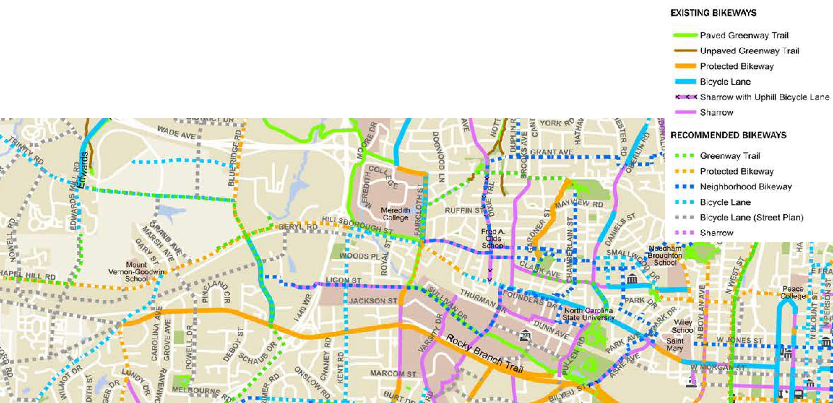
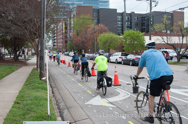
This past weekend, Oaks and Spokes, Raleigh’s loudest and most organized voice for bicycling in Raleigh, set up a cycle track demo for a section of Harrington Street. As a huge supporter, I hung out, volunteered, and just absorbed the street with this temporary cycle track in place.

Having only seen cycle tracks in other cities but never actually ridden through one, it was a pleasure to ride through it in my own city. After giving it some thought, here’s what I took away from this weekend’s demo.

Two-Way is the Right Way

When you compare the suburbs with downtown, one major difference is the mobility scale of each environment. Historically, downtowns that pre-date the car were built at a more human-scale with things closer together while suburban areas planned around cars are more spread out.

In downtown, walking, a human-scale form of mobility, is well accommodated with sidewalks on both sides of the street and no real “direction.” There is no such thing as a northbound sidewalk for example where as Wilmington Street is a one-way street for cars heading north. Wilmington is an example of a road designed for car-scale mobility.

This was fine for awhile but with a street culture obsessed with markings and direction today, when we make space for human-scale things (i.e. bicycles and scooters) they don’t work when the scale is actually intended for cars.

We should strive to make all street space two-way for bicycles, scooters, etc. in order to make on-street, human-scale movement more intuitive and natural.

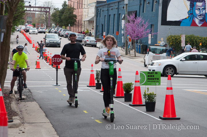
This probably explains some of the “bad behavior” we have seen with scooters recently because it takes too long to circle the block if the final destination is closer when going up a one-way street.

Consider me an advocate now for having every single downtown street converted to two-way for bicycles alongside existing car traffic flows.

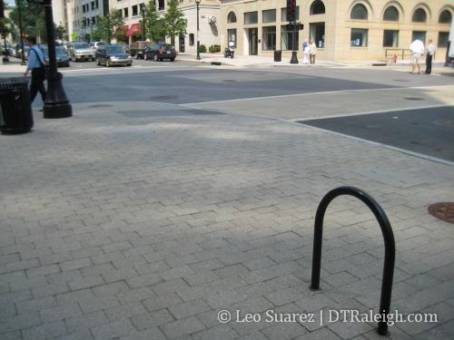
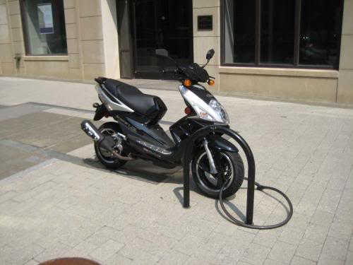
Humans, not Cars, Need Buffers

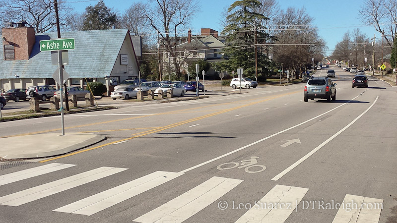
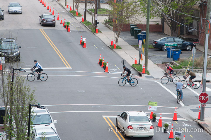
Similar to the above point, I want to reiterate a solid point that the cycle track gives users above painted bike lanes. Physical separation is the key point here and should be required in future installs.

It’s in plain sight yet few seem to notice that when we drive a car, the car itself is wrapping us with safety features and physical protections. At the human-scale, as a walker or cyclist, those features don’t exist and we rely on our physical environment for safety.

This is true in other areas as well outside of transportation. I think most obvious is with outdoor seating. Outdoor seating is more popular along sidewalks with on-street parking versus active travel lanes. The cars act as a barrier and makes it more comfortable to sit.

We need to familiarize ourselves with a variety of ways we can physically separate our human-scale mobility options away from the car-scale options.

Curb Space Productivity Needs to be Explored

As publicly-owned space, our curb areas and how we are using that space is being brought into the conversation. Alongside plans for future cycle tracks and other new street space like dedicated bus lanes, we need to understand how to make this limited space more productive.

This means objectively challenging the thought that removing on-street parking will be a detriment to nearby businesses. New parking decks are popping up around downtown Raleigh so their use in addition to the loss of the few spaces per block needs to be looked at.

Loading zones also need to be looked at as the streets also need to be a transportation network for our downtown businesses. Are their operating hours set correctly? Can these be consolidated?

I do think it doesn’t necessarily mean that a cycle track gets 24-hour access to the space either. Allowing deliveries to be made inside a cycle track between certain hours may be appropriate. Delivery persons may have to put cones out to redirect riders into the street, as just an idea.

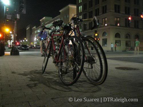
The Cycling Community is Alive in Raleigh!

This past weekend, I met folks who knew about the project and all the work that was going into it as well as those who just came out of curiosity. Others just stumbled on the project and had positive things to say. Advocacy was strong and the community stepped up to support.

I feel like a real community has been built in Raleigh around cycling and the longer we don’t serve that community, the louder and louder it’ll get.

Again, a lot of credit and thanks goes to those behind Oaks and Spokes so if this is something that interests you, reach out and help.

Buses, Bikes, and Sidewalks in the Downtown Transportation Plan

Last week, the most recent version of the Downtown Transportation Plan was released to the public and those behind it are looking for your feedback.

Dive right into it at goraleigh.org/downtownplan

What is BRT? Click for larger.

This downtown plan attempts to lay out the groundwork for how our future transit system will work within the downtown area. The future bus network of Raleigh will consist of bus-rapid transit lanes and higher frequency bus routes that are running longer hours. Combined with an expanded bicycle network, the downtown portion presents some pretty unique challenges.

The streets aren’t getting any wider so reallocating space is a community-driven conversation that is currently starting. When we talk about dedicated bus lanes for faster service that means less space for other things on our downtown streets.

Online survey feedback shows a desire for non-car mobility. Click for larger.

Full build out is planned for 2027 and with portions relying on state and federal funding, applications are being prepared right now!

When you look at the plan, you’ll see near, mid, and long-term plans for the downtown portion of the bus rapid network. The routes aren’t set in stone as different variables and decisions that haven’t been made may impact those routes.

Below are the maps for the three plans, meshed together for easier viewing. Click for a larger view.

Planned to be up and running in 2023, the east Raleigh BRT line is the first of the rapid transit lines to come online. Moving east/west down New Bern Avenue and Edenton Streets, this route has the least amount of impacts from a historical and infrastructure perspective.

I also think it’s sort of the most obvious when you look at serving the eastern portion of the city. Plus, the current bus route along this corridor has the second-highest ridership in the system. (only behind the Capital Boulevard route)

Mid-term, the BRT routes serving the west and south will come online connecting at GoRaleigh Station. The route down Western Boulevard is also most direct while a choice still exists for the routes to the south. Saunders, McDowell/Dawson, and Wilmington Street could all be possible entry/exit points to downtown. There are still two many outside variables that need to be determined so this has been left open.

Last, parts to the north have many variables in play here, leaving several options on the table. Integrating Raleigh Union Station’s bus facility and the west street extension could play a role in how this route helps tie the network together.

Along side all of this is a greatly expanded bicycle network. A mix of protected lanes and non-protected lanes will be added as a way to compliment the bus traffic moving throughout downtown. This is shown through another map below.

Full build out bicycle facilities. Click for larger.

There is a lot to consider here when looking at the plan so far. As unpopular as it may sound, I worry about the fact that downtown is on a path to having two bus stations with GoRaleigh’s recent renovations and RUSbus being planned to integrate into train travel (Amtrak and future commuter rail) at Union Station. Won’t this bifurcate the system as it approaches downtown? I fear this may slow things down canceling out the improvements we’ve provided through dedicated lanes.

This BRT plan is still only one layer, one lens of the entire thing though. I’ll be really interested to see the full build out and future plan with all modes coexisting. That means with local bus, rapid bus, commuter rail, and bicycles lanes, the system just might function more robustly and speedier than I think.

What do you think? We have a huge discussion going on the Community. Come share.

Raleigh Bike Plan Update Shows Us The Network

New bike lane on Hillsborough Street

Fresh paint on Hillsborough Street.

In mid 2014, I did a post about the evolution of Raleigh’s bicycle network. It’s been years, it feels slow-moving, but the pieces may be starting to connect and create this thing called a “Network”. I got really into looking at the maps in the latest draft chapter of the Raleigh Bike Plan Update. The complete document should be done before the end of the year and some of the material is available now.

Dive in to the Raleigh Bike Plan Update.

Looking at Chapter 3 shows the recommended network. It includes 126 new miles of greenway, 149 miles of new protected bikeways, and 277 miles of new bike lanes. The full breakdown is in the below table.

Table 3-1

It’s great to see so little sharrows being planned as, in my opinion, they don’t do very much. The recommendation is for more than three times more miles of bike facilities versus what we currently have. That’s a big ramp up in expanding the “Network.”

Protected bikeways are a huge step in the right direction to get riders on to the network. A protected bikeway is described as such:

This plan update defines a protected bikeway as a bicycle facility that is physically separated from motor vehicle traffic within a street corridor. For this Plan, this includes cycle tracks and buffered bike lanes, in addition to the City’s shared-use path and greenway network. The on-road physical separation can be achieved through parked cars, curbs, medians, bollards/traffic posts, planters, or marked buffered space between the bike lane and adjacent travel lane.

The one catch that I don’t like about greenways is that they have, historically, been seen as recreational paths versus effective transit routes. In only a certain amount of cases does a greenway help someone get from point A to B faster than a street.

Speaking of Point A to B, the chapter shows us the recommended network on a map of Raleigh. I decided to take a look at five possible routes starting from downtown Raleigh and seeing how the bicycle network of the future would accommodate versus today.

I have a deep hope that the Raleigh of the near future can make all of inside-the-beltline a bikeable haven for residents to easily zip around on. The network should get folks from their homes to any major destination easily.

I’ve included a doctored-up screenshot of those maps with each route.

Downtown Raleigh to North Hills
From one urban center to another, getting to North Hills and back by bicycle would be a fantastic way to move around. Today, the greenways are just too far away and don’t provide a direct enough route. With Capital Boulevard being a huge east/west barrier, getting to St. Mary’s Street is the best option. Heading North, the ride should cross over to Lassiter Mill Road where it will take you to North Hills.

Recommended route to North Hills from downtown Raleigh

Click for larger

Currently, both of these roads have bike lanes and sharrows for almost the entire route with some sections unmarked. According to the draft plan, a new protected bikeway would go in starting north of Peace Street but wouldn’t be that long. (up to Wade) Along with some new sharrows on Lassiter Mill Road, there’s not much improvement on this route.

Downtown Raleigh to Five Points

The closest two destinations in this list, getting to Five Points is pretty much a ride up Glenwood Avenue. Today, there are no bicycle facilities between Five Points and Glenwood South. The two-lane road isn’t so difficult but that does mean you need to be comfortable riding in traffic.

Sadly, the recommended network has nothing planned for Glenwood Avenue here. Instead, a new route will go in along West Street. A protected bikeway/greenway trail, which we’ve covered before, is recommended form the Warehouse District all the way to Wade Avenue. The route will split with a greenway going northeast along Capital and sharrows along Fairview Road. That will lead you straight into Five Points.

Recommended route to Five Points from downtown Raleigh

Click for larger

This will be a great north/south connection and I’m interested to see if it’s possible to add a connection, somehow, to this greenway along Capital Boulevard from the eastern neighborhoods, like Mordecai and Oakwood.

Downtown Raleigh to Crabtree Valley Mall

Ride to the mall? It’s probably better to just take the bus. Route 6 is a direct shot from downtown Raleigh to Crabtree Valley Mall. You can’t get more convenient then that. Still, riding your bike adds a little freedom. I’ve done this once with the intent to get some exercise and do some shopping. It’s not for every day though but maybe it is for some.

Today, Glenwood Avenue towards Crabtree is pretty hectic and there are some bike lanes but only for a small portion of the route. The recommended network adds protected bike lanes north of Glenwood/Oberlin. Taking the route to Five Points would be how you start. You then would most likely continue north on Fairview, get to Oberlin where bike lanes exist today, and take Glenwood north on the new protected bike lanes.

Recommended route to Five Points from downtown Raleigh

Click for larger

This is a big improvement. The challenge though is pulling into Crabtree Mall once you are there. It would be fantastic to see the spaghetti bowl in that area cleaned up but an easy fix might be a bicycle “off ramp” onto the greenway that goes underneath Glenwood Avenue and goes to the Crabtree Valley Avenue entrance.

Downtown Raleigh to the Fairgrounds

Hillsborough Street is so direct, so straight that using it for cycling transit would be really tempting when going west. Up until just this week, we now have bike lanes starting from the Capital building mostly going up until NC State University. Currently, it then fades out for now but the two lanes west of Faircloth Street might makes things manageable for biking without any lanes.

Recommended route to Five Points from downtown Raleigh

Click for larger

The recommended network continues the bike lanes in front of the university and uses a combination of protected (mostly) and bike lanes to get to the fairgrounds. The plan is actually to extend them all the way out to I-40.

This is a huge improvement for connecting to West Raleigh.

Downtown Raleigh to the Farmer’s Market

Today, getting to the Farmer’s Market by bicycle isn’t the mot difficult as you have a few options. The longer but safest route is by greenway but a few residential streets could get you out there faster without the need for bicycle facilities. Still, a straight shot would be most ideal and that most likely means that Lake Wheeler Road needs a makeover.

Recommended route to Five Points from downtown Raleigh

Click for larger

It is great to see a protected bike lane on the recommended draft map between the Farmer’s Market and downtown Raleigh along Lake Wheeler. A protected lane is probably best as Lake Wheeler has some nice hills and is pretty direct.

Great improvement here.

Wrap Up

For me, connecting major destinations together in a more direct route is what I’m looking for in bicycle improvements. Since this is a downtown Raleigh blog, that’s the approach I took in these five routes.

As always, the draft bicycle plan is still a work in progress and you can submit feedback on what you see up there.

It’s The [Bicycle] Network

Bike lane on Hillsborough Street.

In April 2014, Raleigh’s premier bicycle festival, Oaks and Spokes, took place. The week long event combined community rides, cycling education, and a public forum that all focused around the idea of spreading the love of cycling culture in the city. Between the fun events and public information that took place that week, I had a thought about where we are heading with regards to bicycle infrastructure.

Are we spreading ourselves too thin with mediocre (at best) bike infrastructure here in Raleigh? Are bike lanes and sharrows really spreading the cycling culture throughout our city?

In my opinion, it almost feels like the efforts we’ve made are a bit timid while a lot of other cities are really cranking up the bicycle lanes, making them protected, scenic, and comfortable to use.

I’ll pick on one of the city’s currently ongoing bicycle projects. Through a $1.1 million grant, the city will install “27 miles of marked, on-road bicycle facilities.” This project has been mentioned on the blog before and the post lists several streets in and around downtown Raleigh that will get these bicycle facilities. The rest of the city is getting some bicycle love as well so it’s important to note that this is a city-wide effort.

The project page on the city’s website has now been updated with draft plans for each street. Take a look and get your feedback to the city before May 9.

2014 Bicycle Pavement Marking Project

Click for larger

For downtown, the proposed bike facilities include bike lanes on Wilmington and Salisbury between Peace Street and MLK Boulevard. Also, sharrows will be added to Hillsborough and Cabarrus Streets under the current draft. This is just a small piece of the larger network that is being built across the city.

Dedicated lanes and sharrows might be just paint on the road but it is a step towards creating that bicycle-friendly city. Certainly there is room for improvement on what’s being installed but $1.1 million can only do so much.

Is this a quantity (coverage) versus quality (safety) situation?

Certainly more miles of “marked, on-road bicycle facilities” sounds better than less but let’s discuss an alternative approach. If you think about other forms of transit, rail lines connect major areas to each other and then over time, new lines link up to that and form a network. Highways connect cities and over time have formed their own quality network. Just like them, one mega-bicycle project could be a success in Raleigh, sacrificing total coverage but being of a much higher quality.

Instead of 27 miles of paint for bike lanes and sharrows, what if we could get 5 miles of cycle tracks and/or protected lanes? A 5 mile direct route like this could really connect places, for example:

  • It is about 5 miles along Hillsborough Street from the State Capitol to The Fairgrounds
  • In the other direction, it is less than 5 miles from the Capitol to WakeMed along New Bern Avenue
  • Glenwood South and North Hills could be connected using St. Mary’s and Lassiter Mill Road

Granted, these are highly simplistic ideas making a lot of assumptions and not taking into account a mountain of factors. However, if major connections are made between these centers of activity with high-quality bicycle facilities there may be more chances of cycle adoption, increased bicycle use in the city, and possibly giving more political backing for future projects just like it.

The Network
Mega-projects don’t just happen though. Our bicycle network, at least up until a few years ago, has been implemented from almost nothing in the city budget and some creative thinking from city planners. This includes adding bike lanes or sharrows when a road is due to be repaved, taking advantage of the need to re-stripe the street anyway.

What the city is doing to deliver our bicycle network is subtle and can be described as a slow boil. Just like the greenway network, which started being built in the 1970s, the bicycle network is being put together in any way that it can be, piece by piece.

When you look at the greenways, it is only recently that the they have really been making major connections to form that comprehensive network across the city.

Raleigh Greenway map section

So while huge projects can be fun and exciting, working towards that day when the bicycle network all comes together could be even more magical. That is one way to make Raleigh, from downtown to the outskirts, a complete bicycle friendly city.

Federal Grant Funding Miles of Bicycle Facilities In Downtown Raleigh

Salisbury Street

Salisbury Street in the government district

As part of a federal grant, the City of Raleigh is receiving funds to apply marked bicycle facilities around the city. From the city’s website to the blog:

The City of Raleigh received a $1.1 million dollar grant from the federal Congestion Mitigation and Air Quality Improvement (CMAQ) program to construct at least 27 miles of marked, on-road bicycle facilities. A proposed list of twenty-two bicycle projects have been selected in order of adopted bicycle plan priority and previously adopted CIP projects. The design of these projects is currently underway and the lead consultant is Vanasse Hangen Brustlin, Inc. joined by Alta Planning + Greenways, Inc. and Kittelson & Associates, Inc.

*Bicycle Pavement Marking Design Project

We’ll have to wait for the designs to see what kind of “marked, on-road bicycle facilities” will be created but $1.1 million dollars spread across 27 miles doesn’t sound like much. I expect a mix of bike lanes and sharrows.

Here are the streets being looked at within downtown.

  • Wilmington Street from Saunders Street to Peace Street
  • Salisbury Street from Martin Luther King Jr. Boulevard to Lane Street
  • Martin Street from West Street to Tarboro Street
  • Hillsborough Street from Morgan Street to Salisbury Street
  • E. Cabarrus Street from Wilmington Street to Chavis Way
  • W. Cabarrus Street from Western Boulevard to Salisbury Street

See the link to the city’s website for more information.

[UPDATE] Bicycle Parking In Downtown Raleigh

As a new bicycle owner, I’m starting to think about how bike-friendly downtown is. It is rather easy riding around on the streets within the core of downtown because of the naturally slower traffic and short distances. The issue I see, however, is the extreme lack of bike racks in the area and you can see it as riders chain their bikes to different poles and trees. Bike racks are also hard to find because there are simply too few of them. This will have to change so that the culture of commuting by bicycle to downtown grows.


Bikes grouped together on Fayetteville St.

To maintain the quality and competitiveness of our downtown, I think that an alternative to driving should be offered. While mass transit is being figured out now, we can focus on ways to encourage people to get out of there cars and ride a bike, scooter, or other “one-person vehicle” to get in and out of downtown. Right now, I think that riding a bike to visit one day on the weekend and chaining it to a tree is kind of acceptable, because of the so few times that you actually do this. But to get the downtown employees to ride to work five days a week, we do not need more trees rather a bike “parking deck”. Just like anyone can drive downtown and leave their car in a deck, a bike should be parked in a small area that is specifically used for the purpose of storing your bike, scooter, hoverboard, whatever. Would you ride more if there were dedicated bike parking areas with:

  • Plenty of spaces; you can always count on an available slot to lock up at.
  • Lots of night lighting to make anyone feel safe.
  • Covered shelters so “vehicles” do not get soaked if it rains while you are at work.
  • Electricity for those with electric scooters, segways, or whatever may come in the future.

IDEA: Downtown Bike Pad

To incorporate the thoughts above, here is an idea that came about in a recent conversation with a friend on this topic. The picture above shows the M&F Bank parking lot on the corner of Hargett and Wilmington St. The lot is for employees only and has six spaces. I have nothing against the bank but I feel that this space should be given up and a deal cut for parking in the Alexander Square deck right behind them. This would be a perfect area for what I’m calling a Downtown Bike Pad.

The entire lot will be used for parking bikes, scooters, segways, and other “vehicles”. The pad will be flush with the street so the sidewalk “peninsula” will have to be flattened. This will make getting in and out by anyone pretty easy. The pad will also be a different color then the road, making it distinct and easy to find. Shelters can cover the area so that anyone’s “vehicle” is protected by any precipitation. Add an artistic touch to the whole thing and I think we’ll have something people will ride too. A LOT of people are already used to the idea of driving downtown, parking in a deck, then walking to their workplace. This is essentially the same thing but takes up less space, is more environmentally friendly, healthier for you, and a cheaper solution to building/expanding our parking deck arsenal.

My idea for the M&F Bank lot would be the ideal solution but until mass transit comes around 15-20 years from now, a modified version of this, perhaps on a smaller scale, could be used. If bike pads were strategically placed in a few spots downtown, I think we would see a rise in biking/alternative commuting and would be a great selling point for new residents and businesses looking at moving here.


Bicycles are not the only ones parking in downtown

[UPDATE 10-6-08]
An update almost a month later but it is still relevant to the conversation. There is a bike rack in the municipal deck, facing Dawson St. at Morgan St. It will cover your bike or scooter from the weather and it is easy to get too. We need much more of these around downtown.