Municipography: Union Station and R-Line Changes

Municipography is a summary of current issues going through the Raleigh City Council and other municipal departments in the city. The point is to try to deliver any video, photos, and text associated with the discussions happening at City Hall or elsewhere. Since this is a downtown Raleigh blog, the focus is on the center of the city.

I recommend email readers click through to the website to see the embedded video.

At the Raleigh City Council meeting on September 4, 2012, the council discussed funding for the Union Station project as well as approved some changes at the Moore Square Bus Station that will effect the R-Line.

Union Station

During the meeting, council discussed a future commitment of $3 million towards the Union Station project. Comments were generally positive about the station and it really feels that Raleigh and NCDOT want this project to succeed. With a 6-1 vote, the council approved the additional funds.

The city also approved the allocation of funds towards development of a schematic design for the project.

Bus Traffic at Moore Square Station

We haven’t talked about it on this blog before but there have been grumblings about the bus and pedestrian traffic along Wilmington Street and the effect it has on nearby businesses. To catch readers up, I’ll point you to a few articles from the local news media:

Business owners and residents in the Moore Square area met with the City of Raleigh on Tuesday, trying to come up with ways to address loitering, panhandling and bus congestion in the Moore Square District.

*Downtown Raleigh residents decry loitering, panhandling, ‘riff-raff’

Business owners say the crowds, coupled with bus congestion along the street, create an uninviting atmosphere for customers.

*New merchants chafe at crowds from Moore Square bus terminal

Here’s an alternative viewpoint from Barry Saunders at the N&O.

Here’s my advice to the business owners who are so dismayed that a city’s downtown transit center has people occupying various rungs of the social ladder: go out and meet them and talk to them. You may find that they are just like you, except they don’t have a car.

*Saunders: Respect needed among Moore Square’s old and new

Now that you are caught up, at the city council meeting this week, the recommendations from the Law and Public Safety Committee were unanimously approved. Those include:

  • Expand the bus zone on Wilmington Street to relieve bus congestion.
  • Move the R-16 Moore Square Deck station south of Martin Street.
  • The R-Line will now always run along the nighttime route that rounds Moore Square.
  • Immediate upgrades to the Moore Square Station including better pedestrian access, lighting, and safety upgrades.

While this may or may not solve the bus traffic issue on Wilmington Street, the R-Line may be the victim. R-Line riders could potentially experience added wait time as the bus will always make the trip around Moore Square rather than driving straight up Wilmington Street during the daytime operating hours. However, this may be a temporary solution until the Moore Square Bus Station is significantly upgraded for more bus capacity.

Some Additions To The Downtown Arena Discussion

A Carolina Hurricanes hockey game at the RBC Center in 2010.

We talked about parking earlier in the month and now it’s time for another love affair of mine; the downtown sports arena topic. I just want to quote two articles that add to the ongoing conversation. For newer readers, a sports arena in downtown Raleigh is an idea that floats in every now and then and is by no means planned or even in concept at this time.

You could certainly argue that I think we’re not ready for an urban arena and that the location of the PNC Center is perfectly adequate. To add some points on the development topic, whether arenas spur it or not, Richard Florida asks exactly that with an article at The Atlantic Cities.

Sports boosters claim the new stadiums bring economic benefits and add to a city’s “big league” status. But objective academic studies have countered this view, noting that stadiums add little in the way of actual economic benefit.

*Do Basketball Arenas Spur Economic Development?

The study that Mr. Florida writes about does mention cities that had a positive affect on development and a rise in regional income. However, it’s possible that this rise in an area’s income is a result from the arena moving from the suburbs to the city. The net could be zero.

And then comes the taxpayer benefit from making the investment in additional teams and stadiums/arenas. Dr. Kurt Rotthoff of Seton Hall University talked on the radio at WAMC about how politicians may try to sell the idea that sports teams and using incentives to build venues are a catalyst for economic development.

Hundreds of millions of dollars are spent on new stadiums, with the claim that they will create tens- or hundreds of millions of dollars of local economic impact; however, looking at county employment and incomes after a team enters or leaves a town, a co-author and I find mixed results on employment, with no overall impact, and mainly no impact on incomes, but a few cases of a negative impact. This means there is no impact, or possibly a negative impact, of bringing a team to town, and no impact, with the possibility of a positive impact, when the team leaves town. This primarily occurs because there is a shift in consumption, from restaurants and bars to the stadium, when these teams come to town and thus no net increase in consumption. Restaurants and bars do open closer to the stadium, but this is a result of them closing locations in other sections of town.

*Dr. Kurt Rotthoff, Seton Hall University – Economic Impact of Sports Arenas

One can just look at West Raleigh and see that development has not followed the PNC Center and it’ll be years before it does. Mr. Florida ends his article well with:

The present research is generally consistent with the notion that professional sports are not the cause of development so much as they are the effect.”

West Raleigh fans do have a lot to look forward to in the Blue Ridge Road District Study which may turn that street and all the areas around the fairgrounds and the sports complex into an active destination.

Breaking Apart The Wishbone Intersection At Peace Street

Email readers: This blog post has image galleries. Read the post on the blog to see all the images.

The intersection of Peace, Wilmington, Halifax, and Salisbury.

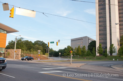
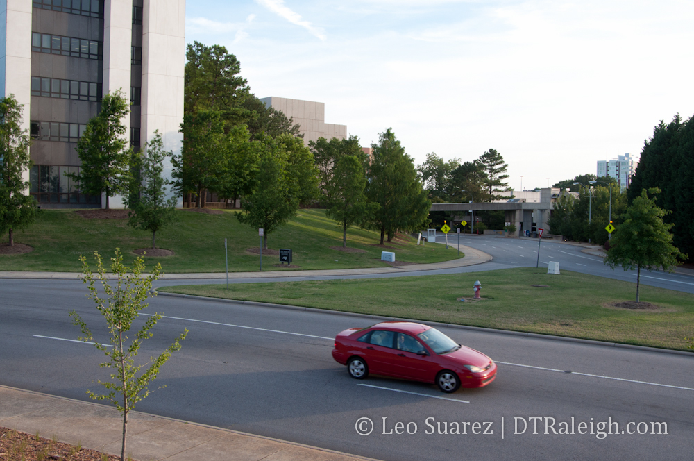
Talks, visions, and plans for lots of places in downtown Raleigh exist if you know where to look. Solving problems like traffic congestion or providing new amenities for pedestrians and bicyclists are driving factors for new plans. The intersection on Peace Street with Wilmington, Salisbury, and Halifax Streets is being looked at and I thought it might be fun to go over some points that I see in the Peace Street Visioning Study, a sub-topic in the Capital Boulevard Corridor Study.

No plans are final and the report mainly discusses topics for future exploring. One highlight mentions:

The Wilmington/Halifax/Peace Street intersection represents a second opportunity to improve traffic flow and reduce congestion. A two-lane roundabout is recommended for feasibility analysis by the City transportation engineers. This intersection continues to be a bottleneck which may be improved with more conventional traffic engineering solutions. However, there is some prospect that a two lane extended roundabout might provide free-flowing traffic while establishing a signature open space at this important gateway into the state government center and downtown. The roundabout would extend south in to the Wilmington Salisbury loop, with the roadway geometry offset to the south.

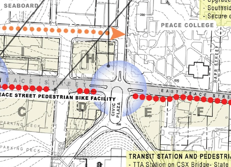
Here’s a screenshot of a map of that section and what it might look like from a conceptual level.

Peace Street Visioning Study, intersection of Halifax, Wilmington, and Peace Streets.

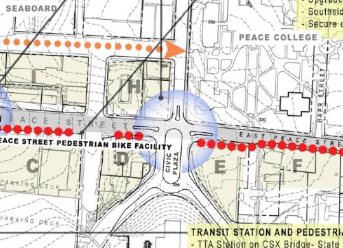
Seems like Raleighites either love or hate these larger roundabouts. It will be interesting to see the analysis and if the plan has merit.

The civic space within the center of the roundabout has potential but I question whether pedestrians will use it. Could an active public space exist within a busy roundabout of this small size?

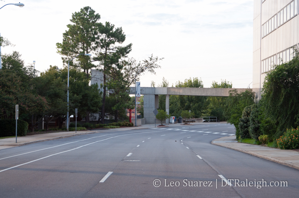
I’d like to see another plan for this area, one Raleigh has already had, and that is to return the streets to their original configuration. The wishbone piece of the intersection could be removed and Wilmington and Salisbury Streets can be straightened out up to Peace. A map of Raleigh in 1914 shows this configuration including Halifax Street making it’s way up to Union Square as it has always been before the state government complex was built. (yay, urban renewal?)

It’s possible that this idea takes a busy intersection and splits it into two smaller ones. Here’s a mock up in Google Maps of what it could look like.


View Peace/Salisbury/Wilmington Intersection Idea in a larger map

Current properties in the map, shown in blue, are the AIA NC building and a Department of Administration building. In orange, you can see the returned street extensions and the green covers the wishbone piece of the current intersection. I also highlighted two service entrances in purple that are needed for the government complex.

The new green space is wide open in terms of future uses. Possibilities for it are new mixed-use developments, completely open green space, or a balance of the two. If a civic plaza is desired, the complete road removals would allow for more space.

In terms of traffic flow, I’m also curious what would happen if Salisbury Street were changed to a two-way street. With it connecting directly into Seaboard Station Avenue, bicycles and vehicles would have a direct connection from the core downtown to Seaboard Station.

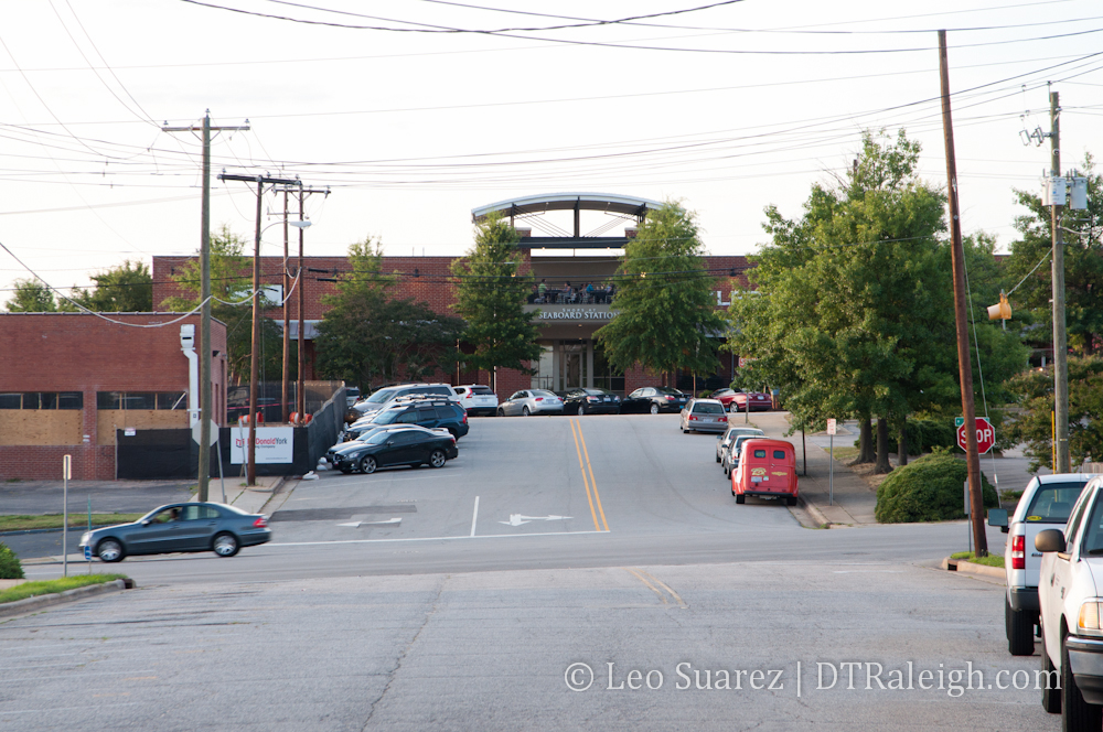
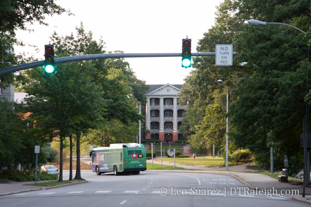
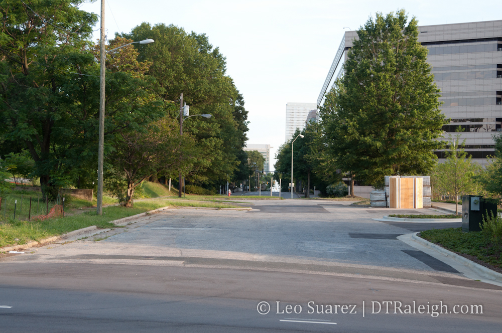
There is also a really great view looking north at Seaboard Station that anyone driving, pedaling, or walking on Salisbury would feel more welcomed to a different downtown district. If you notice on a map, Vaughn Court is the current “extension” of Salisbury Street. Here’s a view looking north from that street. Click for a larger view.

Seaboard Station entrance from Vaughn Court

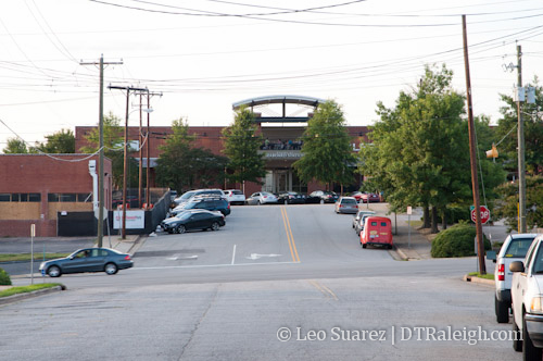
I feel that this should become a “main entrance” to Seaboard Station in more of a way that it is today. With a two-way Salisbury Street, there could be better connections from Seaboard Station to downtown. You also get the visual bonus in that drivers and pedestrians can see their destination a few blocks away. Currently, you have trees and parts of the government center parking deck in front of you.

Looking North on Salisbury Street.

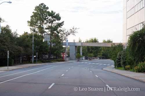
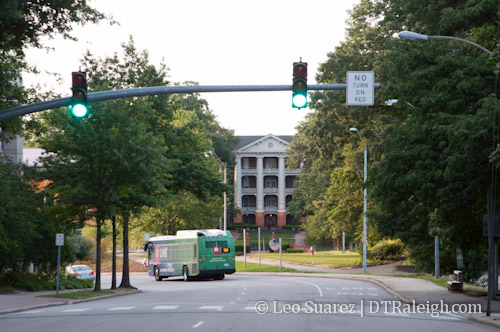
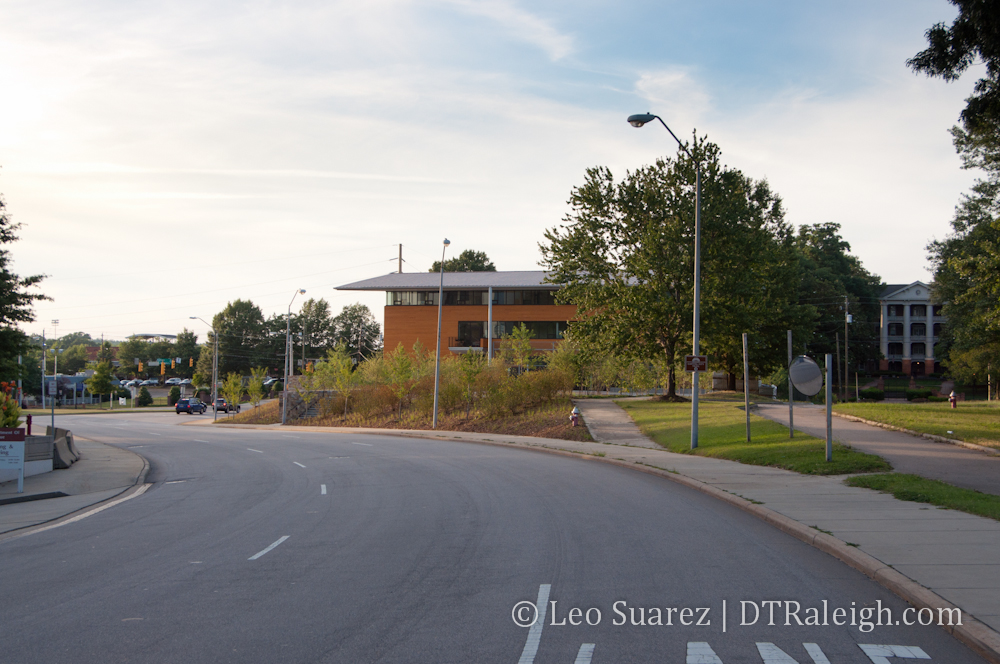
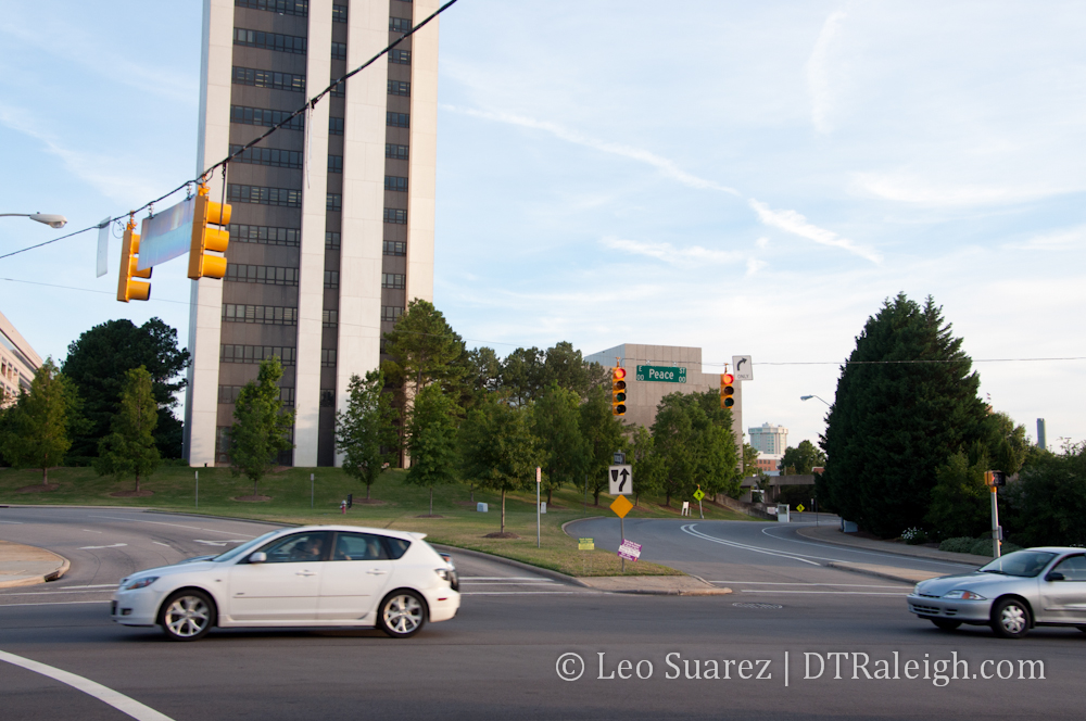
Wilmington Street already has a great view with the William Peace University main building front and center to traffic. An extension to the road could make the new intersection of Wilmington and Peace a more interesting place, brought about with any future developments that come from the Blount Street Commons project.

View of William Peace University down Wilmington Street.

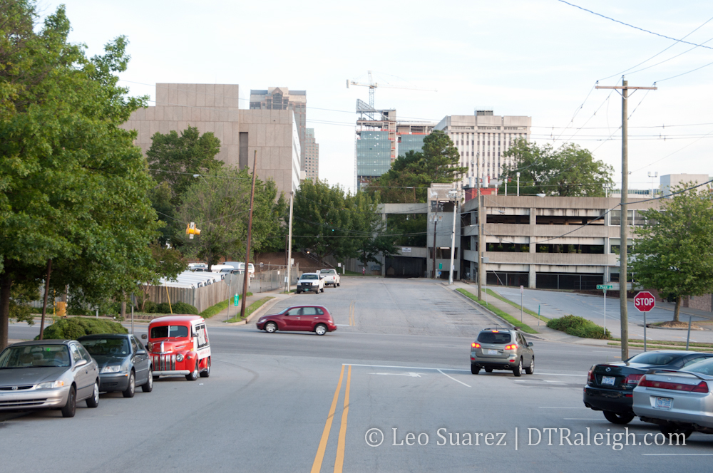
With more development coming, an improved road network may make for more successful redevelopment in this area and who knows, maybe the government district could begin to grow some life during the off hours.

Click on the image below for a gallery of more images of the area.

View of the AIA NC building and William Peace University main building from Wilmington Street.

Municipography, Capital Boulevard and a Transit Tax

Municipography is a summary of current issues going through the Raleigh City Council and other municipal departments in the city. The point is to try to deliver any video, photos, and text associated with the discussions happening at City Hall or elsewhere. Since this is a downtown Raleigh blog, the focus is on the center of the city.

I recommend email readers click through to the website to see the embedded video.

This week, there was action at both the city and county level. Heated comments took place at the Wake County Commission meeting over a tax increase that would support expanded transit options in the county. Raleigh city staff presented the Capital Boulevard Corridor Study, a vision to remake the area from Peace Street all the way to I-440.

Capital Boulevard Corridor Study

City staff presented a general overview of the Capital Boulevard Corridor Study as well as some of the data gathered and citizen feedback. After some light conversation, the city council moved it to the Comprehensive Planning Committee for further review. An endorsement of the plan is needed before August to align with the NCDOT’s plans to design new bridges for Capital Boulevard at Peace Street and Wade Avenue.

Councilors briefly mentioned the topic of the at-grade intersection at Capital and Peace so I expect more conversation about it at the committee meeting. Still, city staff has added some excellent reading as an appendix to the corridor study and breaks down the metrics of measuring an intersection’s effectiveness. They explain the advantages and disadvantages of each interchange design including one type of at-grade proposal.

Wake County 1/2 Cent Sales Tax For Transit

On Monday:

In a 4-to-3 vote along party lines, members of the Wake County Commission Monday turned down a proposal to consider a transit plan and a half-cent sales tax referendum for this November’s ballot.

Commissioner Erv Portman presented the motion, at the very end of a meeting during which more than 20 people spoke in favor of putting the referendum on this November’s ballot.

Although Monday’s meeting agenda included no mention of the sales tax for an expanded transit plan in the Triangle, the topic dominated the public comment period.

Commission Votes Against Debate on Transit Sales Tax via Raleigh Public Record.

To hear/watch the public comment period, jump over to the Wake Board of Commissioners meeting agenda for June 18, 2012.

The needed 1/2 cent sales tax increase to secure a source of funding before transit in Wake County can be expanded has now been kicked down the road again. Durham County has approved it and is waiting for Orange and Wake Counties to do the same before they start collecting.

Orange County votes on the 1/2 cent sales tax increase this November.

Introducing Link Peace Street, A Resident Backed Alternative For Capital Boulevard and Peace Street

Peace Street with Capital Boulevard bridge

There’s a new project that’s growing some legs in downtown Raleigh. Link Peace Street is a vision from Raleigh residents for a more walkable environment on Peace Street. It coincides with the Capital Boulevard Corridor Study and hopes to put another alternative onto the table that is currently not being considered. I’m helping out with the effort and the core focus of it revolves around creating a plan for an at-grade intersection at Capital Boulevard and Peace Street.

Over the next few days, more information will be put onto the vision website of Link Peace Street so I encourage readers to check out the site we’ve built and sign up for updates.

Link Peace Street revolves around three main goals,

  1. Economic development in a form that fits into downtown Raleigh.
  2. Strengthen the connections between neighborhoods.
  3. Deliver on the 2030 Comprehensive Plan.

The Capital Boulevard Corridor Study, taking public comments at this time, targets private investment in the area using several projects. Some of those include an expanded greenway, a park at the old Devereux Meadow site, and multiple tweaks to Capital Boulevard itself. We’ve mentioned here before that the state of North Carolina is going to replace the bridge over Peace Street within a few years. The study wants to piggyback on that project and is considering some alternative routes to getting on and off of Peace Street. You can read about those alternatives on the Peace Street Vision document in the sidebar on the city’s website. These ideas are what planners think will help spur private investment in the area.

All plans being considered so far include the new NCDOT designed bridge and Link Peace Street wants them to consider the ‘no bridge’ option. We feel that the upgrades to Capital Boulevard, outlined in the study document, only promote more speed and will continue keeping vehicles moving through the area rather than stopping at a destination. Peace Street is the northern border of downtown Raleigh but most people don’t see it that way as the built landscape is not meant for a downtown at all. It’s possible that an environment that balances pedestrians, cyclists, and vehicles can promote development that is appropriate for downtown Raleigh and is a much better use of land.

With vehicles speeds kept the same and not increased, a walkable Peace Street will connect the neighborhoods rather than be an obstacle between them. In March, the Blount Street Commons project was asking the Raleigh City Council for a zoning change to allow for more density. At the same time, there is an apartment boom near Glenwood South. Both neighborhoods are so close yet feel much farther because of the uneasy walk down Peace Street in its current state.

It is a half mile walk from the Mellow Mushroom to Tyler’s Taproom yet so few people make that walk. In comparison, Fayetteville Street from one end to the other is a half mile. Peace Street may never have the towers and historic structures of Fayetteville Street but we think that we can atleast set up Peace Street for the same walkable experience. To have it, it starts with people and not vehicles.

The 2030 comprehensive plan specifies that this area is in the Core Business District category. It states:

This category applies to the Raleigh Central Business District, and is intended to enhance Downtown Raleigh as a vibrant mixed use urban center. The category recognizes the area’s role as the heart of the city, supporting a mix of high-intensity office, retail, housing, government, institutional, visitor-serving, cultural, and entertainment uses. Multiple zoning districts apply within the CBD, corresponding to the different character and vision for its various neighborhoods. The maximum residential density in this area would be 320 units per acre with densities tapering off towards edge areas adjacent to established residential neighborhoods, but not falling below 40 units per acre.

The Capital Boulevard study wants to widen lanes and help the flow of traffic. This does not fit with the description above and Link Peace Street feels that goes against the plan adopted just a few years ago.

How can we continue to do what we’ve been doing here in the corridor and expect different results?

Insanity: doing the same thing over and over again and expecting different results.

-Albert Einstein

We’re hoping to build support for the idea before the study is brought to the city council before the May 1st meeting.

Municipography, Walking, Union Station, and Commuter Trains

Municipography is a summary of current issues going through the Raleigh City Council and other municipal departments in the city. The point is to try to deliver any video, photos, and text associated with the discussions happening at City Hall or elsewhere. Since this is a downtown Raleigh blog, the focus is on the center of the city.

Walk Raleigh

Matt Tomasulo and his Walk Raleigh signs have been accepted as a gift to the city. The signs brought international attention to Raleigh and after some time had to be taken down because of the lack of a permit. Still, the signs made their statement and some will be put back up for a 90 day pilot program.

The council unanimously approved.

Union Station Financials

Last month, city staff was authorized to apply for a Transportation Investment Generating Economic
Recovery (“TIGER”) grant for a component of Union Station. The NCDOT and Triangle Transit are helping with the application too and have come up with this financial breakdown:

  • Station development: 80% federal, 10% state, 10% city
  • Rail/track/platform improvements: 80% federal, 20% state
  • Street improvements: 80% federal, 20% city

This puts the city’s cost at $7 million. Remember, that last year $3 million was approved by voters in the Transportation Bond. So the remaining $4 million will have to be worked into next year’s budget cycle. This move helps the grant application.

John Odom voted against this stating concerns about the cost while the rest of the council approved.

Commuter Rail Station Locations

The city’s Passenger Rail Task Force stopped by to endorse the locations of the commuter rail stations in Raleigh. Those four being at:

  • Southeast Raleigh at Hammond and Rush Streets
  • Downtown Raleigh at the Warehouse District
  • NC State near Dan Allen Drive
  • West Raleigh near Corporate Center Drive

You can read about more about this as well as light rail and buses at the Transit tag link but for the best wrap up of the commuter rail plans jump to, “Transit, Commuter Rail, and More, We Dive Into The Docs.”

The council approved this unanimously.

Updated Unified Development Ordinance Now Available

Another draft of the city’s Unified Development Ordinance (UDO) is now out for public comment. I’ll admit, this is a tough one for citizens to swallow so perhaps after some time, there will be some highlights about it. For now, I’ll try to inspire readers to dive into the documents over at the city’s webpage for the UDO.

If you have time, please watch this video, embedded above, from the city’s Youtube channel that talks about the new code and can maybe clear this up for more people, even if just a little.