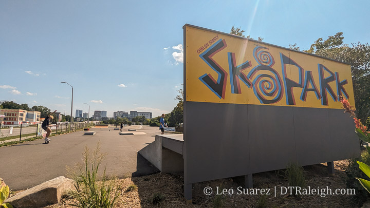
Have you seen, or even used, the new skate park along Capital Boulevard? The new Conlon Family Skate Park has been set up near Capital Boulevard and Dortch Streets. You can spot riders and skaters at all times of the day from what I have seen.
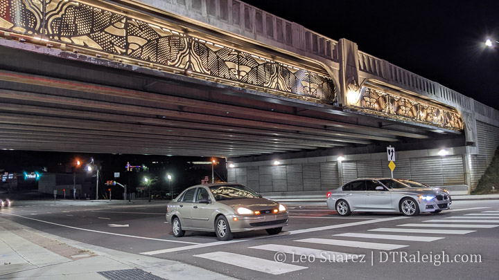
Have you been under the Capital Boulevard bridge at night lately? It seems like it was delayed (what isn’t delayed these days?) but the art installation for the bridge over Peace Street looks finished and is lit up very nicely now.
I’d like to think this project is finally done now that the lights are on. The Capital Boulevard project is a pretty long-lasting one as far as this blog goes, with posts about it going back to 2010. The area will probably see even more public investment as Devereux Meadow park, right next door to this bridge, goes through its planning phases.
The city held a virtual open house in May, 2021 about a future urban park at the Devereux Meadow site. The site sits just north of Peace Street directly west of Capital Boulevard. It’s currently being used to store city vehicles but that will all be moved soon. Jump into the video above for the full 2-hour details, or 1 hour and 20 min if you watch it at 1.5x speed, the preferred watching speed here at DTRaleigh HQ.
You can also check out the project page on the city’s website for the slides and contact information: Devereux Meadow Project
Devereux Meadow has popped in and out of the blog over the years as the site has been mentioned for future plans going back all the way to a 2011 Capital Boulevard Corridor study. That street is well documented on this site and I even have a post up about the baseball field that was built in 1938 right next to Capital. Finally, the Devereux Meadow site has been planned to become a park as part of the 2015 Downtown Plan which I covered here.
The session and presentation is quite nice and in addition contains some history. Even more history can be watched in an additional video.
Getting back to the present, the plans for the urban park are starting to materialize as the city is in the process of finalizing the schematic design. The construction of the park itself is still unfunded but could be on a future, this year even, parks bond.
The team is presenting three concepts for your review and I’d like to share each one below. The main points of each plan address the Pigeon House Branch creek in different ways and I think everything else kind of reacts around it.
Line Drive
The Line Drive concept is the first one in the list and does the least, relatively, to the creek compared to the other two plans. The creek “is stabilized in place, with stream shelf and instream structures to promote floodplain connectivity and bedform diversity.” A portion of the creek that is currently covered in concrete would remain.
This plans comes in as the cheapest and the report sums up how it stacks up against the rest with:
“Stabilization in place of the current stream. Aqueduct, site access road and Dortch Street culverts remain, leaving no room for stream alignment or grade manipulation. Incorporation of a stream shelf promotes floodplain connectivity, and instream structures develop bedform diversity. Lowest cost, lowest ecological uplift.”
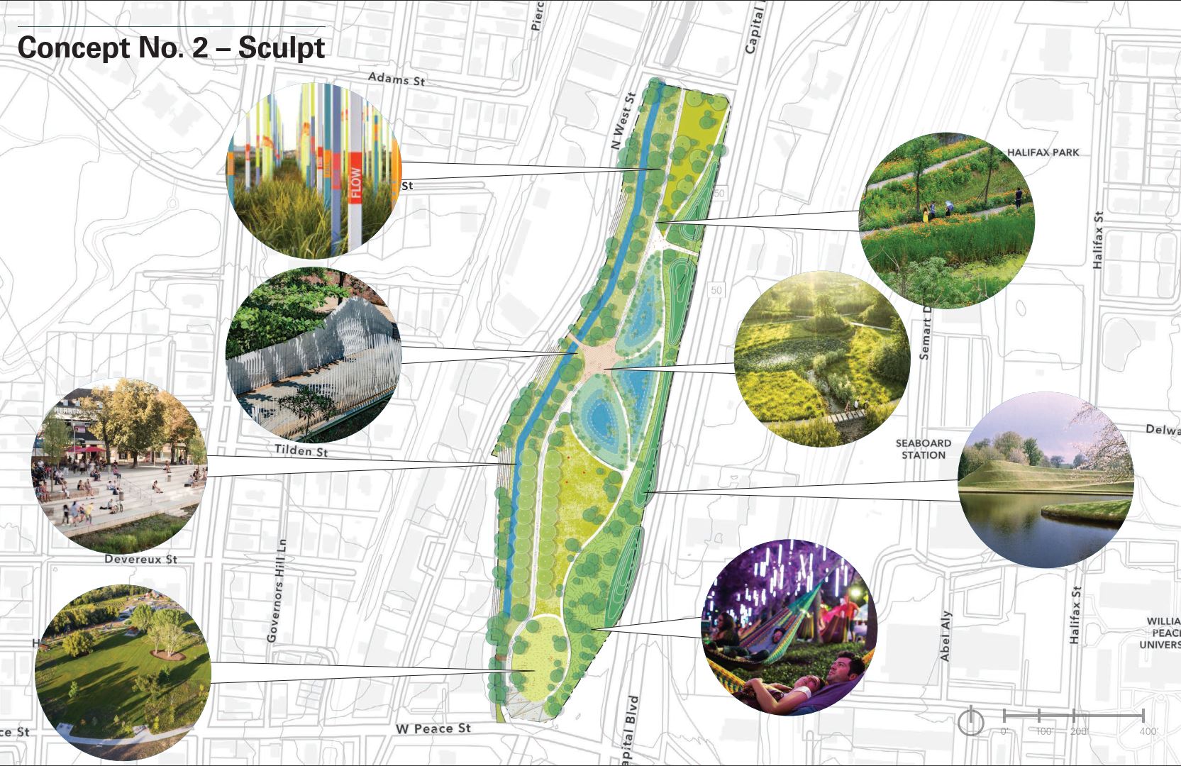
Sculpt
The Sculpt concept is the “middle” option, for lack of a better word, as this one has some work being done to the stream and the cost is in-between the other two. This plan opens up the creek a bit as that concrete cap on the southern end is removed. The creek “is restored in place, with increased stream bench and instream structures for greater habitat and flood capacity and bedform diversity.”
The high-level states:
“Removal of the concrete cap over the aqueduct and limited manipulation of the stream alignment and profile. Increased extent of stream bench for greater habitat and flood capacity. Instream structures develop bedform diversity. Moderate cost, moderate ecological uplift.”
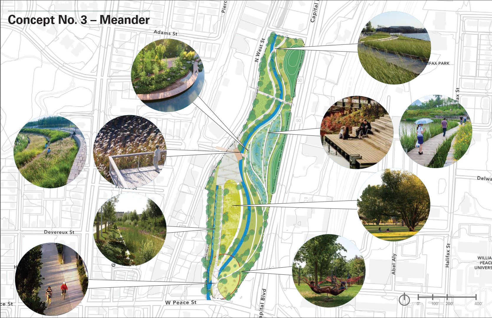
Meander
Meander would offer the most significant transformation. As you can see, the stream is practically reconfigured on the site and would offer flowing walking paths alongside. In this plan, “Pigeon House Branch is realigned, with stream and floodplain designed to maximize floodplain connection, habitat health and visitor interaction.”
There’s also the most opportunities for programming and public uses of the space. As the report states:
“Total relocation of the stream alignment and profile. Stream and floodplain design are based on bankfull hydrology and maximize floodplain connection and function. Greatest potential for visitor interaction, diverse habitat communities, and incorporation of stormwater treatment. Highest cost, highest ecological uplift.”
Which one do you like? Make sure and take the survey and give the city your thoughts.
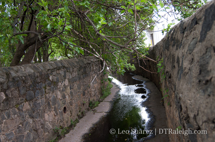
For me, I go back and forth between Sculpt and Meander but I think Sculpt gets my vote. There’s a line of oak trees, referred to as the Oak Allée, on the western side where new oaks would be planted as part of Sculpt. The other two plans don’t have that. In addition to opening up the stream on both plans, this just seems like a nice element to have in the future, once the new oaks mature.
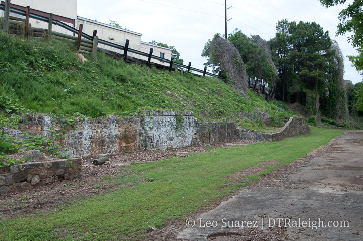
Finally, I have to share some old photos I took when I lurked around the area in 2012. You can see the concrete cap over the creek and some of the oak trees. These are around the southwestern side of the site.
What positives or negatives do you see? Come over to the Community and discuss it with us.
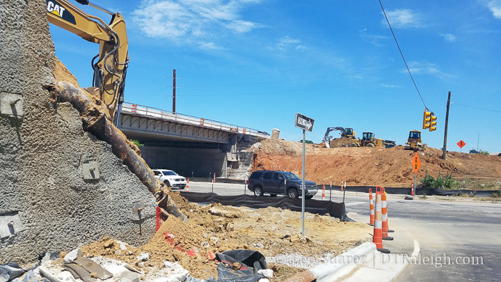
The old Capital Boulevard bridge over Peace Street has now been removed.
Torn apart and dismantled during the night throughout the last few weeks, the bridge that was close to reaching its end-of-life and has stood up over Peace for over 50 years is no more.
The “square-loop” traffic pattern is more and more coming into place around the new bridge, which already has traffic flowing in both directions. With the northbound exit to Peace now open, the next major connection should be the new Peace to Capital on-ramp (and Cotton Mill entrance) road.
I’m really hoping to see this project wrap up this year as was planned.
On the left, the new Capital Boulevard bridge under construction. Center-right is the old bridge. April 2018.
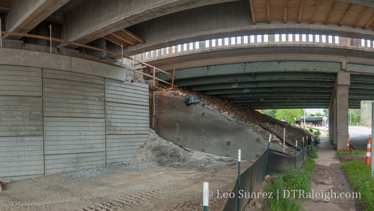
Here are some observations from a walk along Peace Street, specifically underneath the new Capital Boulevard bridge. The photo above shows the old bridge, on the right, and the new bridge, on the left. You can see with the upgraded design that a lot of space is reclaimed when you compare the old “rock mound foundation” versus the “concrete wall foundation” of the new. (like my technical terms?)
It’s almost a vehicle lane, about 12-14 feet, on each side!
This made me pull out the map and below is the one shared from the NCDOT project page. When looking at it, up is West (peace going up/down) with Capital going left-to-right and the dark red being the new bridge.
Click for a larger, zoomed out view of Peace Street.
What is great to see is that while Peace is wider, it will still be a two-lane road just like today. The additional space is being given to turns lanes but also wider sidewalks and bike lanes. The bike lanes aren’t very clear on this map but if you look hard, they are there.
I will say that some of the added road space is going toward center turn lanes also. Either way, the road has to slim down because the CSX bridge to the east isn’t getting any wider.
Anyway, it’s cool to see this come together one small piece at a time.
Email readers: This blog post has a virtual reality image. Read the post on the blog to see it.
Click for larger
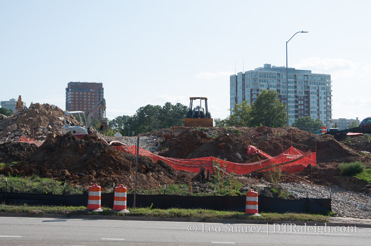
One day, I was riding south into downtown on Capital Boulevard and caught a glimpse to the west towards Glenwood South. The clearing of so many buildings just struck me and I had to come back to take some photos. This would have really been nice to have a drone for this post but either way the photo above attempts to show how much has been cleared.
Between Johnson and Peace, Capital and West Streets almost all buildings have been demolished this year. With the help of iMaps, I estimate about 6.5 acres have been cleared in just this area.
History repeats itself?
Well, probably not. A residential neighborhood, the late Smoky Hollow, isn’t being cleared again but the state is still flexing its eminent domain muscle for highway improvements. Let’s hope this time it sticks.
Click for larger. Note the new Johnson Street connection already planned for. Next, the Harrington connection to Peace.
The photo is from the west side of Capital Boulevard with the new bridge over Peace Street directly to my right. I will probably not be able to get an exact after-shot once that project is complete but I’ll certainly try. (safely)
First to watch is the 12-story residential tower called Peace, formerly Smokey Hollow, at the corner of West and Peace Street. It was announced that a Publix grocery store would anchor the ground-floor space of this project. I bet that’s a huge selling point for more development in this area.
That’s all that’s confirmed at this time but I’m sure there will be more coming and with it all currently zoned for a maximum of 12-stories, an entirely new neighborhood (dare I say Smoky Hollow?) could be created with that kind of density. (by Raleigh standards anyway)
For more views, here’s a VR shot I took while up there. If you can’t see the embedded VR view, try seeing it directly on the blog.
[UPDATE: 12-19-17, a RalCon reader has submitted a different view of the area from the 510 Glenwood building.]
Warning! (or treat!) This will be an image-heavy post.
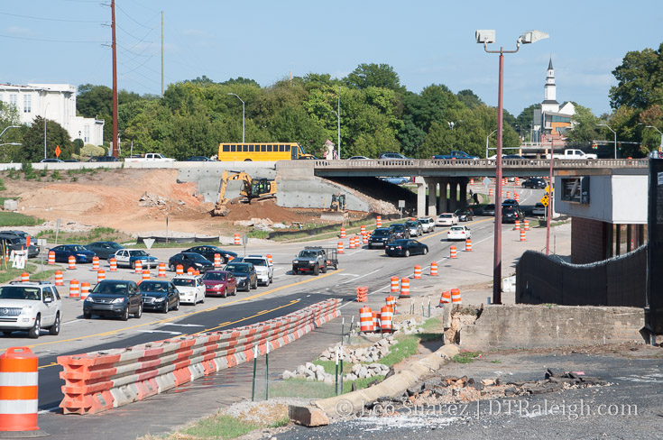
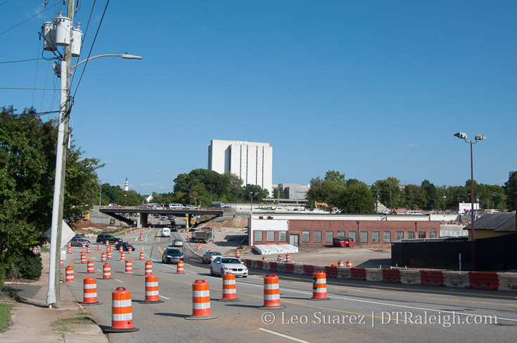
I had the pleasure of taking a walk up Peace Street recently, during rush hour, to witness all the demolition and work taking place around the Capital Boulevard bridge. We’ve all been following the work in this area for awhile but when you walk it, it’s truly at another level.
I’ll write a little and then let the photos do the talking.
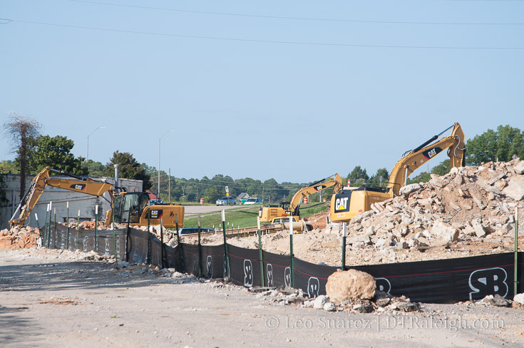
The Capital Boulevard work is really in full swing here as clearing for the new bridge over Peace Street takes place. Buildings have been demolished and old foundations chipped away to make way for the Square Loop.
At this time, construction fencing is up around the Smokey Hollow site. Even more demolition should be taking place in the coming weeks for the 12-story mixed-use project.
It’s a swarm of development in such a short amount of time. The end of 2019 should see all the street work wrap up for us to enjoy it.
I’m starting to think that the state’s Capital Boulevard project would be this decade’s most impactful public-funded project taking place in downtown Raleigh. (Fayetteville Street being the clear winner in the 2000s) I wanted it to be Union Station but so much is going on here that I think this edges it out.
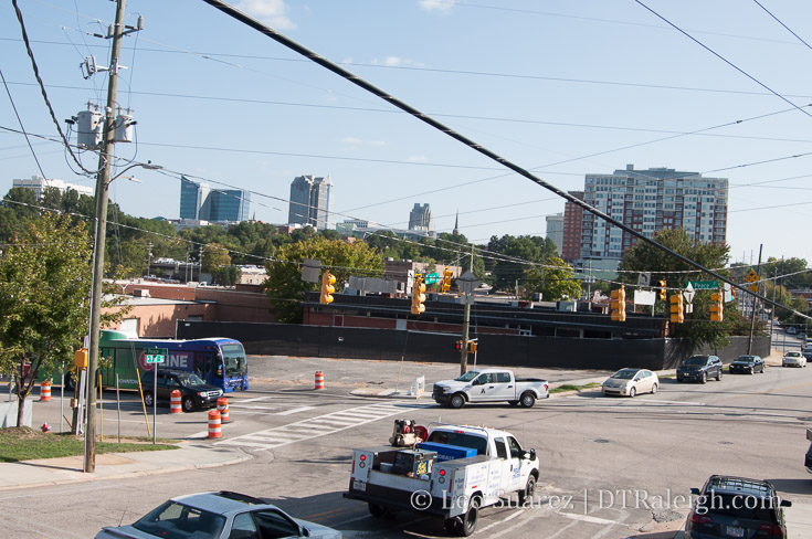
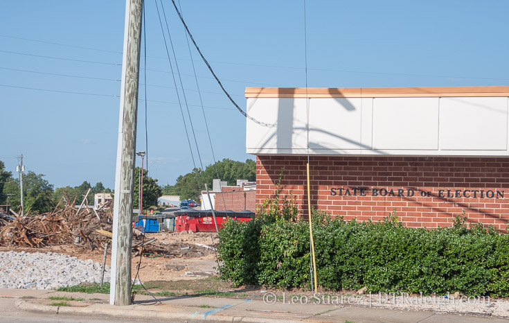
Peace Street, September 2017. The former Fairway Advertising.
Peace Street, September 2017.
Peace Street, September 2017.
Peace Street, September 2017. The former Finch’s restaurant.
Peace Street, September 2017.
Peace Street, September 2017.
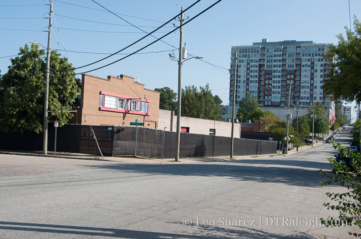
Peace Street, September 2017. Construction fencing around Smokey Hollow.
West Street, September 2017. Construction fencing around Smokey Hollow.
West Street, September 2017. Construction fencing around Smokey Hollow.
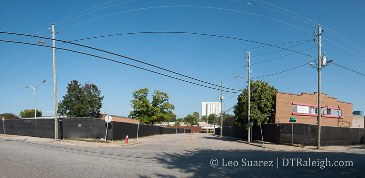
Johnson and Harrington Street, September 2017. Construction fencing around Smokey Hollow and future Johnson Street connector.
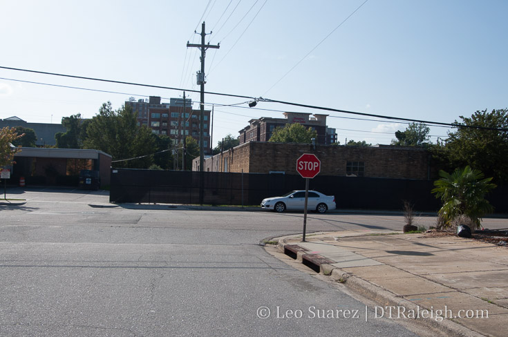
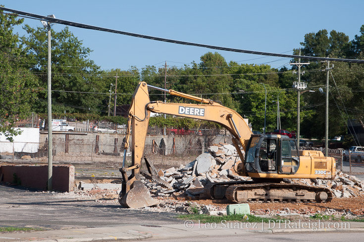
Capital Boulevard area, September 2017. Clearing of buildings for the square loop.
Capital Boulevard area, September 2017. Clearing of buildings for the square loop.
Capital Boulevard area, September 2017. Clearing of buildings for the square loop.
Capital Boulevard area, September 2017. Clearing of buildings for the square loop.
From the meeting this week hosted by NCDOT, the video above was being played on a loop at the Borden Building in Fred Fletcher Park Thursday evening. If you can’t see the embedded video, go here.
The video is a great watch for those following this project and construction starts on Wade Avenue first this Fall.