A Walk Down New Bern Avenue

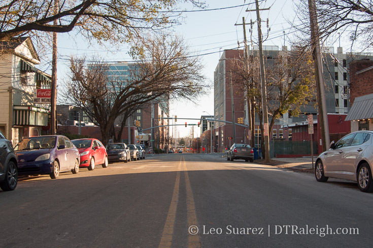
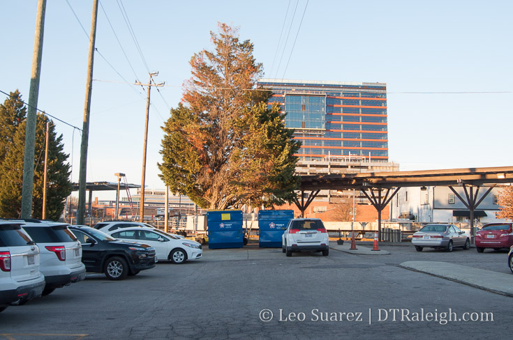
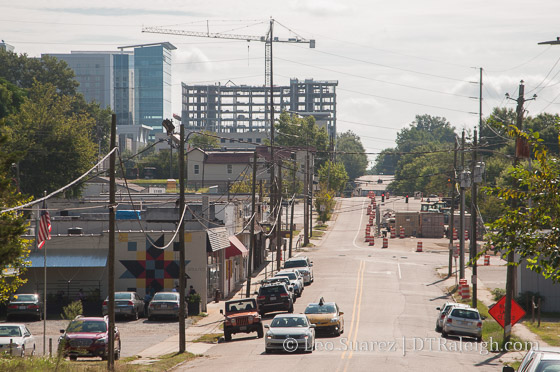
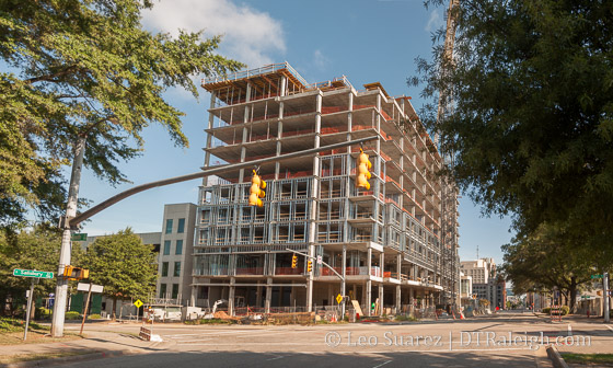
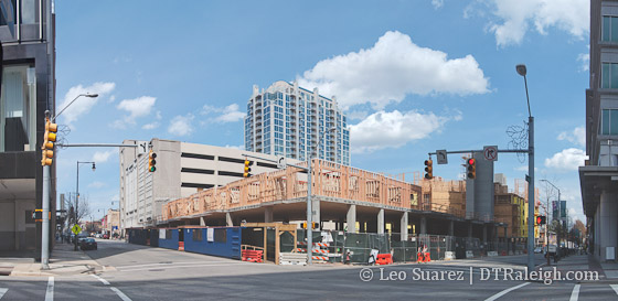
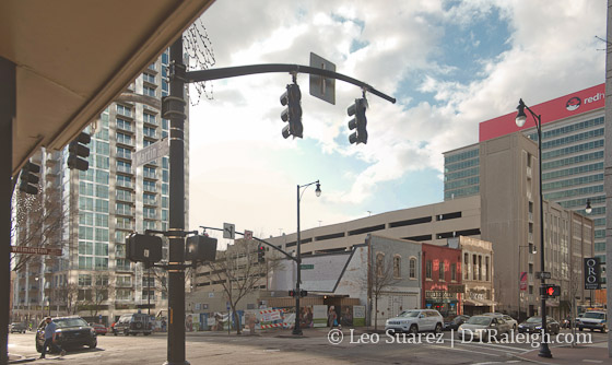
The blog and Community tend to focus on new developments in the downtown core, such as 301 Hillsborough or The Willard hotel, that we may be overlooking some other activity just on the outskirts of downtown Raleigh. I thought it time for another Walk Series post to show off the east side of downtown, mainly the New Bern corridor.

The New Bern corridor interests me mainly due to some key observations and upcoming projects:

  • Planned location of the city’s first Bus-Rapid Transit route
  • Increased residential units from new townhome developments
  • Upcoming zoning conversations for the area

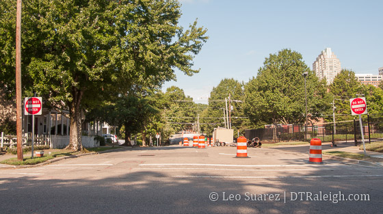
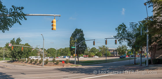
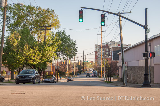
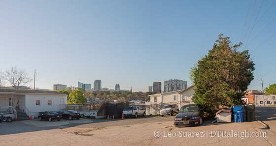
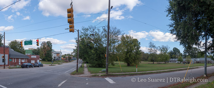
Loosely defined, for this Walk post, I’m focused on New Bern and Edenton Streets between Tarboro and East.

BRT Transit is Coming

With the implementation of the 1/2 cent sales tax for transit in 2017, higher-capacity transit, among other improvements, are being planned all over the county. Along New Bern and Edenton Streets, bus-rapid transit (BRT) will be rolling through in a few years if everything stays on schedule.

Being one of four planned BRT routes, high frequency transit will be flowing in and out of downtown Raleigh to the eastern parts of the county. Read more about the plan for BRT here.

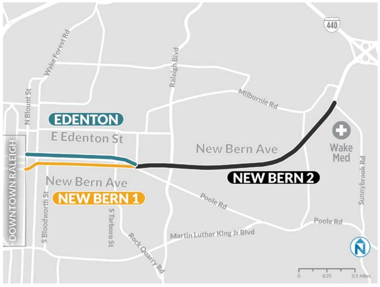
The corridor may see dedicated bus lanes, expanded bike lanes, and new sidewalks on both sides of the street. It’s a big upgrade for the same corridor that currently runs the GoRaleigh bus route with the second highest ridership in that transit system.

Tarboro and New Bern/Edenton is loosely planned to get a BRT station on this upgraded route. The next stop inbound would be downtown itself.

Last reported, before the pandemic hit, plans were to be rolling buses in 2023-2024.

From Single-Family to Townhome

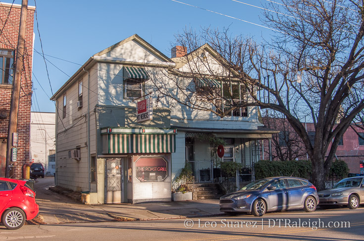
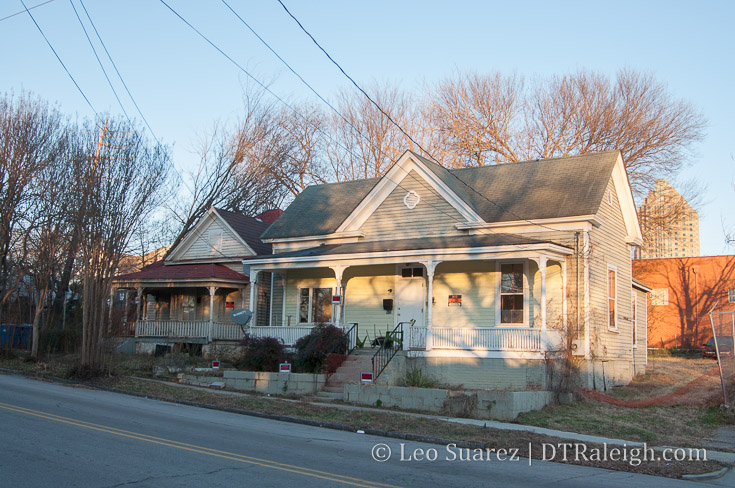
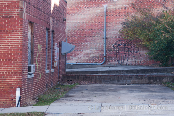
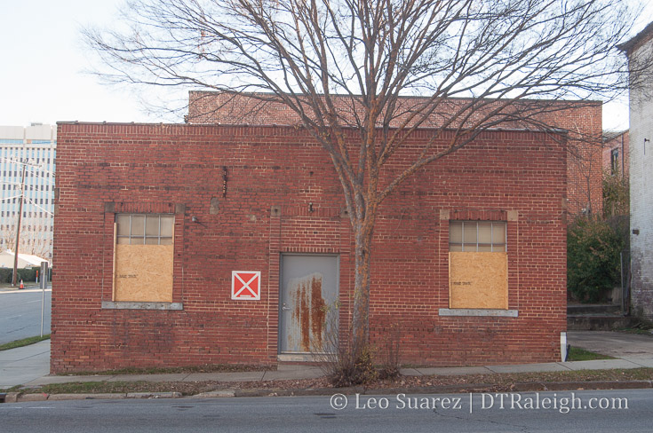
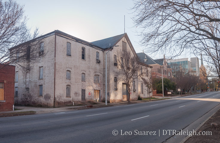
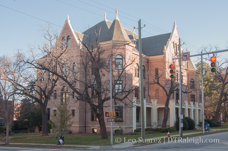
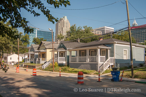
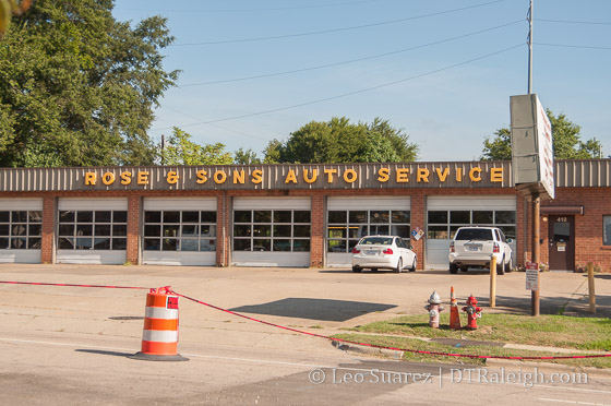
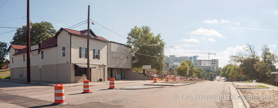
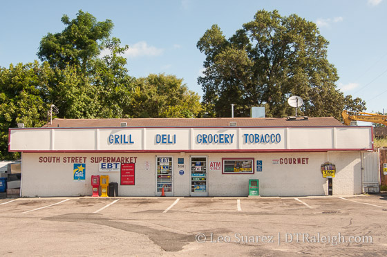
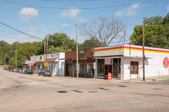
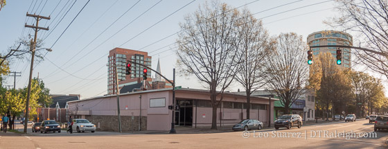
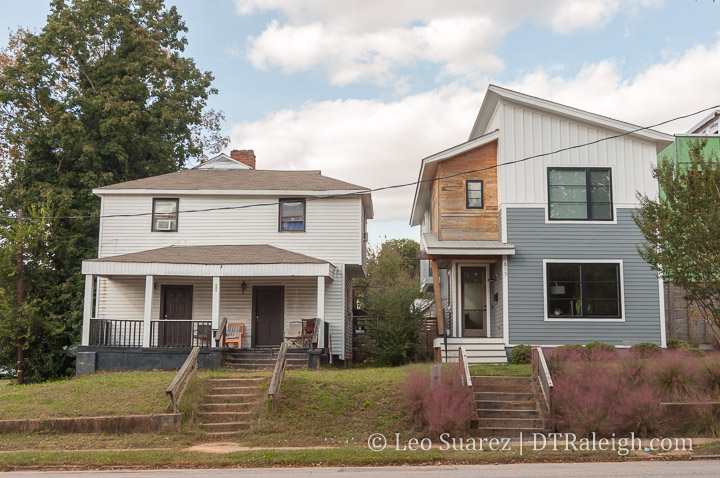
Historically, the corridor consists of many larger lots with single-family homes. You can still get a sense of the character going back to the early 1900s with the bungalows and larger houses facing the street.

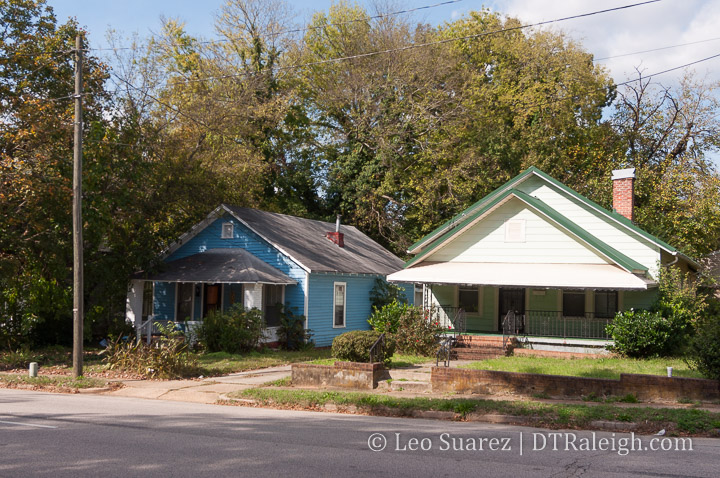
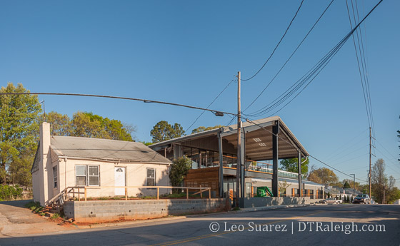
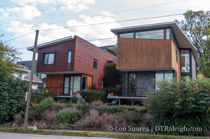
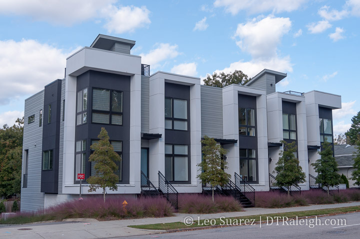
However, it’s not hard to spot some newer homes, mostly of modern architecture style, sprinkled throughout the area. These homes were popping up between about 2008 until today. These homes add a stark contrast to the area as you can see in the photos.

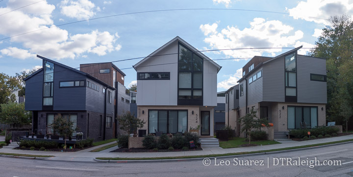
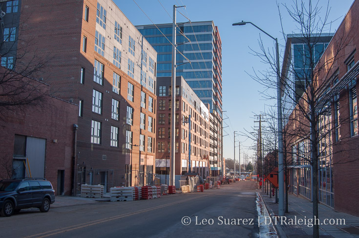
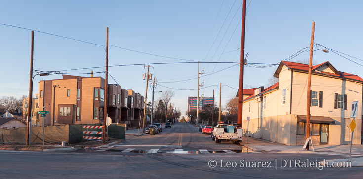
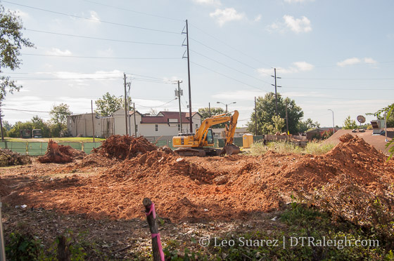
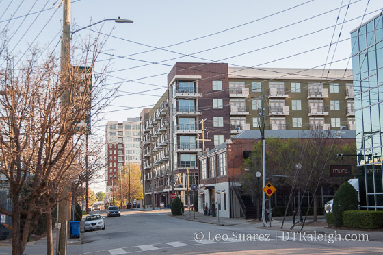
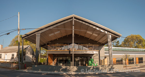
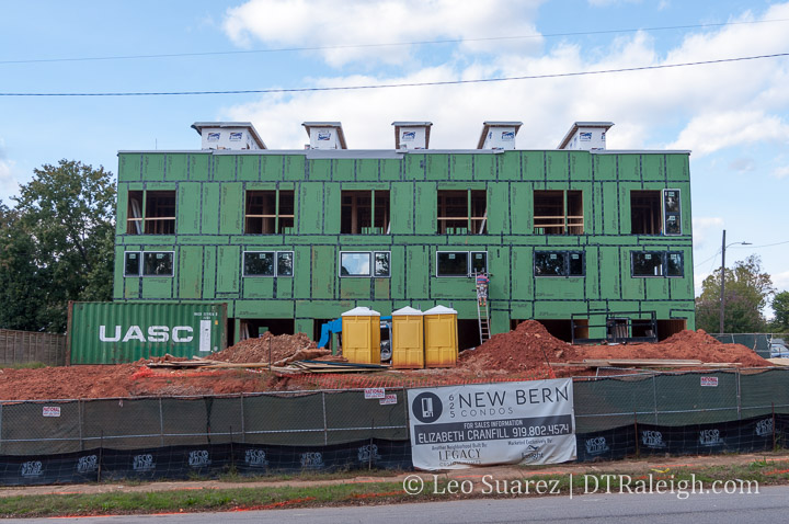
And if you really look more, the modern townhome seems to be making its way into the corridor as of recently. First, the ten-unit project named 10 Arros completed along New Bern within the last few years. Construction is currently taking place at 625 New Bern where 18 units are planned. Similar modern style as the former.

Finally, across the street from 625 New Bern is Oak City Overlook. This development plans 20 modern townhomes and land has already been cleared at the site.

Could more be coming? I’ve seen plans submitted for more and you have for sale signs like this one at 914 New Bern which advertise, “Townhome/Condo Site for Sale.”

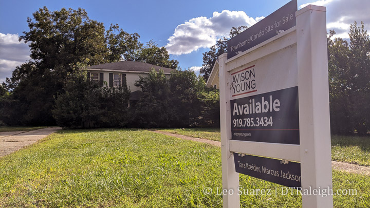
And there’s no shortage of space along this corridor. As I mentioned earlier, the single-family houses are on large lots that could easily be subdivided.

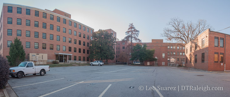
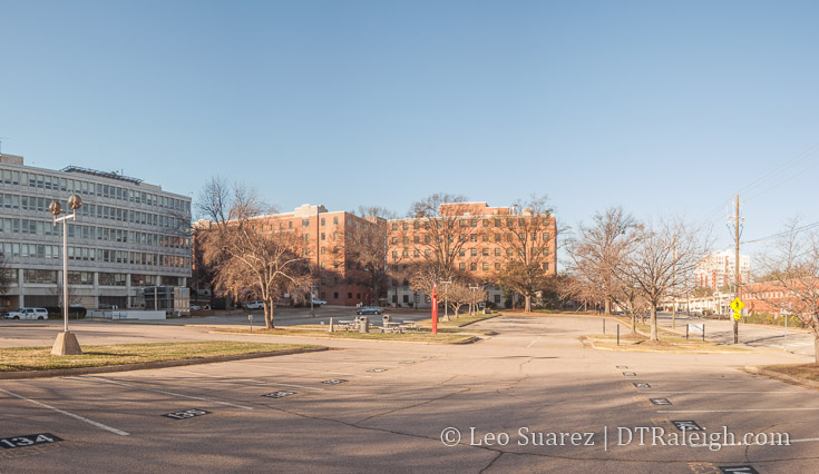
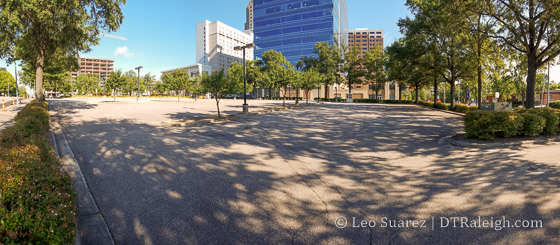
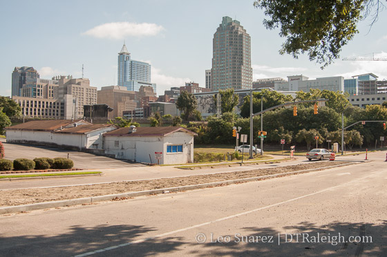
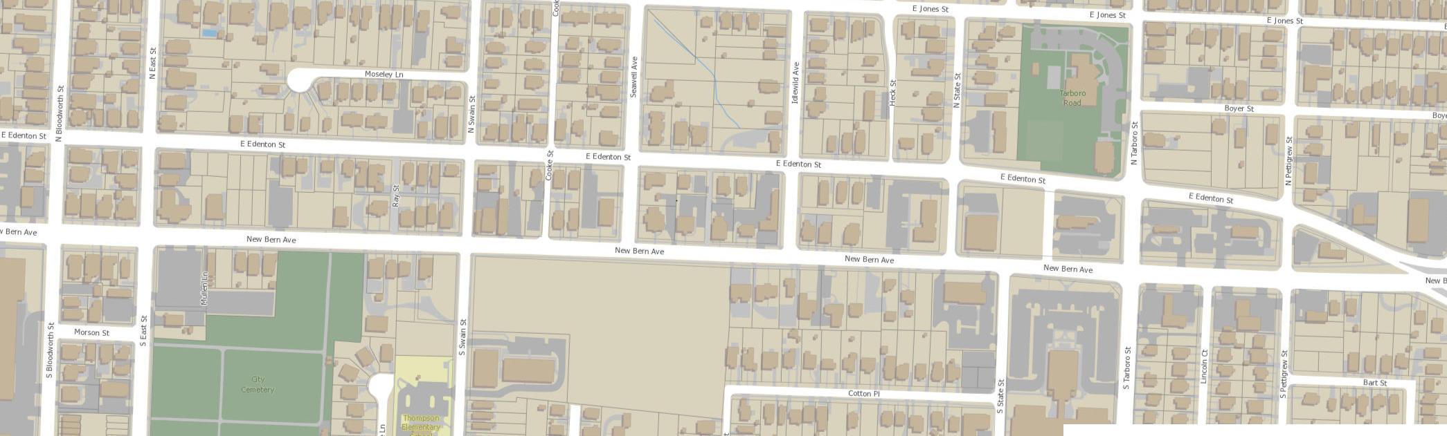
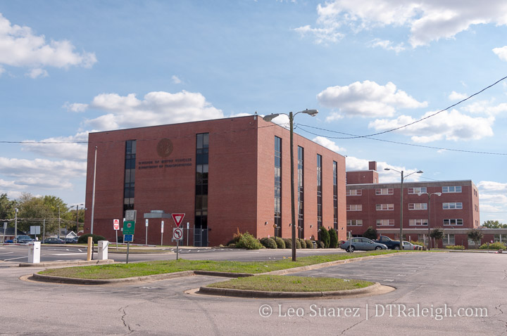
You also have the North Carolina State government vacating a large site at New Bern and Tarboro. The long-time site of the NC DMV is being vacated soon and that’ll put 5.4 acres of land a stone’s throw away from a rapid transit stop. Any development here, plus the adjacent surface parking that supported the NC DMV, could greatly change over if the state decides to sell it.

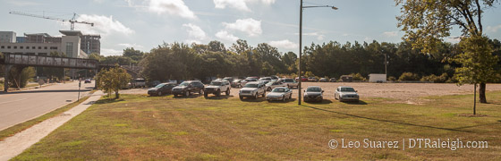
We also have 8 acres of undeveloped land at New Bern and Swain. Currently, the lot is only partially used by the Exploris school in temporary buildings but 8 acres offers a ton of flexibility, capable of a pretty transformative project. Just look at the map above, it’s that empty lot in the middle. That’s huge!

Zoning it Properly

From my perspective, you have two forces that are about to collide. The development is coming. Should transit only serve the single-family and new, high-end townhomes being built here?

To get more people access to the future transit network, an awkward conversation is soon to come, Raleigh. It’s time to talk about re-zoning the area.

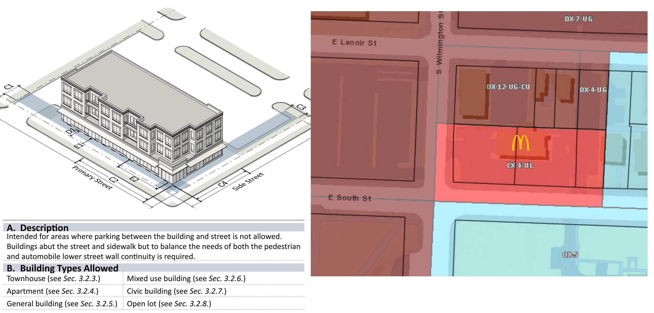
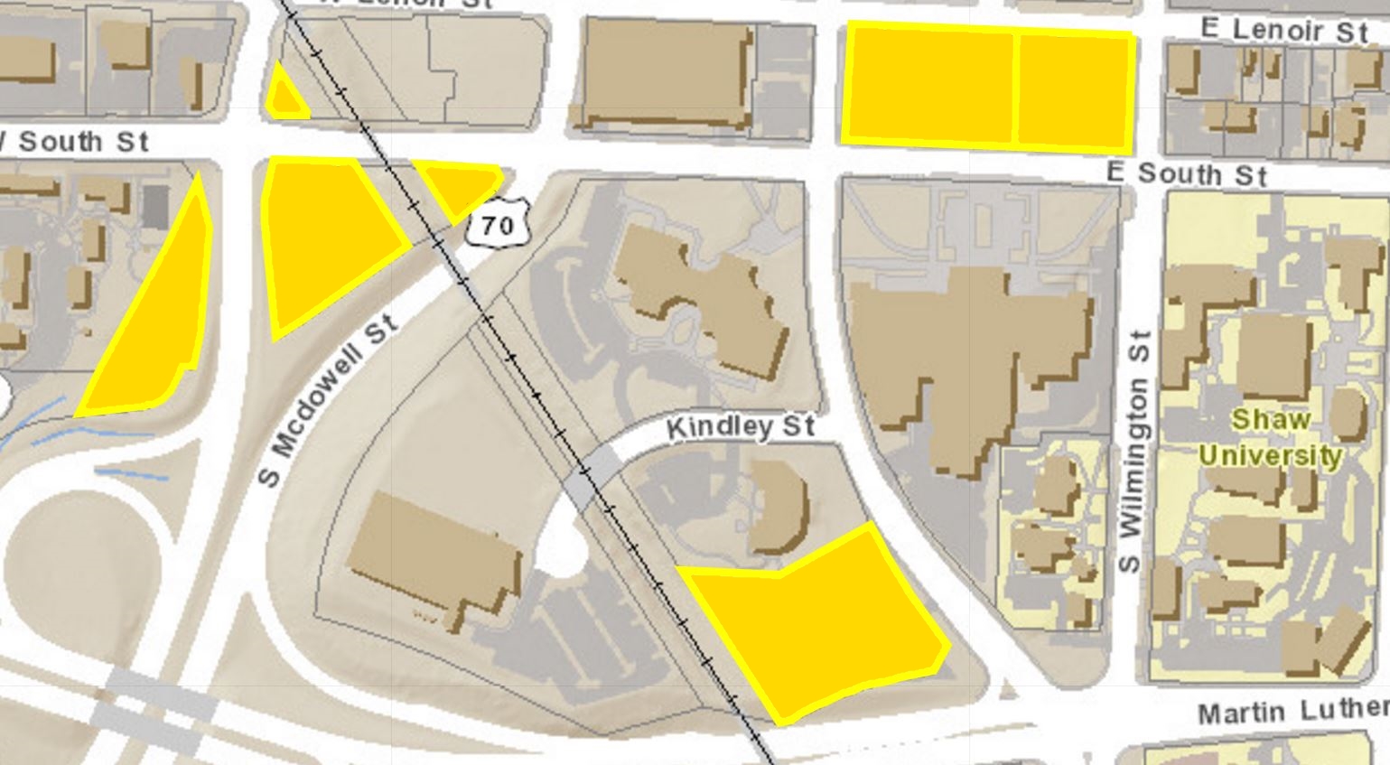
This is a good time to revisit a collaborative post I did about a zoning tool called the Neighborhood Conservation Overlay District (NCOD) and it just so happens that this area has one right in the middle. Below is the New Bern – Edenton NCOD and you can see, almost everything mentioned so far sits right inside it.

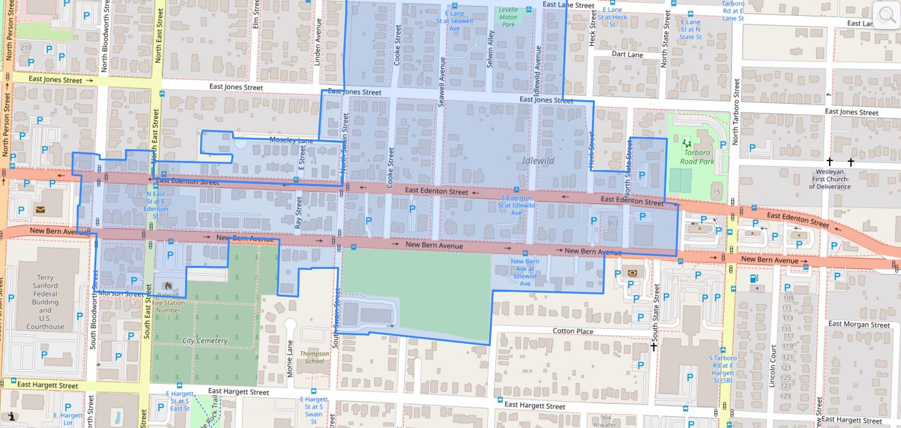
In short, the NCOD applies additional restrictions on height, setbacks, and is a tool to encourage new development be consistent with the current character. This NCOD was put in place in 1992.

To make transit more effective, these townhome developments help but we’ll need some larger projects in here to ensure additional office and residential density as they will be within walking distance of a high-frequency bus stop. It is a prime opportunity to get Raleigh residents on a car-less lifestyle at a variety of income levels.

I feel that the NCOD implemented in 1992 needs a revisit and with the current talks of more affordable housing around transit, it would be better to deliver hundreds (thousands?) of new units here rather than status quo townhomes near transit.

The land is still available but the development is starting to pick up. I’m hoping the city can start purchasing land for affordable housing as well as pushing for new zoning updates to match our 2030 and beyond goals as a city.

More conversations on this topic are sure to come.

A Walk Down South West Street

Looking South down South West Street.

Looking South down South West Street. January 2018.

As a compliment to a 2016 post on North West Street, today I wanted to take a look down South West Street. West Street through downtown is becoming an important corridor and from one end to the other, there are projects taking place that may make it a pretty desirable street in the future.

In case you weren’t aware, the directional prefixes for streets running north and south start at Hillsborough Street (west of the Capitol) and New Bern Avenue. (East of the Capitol) Hence, we start our walk at Hillsborough Street.

New developments and businesses are great but we always have to give a nod to the old favorites that have been threw a lot. I want to give a quick shout out to The Roast Grill, having been at this spot on 7 South West Street since 1940.

Photo of The Roast Grill.

The Roast Grill, open since 1940.

Will they make it to a hundred years? Time will tell but I certainly am pulling for them. The TBJ has an article (subscription required) that suggests they aren’t selling out. However, the pressure may rise as nearby developments take shape.

Heading towards the 100 block of South West brings us to the Morgan Street Food Hall. Food halls are a trend that’s happening around the country and Morgan Street will be our first (first, right?) food hall in recent memory. Plan for them to open this Spring.

Construction continues on Morgan Street Food Hall

Construction continues on Morgan Street Food Hall. January 2018.

Citrix employees should be food connoisseurs after that place opens.

The food hall will also get a nice infusion of nearby residents from the residential portion of The Dillon. Residents should be moving in this year and the developer has already landed a few restaurants and retail for the ground-floor spaces. Announced so far, we have:

And there’s plenty of space for more.

The residential units of The Dillon on South down South West Street.

The residential units of The Dillon on South down South West Street. January 2018.

As you walk by the residential units of The Dillon along the 200 block, there’s a sharp contrast between the life that will soon pop here and the still empty warehouse building on the west side. Plans have seemed to come and go for this huge warehouse.

Another Citrix-like rehab could be a decent proposal for this site as it has a large-footprint but hopefully a more mixed-use repurpose can be done. At this time, no plans have been announced.

The office portion of The Dillon.

Looking up at the office spaces at The Dillon. January 2018.

The end of the block approaches the office tower portion of The Dillon and Raleigh Union Station.

West and Martin Street will be a cool intersection I think. The Dillon’s 18 floors will draw activity here during the work days and the retail spaces, CAM, and Union Station will fill in the off hours a bit. I think it’ll feel lively and offer great views towards the downtown core.

Some warehouses nearby are also getting some renovation love. Father and Son’s newest location, the former Flanders Gallery, and the next-door neighbor have visible signs of upkeep.

Union Station is set to open early this year and I think you’ll see a small uptick in visitors as people from all over will come down to check it out. I remember when Fayetteville Street first opened in 2007 and on the first Sunday night after opening (when everything was closed) the street was jammed with cars filled with curiosity.

I think the same thing will happen this year.

Looking at Raleigh Union Station from West Street

Looking at Raleigh Union Station from West Street. January 2018.

Renovated warehouse along West Street.

Renovated warehouses along West Street. January 2018.

New train platform that will serve Raleigh Union Station

New train platform that will serve Raleigh Union Station. January 2018.

At this point, West Street ends but my walk does not.

The city is studying plans to make West Street tunnel beneath the train tracks and connect to itself at Cabarrus Street. The street currently goes below the tracks and turns into the Union Station parking lot so some of the work is already done.

Looking at Raleigh Union Station and The Dillon over West Street

Looking at Raleigh Union Station and The Dillon over West Street. January 2018. Click for larger.

Next to Raleigh Station, you can see how the grid is still aligned and the West Street tunnel would make the grid connect.

West Street across the train tracks

West Street across the train tracks

At Cabarrus, there is the old Raleigh Station, waiting to be demolished sometime this year. The future of this property is still up in the air as Amtrak services and offices will relocate into Union Station.

The 500 block of South West transitions us from the warehouse district into a more residential area.

Condos are planned at the corner of West and Lenoir. The Fairweather plans 45-units in a five-story, modern building. Construction hasn’t started just yet but the announcement of the project claims an early 2019 opening.

Worth mentioning again, one Raleighite has an idea to save two houses on this block of West. When pitched at a city council meeting in December, the idea didn’t fly with some councilors due to the fact that he sits on the city’s planning commission.

Old homes along West Street, planned for demolition.

Old homes along West Street, planned for demolition.

There is a risk of losing these homes that well represent Raleigh’s former Fourth Ward neighborhood, and in addition a plan to offer some affordable housing unless something happens in the near future. Jump back to the full story on this here.

At the corner of West and Lenoir, across from the future Fairweather project, is an old gas station that is planned to be renovated for a restaurant. No work seems to be taking place on the exterior at the moment so perhaps it’s all inside work right now.

Service station with plans for a restaurant.

Service station with plans for a restaurant at the corner of Lenoir and West Streets. January 2018.

Along the 600 block of West, the townhomes called West + Lenoir are wrapping up. These are some of the earliest townhomes to be completed in this area as nearby Fourth Ward and 611 West South have not really begun yet.

West + Lenoir Townhomes

West + Lenoir townhomes. January 2018.

West Street ends at South Street and so does our walk.

Along South, more demolition and construction is taking place as the area turns over. The South Street Market was just recently demolished and the storage facility has recently topped out.

Click here to view the map on Google.

Now that we’re familiar with West Street, I’d like to zoom out a bit. Above is a map of South West Street with highlighted locations from this post. In my opinion, the momentum behind Dix Park and downtown Raleigh put the affordable housing units of Heritage Park in the crosshairs.

I just can’t imagine the investment of over $10 million for a West Street tunnel, “bridging” just two blocks into downtown, is worth it if there was not some other driving force behind it.

When you look at it on a map, there’s no denying the temptation to push West further south, maybe even trying to connect it to Lake Wheeler. That would be a great downtown connection to Dix Park. With current politics, pushing aside Heritage Park wouldn’t be popular. However, from a strictly planning point-of-view, it’s worth a look.

I’m not advocating it. I do think there might be plans for a major road shakeup in this area in the next 3-5 years.

The end of South West Street at South Street.

The end of South West Street at South Street. January 2018.

Either way, West Street will continue to grow and play an important role for downtown in the coming years.

A Walk Around Caswell Square

Graffiti on a building in Caswell square, December 2016

Some of the locals at Caswell Square, December 2016

Caswell Square has made the news recently as a piece of the state-owned land is being considered to be sold to a private developer. A few buildings on the square are planning to be renovated for medical offices. The North Carolina Council of State needs to approve the sale of these properties.

At first, it doesn’t sound like a big deal but if you aren’t familiar with Caswell Square then allow me to inform you.

Caswell Square is one of the original squares of the William Christmas plan. This plan laid out the street network for Raleigh and was to include five public squares, owned by the state.

You almost certainly have heard of Nash and Moore Square, operating as parks today, and also Union Square, where the historic North Carolina Capitol building sits. Lesser known Burke Square has the Governor’s Mansion, also called the Executive Mansion, and finally, Caswell Square.

Bounded by Lane and Jones Streets to the North and South, McDowell and Dawson to the East and West, Caswell Square, for over 100 years, has had state government buildings on it.

Interior of Caswell square, December 2016

Interior of Caswell square, December 2016

The entire block is now consumed by buildings and surface parking. Some of those buildings are even empty and boarded up. Still owned by the state, they sit waiting to be torn down or for renovation work to take place.

As part of the Governor’s plan, called Project Phoenix, to revitalize the state government complex in downtown Raleigh, a portion of Caswell Square, owned by the state since the birth of Raleigh in 1792, is up for sale for private use.

Plans for medical offices in now empty buildings are on the table as millions of dollars in renovations would take place in the old buildings on the square. The sale would generate $1.75 million to the state.

Preservationists have come forward and claimed that the state should not offload the historic piece of property as it dates back to the original plan of Raleigh, the Christmas plan.

Below, are the three empty buildings being discussed for sale. They are located primarily along Dawson Street, next to each other, starting from the corner of Dawson and Lane.

Empty building on Caswell square, December 2016

Empty building on Caswell square, December 2016

Empty building on Caswell square, December 2016

The Oral Hygiene Building.

For me, I’ve been a huge supporter of the ideas in Project Phoenix but this one makes me pause. Offices can go anywhere but public squares aren’t being planned anymore. I’m not sure I agree with those that want to sell of parts of Caswell Square.

First, let’s take a look at what it’s like around Caswell Square. Below is a Google Map I made. (If you can’t see it, click here)

The square is in green, in the center, with the eight blocks surrounding it loosely categorized. We can notice a few things:

  • To the east and south of the square, the properties today are largely dominated by state government properties, mainly offices and museums.
  • The museums are a relatively new addition compared to most of the other offices, having been there for decades.
  • To the west, you have the fringes of Glenwood South residential, a relatively new addition (The Metropolitan is under construction now)
  • A mix of commercial activity exists to the east and north of Caswell Square including law offices, the Days Inn hotel, Babylon restaurant, and other office space. I would consider this very small scale.
  • Edenton Street United Methodist Church has also owned land, been a presence nearby for quite some time.

The eastern edges of Glenwood South and the state museums are basically the new, the momentum, with the church and state government offices being the old, the legacy downtown. They are starting to mix and this brings us to Caswell Square, stuck in the middle.

We don’t know yet the impact of Glenwood South and how much it’s success could cause more development to the east. Hillsborough Street projects, with 301 Hillsborough being close by, could also impact uses at Caswell Square in the future. Work on Project Phoenix within the government complex could create new uses for Caswell Square.

You also have all the work taking place along Capital Boulevard and the square loop at Peace Street.

NC School for the Blind and Deaf

Caswell Square historical asset, the NC School for the Blind and Deaf. Read more about it on Goodnight, Raleigh.

In my opinion, the future is bright for downtown and taking this opportunity to sell off a historic piece of land for a cool $1.75 million isn’t the right way to go. In the 1950s and 1960s, when the state government complex was built, lots of land was acquired, some with eminent domain. I’d like to see some of that land sold back to private hands for reuse first before even thinking of carving up a major piece of Raleigh history.

I’m not sure I’ll see the day but I’d like to see the state government clean up and efficiently use the properties with no historical significance, the northern end of downtown, before they start discarding history.

NC State offices in the Caswell Building

NC State offices in the Caswell Building at the corner of McDowell and Jones Streets.

Instead of immediate gains, I’d like to see the state, partnering with Raleigh, to use Caswell Square as a way to boost nearby activity. It just so happens you have a top 5 visited attraction, the N.C. Museum of Natural Sciences, in the state nearby to the square. With the Nature Research Center recently completed, maybe a park extension in Caswell Square could boost the museum’s profile and bring more tourism to the area.

Surface parking around NC State government buildings.

Surface parking around NC State government buildings.

To the east of Caswell Square sits a massive surface parking lot. Parking consolidation is easily a project that the state should undertake, freeing up new land for either more office buildings (mixed-use office buildings by the way) or to be sold for private use.

Ideas like these could have long-term benefits that if done well, could bring the state much more than $1.75 million.

The discussion to sell the land was on the agenda for the Council of State last week but a decision was delayed until a future meeting.

A Walk up South Street

West South Street, August 2016

West South Street, August 2016

On a warm Sunday morning, I took a walk along South Street, an area of downtown Raleigh that has a lot to talk about. South Street used to be the original southern boundary to the entire city.

Today, you could argue it’s the southern boundary of downtown but generally Western Boulevard/MLK Boulevard holds that title. South Street could just be the boundary of the “walkable downtown” as points south of it have no real business concentration and the area transitions to neighborhoods and wider streets.

The main point of the walk was to get a sense of the two-way street conversion that is currently under construction. With it’s pair, Lenoir Street, the streets have been pointing people in one direction for a few decades. The change may have a significant impact on the area.

Below is a map of points of interest and spots mentioned in this post.

If you don’t see the embedded map, click here.

East South Street at South East Street, August 2016

East South Street at South East Street, August 2016

Going east to west, South starts at East Street in the South Park neighborhood. (You guessed it, the southeastern corner of the original city) There is a mix of single-family homes, some newly renovated with others in varying states of age.

Nearby Lenoir Street makes for a great entrance to Chavis Park. When the two-way conversion of Lenoir is finished, eastbound traffic can come from downtown and into the entrance along Lenoir. Bicyclists can also exit the Little Rock Trail on Lenoir to get into downtown, and vice versa. It’s just a more direct route.

The pull of the park should increase over time as the master plan is carried out. You can read more about it on the project page on the city’s website. While Dix Park is exciting and getting all the attention, Chavis Park will be downtown Raleigh’s true park in my opinion.

East South Street, August 2016

East South Street, August 2016

Walking along, the area transitions into Shaw University and for a few blocks, there is a mix of single-family homes and collegiate buildings. Renovations on housing continue here as well with Shaw working on internal changes at the moment.

Recently, Shaw has shown positive signs of getting their books in order as this TBJ article (subscription required) states that employee pay is going up. I wrote about Shaw for Raleigh Magazine as well if you are interested in additional reading on the subject.

As you head past Shaw, you start to enter the Downtown Overlay District according to our development ordinance. While not quite exciting at this time, the area is zoned for urban development at much higher heights.

Standing on the edge of the district at Wilmington Street is a McDonald’s restaurant. I think it’s worth mentioning here as our newest development ordinance may make a big change here.

This particular McDonald’s hasn’t been updated like the ones in the rest of the city and I want to think I know why. If I recall correctly, the owner of this McDonald’s was against the new development ordinance, seen during the public comment period last year, and claimed the ordinance would prohibit him from making renovations.

UDO and Current Zoning of the area

Snapshot of the UDO and zoning of the area from iMaps, August 2016. Click for larger.

McDonald's at Wilmington and South Street, August 2016

McDonald’s at Wilmington and South Street, August 2016

The “Urban Limited” designation of that property dictates that parking is not allowed between the building and the street. I guess you can’t level the building and bring in a “McDonald’s in a box” like others have in Raleigh.

For now, we have an antique at the corner of Wilmington and South until an entirely new development comes about. I’m sure there are other examples of this coming change on the fringes of downtown due to the new development ordinance.

Parking lots along South Street, August 2016

Parking lots along South Street, August 2016

Next, you have the city-owned parking lots in front of the performing arts center. The city is thinking about how best to dispose of or use these properties, along with many other ones in downtown. Raleigh Agenda was at a recent public meeting about this and has more:

The most enviable property the city owns downtown may be the two-and-a-half acres at the south end of Fayetteville Street. Now a parking lot, the site sits directly across the street from the Duke Energy Center for the Performing Arts. It is zoned for forty stories.

*The Best Ideas We Heard for the Ten Downtown Properties the City May Sell

Parking lots along South and McDowell Street, August 2016

Parking lots along South and McDowell Street, August 2016

Parking lots along South Street, August 2016

Parking lots along South and Dawson Street, August 2016

The same conversation also includes some of the gravel parking lots around McDowell and Dawson Streets. All I’ve seen them used for now are parking for amphitheater events, storage for convention center events (trailers, etc.), and fireworks viewing during July Fourth and First Night.

Here are all the properties that the city owns in this area.

City-owned properties along South Street, August 2016

City-owned properties along South Street, August 2016. Click for larger

No surprise to frequent readers but the Residence Inn hotel along Salisbury Street has topped out and is moving right along. I’m sure it will support the convention center but being under the 400 room magic number, it may or may not help book very large conventions.

Residence Inn Construction site.

Continuing east, the view of downtown from South at Dawson Street starts to get more and more prominent. You start walking uphill and the view is really photogenic.

West South Street, August 2016

West South Street, August 2016

The Heritage Park neighborhood spans from Dawson to South Saunders here along the southern end of South Street. Across South, long-time businesses and buildings have been operating. The South Street two-way conversion is taking a very wide South Street and adding bike lanes and landscaped medians here.

The TBJ reported earlier this month of a new development. NitNeil Partners, a builder of high-end storage, plans to put a four-story building where Rose & Sons Auto Service is currently located. The article states that they want to break ground this Fall.

The property is actually quite large and also faces Lenoir Street. The new storage facility will certainly have a major presence on this block.

West South Street, August 2016

West South Street, August 2016

West South Street and West Street, August 2016

West South Street at West Street, August 2016

Hopefully you’ve gotten a lesson on our historic street names as South West Street then intersects with West South Street. (The southwestern corner of the original city)

Around the intersection with West Street, older buildings contain convenience stores, a tattoo shop, and a club. Land is being cleared for 12 new townhomes along West between South and Lenoir. According to the site plans, there will be three four-unit buildings on the site with vehicle access to the alleys on Lenoir Street.

Land clearing for townhomes, August 2016

Land clearing for townhomes, August 2016

West Street Townhomes site plan

Click for larger

A convenience store on South Street, August 2016

A convenience store on South Street, August 2016

The hub of West South Street is probably found at Saunders and South, where a line of urban-facing buildings create a cluster of retail space. Shops such as Holder Goods, Boulted Bread, and Artikle 74 have moved in recently creating some neighborhood urban-scale activity.

Urban-scale retail shops, August 2016

Urban-scale retail shops, August 2016

The walk finally ends as South Street heads into the Boylan Heights neighborhood, the western bookend to South Park’s eastern bookend. The view looking back is the header image of this post.

South may become a strong artery for neighborhoods to get into and out of downtown. The residential elements already seem to be there with some institutional aspects, like Shaw, adding a different element that other streets may not have.

There’s certainly a lot to follow on the southern edge of town.

A Walk Up North West Street

Staring down North West Street at Hillsborough Street

On an early morning weekday, I went for a walk up North West Street to check out a few projects and take photos of the current state of the street. West Street is an important street in my opinion as it is a direct connection from the Warehouse District to Glenwood South. Right now, it is more of a go-through street (by vehicle or bike) as opposed to a pedestrian hub of activity. That doesn’t mean there isn’t potential for a different face in the future.

There isn’t much to look at but the potential for new projects here is huge. There isn’t much retail or commercial right now. Some blocks of West are even lacking sidewalks.

While Glenwood Avenue is the primary pedestrian corridor of Glenwood South, West Street might do the heavy lifting with higher density projects in the near future as well as provide better connectivity in and out of the area.

Below is a map I made of highlights up and down North West Street. Let me know if a nearby project is missing and I can add it for completeness.

Open up the map yourself here.

At West and Hillsborough Street, you can already see the empty spaces ready for new uses. The mid-1900s storefronts along Hillsborough and the almost empty block at the corner of Hillsborough and West have been waiting for years. Would you consider this Glenwood South? I feel like this intersection doesn’t belong to either Glenwood South or the Warehouse District so the revitalization of those districts haven’t hit here yet.

Corner of West Street and Hillsborough Street

What could get this area moving are two, big nearby projects. One Glenwood and 301 Hillsborough are about two blocks along Hillsborough in each direction. Those two “bookend” projects could invigorate the street between them.

Heading north, the intersection of West and Jones could be much livelier in the near future. The Link Apartments has recently been finished at the Northeast corner and more residential units are planned at the Greyhound Apartments one block to the east.

The Link Apartments are now open at West and Jones.

The Raleigh Electric Company Power House building is an icon on Jones Street and we’re still waiting to see what comes of the space after Natty Greene’s lease was pulled last summer.

At the end of the block, we’re also waiting for the future offices of Google to open. It’s a high-profile company for sure but I still have mixed feelings against Google taking a great looking building and using it for offices and not something more active, especially in Glenwood South. We’ll see how it turns out.

Moving on, we pass multiple surface parking lots. I hope one-day that these lots will be replaced with more buildings that support more active uses.

The first example of when this could happen is at West and Tucker Street. The east side of West Street has had plans for years for more apartments. The West Apartments and West II Apartments have been in planning for awhile. I haven’t seen big changes to the plans but we’ve known about these projects since 2012. Hopefully, things will move on that in the near future as it is a big infill project as you can see on the map.

The West Apartments are planned for this surface lot.

A project that has been talked about for years, and is always worth highlighting, is not one around the street but under it. The Pigeon House Branch creek is buried below the area around North West Street. You can catch a glimpse of the creek about mid-block between Tucker and Johnson Street.

Creek to the left, street to the right.

Talks of opening up the creek have come and gone for awhile and it could be an asset in the newest Downtown Plan. The Glenwood Green district shows a plan for redevelopment in this area with a greenway that follows the creek path. It could be one of the most unique areas in downtown around that natural water feature.

Screenshot from the latest Downtown Plan.

West Street becomes more desolate around Johnson Street with the west side lacking sidewalks and more surface parking nearby.

Recently, news came out about the purchase of the buildings at 600 North West Street, the current location of Southland Ballroom and Themeworks. It was purchased by a joint effort involving Kane Realty and Williams Realty & Building Co.

No plans are out yet for the site. Once the replacement of the Capital Boulevard Bridge is finished, the area will see a reconfigured Harrington Street that connects to Peace rather than bending over to connect to West Street. Those plans may have played a factor in the area’s attractiveness to invest.

600 North West Street, current home of Themeworks and Southland Ballroom.

Hitting Peace Street, the walk has to continue northward. I hadn’t noticed before but the pedestrian amenities are much improved at West and Peace.

North of Peace Street, West Street doesn’t resemble the straight-as-an-arrow urban street but changes to a swerving street as it edges up against the Pigeon House Branch Creek. This light industrial and commercial area is seeing some signs of new activity.

Renovation almost complete at the corner of West and Peace.

At the Northwest corner of Peace and West, the renovation of the building where Lighting Inc used to be looks to be almost completed. The Lundy Group has come in here and bought this building and a few behind it for future redevelopment. Technology companies will be moving in here soon once the former Lighting Inc. building is finished.

While the area gets less urban the more north you go, there is something to be said about the view. Best view of downtown, in my opinion. Who can build a condo here for me?

The land topography may prove to be more challenging for a new development but with a possible park to the south called Devereux Meadows (see the Glenwood Greens plan above) it’s just a matter of time before this area gets built up.

Along the 800 “block”, a fantastic warehouse renovation has taken place. At this time, Morehead Capital is the current tenant.

There are also plans for the house next door. Each are shown in this photo below.

Old house at 713 North West Street, next to the warehouse renovation at 801 North West Street.

Development plans are on the city’s website for The Cardinal (SR-20-16), a bar and lounge planned for the house there at 713 North West Street. The lot next to it will be paved for surface parking.

I finished my walk once I hit 1000 North West Street and decided that was good enough. It’s all industrial at this point and with West ending at Wade, there isn’t much traffic. That could change if, as part of the Capital Boulevard Corridor, West Street is extended northward to connect to Fairview Road.

It may not look like it but West Street could be poised for something big and the pieces just feel like they are coming together for this very important downtown street.

A Walk Around the News & Observer Block

The News & Observer building in downtown Raleigh

It’s great to introduce a new project to follow here on the blog. Just this week, it was announced that the News & Observer has reached a deal to sell their headquarters site in downtown Raleigh to local developers. The deal is one of the biggest, coming in at $20.2 million for the 3-acre site. Having walked by there hundreds of times, I had to do it again but this time with this deal in mind.

The News & Observer owns a majority of the land on their block but not all of it. Here’s a quick map of the block and the properties involved.

Click for larger

Between Martin/Hargett and McDowell/Salisbury Streets, the yellow and orange areas shown in the map are properties that were owned by the News & Observer. The yellow area is open for development. The orange indicates where McClatchy Interactive currently has a lease and this area is not part of the development deal.

According to the N&O, things will start taking shape on the southeast corner of the block.

The first phase will involve renovating the building at the corner of Martin and Salisbury streets that now houses The N&O’s printing presses. The N&O has signed a long-term lease to occupy about 50,000 square feet in the renovated building, which will also include street-level retail.

*N&O reaches deal to sell downtown Raleigh headquarters

That makes sense as the employees need space to work before demolishing the current site. It’s great to see the N&O employees staying in downtown Raleigh.

Corner of Martin and Salisbury Street

Corner of Martin and Salisbury Street

After that, there will be plenty of room for new construction and the development group will most likely work on the plans throughout next year. The article mentions a hotel and apartments.

There really are a lot of positives to this downtown site from what I see. The location puts you a few blocks from Fayetteville Street and Moore Square as well as the Warehouse District. There is easy in and out access using McDowell and nearby Dawson Streets when driving. Raleigh Union Station will be three blocks away and downtown’s main bus station is two blocks away.

Salisbury Street

Salisbury Street. I will not miss this crumbling parking deck.

For a hotel, the convention center is within walking distance as well as all the dining and amenities on Fayetteville Street. Government and private sector workers should easily consider a hotel stay here because of its close proximity to so many companies and government buildings.

While Fayetteville Street dominates the pedestrian population counts these days, the Martin and Hargett pair are becoming key east/west walking corridors. Being right in between these two streets, the new development could really add more retail space to Martin Street, keeping that “block after block” of active space theme that’s needed to create some real shopping activity.

It’s yet another fun-to-watch development in the pipeline for us.

A Walk Around The Edison Block

Polishing off Skyhouse Raleigh

A worker looks out over a balcony at Skyhouse Raleigh.

The flowers and leaves aren’t the only things that are growing in downtown Raleigh. I took a walk around the Edison block and snapped a few photos of the new and upcoming developments here. These include the apartment buildings of Skyhouse Raleigh, the Edison Apartments, and the Edison Office tower.

All being delivered by the same developer, when open these projects will add a serious injection of new residents and office space to the downtown core. It’s possible that the bump in residents might trigger more retail or counter-service food places. Nearby Sosta Cafe has already posted that they will experiment with longer hours, including staying open on weekends because of the Edison Apartments right across the street. Maybe more will follow.

Skyhouse Raleigh from Person and Davie Streets.

Skyhouse Raleigh from Person Street

Skyhouse retail spaces at the corner of Blount and Martin Streets.

Skyhouse retail spaces at the corner of Blount and Martin Streets.

Artwork being installed over the vehicle entrance along Blount Street.

Artwork being installed over the vehicle entrance along Blount Street.

The construction of the Edison Apartments is humming. The Blount and Davie corner is much farther along compared to Davie and Wilmington. Unlike Skyhouse, this building goes right up against the parking deck. That means even more space for retail along all the sides of Blount, Davie, and Wilmington.

Construction of the Edison Apartments as seen from Davie Street.

Construction of the Edison Apartments as seen from Davie Street.

Corner of Davie and Blount Streets.

Corner of Davie and Blount Streets.

Corner of Davie and Wilmington Streets.

Corner of Davie and Wilmington Streets.

The Edison Office tower hasn’t actually started yet but below is a shot of the corner of Martin and Wilmington Streets where the project will go. The latest renderings on the J Davis Architects website show something similar to the towers that are at North Hills. It is described as:

Edison Office will be a 19 story office building with 14,350 square feet of retail and 245,895 square feet of office in downtown Raleigh, NC.

Let’s hope for an increase in office pre-leases as that will help bring this tower into downtown finally.

Corner of Martin and Wilmington Streets.

Corner of Martin and Wilmington Streets.