If the embedded video doesn’t show for you, watch it on YouTube.
The mayor’s 2016 speech, added here for your viewing pleasure.
If the embedded video doesn’t show for you, watch it on YouTube.
The mayor’s 2016 speech, added here for your viewing pleasure.

A crane has shown up at the construction site of the future Residence Inn hotel on Salisbury Street. The image above shows a view down Salisbury in front of the Raleigh Convention Center. The hotel will be seen above the front courtyard of the convention center when it tops out in the future.
Empty warehouse at 117 South West Street.
This week, the folks at the Hibernian Company announced plans for a food hall and market in an empty warehouse on West Street. This space was formerly the short-lived Buckhead Saloon but was really made popular when Jillian’s was in there for (I think??) over ten years.
There’s no name for the spot yet but the new market will house a variety of food vendors, a food court, and event space across the 21,000 square feet of warehouse. The group is hoping to open in Spring of 2017.
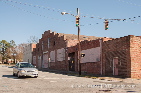
Stone’s Warehouse, February 2016.
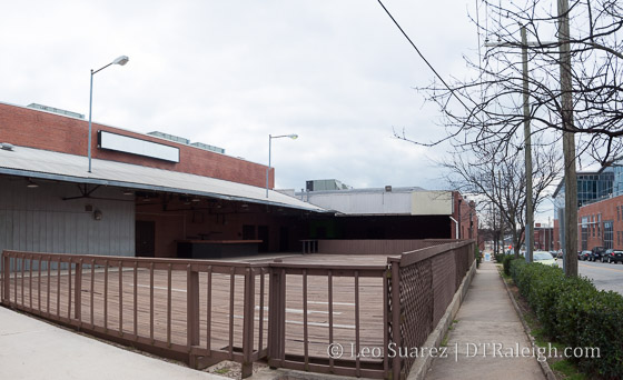
Plans are surfacing a bit on the future of Stone’s Warehouse, the former bus repair facility and senior health care center located at 500 East Davie Street. The future mixed-use site will include retail across both the existing warehouse building and a new construction building. 15 townhomes will also be built on the site.
If not familiar with the site, pan around it here on Google maps to see Stone’s Warehouse and the former Rex Senior Health Care Center buildings. The warehouse will be renovated while the white building where the health center once was, will be removed. To the south, the open area will contain a public plaza and new building for additional retail space.
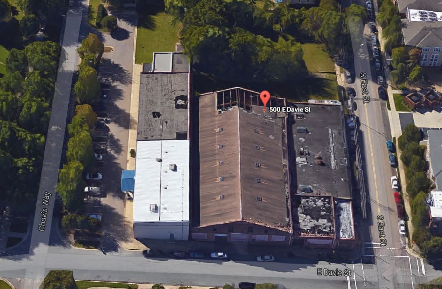
View of Stone’s Warehouse from Google Maps
Looking at the plans, I see some smart, urban aspects to the layout of the buildings and how the plaza incorporates into the fabric of the neighborhood. The Administrative Alternate Request that was submitted for this project shows the public plaza and crosswalk creating a connection through the block from the Chavis Way greenway on to East Street. From the request:
The pedestrian access will physically and visually connect Chavis Way and the adjacent greenway to the plaza amenity and through to East Street through a series of cross-access agreements, effectively segmenting the parking where an island would normally be located. The plaza will be open to the public as well as tenants and is supported as an approporiate use of an urban open space for a mixed-use proprty by City of Raleigh through their RFP process.
Trees that are currently at the site will be moved to align with this plan, as shown in the sketch below.
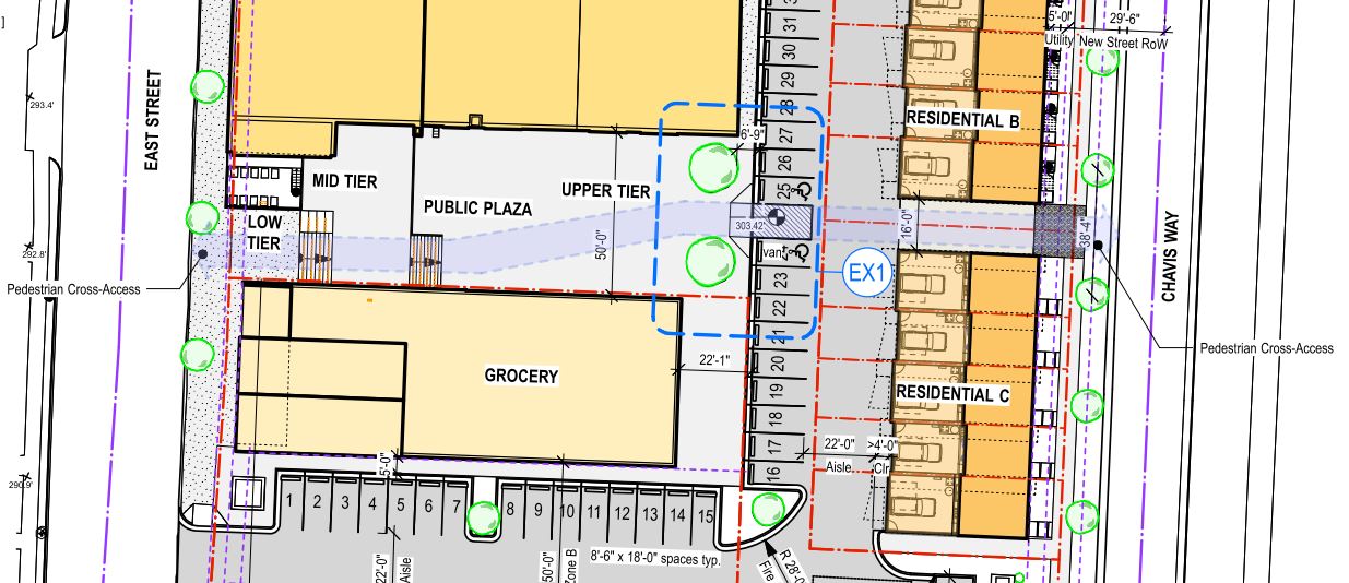
Pedestrian Cross-access planned for Stone’s Warehouse. Click for larger.
The 15 townhomes will line Chavis Way, built in sets of five resulting in three separate groups of units. The plans appear to show garages for the townhomes so residents won’t have to compete for parking. 52 parking spaces will be included as well to support the retail buildings.
This is a great, unique project in a transitional area. Residents in the core should have an easy time walking to the site while those in neighborhoods should not have difficulty getting here by bike or car. It’ll be great to watch the renovation take place.
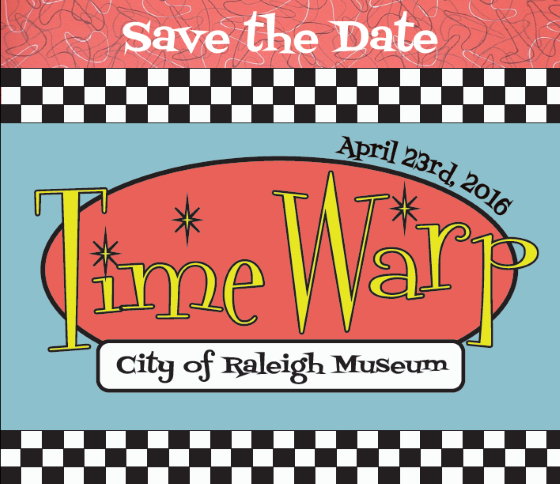
The City of Raleigh (COR) Museum’s biggest party of the year, Time Warp, is coming up and I want to invite all readers to save the date for April 23. This past year, I have joined the Friends of the COR Museum and am helping with raising awareness of the museum and working towards enhancing the membership experience.
I’m having a great time working with passionate folks on the board and I think the best way you can support our city’s museum is to come to Time Warp. There will be food, drinks, music, and an auction, all around a 1950s theme.
You can find out more information as the event team releases it at this page: Time Warp 2016.
Let me know if you’re coming. The toughest decision for Time Warp? Letterman or leather jacket, fellas?
Date/Time: Sat., April 23 from 7 p.m. to 10 p.m.
COR Museum
220 Fayetteville Street
Raleigh, North Carolina 27601
If the video doesn’t show for you, go to A Few Minutes with the Mayor – Episode 2 on YouTube.
Episode 2 in the series called, “A Few Minutes with the Mayor” has been posted for your viewing pleasure. I posted episode 1 a few weeks ago.
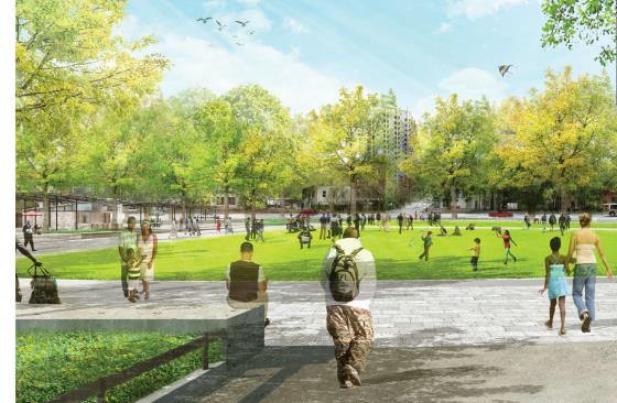
Views across Moore Square from the northeast
It has certainly been quite a few years in the making but while the movement may be slow, it’s always forward on this project. The design around a new Moore Square should be at around 40% in March of this year with construction starting this summer.
In December of 2015, the 15% schematic design was presented to council and approval was given to start permitting and getting construction documents made. Screenshots in this post are from that 15% design with the full document available on the city’s website.
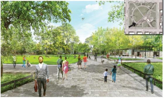
Views across Moore Square to the northeast
For those that are not aware, Moore Square falls into the State’s territory so they need to give the nod before Raleigh goes ahead with their plans. All seems positive as earlier this year the North Carolina Council of State approved a partnership with the city.
As part of Governor Pat McCrory’s “Project Phoenix” initiative, the North Carolina Council of State has approved a partnership with the City of Raleigh to improve Moore Square in downtown Raleigh. While the State of North Carolina owns the property, the City of Raleigh is responsible for its upkeep. In recent years, the park has been in need of improvements, and today’s vote will start the process for that to happen.
*Improvements to Raleigh’s Moore Square Approved as Part of Governor McCrory’s Project Phoenix Initiative
We should also see strong commitment from our council on getting this project done as it was a major work item from their latest retreat.
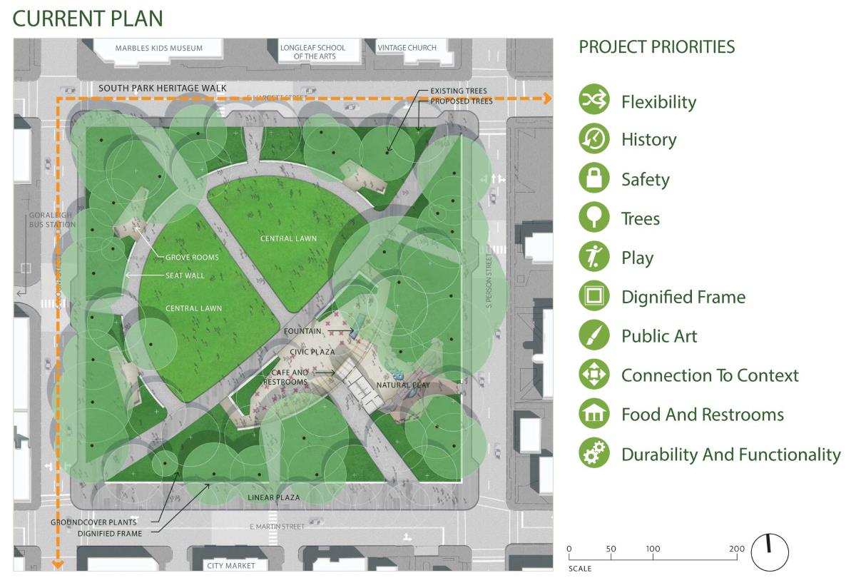
Current plan. Click for larger.
Even with much discussion, discussion against in my opinion, the presence of the kiosk and restrooms are still shown here in the square designs. (which this blogger supports) The location has changed slightly and the new building incorporates both amenities in a smaller footprint versus the former plan.
Expect the new Moore Square to open in Summer/Fall 2017. Will Moore Square continue to house the giant acorn? That is yet to be determined.
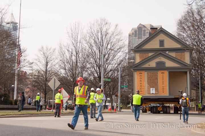
This past weekend, the Levin-Tarlton house was moved from it’s home at 208 North Harrington Street to it’s new home at 414 New Bern Avenue. The good folks at Monarch Property Co. were behind the move. This makes way for the upcoming Greyhound Apartments that are planned for the Harrington Street site.
Below, I’ve embedded some of the Instagram videos from the move taken by Monarch that I thought were very shareworthy. Enjoy!
The Levin-Tarlton house is moved in front of the North Carolina Legislature. Source.
The Levin-Tarlton house is moved down Morgan Street. Source.
The Levin-Tarlton house is backed into its new home on New Bern Avenue. Source.