It’s time again to put a face to the readers and members of this online community with the first meetup of 2019. Come on over for some happy hour apps and drinks as we discuss downtown, transit, hobbies, and life. (IE anything)
I’m once again playing host with those behind the Oak City CRE Newsletter and Inbound Raleigh, other fine media projects that you should follow and subscribe to.
See you then!
February 2019 Reader Meetup
Date/Time: Tues., Feb. 19 from 5:30 p.m. to 7:30 p.m.
Growler USA
314 S Blount St, Raleigh, NC 27601
Raleigh Skyline during the supermoon on March 19, 2011.
Today marks 12 years of downtown Raleigh geeking, blogging, conversations, and meetups.
*Pats self on back*
The 12th year has seen a bit of a different format for the blog as we now have the newly launched Community sitting right beside us.
I always tell people that the reason I started this blog and all the other side projects is to create more conversations about downtown Raleigh. Since readers were chiming in with their own reports and getting to know each other, why not create a platform just for that.
There really is some good conversation over on the Community and I encourage readers to join us over there. The blog will continue on with quick hit photos, project summaries, and a variety of opinion pieces on urban Raleigh. However, if you want to really dive in to the Raleigh weeds, check that one out.
It’s also time for me to use this opportunity to remind folks that while passion runs these sites, there is always an opportunity for you to chip in. I run a lean setup here so dollars can make a difference in helping me out.
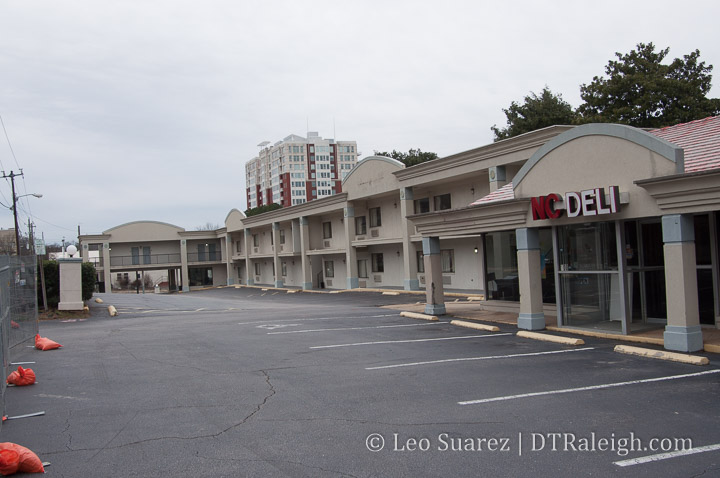
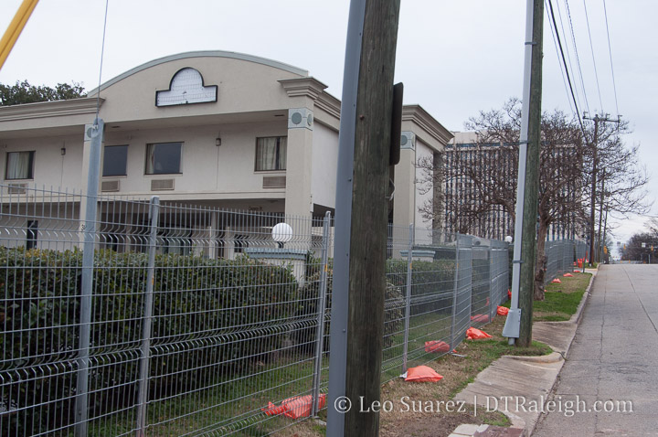
Last December, 2018, the Days Inn on West Lane Street closed. Later, construction fencing went up around the old motor lodge and next-door deli space. A lot of folks took notice and it turns out that local developers have bought the two properties with plans to renovate it all.
Loden Properties plans to create a boutique hotel called The Longleaf Hotel as well as overhauling the former NC Deli into Ish Delicatessen.
The buildings won’t be demolished but the renovation will be pretty deep so I imagine this year we’ll see the lot looking pretty bare. Reports say the job will take around 9 months so hopefully visitors can start booking towards the end of this year.
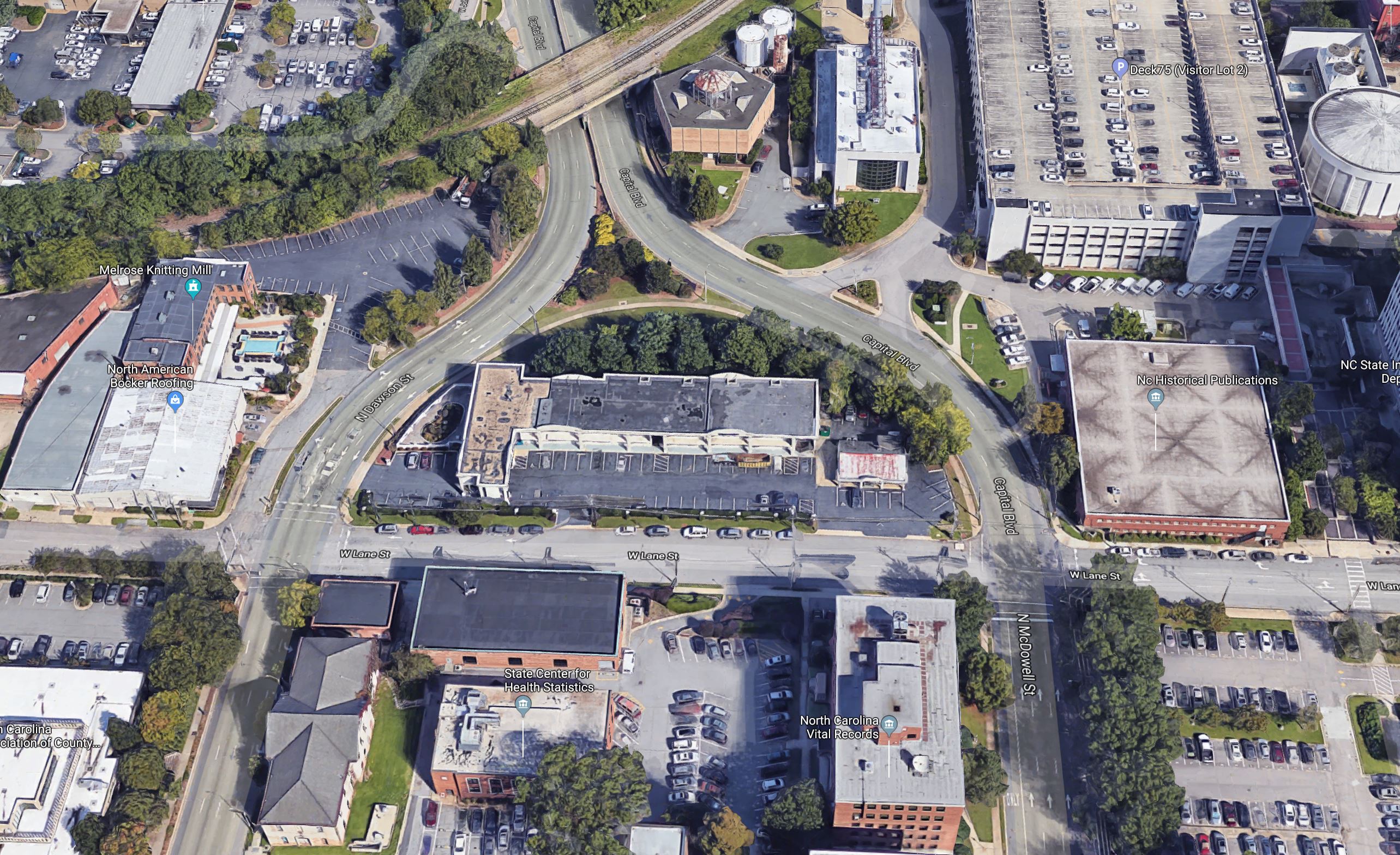
Google 3D image of West Lane Street. Click for larger.
Looking around the area of West Lane Street, the hotel is a few blocks away from some of downtown’s latest developments but nothing exciting is directly nearby. A great location either way and easy walk to Fayetteville Street and Glenwood South, the new hotel would offer a more authentic Raleigh experience compared to a corporate hotel such as the ones near the convention center.
It would almost be good to review some of the street paint on this block of West Lane Street. The street is incredibly wide for the amount of car traffic and a sidewalk is missing right in front of the hotel.
No sidewalks along West Lane Street. No reason on-street parking wouldn’t work here also.
The grassy, shrubby “arch” to the north of the hotel is owned by the state so I expect nothing to change there.
The cool thing to see with a boutique hotel like this is that it is going after a more local, unique experience, trying to attract travelers who want the “Raleigh experience”. That should present well with Ish Delicatessen next door as it’s being run by Matt Fern, a veteran of the Raleigh food scene.
I’m excited to see how this goes and see some new activity to this area on the weekends.
One Glenwood, the first tower of Bloc 83, is really starting to wrap up along Glenwood Avenue. The sidewalks are basically open and the lobbies are mostly finished. All that’s needed is some furniture.
Once the tenants have their spaces ready, the building should really start adding activity to the southern end of Glenwood South. Next to watch is the Origin Hotel right across Morgan Street.
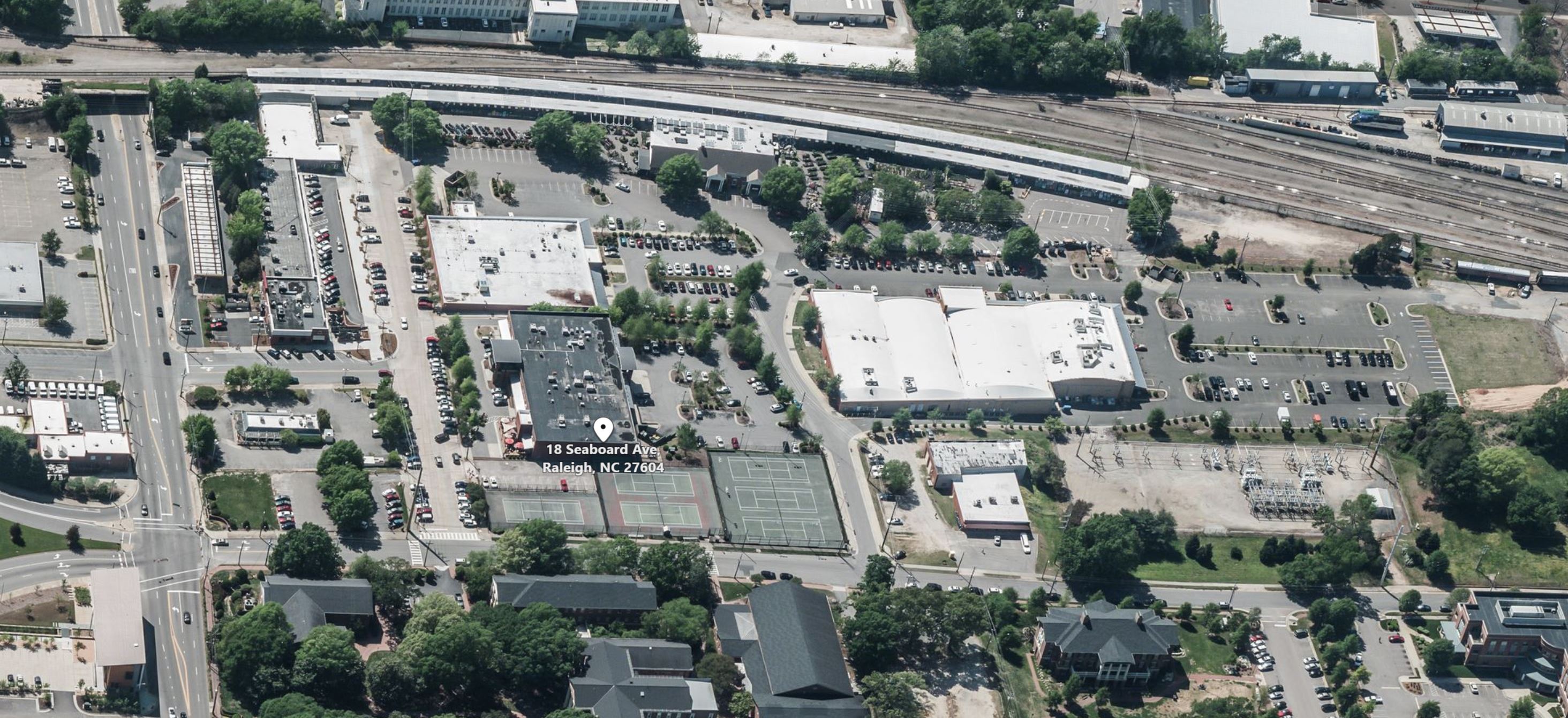
In December 2018, it was announced that a developer had been selected to buy parts of Seaboard Station from the owner, William Peace University. Plans for new development are underway including apartments, hotel space, and more retail.
From the press release:
PN Hoffman, the developer of premier urban communities across the Washington Metropolitan Area including the $2.5 billion Washington, DC, waterfront neighborhood The Wharf, along with William Peace University and TradeMark Properties today announced PN Hoffman’s purchase of Seaboard Station in the north end of downtown Raleigh. The expansive $250 million project will be built in three phases and consist of approximately 800,000 square feet of mixed-use space at full build-out.
….
Additional details include: Approximately 650 Apartments Approximately 150 Hotel keys Approximately 90,000 square feet of new retail space and a total of 135,000 SF of retail space at full build-out
With this news, Seaboard Station has the potential to really break out from just a destination but into a district with its own personality. I thought this would be a good time to walk around and grab some photos of the area.
If you are not familiar, Seaboard Station consists of a hodge-podge of brick buildings from the 1950s and 1960s with Peace Street acting like the main “frontage” of the area. In addition to the former railroad station that now houses Logan‘s, a long-running garden shop, the businesses here make up Seaboard Station and are marketed as a destination.
Aerial shot of Seaboard Station from Bing Maps. Click for larger.
With the buildings built slowly over time, it’s doubtful that a master plan for the area ever existed so we have a frankenstein-esque retail area that represents the car-centric era that it was built. With a stagnating downtown in the 60s, you can see that no real urban feel exists in Seaboard Station with the development at that time.
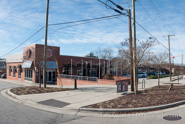
Bolstered by downtown’s growth and surge of new residents in recent history, Seaboard Station has had a big increase in new tenants. Renovations have brought existing spaces to market but no new space has been built.
The one-story buildings dominate the landscape here with streets that are awkward to navigate and parking plentiful. There’s no real public space and even gravel parking lots sit empty giving the area a dull, uninteresting feel at times.
It’s best to just drive in, get what you want and leave.
Plenty of parking at Seaboard Station
The potential here though is that all this space can be used for wide sidewalks and plazas. Building upward is almost mandatory.
Indeed, the new owners have announced that the first phase of the development will include a hotel. Hotel visitors will want to be able to walk to places so anything nearby within Seaboard Station would be highly considered.
In the future, as Peace Street gets its road diet and Smokey Hollow continues to extend Glenwood South closer to Seaboard Station, Peace Street might become a destination street linking both areas together.
We’re following Seaboard Station in-depth over on the Community so come join the conversation.
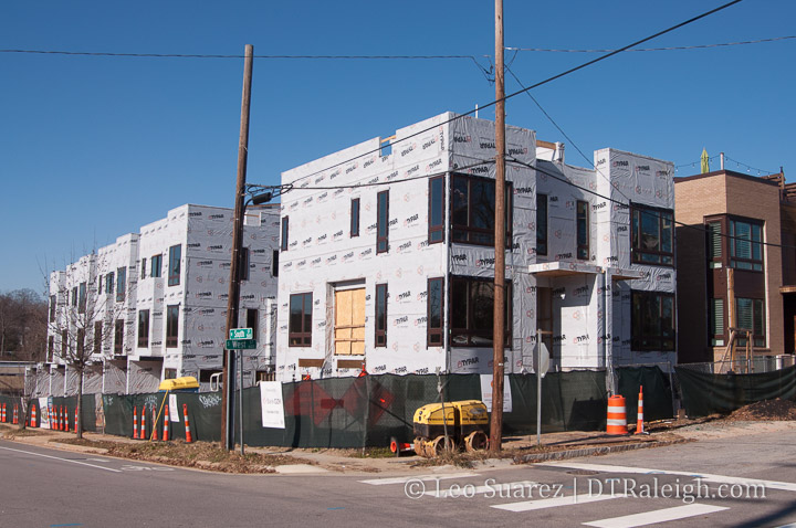
Phase 2 of the West + Lenoir Townhomes are filling in the 500 block of West South Street. Paired up with the now open units next door along West, these townhomes offer similar amenities with a lot going on in the near future.
Surface parking behind 307 West Martin Street. December 2018.
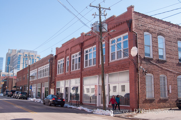
Clearscapes is planning a new building near their properties over in the warehouse district. They recently gave a short presentation at a Central CAC meeting about it and while the address of the project includes some of the brick buildings facing Martin Street, the real work will take place on the surface parking lot behind them.
307, 309, 311 and 313 West Martin Street are currently zoned for 5-story development. Clearscapes wants to rezone it for 12 in order to bring a residential tower to the parking lot behind the buildings.
As I shared on the Community, here is my sketch of the project as well as additional photos to help readers understand the location.
Sketch of the proposed project location.Brick buildings along West Martin StreetParking lot behind the 300 block, Martin Street facing buildings.
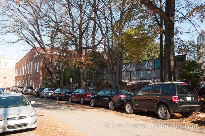
Clearscapes envisions a 10 to 12-story tower with residential units. The first two floors will be parking however the top floor of the parking is actually at the same level of the lot shown above.
That means the tower’s parking garage will go underground and that can be done more easily due to how this lot sits above street level. You would enter the garage on Commerce Place, a street that is one-level below the current parking lot behind the buildings.
Commerce Place. The Martin Street brick buildings are seen in the left background.
Between the tower and brick buildings along Martin would be a public plaza as a means to tie the tower and warehouse buildings together
Next steps for the project is the rezoning and with Clearscapes’s solid Raleigh reputation, the fact that the Martin Street buildings will be untouched, and only surface parking being removed (private parking by the way) I hope the rezoning goes through smoothly.
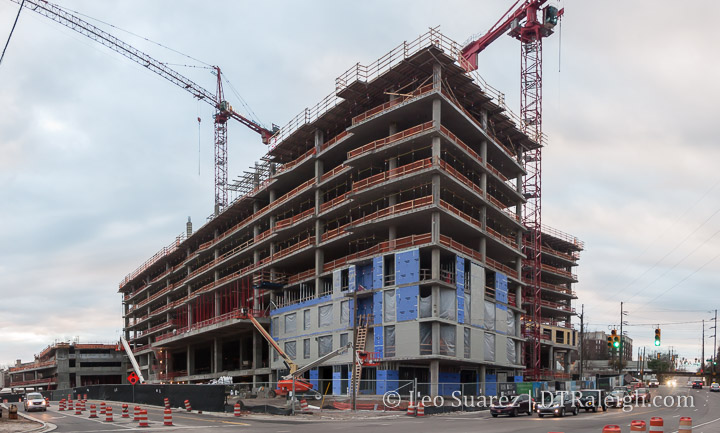
There has been a lot of change along Peace Street this year and Phase 1 of Kane Realty’s development along Peace, as well as Harrington and West Streets, is really starting to take shape.
The apartment building at Peace and West is close to topping out and siding is already starting to go up. The parking deck behind this tower is catching up also.