Renderings of The Willard Hotel in Glenwood South

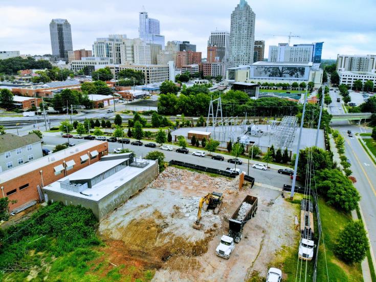
Future site of The Willard hotel on Glenwood Avenue. February 2018.

Future site of The Willard hotel on Glenwood Avenue. February 2018.

On the city’s website, a submitted Administrative Alternate for Design (AAD-1-18) shows renderings of The Willard, a planned hotel and condo building for Glenwood South. Taking a peak, I wanted to share those renderings here on the blog.

As a refresher, The Willard will be an AC hotel by Marriott brand hotel on the southwest corner of Willard Place and Glenwood Avenue. The building will have hotel rooms and some residential units. Shown in the photo above is the site of the project which will see the demolition of two brick office buildings and the surface parking lot in between.

This particular AAD case seems to deal with the placement of the building and how far set back it is. I see a proposal for an outdoor amenity area which sits a little farther back than is required. Seems like a minor issue.

Either way, here are the renderings.

Rendering of The Willard hotel, AAD-1-18.

Rendering of The Willard hotel, AAD-1-18. Click for larger

Rendering of The Willard hotel, AAD-1-18.

Rendering of The Willard hotel, AAD-1-18. Click for larger

Rendering of The Willard hotel, AAD-1-18.

Rendering of The Willard hotel, AAD-1-18. Click for larger

Rendering of The Willard hotel, AAD-1-18.

Rendering of The Willard hotel, AAD-1-18. Click for larger

Rendering of The Willard hotel, AAD-1-18.

Rendering of The Willard hotel, AAD-1-18. Click for larger

11 Years of RalConography

title

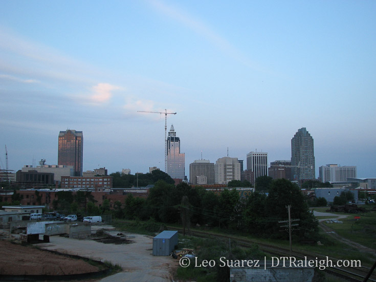
View of downtown Raleigh from the Boylan Bridge, September 2007. Click for larger

Today, we’ve made it to 11 years of downtown Raleigh conversations, writing, and photography. It’s hard to follow year 10 but I’ll still be treating myself to a drink today to celebrate this milestone.

While I was working on an official definition of RalConography, I stumbled on this 2007 skyline photo that I wanted to share. From here, you can see PNC Plaza, then RBC Plaza, being built. The Marriott hotel and Raleigh Convention Center are still under construction. The Boylan Wye is in shambles with overgrown shrubs and myriad scraps piled high. A number of residential and office projects have yet to be seen.

That’s all changed of course and with 11 years of material the blog also takes on an archiving role which I’m enjoying very much.

This also becomes my annual ask for reader donations.

Rolled out last year quietly, I’ve been getting support from readers without even asking. I want to thank those that have contributed so far. I truly appreciate the support.

Contributors will be my first contacts with any major updates I have coming in the future. If a Raleigh digital archive or Raleigh Development Wire service sounds interesting to you, please consider contributing and you’ll be in the know before anyone else.

Donate to the Blog

Two ways to contribute:

  • Paypal – Click Here
  • Venmo – username: @dtraleigh

Thanks all for reading. Let’s keep this thing rolling.

Pic of the Week

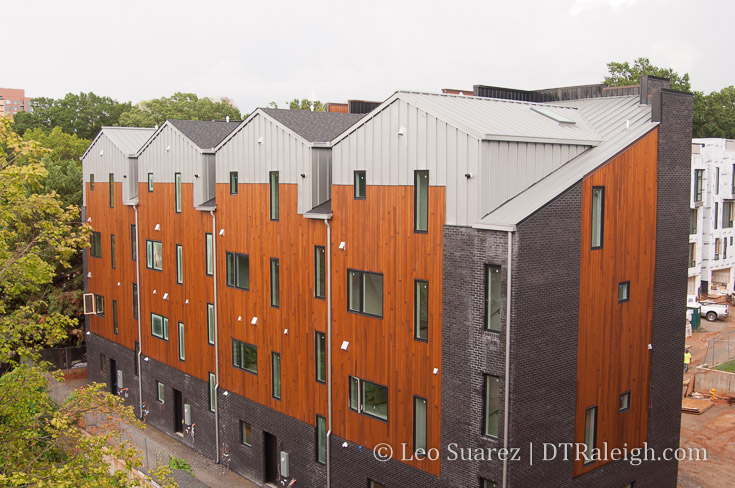
The Saint townhomes under construction. January 2018.

The Saint townhomes are moving right along with the first wave of units topped out. I like to think of this particular property as trying as hard as possible to balance the benefits of both urban and suburban living. They have spacious units but with a great location. Space for two cars but in an entirely walkable neighborhood.

Downtown won’t turn urban overnight but I’d like to think these new developments are moving the needle a few notches in the urban direction when you take in the entire city’s growth direction.

A Walk Down South West Street

Looking South down South West Street.

Looking South down South West Street. January 2018.

As a compliment to a 2016 post on North West Street, today I wanted to take a look down South West Street. West Street through downtown is becoming an important corridor and from one end to the other, there are projects taking place that may make it a pretty desirable street in the future.

In case you weren’t aware, the directional prefixes for streets running north and south start at Hillsborough Street (west of the Capitol) and New Bern Avenue. (East of the Capitol) Hence, we start our walk at Hillsborough Street.

New developments and businesses are great but we always have to give a nod to the old favorites that have been threw a lot. I want to give a quick shout out to The Roast Grill, having been at this spot on 7 South West Street since 1940.

Photo of The Roast Grill.

The Roast Grill, open since 1940.

Will they make it to a hundred years? Time will tell but I certainly am pulling for them. The TBJ has an article (subscription required) that suggests they aren’t selling out. However, the pressure may rise as nearby developments take shape.

Heading towards the 100 block of South West brings us to the Morgan Street Food Hall. Food halls are a trend that’s happening around the country and Morgan Street will be our first (first, right?) food hall in recent memory. Plan for them to open this Spring.

Construction continues on Morgan Street Food Hall

Construction continues on Morgan Street Food Hall. January 2018.

Citrix employees should be food connoisseurs after that place opens.

The food hall will also get a nice infusion of nearby residents from the residential portion of The Dillon. Residents should be moving in this year and the developer has already landed a few restaurants and retail for the ground-floor spaces. Announced so far, we have:

And there’s plenty of space for more.

The residential units of The Dillon on South down South West Street.

The residential units of The Dillon on South down South West Street. January 2018.

As you walk by the residential units of The Dillon along the 200 block, there’s a sharp contrast between the life that will soon pop here and the still empty warehouse building on the west side. Plans have seemed to come and go for this huge warehouse.

Another Citrix-like rehab could be a decent proposal for this site as it has a large-footprint but hopefully a more mixed-use repurpose can be done. At this time, no plans have been announced.

The office portion of The Dillon.

Looking up at the office spaces at The Dillon. January 2018.

The end of the block approaches the office tower portion of The Dillon and Raleigh Union Station.

West and Martin Street will be a cool intersection I think. The Dillon’s 18 floors will draw activity here during the work days and the retail spaces, CAM, and Union Station will fill in the off hours a bit. I think it’ll feel lively and offer great views towards the downtown core.

Some warehouses nearby are also getting some renovation love. Father and Son’s newest location, the former Flanders Gallery, and the next-door neighbor have visible signs of upkeep.

Union Station is set to open early this year and I think you’ll see a small uptick in visitors as people from all over will come down to check it out. I remember when Fayetteville Street first opened in 2007 and on the first Sunday night after opening (when everything was closed) the street was jammed with cars filled with curiosity.

I think the same thing will happen this year.

Looking at Raleigh Union Station from West Street

Looking at Raleigh Union Station from West Street. January 2018.

Renovated warehouse along West Street.

Renovated warehouses along West Street. January 2018.

New train platform that will serve Raleigh Union Station

New train platform that will serve Raleigh Union Station. January 2018.

At this point, West Street ends but my walk does not.

The city is studying plans to make West Street tunnel beneath the train tracks and connect to itself at Cabarrus Street. The street currently goes below the tracks and turns into the Union Station parking lot so some of the work is already done.

Looking at Raleigh Union Station and The Dillon over West Street

Looking at Raleigh Union Station and The Dillon over West Street. January 2018. Click for larger.

Next to Raleigh Station, you can see how the grid is still aligned and the West Street tunnel would make the grid connect.

West Street across the train tracks

West Street across the train tracks

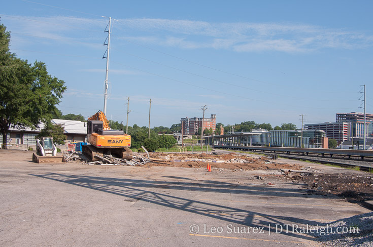
At Cabarrus, there is the old Raleigh Station, waiting to be demolished sometime this year. The future of this property is still up in the air as Amtrak services and offices will relocate into Union Station.

The 500 block of South West transitions us from the warehouse district into a more residential area.

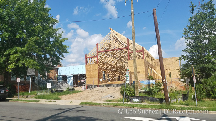
Condos are planned at the corner of West and Lenoir. The Fairweather plans 45-units in a five-story, modern building. Construction hasn’t started just yet but the announcement of the project claims an early 2019 opening.

Worth mentioning again, one Raleighite has an idea to save two houses on this block of West. When pitched at a city council meeting in December, the idea didn’t fly with some councilors due to the fact that he sits on the city’s planning commission.

Old homes along West Street, planned for demolition.

Old homes along West Street, planned for demolition.

There is a risk of losing these homes that well represent Raleigh’s former Fourth Ward neighborhood, and in addition a plan to offer some affordable housing unless something happens in the near future. Jump back to the full story on this here.

At the corner of West and Lenoir, across from the future Fairweather project, is an old gas station that is planned to be renovated for a restaurant. No work seems to be taking place on the exterior at the moment so perhaps it’s all inside work right now.

Service station with plans for a restaurant.

Service station with plans for a restaurant at the corner of Lenoir and West Streets. January 2018.

Along the 600 block of West, the townhomes called West + Lenoir are wrapping up. These are some of the earliest townhomes to be completed in this area as nearby Fourth Ward and 611 West South have not really begun yet.

West + Lenoir Townhomes

West + Lenoir townhomes. January 2018.

West Street ends at South Street and so does our walk.

Along South, more demolition and construction is taking place as the area turns over. The South Street Market was just recently demolished and the storage facility has recently topped out.

Click here to view the map on Google.

Now that we’re familiar with West Street, I’d like to zoom out a bit. Above is a map of South West Street with highlighted locations from this post. In my opinion, the momentum behind Dix Park and downtown Raleigh put the affordable housing units of Heritage Park in the crosshairs.

I just can’t imagine the investment of over $10 million for a West Street tunnel, “bridging” just two blocks into downtown, is worth it if there was not some other driving force behind it.

When you look at it on a map, there’s no denying the temptation to push West further south, maybe even trying to connect it to Lake Wheeler. That would be a great downtown connection to Dix Park. With current politics, pushing aside Heritage Park wouldn’t be popular. However, from a strictly planning point-of-view, it’s worth a look.

I’m not advocating it. I do think there might be plans for a major road shakeup in this area in the next 3-5 years.

The end of South West Street at South Street.

The end of South West Street at South Street. January 2018.

Either way, West Street will continue to grow and play an important role for downtown in the coming years.

Photo Gallery of Raleigh Station in 2018

Platform waiting area of Raleigh Station. January 2018.

Outside waiting area of Raleigh Station. January 2018.

With the opening of Raleigh Union Station only a few months away, I just had to capture the look and feel of Raleigh Station, our current train station on Cabarrus Street. This post is basically just a bunch of photos for posterity to show the station that has served Raleigh since 1950.

If you can make it down there in the next month or two, it is such a drastic difference between the upcoming station and the current one. It really feels like Raleigh leapfrogged our next train project and just went two levels higher instead.

The splintering wood, the rusty metal, and the washed out signs basically show a station that has reached its end-of-life. The interior is nothing but functional however you can’t help but admire the downtown view.

I’ll be referring to this post in the future but for now, enjoy the photos.

Google maps aerial of Raleigh Station.

Google maps aerial of Raleigh Station.

Exterior of Raleigh Station. January 2018.

Exterior of Raleigh Station. January 2018.

Exterior of Raleigh Station. January 2018.

Exterior of Raleigh Station. January 2018.

Exterior of Raleigh Station. January 2018.

Exterior of Raleigh Station. January 2018.

Interior of Raleigh Station. January 2018.

Interior of Raleigh Station. January 2018.

Interior of Raleigh Station. January 2018.

Interior of Raleigh Station. January 2018.

Interior of Raleigh Station. January 2018.

Interior of Raleigh Station. January 2018.

Interior of Raleigh Station. January 2018.

Interior of Raleigh Station. January 2018.

Platform waiting area of Raleigh Station. January 2018.

Skyline view from the boarding area of Raleigh Station. January 2018.

Platform waiting area of Raleigh Station. January 2018.

Signs of Raleigh Station. January 2018.

Platform waiting area of Raleigh Station. January 2018.

Boarding area of Raleigh Station. January 2018.

Platform waiting area of Raleigh Station. January 2018.

An out-of-date map of downtown Raleigh outside of Raleigh Station. January 2018.

Platform waiting area of Raleigh Station. January 2018.

Boarding area of Raleigh Station. January 2018.

Platform waiting area of Raleigh Station. January 2018.

One of the entrances to Raleigh Station. January 2018.

Platform waiting area of Raleigh Station. January 2018.

Current boarding area of Raleigh Station with new platforms for Raleigh Union Station in the background. January 2018.

Platform waiting area of Raleigh Station. January 2018.

Boarding areas of Raleigh Station. January 2018.

Platform waiting area of Raleigh Station. January 2018.

Boarding areas of Raleigh Station. January 2018.

Revisiting The Downtown Plan’s Glenwood Green Project Area

View from the upper floors of the West at North Tower. Photo credit Robert Winchester

View looking north from the upper floors of the West at North Tower. Photo credit Robert Winchester.

There has been a lot to follow around the Smokey Hollow area of Glenwood South. The reader-submitted photo above shows another view of all the demolition that has taken place. The “Glenwood Green” area has basically been wiped clean and will be rebuilt over the coming years.

The term Glenwood Green comes from the 2015 downtown Raleigh plan and I thought this a good time to see if the planned developments are in line with what was envisioned for the area.

Here’s what we know so far:

  • Peace (formerly Smokey Hollow) – 400 unit residential tower with ground-floor retail at the corner of Peace and West Street. A Publix grocery store has been announced so far.
  • Directly to the south, the same developers have bought land for a phase 2 mixed-use project.
  • Smokey Hollow. Courtesy of Cline Design.

    Latest rendering of the development for Peace and West

    By the way, the name of the development may have changed from Smokey Hollow to Peace but this blog will always recognize this area and basically any new developments going forward as part of Smokey Hollow.

    Let’s map it all. I like this one from Raleigh DLA.

    Map of planned developments in Smokey Hollow

    Glenwood Green Vision

    The Glenwood Green vision as part of the 2015 downtown plan so far is coming along. Granted, not much “green” has been planned in this area but once the Capital Boulevard bridge project (the square loop) is finished in 2019, the city can deliver that green with a planned Devereux Meadows Park north of Peace Street.

    Here’s the two-page overview of the Glenwood Green vision.
    Glenwood Green project area - 2015 Downtown Plan

    Click for larger

    The vision overview behind Glenwood Green wants Harrington Street to be a new “main street” for the area. This should be where the majority of retail is located and the planning folks have shown us this in their latest update of retails streets in the 2030 Comprehensive Plan.

    Harrington Street has the opportunity to be the gateway from the Devereux Meadows Park through Smokey Hollow and into the Warehouse District.

    Notice that Kane Realty has projects at both ends of this street. (All the Smokey Hollow work + The Dillon) Not a coincidence I’m thinking here.

    Public Space and Greenway Connections

    What still isn’t being talked about is the idea of a central plaza in Smokey Hollow to really give this area a sense of place. In addition, a greenway or urban cycle track connecting parts north and south would run through this area with this public space being the central hub.

    The vision in the downtown plan proposes a civic building and plaza but something else could work to make it into a destination. A park could also serve as a meeting place and destination.

    When you add up the plans for a greenway through Devereux Meadows, the city experimenting with a cycle-track along West Street, and connectivity from the Warehouse District to Dix Park, you can really see how important Smokey Hollow is to north/south connectivity through downtown Raleigh.

    If you look at the latest map of the Raleigh Greenway system, there’s a core loop around downtown and the surrounding neighborhoods. We still don’t have that middle section that cuts through it. The Glenwood Green vision supports this major connection.

    Raleigh Greenway system, January 2018

    Raleigh Greenway system, January 2018. Click for larger

    A proposed route from Smokey Hollow to the north towards the current greenway exists. A lot of it would run through Devereux Meadows alongside Capital Boulevard. This was talked about as part of the Capital Boulevard Corridor Study, an effort that took place around 2011. Here’s a map of the proposed greenway route connecting areas north of downtown.

    Right now, there hasn’t been talk of incorporating that civic space or greenway into Smokey Hollow. Those interested in creating a vibrant area here should keep an eye out because as all this development starts, the opportunities for the connections decrease.

    If all the land is dedicated to buildings then the idea of a public plaza becomes significantly harder to plan for. The greenway connection may also turn into a glorified sidewalk path rather than something unique.

    As plans form, I look to the city to work with developers to get this built and see the vision behind Glenwood Green come to full form.

Pic of the Week

Moore Square, January 2018

Moore Square, January 2018

The renovation of Moore Square is very much underway with a lot of small shrubs and short trees being removed. The holidays were a distraction but I noticed the difference recently and just had to grab a photo.

In the winter, with the leaves off the old oak trees, you can really see right through the square which makes it feel a lot bigger than it really is.

Pic of the Week

Raleigh Amtrak Station, October 2017

Raleigh Amtrak Station, October 2017

Happy New Year all!

Shown above is a photo of the Raleigh Amtrak Station in October 2017. I show this because the Triangle Business Journal had an article stating that once our new train station, Raleigh Union Station, opens this year the former station will be demolished.

Perhaps the archivists, including myself, need to get down there to photograph the station before it’s cleared.

The North Carolina Railroad Company, owners of the building and nearby property, have not announced any firm plans yet for that area. Your guess is as good as mine but I’m betting on a more functional use such as surface parking for train-related or utility-type vehicles. (at least for the foreseeable future)