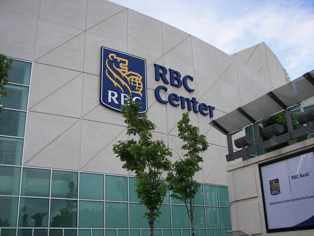
RBC Center by Lalitree, on Flickr
After a hectic hockey filled weekend in Raleigh, the reviews are in. Raleigh was a fantastic host for the 2011 NHL All-star game. Articles and videos from the national media are wrapped up in this great post on Canes Country.
Clicks and Clippings: Soak it up, Carolina
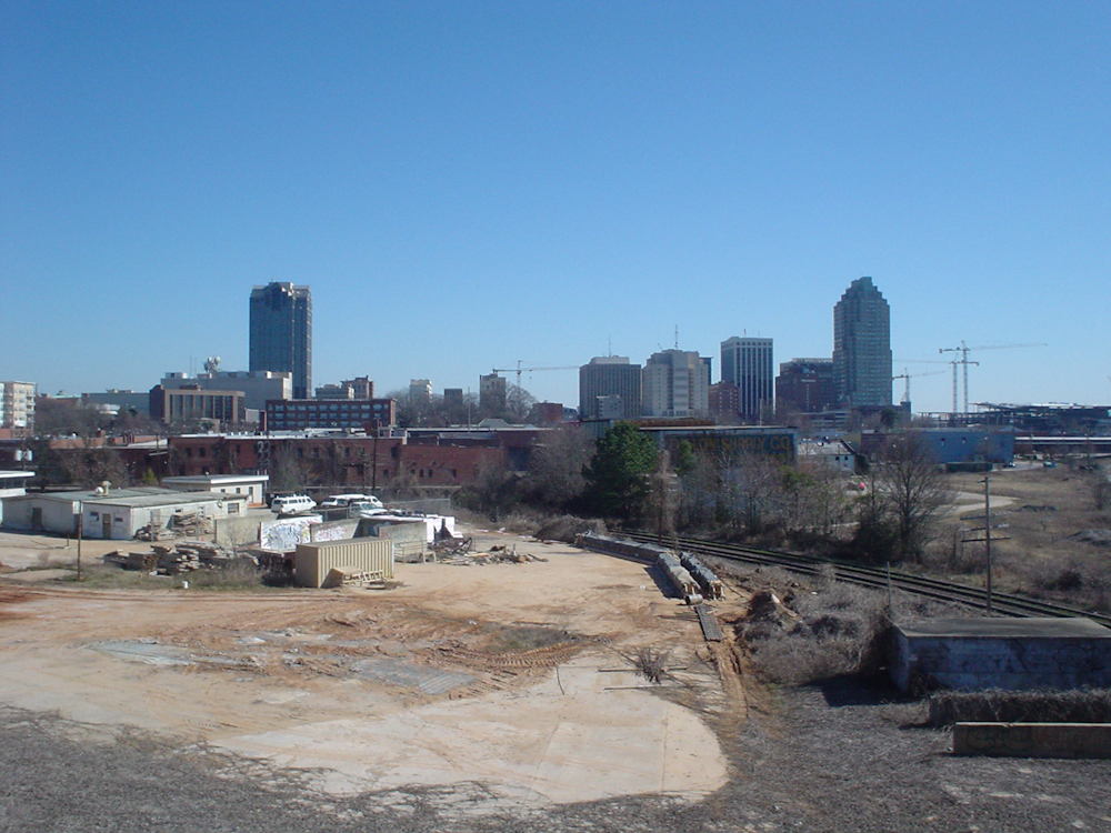
Leading up to the event, talk of a downtown sports arena once again popped up, here and here. Comparisons between Raleigh and Charlotte are included in those articles also. This theme seems to pop up every so often and they all sound the same. If you listen to our local media, Charlotte has it right, Raleigh has it wrong. It’s always the same.
The arena topic in Raleigh is one of those few topics that fascinate me and I feel that no one is having an intelligent conversation about it. People love talking about how to put an arena in downtown but shouldn’t we stop to think about the why? Why do we need an arena in downtown Raleigh in the first place?
I thought this quote was interesting from Michael Farber about the area’s hosting of the All-star game:
The “non-traditional” All-Star venues have been problematic. And by problematic, I mean awful. Los Angeles swallowed the All-Star game without even bothering to chew while the mid-season hockey festivals came and went in Tampa Bay and Florida without leaving a footprint in the sand. The Atlanta event didn’t register within 100 yards from the arena. In all these cases, the tedium was the message.
But the Triangle region of North Carolina faced the challenges of holding an All-Star game — the diffuse nature of the area, the distance of the arena from the modest Raleigh downtown — and stared them down with a smile.
Venue will go down as biggest star of NHL’s All-star weekend: SI.com
The challenges of hosting a national event between areas that are miles apart here in Raleigh were overcome this past weekend and the reviews are incredibly positive. This same event was mediocre at best in cities much larger than Raleigh and with downtown sports arenas on their resumes.
So tell me, why was a sports arena in downtown needed?
Charlotte is Charlotte, Raleigh is Raleigh
One of the things that really gets to me about the downtown sports arena topic is that those that are for it seem to point out that the queen city has done it already. That and their light rail system, seem to be huge topics of comparison.
So what?
Raleigh is Raleigh, and what works for Charlotte does not mean it will work here. Charlotte can offer a downtown arena within walking distance to food and hotels. Why is this scenario seen as the best way to go?
In my opinion, the RBC Center’s current location actually makes more sense in West Raleigh than it would if in downtown. Most readers should know that I am a huge advocate for urban values in this city and hopefully it shows with this blog. But let’s be realistic. The development patterns here in the triangle are focused around moving in your car so the RBC Center on Wade Avenue makes so much sense and makes the experience of getting to it very easy.
I’m not sure of the exact number but I think it is safe to say that close to 90% of attendants to events at the RBC Center arrive by a car. The other 10%, at best, probably would account for taxis or charter buses. Imagine that same 90% figure, driving into a downtown Raleigh arena for an event. The current streets could not handle the amount of cars so more roads would have to be built to handle it. There is nothing urban about more roads in downtown.
Parking decks would have to be built, which cost much more then the surface parking lots at the RBC Center. This would most likely lead to higher parking fees. At $10 per space today at the arena, its anyone’s guess how much deck parking could be for an event.
The way I see it is that the RBC Center’s current location serves the Triangle and the surrounding areas very well. Fans from all over can drive right in and get out easily. A downtown arena would make the experience of getting to it more of an effort for those driving and would therefore deter the most loyal patrons. Those loyal fans are all of us who live here and support the teams that play there.
Charlotte decided to build downtown, or uptown if you live there, in order to better serve visitors from outside their region, visitors that were most likely staying in hotels in downtown Charlotte. That is their decision and it seems to work for them.
The question to think about is what you would prefer; an arena that fits into the development pattern that we have or one that is downtown, allowing visitors from hotels to walk to events and area residents still having to drive.
Stay with me as I try to get to my point.
Arenas Spur Development?
The downtown arena conversation sometimes includes other aspects with it. If the city funded an arena in one area, the thought is it will be a catalyst for development nearby. Let’s not forget that we are still waiting for that development to happen around the RBC Center today.
The reason the media describes the RBC Center as a life saver in the middle of an ocean is because the offices, shops, and condos never happened. At least, not to the extent that was envisioned back in the 90s. Now we are left with an arena all on its own with a few office buildings and no real atmosphere to cater to visitors. (well the Backyard Bistro seems to help out)
This is another reason why the downtown arena topic comes back every now and then. People see downtown Raleigh growing and more restaurants opening up then ever before. The area around the arena needs those restaurants. Downtown + arena seems to be a match made in heaven.
Rather then move the arena to downtown Raleigh, why hasn’t the area been studied and plans made to encourage smart growth around Wade Avenue and Edwards Mill Road? I’m starting to think that the best plan is to re-kindle the development fire around Wade Avenue and come up with a plan for smart growth that serves Raleigh and the arena.
Going forward, Raleigh should never build an arena with hopes to revitalize an area. Lesson learned, we move on.
An Urban Arena For an Urban City
Downtown Raleigh represents only a small portion of urban areas in the city. If a downtown arena was added within a city made of suburbs, the arena would serve the suburbs, not the downtown. The conversation that is not happening is how to mesh an arena into downtown without creating an urban black hole when events aren’t happening and how to handle the massive amounts of traffic when there are.
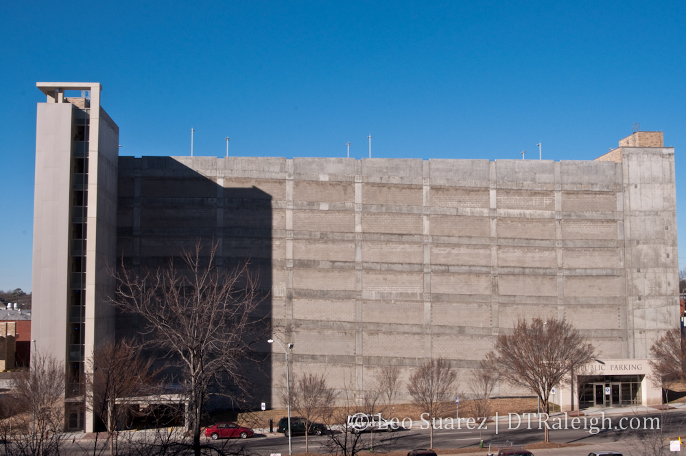
An urban arena that serves the suburbs is one with a lot of parking decks. According to the RBC Center webpage, there are 8,000 parking spaces there. So how many decks does it take to cover 8,000 spaces? According to the Downtown Raleigh Alliance, the City Center Parking deck has 1,000 spaces so we would need eight similar in size. The City Center Deck is approximately half a block in size so we’re looking at four city blocks worth of parking.
Since no alternative to driving exists, except for walking by the few thousand residents in downtown out of over a million people across the Triangle who will drive, a downtown arena is not practical. When you add the fact that our transit system is in need of an overhaul and a huge boost in support, the idea is very weak.
The conversation we need to have after deciding that Raleigh should build an urban arena is at what point in Raleigh’s urban growth do we move it out of the suburbs and onto the urban grid. That is what Charlotte did, they decided to pair up their arena with some urban form but still maintain suburban aspects. It might not have been reported that way but that’s what it looks like to me.
The arena in uptown Charlotte is surrounded mostly by surface parking lots and a few very large parking decks. The time I went to visit for an event at the arena, uptown was gridlocked with cars looking for parking. Charlotte is still suburban enough to cause the same traffic headaches even though the arena is in an urban area.
Their arena, however, has a light rail station and a major bus station adjacent to it. The opportunity exists for them to grow mass transit around the arena as a way to release some pressure off the streets but that may take a major shift in car culture in this country for that to happen. (or decades of intense urban growth in Charlotte)
If Raleigh wants to build an arena in an urban setting, the city’s own urban areas needs to grow as well. Mass transit needs to link the Triangle and be immersed in our local culture. Downtown Raleigh should be five times larger in size and the amount of people living car-free should be a sizable portion of the Triangle’s population.
In my opinion, an arena doesn’t make sense at all for downtown Raleigh and wishing we had one to serve the events of today is silly and getting a little old. So to sum up, Raleigh isn’t urban enough for an urban arena and we shouldn’t have the conversation of an urban arena until our urban areas can handle it. Make urban sense?
Stand Out From The Crowd
A blog I follow to satisfy my urban planning desires is The Urbanophile. Aaron Renn, an urban analyst and consultant, has an article over at Design Intelligence and I wanted to highlight a paragraph.
While cities may specialize in different economic niches and have a historic legacy that gives them a unique built environment, they increasingly have turned to the same standard issue playbook for their development: boutique hotels, upscale housing, generic offices, international fashion labels, celebrity chef restaurants, and above all, starchitecture. The sameness of so many of these cities can be readily seen by flipping through the likes of the Wallpaper travel guides to various cities. On many pages, one would be hard pressed to determine what city is being discussed without looking at the spine.
Century of the City: Design Intelligence
Renn suggests that for cities to stay sustainable and maintain a competitive edge, they cannot follow the leader and build like their neighbors. If Raleigh copied what Charlotte did, Raleigh would trend toward being that generic, glass towered city with the same amenities as everyone else. If all cities offered the same experience then the only difference would be who can offer it the cheapest and that is not a game I want my city to be a part of.
So Raleigh needs to be different from Charlotte, which should actually be a very easy thing for us. With an enormous creative class, why can’t Raleigh try to stand out in the crowd of American cities and offer something other than Starbucks and flashy urban amenities? Renn’s article points to Portland and how they embraced the street car when no one in America was. Now, they own that space and cities that want to revamp their mass transit is going to Portland for advice.
Back to the arena, who’s to say that the RBC Center is located in the wrong place? If we listen to all the other cities that have put their arenas in their downtowns then we are just standing in line and borrowing their ideas. We should always question the decisions we make in building Raleigh but maintain a focus on being competitive and not catching up to what others are doing.
Some may call it weird or strange to try something different then the crowd but that is how you get noticed.
And don’t tell me that doing things just like everyone else is required to land big time events after the NHL All-star weekend in Raleigh.
Let’s Start Thinking
Instead of copying another city, Raleigh should consider creative ideas on how to enhance the experience of the RBC Center in its current location. Ideas no other city has done and possibly grow new traditions that become known across the country.
There is one unique thing that the RBC Center allows us to do that downtown arenas cannot; Tailgating. Carolina Hurricanes fans are starting to get a national reputation for tailgating before games. I remember seeing extensive coverage of the activity during the cup run in 2006 by visiting teams’ newspapers.
Another idea that I feel isn’t embraced enough is Raleigh’s ‘city inside a park’ look. We have a ton of trees around here and that local resource should be protected and even incorporated into certain areas. What if the RBC Center parking lots had towering trees throughout it? That would most certainly stand out to the national crowds looking upon us.
I’m sure an open forum on this topic could produce many more unique ideas from people that live here. What we should do is recognize what other cities are doing but be smart enough to think for ourselves so Raleigh does not turn into a generic city of the 21st century.
Closing Thoughts
So apparently I have some thoughts on the arena topic.
Even though the idea of walking to and from major events at an arena is something that I want, I still believe it is best that Raleigh stick with the RBC Center’s current location for many more years. Let the naysayers talk and try to stir controversy on a subject that is tired and old. I simply won’t listen.
Raleigh’s execution of the NHL All-star game impressed the nation, we should be proud of that. Next year’s hosts are taking notice. Now that we have raised the bar, we should take a look at how to raise it even more and offer something that other cities cannot.
There is still so much we can do to expand downtown into something for Raleighites to use every day and for visitors to take away something unique. Let’s not copy another city or be jealous that they appear to have more. After this weekend, Raleigh needs a bigger challenge.