2017 Transportation Bond Includes Downtown Projects

Map of projects as part of 2017 bond proposal.

Map of projects as part of 2017 bond proposal. Click for larger.

There’s an election coming up and on the ballot for Raleigh residents will be a transportation bond which will include money for upcoming projects around the city and in the downtown area. Early voting has already started but you’ll get your chance to nay or aye this one on October 10.

You can dive into all the details about the $206.7 million package here. The map above shows the location of projects with two being in downtown Raleigh.

Blount/Person Two-Way Conversion

The bond would help direct $6.1 million towards converting Blount and Person to two-way streets. This is probably a result of the work that took place a few years ago, also a result of a transportation bond approved in 2013. I went into great detail on this project in this post.

Rendering of a two-way Blount and Person Street

I’m curious to know what the traffic coming off the Hammond Road I-40 exit would be like when Blount and Person are converted to two-way. The theory goes that two roads would absorb the traffic rather than funneling it all down one resulting in improved flow and lower speeds. The bike lanes would also be welcomed in creating easier routes on the east side of downtown.

West Street Extension South

A portion of this funding would allow the City to proceed with the design of the proposed West Street Extension under the NC Railroad Corridor between Martin Street and Cabarrus Street, which provides a critical connection to the upcoming Raleigh Union Station. The remaining funding would allow the City to provide a local match in order to pursue federal grant funding for the project.

As the description states, the bond money would move the ball along but not fully deliver. The West Street extension has been discussed in the past as well. (also here)

This is an interesting connection, joining West Street to West Street, that could change the dynamic of the warehouse district. Union Station and The Dillon are already going to have quite the impact so we’ll know over the next few years if the West Street extension will ease off the pressures of a crowded downtown corner.

I call it a corner cause the warehouse district really is the corner of downtown, strangled off by the railroad tracks where streets just end.

Go Vote

I think Raleigh has a strong history of approving transportation bonds but the question out there is the appetite for more debt after approving an increase of the sales tax for transit during the 2016 election.

Either way, voice your opinion on October 10. Here’s a sample ballot for this bond referendum.

Sample Ballot of 2017 Transportation Bond

Limebike Bikeshare Spotted Around Downtown Raleigh

Limebike bicycles in Moore Square

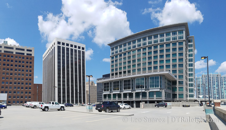
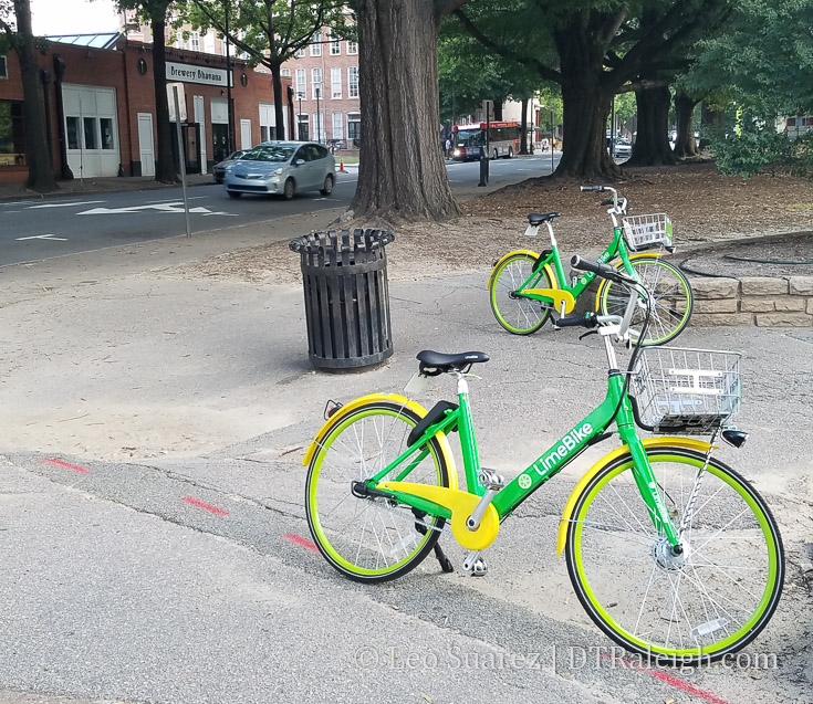
With so much attention going to the city’s bikeshare system, planned to launch in Spring 2018, this was somewhat of a surprise for me. NC State helped launch a private installation of Limebike a few weeks ago and recently, the citrus-colored bicycles have been spotted around downtown Raleigh.

I couldn’t help myself, I just had to try it. There was no signup fee and a 30 minute ride was only $1. (after my first free ride of course)

This system does not use any docks and relies heavily on the use of a smartphone app to help you get to a nearby bicycle. When I went out to use one, I couldn’t find the first but found a pair two blocks away. With a quick barcode scan, the bike was unlocked and ready for use.

Screenshot of the Limebike app.

In theory, I could park it anywhere, allowing others to just grab it for their own ride. The site encourages you to park it where there is existing bicycle parking so after showing it off at home, I rode it back to the nearest park to leave it.

The experience was quite delightful, even with a cheery jingle when the bike is locked and unlocked.

There is cause for debate here. With these bikes around Raleigh and a second system coming next year, I believe this changes the dynamic for bikeshare.

In my book, this is not the most ideal system, fragmenting the user base and causing a poorer user experience. Limebike’s reach won’t be as wide as the city’s system so there is overlap as well as individual coverage areas. To get the most, you need two apps, two sets of rules, etc.

That may seem simple to transit fans but we’re trying to get adoption by as many people as possible. It’s hurting the mission.

At the same time though, we may be in an experimental phase where the two systems can duke it out for user preference.

Either way, riding bikeshare in Raleigh has me excited and I hope for a far-reaching system with a plethora of options one day in the future. It’ll be fun to watch.

Pic of the Week

West South Street looking east

It may not be officially complete as of today but as far as we’re concerned the two-way conversion of South and Lenoir Street is now finished. I say that because the streets are now running as two-way streets compared to their former one-way. The new bike lanes are in and landscaping is done.

According to the city’s website at the time of this writing there is still some drain work to wrap up. Drive/ride away, I say!

Let’s get plans for a Jones/Lane Street conversion going as well!

Raleigh’s Parking Requirements

Top of the City Center Parking Deck

The video below was posted this summer from Vox. They explore a topic of mine that’s one of my favorites; parking requirements set by cities. If you can’t see the embedded video, click here.

One part of the video shows the various parking rules based on the type of development such as number of spots for a public pool or library. It got me thinking about what kind of rules Raleigh has for new developments. I went ahead and pulled it out of the UDO.

Parking Requirements from the Raleigh UDO.

Click for larger

It’s nice to see the bicycle parking requirements right next to the vehicle requirements. What isn’t nice is how little bicycle parking is required, especially on the residential side. Bicycles need a home too!

Nothing too crazy jumps out at me (except maybe parking itself having no parking requirements!) but if you believe the approach in the Vox video, the thinking of Dr. Shoup, then these few pages from our development ordinance play a huge factor in how the city is going to be built and how we will interact with it in the future.

Keep in mind there are ways to get reductions from these requirements when building near transit, which should reduce the amount of built parking as the county expands its transit infrastructure over the next ten years.

I also wanted to post this as a reference as I feel it may be important to look back to in the future.

[UPDATE 8-18: I’ve added the snippet from the UDO about parking requirements for downtown Raleigh]

First Uptick in Bus Service after Sales Tax Increase

GoRaleigh bus along Martin Street

I’m posting this here purely for posterity. If you didn’t see it recently, bus service is starting to expand, including changes on the weekends. This comes as a direct result from the one-half cent sales tax increase that was voted on in the Fall of 2016.

Go GoRaleigh!

Starting Aug. 6, GoRaleigh will:

  • Increase Sunday service to Saturday levels, with the exception of no departures after 11 p.m. on Sundays.
  • Increase frequency on Route 7, which runs along South Saunders Street, to every 15 minutes Monday through Friday.
  • Add Sunday service to Route 3 along Glascock Street, Route 10 along Longview and Route 15L to Trawick Road. Route 31 to New Hope Commons will drop Sunday service, however.

GoTriangle improvements include:

  • Increasing frequency on Route 100 between the GoRaleigh Station and the Regional Transit Center (RTC) in Durham to every 30 minutes Monday through Friday from 6 a.m. to 7 p.m. and starting at 6:40 a.m. Saturday. Route 100 stops at N.C. State University and RDU before continuing to the RTC, where riders can catch a GoTriangle Route 700 bus to Durham or a Route 800 bus to Chapel Hill.
  • Adding midday trips, Saturday trips and new night and Sunday service between Raleigh and Cary on Route 300.

Oaks and Spokes Trying to Bring Community Funded Cycle Track to West Street

Rendering of a cycle track

I stumbled on this Oaks and Spokes project recently and just had to share it. They want to lay down a temporary cycle track along West Street as part of a “6 month pilot to showcase a new type of bikeway and get feedback.”

The project is taking donations from the public and there is a $20,000 project goal. The temporary cycle track will link Glenwood South and the Warehouse District.

West Street would make a great north/south biking street as it’ll be a major connector to Peace Street and north/northwest of downtown all the way to Union Station and parts south. (perhaps one day going all the way to Dix) Jump back to this March 2016 post about all the activity taking place on North West Street.

See more on the project page and support Oaks and Spokes if you can.

City Releases First Map of Proposed Bikeshare Stations

Subset of map of proposed bike share stations

The city has posted their first map of proposed stations for the upcoming Raleigh Bikeshare system. Jump over to bikeraleigh.org to see the whole thing.

The system plans for 30 stations and 300 bikes. Planners want the system running by Spring 2018. This map is the first draft of proposed stations and further work is needed to finalize them.

The system has stations as far out as the North Carolina Museum of Art, the Walnut Creek Wetland Center, and St. Augustine’s University. Dix, Chavis, and Pullen Parks get stations with the majority being in and around downtown and NC State.

Basically each district in downtown has one or two stations as well as the nearby neighborhoods like Oakwood, Person Street, Seaboard, and South Street.

I imagine that with planning a bikeshare system, and only having 30 stations, hard choices need to be made. You can’t spread them out too much, making the system less useful. At the same time, they can’t be too close together which makes the system lack coverage.

I want to guess that spots like Fred Fletcher, Five Points, and Centennial Campus were on the fence as these locations are outliers on a map with little to no bike paths or greenways in their direction.

Next up comes finalizing the station location and announcing rates. Also, I’m hoping there are plenty of e-bikes in the system cause if I didn’t have to actually pedal, you know, that would be great!

The Rosengarten Greenway and Connecting Downtown to Dix

The Rocky Branch Greenway in Dorothea Dix Park.

The Rocky Branch Greenway in Dorothea Dix Park.

Plans are underway for the Rosengarten Greenway, a path starting from West Cabarrus Street and ending at the Rocky Branch Greenway on South Saunders Street. While neighbors in Boylan Heights and Rosengarten Park work with the city on a final plan, a walk along the potential route got me thinking about some kind of connection from downtown to the future Dix Park.

We’ll get to the Rosengarten Park greenway soon but the topic of connecting downtown Raleigh to Dix Park is laced in opinions. Of course, you are about to get one more but that’s why you come to this blog now isn’t it? ;)

I say it a lot and I’ll repeat it numerous times but debates on walking and biking routes hold very little without actually walking the areas first. Driving is of course the easiest way to get back and forth but a tight-knit urban fabric between Dix and downtown could be a huge boost to living and working here.

At this time, I’m not convinced that walking back and forth is for the casual but rather for the dedicated with time on their hands. I’m not saying it’s necessarily difficult but it’s just far enough to not be convenient and the elevation change makes it feel further than it is on a map.

For sake of argument, I’m going to define the entrance to Dix Park as the “intersection” of Western Boulevard and Boylan Avenue. For this blog post, that is the destination we’ll take a look at. Keep in mind, once you are there, you still need to hoof it up the hills into the park itself to whatever future spot you want to get to.

Without diving into the details, it’s about a 15-20 minute walk from anywhere in the Warehouse District to the entrance. We’re talking 25-30 minutes a little further out, say the Capitol building or Glenwood South. In my book, that puts the walk to Dix in the recreation category of my time. Runners might make it a frequent part of their day though.

Walking routes from NC Capitol to Dix Park entrance

Walking routes from NC Capitol to Dix Park entrance. It’s about 30 minutes from the Capitol to the entrance of Dix Park.

That’s no problem for residents but I don’t see visitors to downtown, staying in the hotels for a visit whether it be for a convention or family event, taking a casual walk out there. I’m not sure it’s enough to justify any special walking paths anyway.

It’s also not very flat.

To the south of downtown is the Rocky Branch creek. Parts of downtown slope downward towards it, dropping almost 80 or 90 feet in elevation. You’ll feel those hills on a warm day.

I’ll leave the walking piece of this to the small group of dedicated peds. It’s the cycling route I’m interested in. With a Bike Share system coming next year, cycling out to Dix would be a great to-do when staying in downtown. Cycling would be much more pleasant compared to that previously mentioned walk and drops the time down to 10 minutes on average.

The Rosengarten Greenway

The Rosengarten Greenway likes to be thrown in to the conversation of connecting downtown to Dix. You can dive into the project on the city’s website.

Rosengarten Alley, June 2017.

Rosengarten Alley, June 2017.

Starting at Cabarrus Street at Rosengarten Alley, the goal is to connect a greenway to the current Rocky Branch trail. (which is south of Western Boulevard) In the past, (2009ish) a more lofty plan existed but with new developments taking place since then the path has been modified some. Below is what we have from the past plan and the latest from the city’s website.

Downtown West Gateway Comprehensive Plan Chapter - City of Raleigh

Downtown West Gateway Comprehensive Plan Chapter – City of Raleigh

Rosengarten Greenway plan, 2017

Rosengarten Greenway plan, 2017. Originally in gray, I’ve colored it orange so it can be followed easier. Click for larger, full path map.

The latest plan is a little piecemeal, sending greenway riders on a lot of sidewalks rather than dedicated paths. When I walked the proposed route, it was pretty scenic with an overgrown stream going north/south into and then just turned into regular sidewalks.

Whatever “controversy” there is around this path, I can’t see it. It seems like a normal, everyday path to me.

It feels like standard operating procedure here from the city. If there’s an opportunity to put a greenway along a stream, then they will plan it. I think people are getting a little to hung up on the downtown to Dix connection and this greenway is getting thrown into the mix when it really shouldn’t.

The downtown to Dix connection has to be on the streets.

Bike to Dix

Dix presents a perfect use case for bike share. Steering riders easily between downtown and the park could create a nice downtown to-do for anyone in town.

[For an update on Raleigh Bike Share, hear episode 19 of Inbound Raleigh, a podcast about transit and transportation in Raleigh.]

From Glenwood South and parts of Hillsborough Street, the route is mostly obvious. (the Boylan Avenue downhill speed run)

The two-way conversion of Lenoir and South Street makes it easy from eastern downtown.

It’s the warehouse district that is tricky because of the separation around the tracks at the depot. This is where, I feel, the West Street connection was right-on with creating critical connections in the southwest side of town.

Mentioned in this 2013 post, there were plans to tunnel West Street underneath the tracks in the depot and connect the street to itself.

I haven’t seen plans for the tunnel in 2017 but I do see West Street being a pretty great street for connecting the Rosengarten Park area to the north. While the tracks are active, I imagine it possible for an at-grade railroad crossing for pedestrians and bicycles. Proper fencing and safety gates would be needed to divert bike/ped traffic from around Union Station to West Street south of the tracks.

This would be much cheaper than the tunnel option and examples of this exist in other cities. It would take coordination between the city and the state to get this done. Here’s a rough idea of what it could look like on a map.

The view from West Street just calls to be connected. Imagine riding a bike back from Dix and be greeted with this view.

South West Street, June 2017.

South West Street, June 2017. The Dillon could greet riders and pedestrians here as they come back from Dix.

Southwest downtown Raleigh is becoming a blend of neighborhood mixed-use with retail and residential. Vehicle traffic is slow and vehicle counts are low that the street space can be used for other modes of travel than a car. I’d really like to see rental bikes zipping through that area in the years to come.