Digging Into Raleigh Through Baseball

Started in 2018 and growing throughout 2019, the MLB Raleigh movement has been creeping into different sectors of our city. “the time is now for Raleigh to get organized and put their city and their support for Major League Baseball on display,” their site says.

The folks behind MLB Raleigh have made merchandise that have flown off shelves. Trophy Brewing made a beer. Their profits go towards fixing up baseball fields, partnering with the Boys and Girls Club of Raleigh.

They also have the data to show that we line up, sometimes better, than other cities that have established professional baseball teams.

The guys I’ve talked to behind MLB Raleigh are enjoying the questions they get when they announced to the city, “Why doesn’t Raleigh go for a baseball team?” (see their FAQs) The community has shown up for this and through it, ideas for a team, location, and stadium, have risen out of this grassroots effort.

Whether an MLB team in Raleigh makes sense or not is one thing but behind the covers of this sports-related effort is a true Raleigh-based conversation. The group is using baseball as a vehicle to help educate others on the region’s size and growth, start conversations on city planning and transit, and even diving into a much-discussed topic in Raleigh; brand.

What would you call our baseball team?

Where would your baseball team play?

What colors or logo would they use?

That has been an exciting aspect to watch as MLB Raleigh has tapped Raleigh’s design community to brainstorm and create. You need to dig deep and figure out what, with a logo or name, speaks to people and tells them that this is Raleigh and no other place.

In August 2019, a design event showcased some of those team names and logos that have come from those thinking about how to speak Raleigh to potential baseball fans. This is a fantastic exercise in a topic that I think is important for Raleigh.

What is Raleigh’s brand?

One aspect that I think a lot of folks forget or either don’t know is that Raleigh really was a small town leading up to the mid-1900s. You could argue that we are in the first big growth boom that Raleigh has experienced. Other cities have seen growth at different periods in their history so have been able to layer that history, and aspects from it, on top of each other, making it a part of their identity. (and their sports teams for example)

As Raleigh’s growth continues it would set us up well if the city could find that identity and build some kind of foundation to build on. We have the opportunity to blend many different perspectives with so many locals and newcomers.

With the baseball movement, we may get more out of it than just summer-time games to skip work for. If baseball helps bring out an aspect of our city that we can embrace and the world starts seeing it as the Raleigh-way, it’ll be more than just baseball that benefits but something that Raleigh-based businesses, non-profits, residents, and visitors can experience 365 days a year.

It may just take a logo or name that tells the Raleigh story.

If you’re interested in MLB Raleigh and getting involved, check out their website and sign up to be a supporter.

The Unintended Consequences to Conserving Raleigh’s Neighborhoods

[This post was written in collaboration with James Demby. James is fascinated by how and why different housing types are or are not built. He has been doing an informal study into what has happened in Raleigh housing (ITB specifically) over the last 10 years. See more of that on Twitter.]

Buckhead Drive, Raleigh.

Tom Whaley has noticed a lot of changes going on in his neighborhood in the past year. He lives in the North Ridge West neighborhood of Raleigh and worked with some of his neighbors through the city’s Neighborhood Conservation Overlay District process, or NCOD for short.

“Houses being bought, torn down, lots being split up, houses being rebuilt that were much larger and much denser,” Whaley said. “Those types of homes were not fitting into the characteristics of our current area.”

North Ridge West predominantly consists of one- and two-story houses built in the late 1960s through the 1970s. The typical size of a property there is around 20,000 square feet or almost half an acre. If you are doing the math, that comes out to about two houses per acre.

The city’s development code allows for six houses per acre in this area which, in response to Raleigh’s growth in the housing market, allows for the lots to be subdivided for more housing. The neighbors there see this activity as a problem.

“We’re seeking an NCOD due to a point of inconsistency with the zoning and the current build-out,” says Peggy McIntyre, one of the original petitioners and resident in North Ridge West who helped get this process started.

There is nothing wrong with Raleigh citizens getting together and choosing to rezone themselves, but as more and more NCODs are being put into place, it is a good time to ask, “What are the possible impacts of allowing whole neighborhoods to do this?” Since the first one in 1990, NCODs are starting to become a frequent occurrence and their restrictive zoning conditions may have unintended consequences for the city’s big-picture goals.

Source: Open Data Raleigh – link. See larger map here.

Above is a map of all NCODs in place in Raleigh. Feel free to browse the map and click on each shape to see a pop-up of information on each one, including the name and date it was put into place.

NCOD Highlights

  • Number of NCODs: 20
  • Year of first NCOD: 1990
  • Smallest NCOD: 24 Acres (North Ridge West)
  • Largest NCOD: 557 Acres (Brookhaven)

What is an NCOD?

An NCOD is a zoning tool intended to create a specific result. The City of Raleigh officially defines a Neighborhood Conservation Overlay District (NCOD) as:

A zoning overlay that preserves and enhances the general quality and appearance of neighborhoods by regulating built environment characteristics such as lot size, lot width, setbacks, building height, and vehicular surface area. NCODs generally apply more restrictive standards than base zoning districts.

Character Preservation Overlay Districts – City of Raleigh – link

The city has a number of zoning types that are standard throughout the city. If you are in an R-10, for example, near Crabtree Valley mall or in R-10 zoning near South Park, you have the exact same restrictions as far as the city is concerned. NCODs create specialty overlays to add more restrictions to an area. The NCOD would create additions to the base zoning, so instead of R-10, you would have “R-10 with NCOD conditions.” Each NCOD gets their own additional, custom restrictions and they are listed in our city’s development ordinance, one-by-one.

NCODs are not Historic Overlays Districts. Historic Overlays consider the historical significance of a group of buildings from Raleigh’s past to protect them. NCODs do not necessarily take into account historical aspects of the buildings or structures of an area.

Why would someone want an NCOD?

The most often mentioned reason for wanting an NCOD has been as a response to teardowns. In these cases, a teardown might mean that a smaller, older home is replaced with a new home, larger than the ones nearby.

Lot splits are also a common reason for applying for an NCOD. This happens when an existing lot is divided and the former home removed for two new ones.

Residents near these changes can see an NCOD as a way to stop these types of changes. A desire to keep a neighborhood the way it was, sometimes described as its “character,” is a frequent motivation for requesting an NCOD. Every instance of NCOD so far in Raleigh has been to add a restriction to what can be built in that area. 

Affordability has also been used as a reason to put an NCOD into place. With Raleigh’s growth, older homes have been torn down and being replaced with newer ones, resulting in the higher prices that come with new construction. If teardowns can be prevented, the thinking is that the area stays affordable.

As you can imagine, a lot of aspects come up when thinking about the character of a place. Distance between houses, trees, density, and traffic are just some factors in most residents’ idea of neighborhood character.

These can be good, even great things, to protect. Yet the NCOD zoning could be creating conflict in the Raleigh of today.

Controversy and Potential Conflict?

Recently, the most cited reason for adding an NCOD has been to stop lots from being split and old homes from being torn down and replaced by bigger, more expensive ones. That doesn’t sound like the worst idea on the surface, but where this has been controversial is in the execution. 

Because of the steps required to obtain an NCOD, these overlays are generally going to wealthier and more organized neighborhoods. So, we are making special protection districts for the areas that already have the most resources, adding privilege. 

The other controversy is that NCODs have all been pointed toward restricting housing types. While blocking lot splits, they also block any type of added density. This means that growth will always be pushed somewhere else. If we add restrictions on certain areas, then that means other areas must absorb growth. This rewards the organized communities while adding pressure to other areas.

NCODs never expire, making them a tricky restriction when planning for the future. The situation around an NCOD may change dramatically, but it now takes 50% of the people in that NCOD to make any new change to even a few properties.

The King Charles NCOD is a good example of this. It was planned with restrictions including a 0.7 acre lot minimum at a time when the neighborhood expected most of Raleigh’s growth to go in another direction. Then years later, the nearby New Bern Corridor was selected for Bus Rapid Transit (BRT) and now roughly a third of the area around this big investment in transit will be locked down with an NCOD requiring 0.7 acres per lot. This is now in conflict with the need for density near transit.

The King Charles NCOD, shown in the brown “house” overlay, has a minimum lot size of 0.77 acres, 2-story height limit and minimum 144 feet lot width. Today, planning for a bus-rapid transit line on New Bern Avenue is ongoing. Click for larger.

An interesting side of the controversy around NCODs is whether they protect affordability. In the immediate short term they may, so when neighbors see teardowns and McMansions the NCOD is seen as a way to keep the older more affordable homes intact. 

On the other hand, NCODs are not being used to encourage additional smaller units that could be more affordable; they are usually just restricting the number of homes in the area to stay exactly the same. In a growing city and desirable neighborhood, this could mean that even though the older homes are less expensive than new ones, they now see their value grow even more because they are the only option for the area. In the last few NCODs that have been brought up by council, the older homes in the area have already been worth over $350,000 or higher.

Wrapping Up

Thankfully, there has been some talk at the council level and in planning commission that the NCOD zoning tool may not be generating the results it was designed to create. This conversation needs to be pushed further and with a higher priority as NCOD applications are rolling in, with one every year since 2016. Two have been adopted this year (2019), and a third is on pace for approval in 2020.

With NCOD’s, we are allowing Raleighites to self-restrict in a way that may be giving them an advantage over other areas of the city. This process is not equitable, because the most organized and most diligent get the rewards.

The process also pits neighbors against each other due to the fact that only 51% of an area needs to agree to an NCOD. This process therefore rewards homogeneous areas versus those that are diverse. It also sets in place restrictions for future generations that may want different things.

There may come a tipping point where we’ve custom-zoned too much of the city. Currently, 3.35% of the city is inside an NCOD. Raleigh is planning for growth along transit corridors, corridors that currently have NCOD restrictions in place. This only makes it more difficult to plan for proper housing close to transit.

Fighting for neighborhood protections doesn’t necessarily need to stop altogether in Raleigh. It’s just time to start thinking about the potential impacts these “frozen in time” restrictions have toward Raleigh’s future.

Get Your Raleigh Flag From Civic Flags!

I had the pleasure of meeting up with Steve Rehnborg over at the Raleigh Night Market recently and he showed me his first wave of products that his company, Civic Flags, is offering. This includes a City of Raleigh flag!

Partially inspired by this 2012 blog post about the flag, Civic Flags fills in a gap in our city: you can’t easily order a flag for your own enjoyment!

I’ve got my flag so wanted to inform readers of the new site. Jump on over and see what they got. You can also follow them on Instagram to keep up with them.

Seaboard Station Plans for new Apartments and Hotel

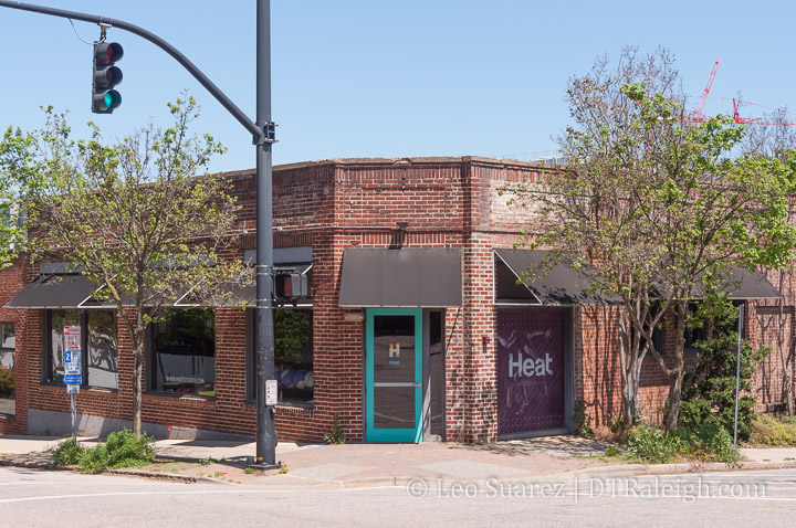
Corner of Halifax and Peace Streets. January 2019.

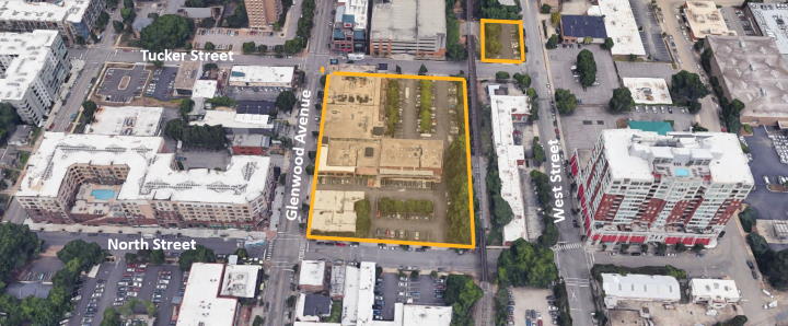
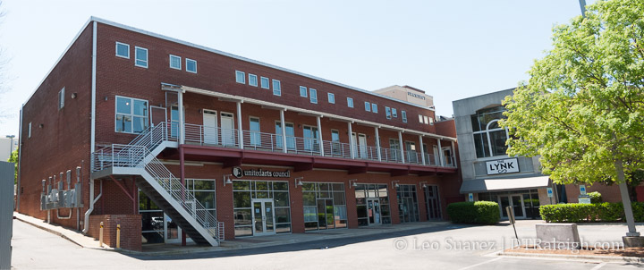
The latest submitted plans (SR-034-19) for new development at Seaboard Station have been submitted. The plans are for a new 7-story building at the northwest corner of Peace and Halifax. Currently here is the building with the Sunflower’s cafe and other surface parking.

Apartments and a hotel would take up this entire block, named Seaboard Station Block A for now, which is bounded by Peace and Seaboard Avenue, Halifax and Seaboard Station Drive.

Aerial of Block A from Google maps.

The new building would be 7-stories and include parking with some spaces partially underground. It’s interesting to see the development proposing 236 parking spaces rather than the required 171. However, with 96 apartments and 150 hotel rooms, that may leave plenty for residents, overnight visitors and daytime, nighttime restaurant-goers.

The plans don’t list any retail or restaurant space other than the hotel bar and kitchen. The ground-floor spaces may be used for parking instead.

Cline Design, architects behind Peace and The Link, are working on the design for the new building.

Finally, the northern side of the block has a very generous sidewalk and converts the striped “turn in” parking to off-street, urban style spaces. The northern side may be the “front-facing” side as it supports the Seaboard Station area. The site plans suggests some public art here as well.

The plans are currently under review by the city so no real timeline is out there yet. When news hit about developing these sites, there was mention of sooner rather than later so hopefully, we’ll see things move soon on what is currently an under-used portion along Peace Street.

Moore Square’s Grand Opening is on August 3

Final touches being applied to Moore Square. July 2019.

Moore Square is getting close to wrapping up its makeover as the city has announced a string of events to celebrate the reopening of the downtown square. The grand opening party is on August 3rd but there will be events the night before as part of First Friday.

Moore Square Grand Opening Celebration
Date/Time: Sat., Aug. 3 from 11 a.m. to 4 p.m.
Moore Square Park
226 East Martin Street

The full schedule is here. With live music, a playground for kids, and a movie, the events should test out the square’s ability to play host.

In addition to the square, the house at 226 East Martin will be the Moore Square Visitor’s center. The center will sell local merch in addition to “a history exhibit detailing the historic significance of the Square and surrounding district to the city of Raleigh.”

226 East Martin. July 2019.

The Community Celebrates 1 Year of Discussion

It’s been a year since I announced the launch of the DTRaleigh Community and soon after shut down traditional comments on this blog. After 365 days, I couldn’t be happier with the results.

In the past year, downtown enthusiasts have been chatting more and even meeting face-to-face. There’s even more eyes on downtown development as residents report in and others ask questions. Answers are found through crowd-sourcing and the conversation is in-depth and respectful.

There are almost 300 registered users and easily hundreds more who read the public-facing topics. Registrations slowly tick up every few days.

As the sole moderator, I’ve found it easy and after users have gotten used to the software, it’s mostly self-policing with rants and flamewars kept to an almost negligible amount.

If you haven’t signed up, I encourage you to do that and jump in with whatever downtown Raleigh topic that’s on your mind. There’s room to grow and who knows where it will go from here.

On to year 2!

Smokey Hollow Phase 3 Wants to Bring Signature Tower to Peace Street

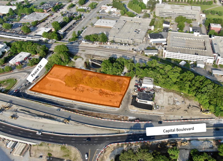
Current site of Smokey Hollow Phase 3 along Peace and Harrington. April 2019.

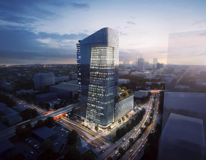
The Smokey Hollow project along Peace Street is moving right along in waves with plans for phase 3 already coming to council soon. The developers, Kane Realty, are requesting a rezoning for the site called phase 3 and the request is to increase the height limit from 12-stories or 150 feet to 40-stories or 500 feet.

The request, found consistent with our city’s comprehensive plan and land-use map, has already been approved by the planning commission and will be coming to city council for approval in May or June of this year.

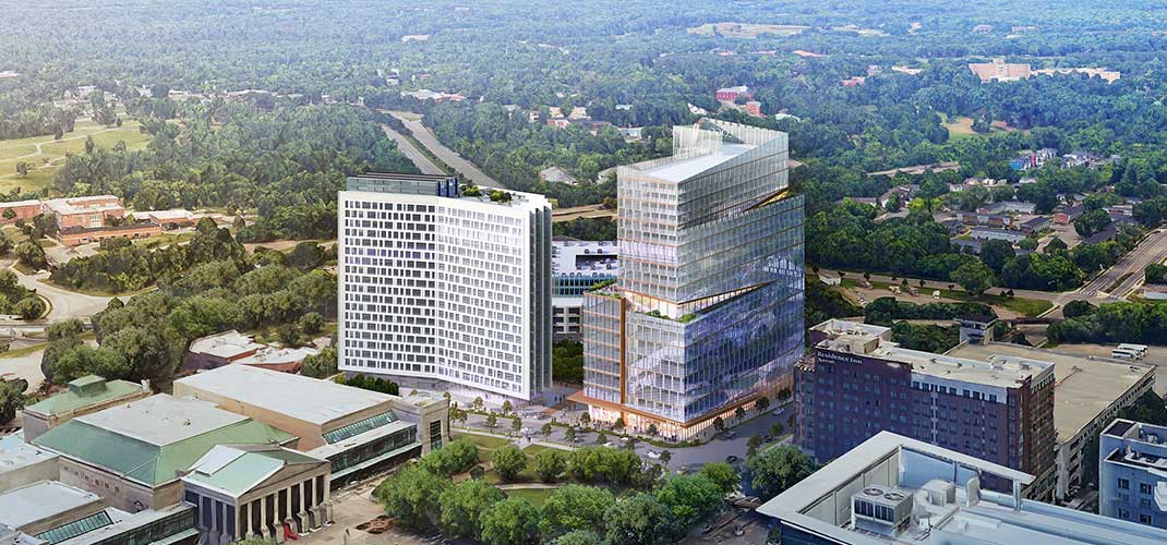
An extremely talented photographer and regular contributor over on the Community provided this aerial of the sites. I’ve reposted with edits and permission to show the scale of everything that’s going on in the area.

Click for Larger. Reposted with permission.

For a recap on phase 1, check out this post here.

For phase 2 details, jump here.

Kane Realty’s rezoning jumps from the 12 to 40 story height limit. There’s a 20 story limit as well so we can assume that their plans consist of something between 20 and 40 stories.

For more in-depth, jump on to the Community as we’ve been following everything but at this point in the development process, we can expect:

  • A large parking deck about 5 or 6 stories tall
  • The parking deck would be wrapped with apartments facing Johnson, Harrington, and Peace
  • The parking would be exposed to Capital but screened to make it better from an aesthetics point-of-view
  • A single mixed-use tower would sit on top with a combination of office and residential

With so much infrastructure here including road capacity, brand new sidewalks, a future cycle-track, and an upcoming bus-rapid transit route, there is a very strong argument for higher-density in this area.

It’s definitely part of a project that will make an impact and is single-handedly multiplying the resident and job count to this area by a factor of 10.