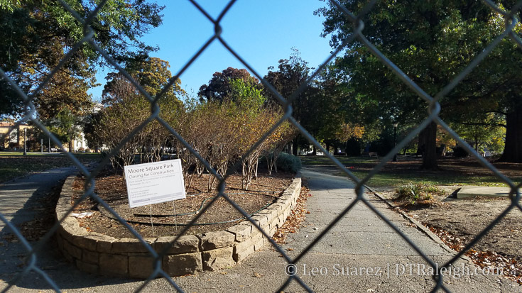
Fencing is going up around Moore Square making it officially closed for the renovation. Art should be placed along the fencing soon as a way to keep the area looking lively.
Fencing is going up around Moore Square making it officially closed for the renovation. Art should be placed along the fencing soon as a way to keep the area looking lively.
Municipography is a summary of current issues going through the Raleigh City Council and other municipal departments in the city. The point is to try to deliver any video, photos, and text associated with the discussions happening at City Hall or elsewhere. Since this is a downtown Raleigh blog, the focus is on the center of the city.
I recommend email readers click through to the website to see the embedded video.
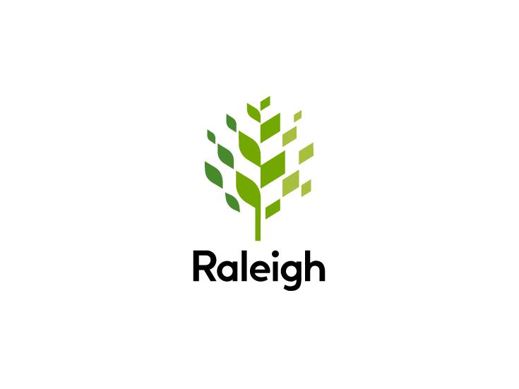
The City of Raleigh government’s latest logo
During this week’s city council meeting, a major update was announced and approved in the long-time process of revamping the city’s brand. The city government now has its first logo, shown above, and will be implemented across the city’s departments.
Not to be confused with the City of Raleigh seal acting as a logo, the new logo will be used in a variety of ways complimented with custom typography (Raleigh Bold) and even future icons that represent the new mission and vision statement.
The logo is for the city’s government and not for tourism.
The presentation given during the council meeting is a good one to watch for more details and I have it embedded below. If you can’t see it, click here to go to YouTube.
Social and news media certainly likes to highlight the plethora of criticism about the new logo. You can’t help but comment when you consider that $226,000 went into the process of creating it.
I don’t have the eye to criticize the logo itself but I do want to elaborate a bit on this cost, a cost that I see well worth it and there are critical things I think folks are missing.
If Raleigh wants to be a national player in business recruitment and even be well represented at some international conversations, a well-thought-out and high-quality brand is a must. To get that, a thorough process that takes community feedback to guide the design team towards this logo “package” is an equitable approach.
The cost wasn’t just for that tree at the top of this post but for an in-depth process to get the pulse of Raleighites and represent that in a simple and effective logo. The feedback collection process was actually a larger share of the cost compared to the actual design work.
For me, I felt like I saw huge value in the logo’s versatility with this video that shows how it can be used in a variety of ways. I can picture print, media, and video incorporating it in consistent yet slightly different ways than the next. If you can’t see it, click here to go to YouTube.
As the branding package rolls out, I think then that more and more people will see the value here. I’m happy to see us tackle a topic that is so subjective and come forward with something strong.
Bravo to city staff who played a role in getting this out there! (and how can I get Raleigh Bold on this website!)
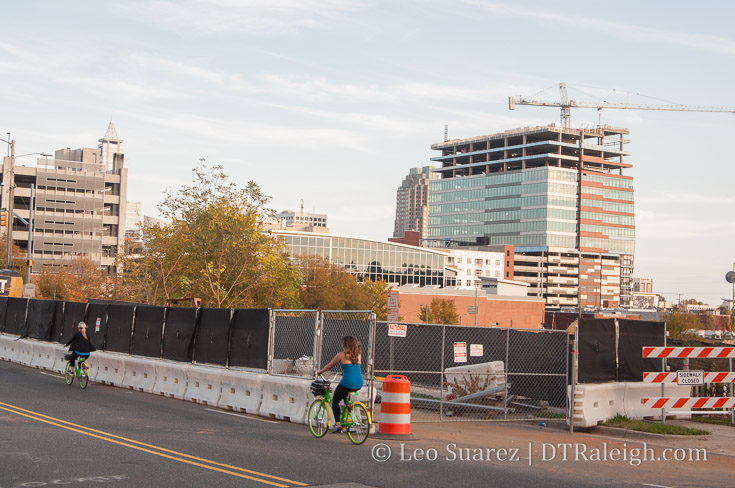
Limebike riders pass in front of the former warehouse of Shelton’s Furniture on Morgan Street, November 2017.
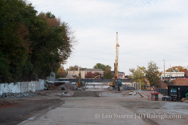
One Glenwood is really moving now. Across Morgan Street from the office tower site, the warehouse where Shelton’s Furniture was located has now been removed.
The adjacent site will be the parking deck that supports the office tower. Plans for a future phase 2 mention a possible hotel on top of the deck but there are no solid plans out for it yet. The parking deck will have a driveway along Morgan as well as Hargett Street.
Staring at the One Glenwood parking deck site from Hargett Street, November 2017.
Foundation work for the tower is also underway. That typically means a tower crane will show up soon for those following along.
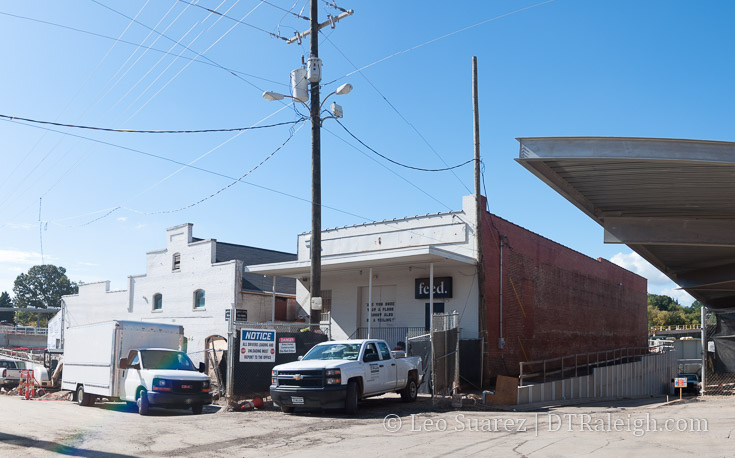
Future home of Father and Son on West Street
This week, a few bits of news came out related to the downtown Raleigh retail scene.
First, long-time favorite Father and Son will be moving from their spot on the 100 block of West Hargett Street to the Warehouse District. They’ll squeeze into the warehouse that used to have Flanders Gallery at 302 South West Street.
There was no announcement on when that move will take place but what a great bookend for Martin Street. The Dillon will provide some new retail space a block in front of it that also ties it to the storefronts down the street. Shopping will be possible from Nash Square all the way to Union Station.
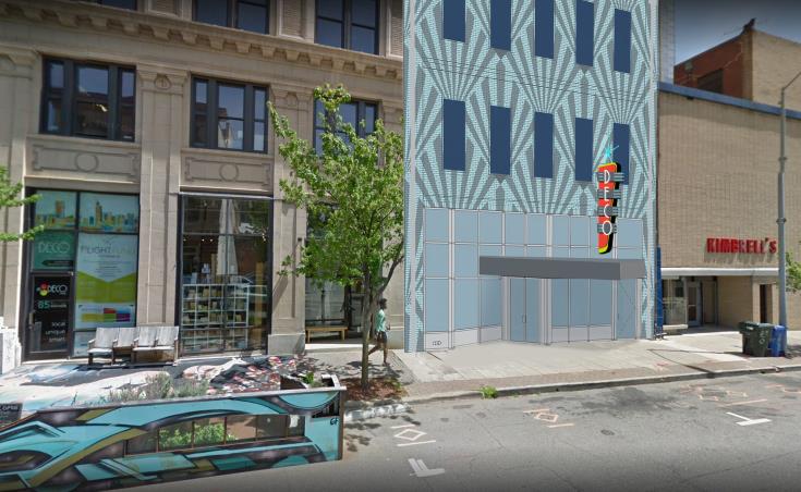
Rendering of future home of Deco Raleigh on Salisbury Street
The second announcement starts with Deco’s future home just down Salisbury Street. Deco and its counterpart Deco Home are combining into an even larger space (more than twice the size) that’s one building down from their current home in the Odd Fellows Building.
Their new home was the former NC State Bar, now over on Blount Street, and the shop will be on the Salisbury half of the building. According to the announcement, “the new space will be the largest footprint for an independent retailer downtown.”
With Deco now expanding after five years in operation, the store seems to be one of the leaders in downtown Raleigh. If it’s presence grows that may bring more retail to its former spaces and create a cluster along Salisbury and Hargett.
Future home of Deco Raleigh on Salisbury Street
Finally, it may not be local retail but the long-rumored Publix was announced for the Smokey Hollow development, which is now called Peace by the way, over on the corner of Peace and West Street. This is the second grocery store announcement for the Peace Street corridor as Seaboard Station announced a Harris Teeter in July 2016.
I imagine it’s still years away from either one opening so let’s hope after all the Peace Street dust has settled that groceries will be flying all over the place in that area.
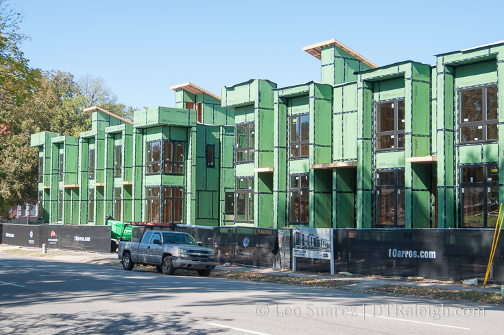
10 Arros Townhomes, October 2017
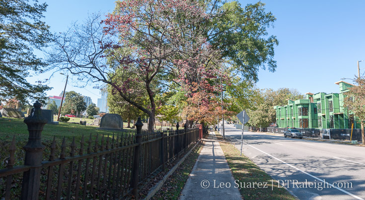
Here are the 10 Arros townhomes being built along New Bern Avenue. With all 10 “arros” basically built up, you can get a sense of their presence onto the street. It’s a nice change from the empty parking lot, wide openness to a more comfortable, urban-fringe kind of presence.
I am also loving this section of New Bern more with the townhomes across the street from Raleigh City Cemetery. Below is a wide shot of the townhomes with the cemetery across the street to try and show it off a little.
If the city can get a handle on the nighttime illegal activity that takes place in the cemetery and can have all three entrances open to the public every day, strolls through the cemetery would actually be quite pleasant. At this time, the city’s approach is to close two of the three entrances to prevent pedestrian through traffic, a more blunt approach to the problem in my opinion.
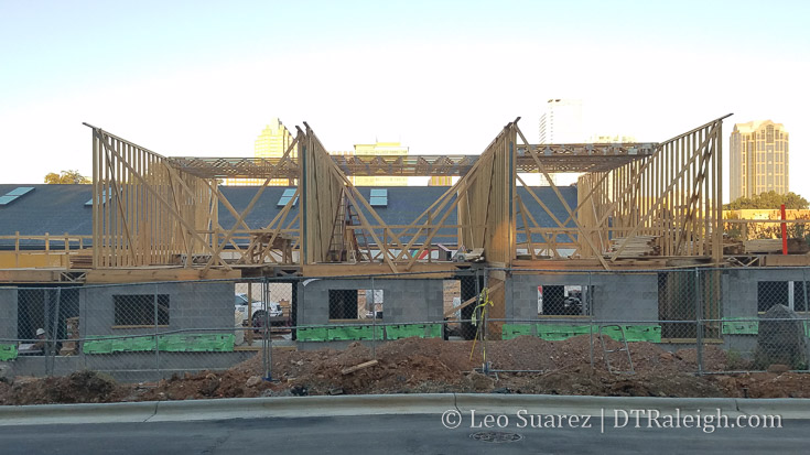
These townhouses along Chavis Way are starting to rise up. This project, called The Ware, is located next to Transfer Company, a renovation of Stone’s Warehouse into a food hall and grocery.
In addition to the photo, I have a surround shot embedded below. This is the corner of Chavis Way and Davie Street. If you are reading through email or RSS, click through to the blog to see it.
Rendering courtesy of Monarch Realty
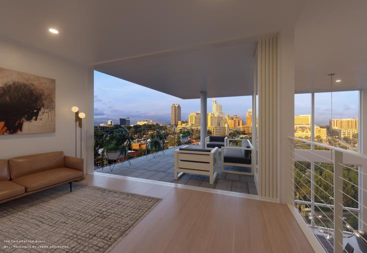
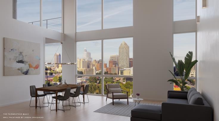
A project that I highlighted here on the blog back in November 2016 is now in the presale phase. The Fairweather will be a five-story condo building with 45 total units. The location is in between downtown Raleigh and the future Dix Park. See it on Google maps here.
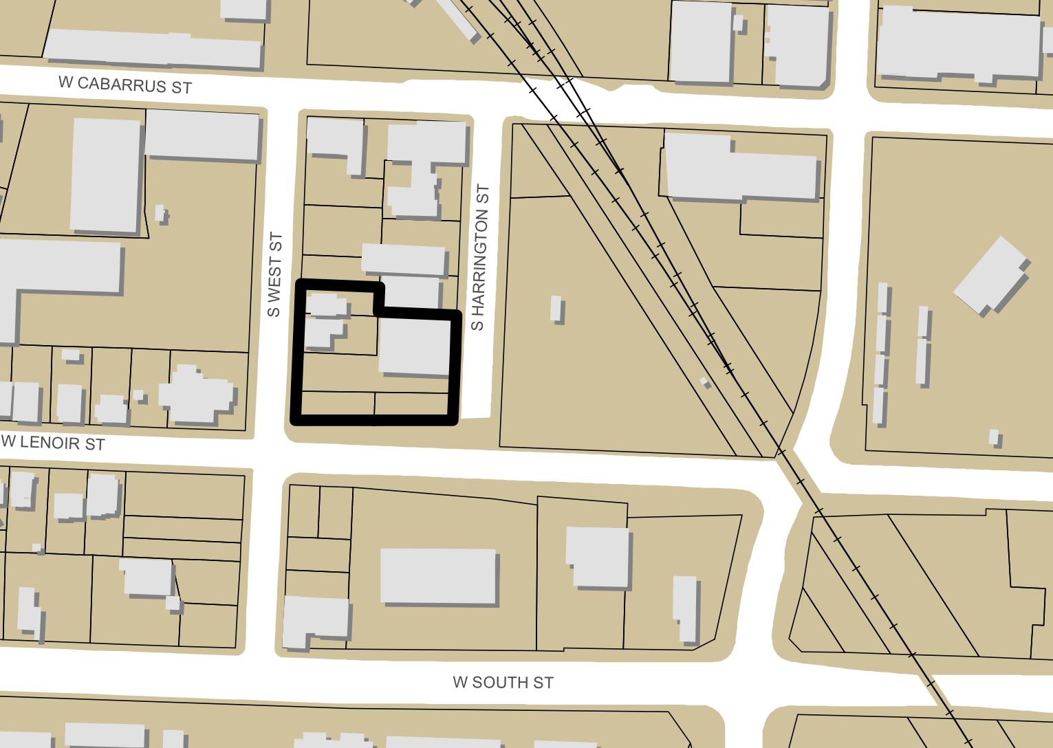
Location of The Fairweather according to its site plan.
From the press release:
Slated to open in early 2019, The Fairweather features five stories with approximately 45 units, ranging from 838 to 2,645 square feet. The first four floors showcase one, two and three bedroom units starting in the upper $300s to the $600s, while the fifth floor offers penthouse suites for $700 to $1 million. Located at the corner of S. Harrington, Lenoir and S. West streets, The Fairweather sits on a hilltop that affords owners views in every direction of Raleigh’s skyline. The development also offers immediate walking distance to landmarks, such as Dorothea Dix Park, the new Raleigh Union Station and the Warehouse District’s upscale restaurants.
Rendering courtesy of Monarch Realty
New-construction condos haven’t been seen in downtown Raleigh in awhile so it may make sense that high-end units come first. I’ve been told this will be somewhat of a more distinctive building compared to what we’ve been used to in the apartment scene.
The exterior renderings will be most interesting to see.
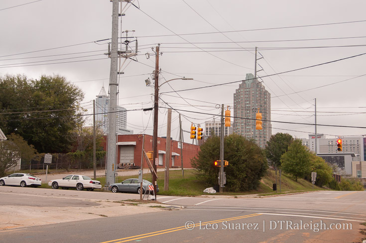
Corner of West and Lenoir Street, October 2017

The city has been moving forward with plans on how best to utilize the land they own in downtown Raleigh. Sell? Develop? To whom and for what?
The idea is to utilize the land that has now increased in value over the last few decades and put it towards supporting some policy goals in the city’s comprehensive plan, downtown plan, and other plans for example. The latest output of this study is the July 14, 2017 Downtown Land Disposition Strategy report which is the meat of today’s blog post.
Dive into the whole thing on the city’s website here.
The July 2017 report was prepared by HR&A Advisors and they are attempting to help the city figure out how to let go or repurpose eleven properties in and around downtown. The report offers possible reuse options, suggestions on how best to sell them, and projects of revenue generated.
The properties, some currently with active buildings and others as surface parking, are mapped below.
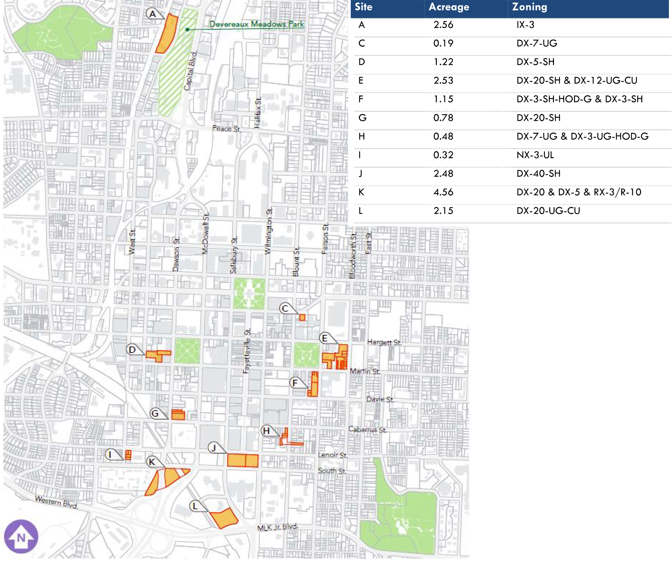
Map of city-owned properties, July 2017. Click for larger
To figure out what’s on the books, what goals the city is striving for, the following policy docs were reviewed:
HR&A was then able to pull some general goals from all this including:
With the general goals defined, the next step is to prioritize and gauge the public on these. Through community meetings, attendees were asked to rank the importance of each one against the other. This chart sums up those findings.
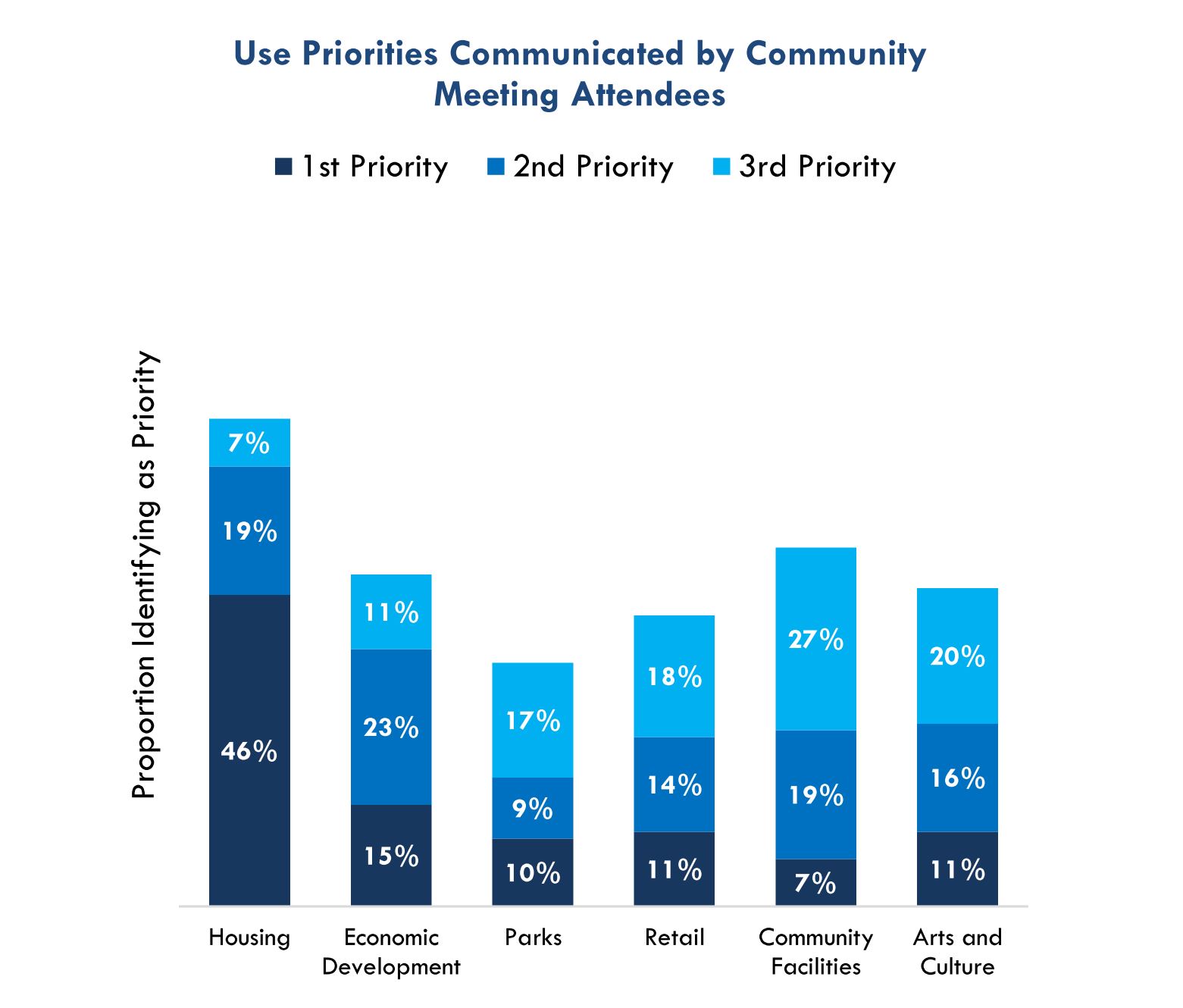
Use Priorities Communicated by Community Meeting Attendees. Click for larger
If you’ve been paying attention even for a little while, it would be easy to guess the top priority. Housing has been an increasing concern for the city as a whole and downtown’s revitalization is shaking up the former housing dynamic.
It’s listed as a clear top priority from the community feedback sessions with economic development being a second priority and community facilities being third.
So much for downtown retail and park space, right?
The report then goes into suggestions and projections for each of the eleven sites in downtown. To make it easier to digest, I’ve taken a snapshot of the report and embedded it into a google map for each parcel which you can see below.
I actually recommend you click through to the Google map itself to see the properties and their pop-ups which include the graphic with additional details. Clicking on the graphic there makes it bigger and easier to read. See it here.
Some quick highlights:
Finally, for those wondering what kind of revenue we’re talking about, the final page of the report gets into it. See it below.
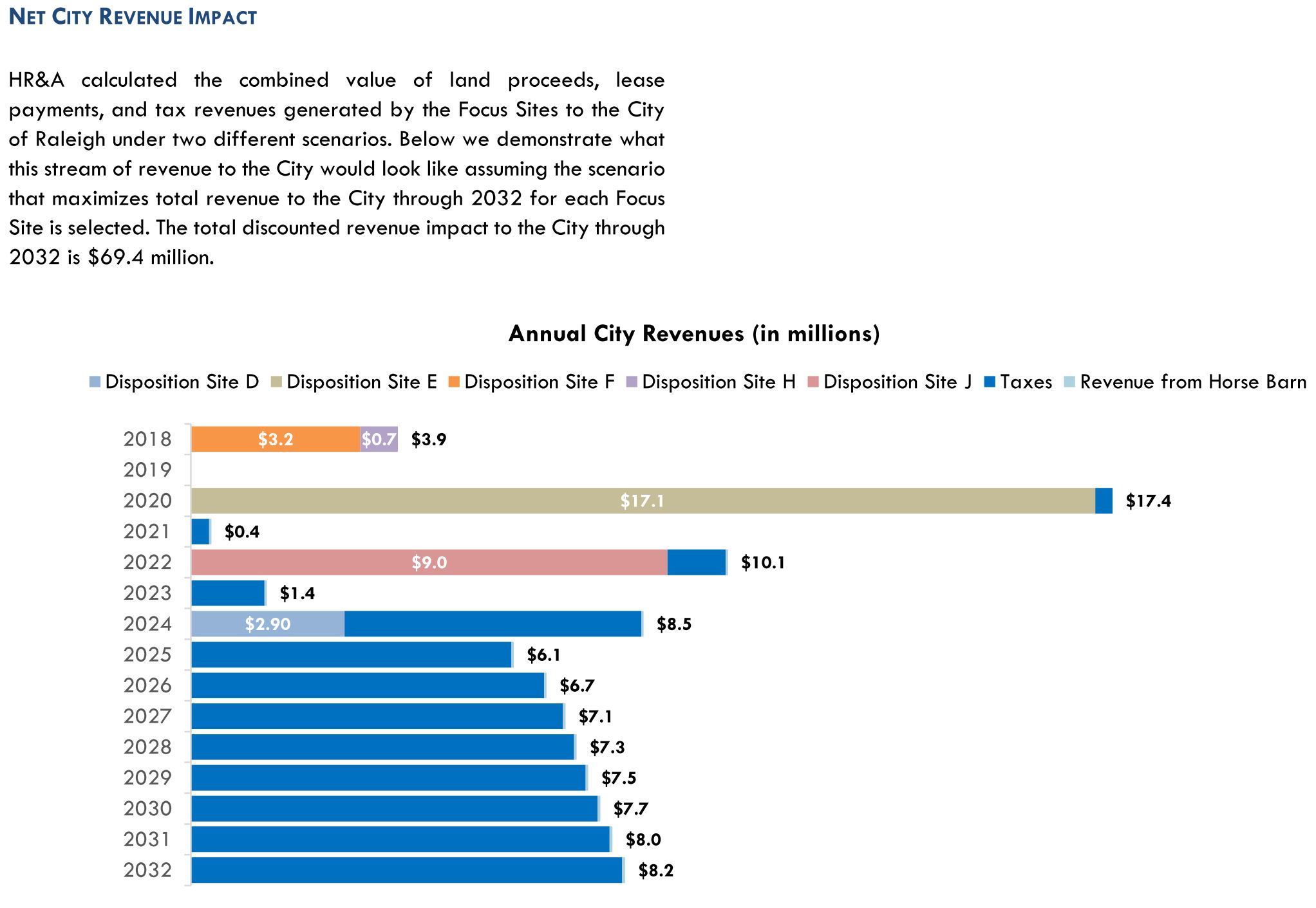
Net City Revenue Impact. Click for larger
It’s a big project for sure. There’s a push for consolidating city offices with a new campus on the current City Hall block. The offloading of these properties could help pay for that, some being very underutilized.
It’ll be interesting to see the next step although I feel this will be a long and carefully thought out process.