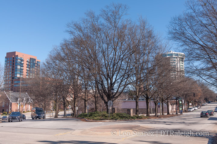
Some real fun plans were announced for the land at 504 Hillsborough Street. A dog park with outdoor bar was announced by those behind CityPlat, the new owners of the property.
Used as a parking lot for years, probably decades, the triangle-shaped lot where Edenton merges with Hillsborough will soon have drinks served out of shipping containers around a dog-friendly outdoor space.
Coming soon to the intersection of West Street and Edenton in downtown Raleigh is a DOG PARK & BAR complete with concession (think coffee, beer), retail, and a large play area for dogs to roam around. Picture an open and welcoming, community-focused space for dog owners and dog lovers alike to connect and play fetch, right in the heart of the city.
I’ve been watching that site for years and finally, someone comes in with a very unique, very cool idea for it. The trees are mature enough to make the space feel cozy but open enough that you’re able to people watch as if you’re in a park.
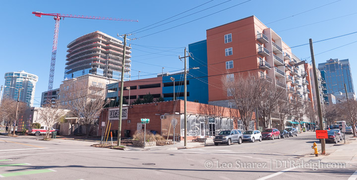
I wanted to get a photo up of the northeast corner of Hargett and Harrington as development plans are in the works here. The Legends “block” may see a rezoning request for up to 40-stories according to this TBJ article. That intersection looks to be pretty significant in the future if any kind of building takes place there.
When I look around, I see The Dillon apartments with Weaver Street on the ground floor. The apartments are on two corners actually with the third being a gravel parking lot, also in a holding state for future development.
The Warehouse district has got a lot of potential.
Above is a short but really nice video showing off the progress over at Chavis Park. It looks quite different from a year ago, about the last time we checked in.
I’m hoping energy and positive experiences in the near future could drum up support for bringing the other aspects of the master plan to bear. I still believe that Chavis could be the park for downtown Raleigh residents as it plans to provide services and amenities that nearby destination park Dix won’t have. (or at least won’t have for awhile)
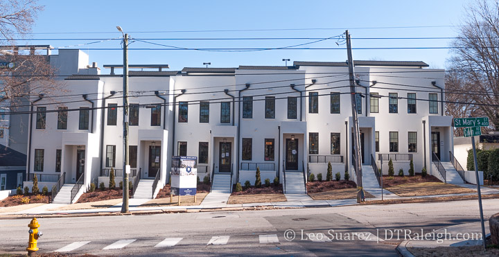
The Cameron Crest townhomes on St. Mary’s Street are looking sharp now that they are completed. These are million dollar townhomes that pack a lot of space in their small looks here in the photo above.
I wanted to highlight the homes’ completion but also take a chance to share that the Downtown Raleigh Alliance has this project on their next Discover Downtown Tour on February 12. Register and take a look at these beauties for yourself!
In the last few years, I’ve been trying to get in touch with more people, more readers, and bring the conversation about downtown Raleigh into the real world.
Year 14 absolutely did NOT happen in the real world and what I learned most is that my interest and my social life depends on the face-to-face and group meetings I have, planned and unplanned, throughout downtown Raleigh. If you are reading this and I’ve met you at least once in real life, I thank you and want to meet you again after the 2020 pandemic is over.
I enjoy the chatter and banter on the DTRaleigh Community but it just doesn’t quite hit it compared to the in-person meetings at the bar. Discussions over public projects at community meetups aren’t the same online. And Zoom? It’s ok, I guess.
Maybe the kids are rolling their eyes at me but count me still 100% IN for downtown Raleigh and face-to-faces in the future. In fact, I can’t wait to start planning meetups and getting people together again. Maybe even more frequently than before.
My extreme binging of pop culture in 2020 was certainly fun while being indoors most of the time but I’m getting over it. The blog has certainly slowed down as a result of the lack of in-person meetings and inspiration from life chats with people.
This site is only the surface of what’s really going on out there. And I just cover development and some city meetings. There’s a lot going on out there and lots of people to meet.
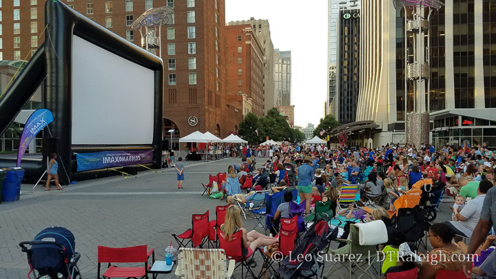
The 100+ movies I watched and 100 hours of video games may have been a factor as well last year. Had to stay safe, am I right? Remember when we watched movies in City Plaza? (photo above) Nostalgia is so good sometimes.
It was a down year for the blog as content was less frequent on my part. I hope to remedy that with a positive outlook on 2021.
If you share my optimism then I hope you can consider donating to my work. I ask once a year, today only, and anything you can contribute helps.
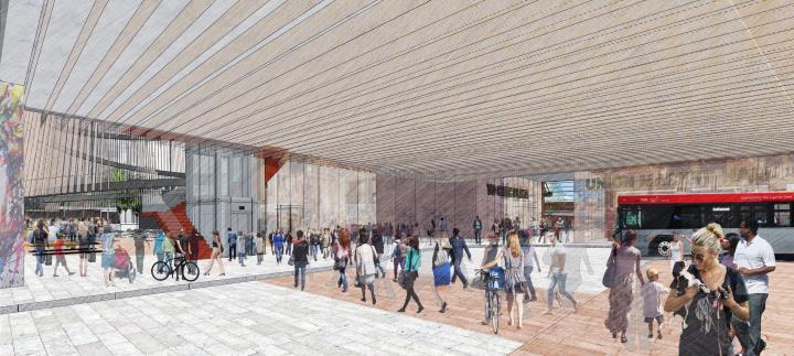
At a GoTriangle Board meeting this week, there were updates related to RUS Bus that show off some high level updates including a 30% schematic design. For those new to the project, RUS Bus is an extension for Raleigh Union Station (RUS) including a mixed-use development with a bus station on the ground floor.
Located right next to Raleigh Union Station, serving train passengers today and possibly commuter rail passengers in the future, the bus component would be the more local transit connection. It’ll most likely have a bus rapid transit stop as well.
Finally, being in the warehouse district, the location would bring a hub of activity to the west side of downtown. I’ve got lots of love for a project like this, which should come as no surprise to long-time readers.
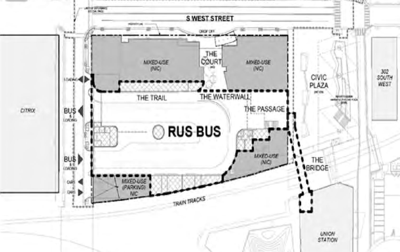
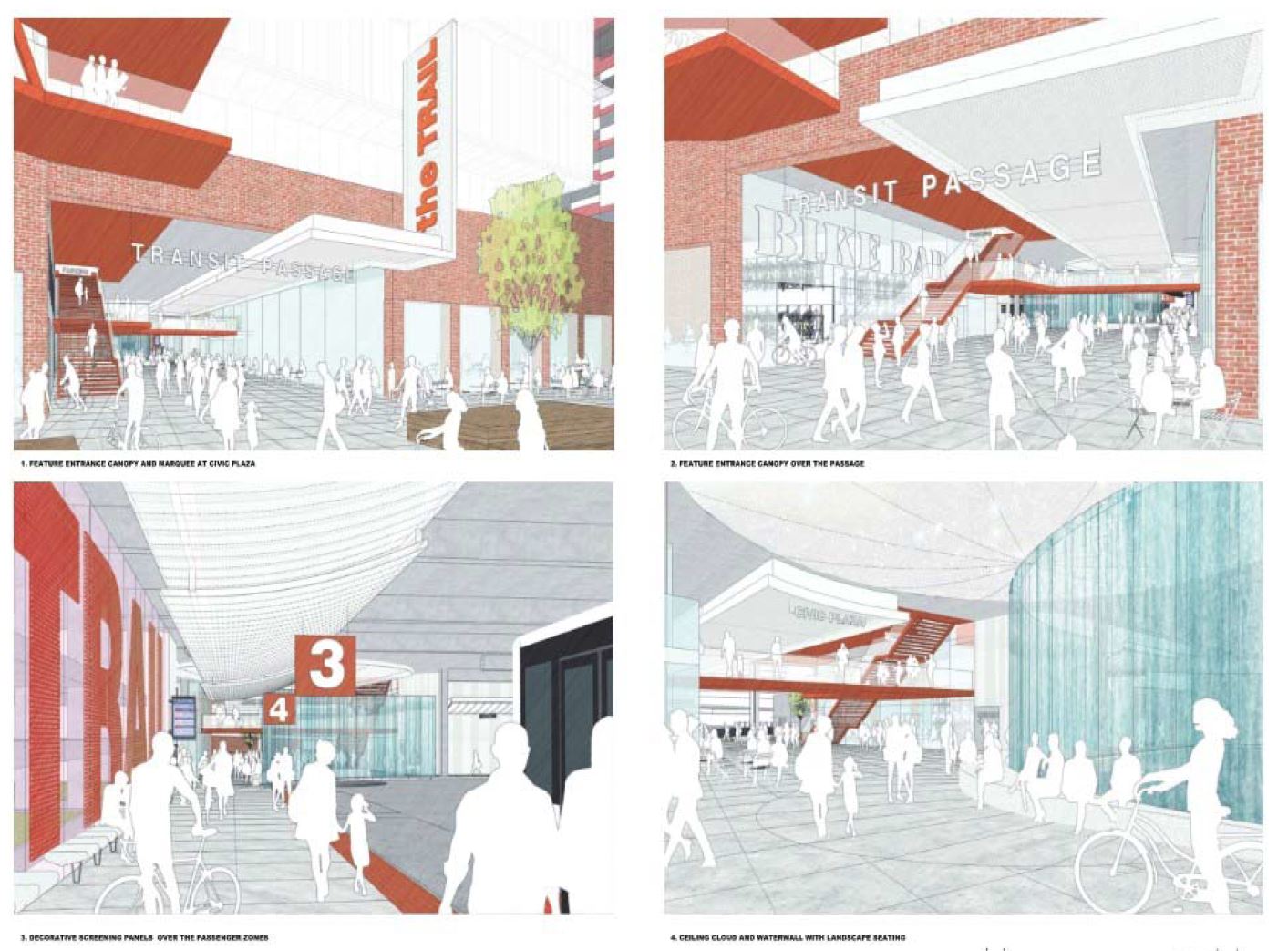
There are more renderings on the architect’s website, showing preliminary designs which look fantastic, but for me, I’m most interested at this time in the preliminary site plan shown below.
The ground-floor of developments typically interest me because that’s probably what most people are going to use anyway. Some interesting elements I see include:
A bridge directly connecting RUS bus to RUS.
Lots of ground floor mixed-use spaces.
A big connection directly into the current civic plaza.
There’s a lot of function shown here along with elements that could elevate the entire transit station into a destination. If you look at the rendering with towers on top, this could be a pretty nice hub of activity at all times of the day, on weekdays and weekends also.
From the GoTriangle board meeting agenda, we also have some dates.
Planned Construction start date: April 30, 2022
Substantial Completion Date: June 30, 2025
Grant funds must be fully drawn: September 30, 2025
The 2020s will be a big year for transit investments in Raleigh.
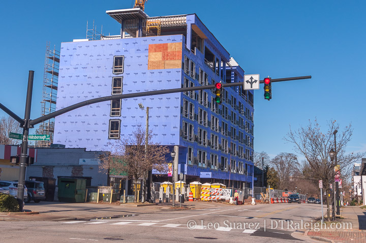
Believe it or not, hotel construction is taking place in Raleigh. The crane for The Willard hotel was taken down this past weekend. That means this project has topped out.
The Willard actually started before the pandemic hit and based on my expert observational skills past and present, the hotel should be finished later this year.
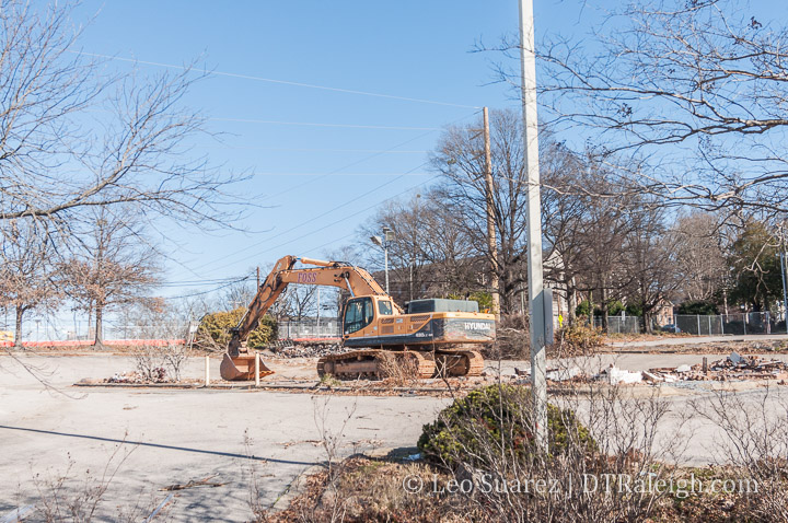
The demolition at Seaboard Station continues. The site with the former Sunflower’s Cafe is no more. Mixed-use buildings with a possible hotel, apartments and ground-floor retail are in the plans for the future.
The area looks huge after the removal of all the buildings and surface parking. It really shows you how much more you can do when you remove all the land dedicated to parking cars.
We’re tracking this development in-depth over on the Community starting with some great aerial photos.