Municipography, Food Trucks and Raleigh Bikeshare

title

Municipography is a summary of current issues going through the Raleigh City Council and other municipal departments in the city. The point is to try to deliver any video, photos, and text associated with the discussions happening at City Hall or elsewhere. Since this is a downtown Raleigh blog, the focus is on the center of the city.

No embedded videos this week as for some reason, the city’s streaming video service is auto-playing the videos. I’m not into that.

Two long-talked topics were approved at this week’s city council meeting. The food truck debate has been a long one and a new pilot program will be rolled out to see how they operate on public property in and near downtown. Also, Raleigh will get its first bike share system in the coming years.

Food trucks

To watch/hear the discussion, click here.

The latest in the food truck saga is over the mobile food businesses operating in the public right-of-way. The plan is to designate five “zones” where the trucks can operate during the lunchtime hours. (10am-3pm) First Fridays will extend those hours to 8pm.

The five locations include:

  • The Warehouse District
  • Polk Street near the State Government Center
  • South State Street near the NC DMV
  • Bloodworth Street between Martin and Davie
  • The northern end of Moore Square

At this time, the Moore Square zone was dropped due to all the construction from the GoRaleigh Transit Station and Moore Square renovation.

The plan with the four zones passed unanimously and the new food truck pilot could be in place in 2-3 months.

Raleigh Bike share
To watch the video, click here and jump to around the 48th minute.

We talked about bike share in Raleigh recently and after a work session earlier in the day, the council decided to vote on it.

The plan was approved after a few brief comments. While councilors recognized that the city has needs outside of funding a bike share, the opportunity to have 80% of the installation costs covered by a federal grant was one they felt had to be taken. There was also lots of interest from the private sector to sponsor the system and the bike community was very vocal about their support.

“It’s up to you guys to use the system,” said Councilor Thompson. After three year, the system will be evaluated. It will most likely take two years to finalize the details and roll out the bike share system.

Council Discusses Bikeshare in Raleigh

Denver Bike Share Station by David McSpadden

During last week’s city council meeting, discussions about a possible bike share system in Raleigh took place. A presentation by Eric Lamb, the Transportation Planning Manager, took the council through a brief recap of what has been done so far, for the benefit of the newer council members, and where we stand today. The presentation and council discussion can be seen in the video below.


If the embedded video does not load for you, see it here.

No decision was made and the converation will continue at a March 15 work session.

The scenario we’re in includes an April 1, 2016 deadline to accept a federal grant. The council just needs to endorse accepting it as the grant is approved and ready to go. The grant would cover $1.6 million of the $2 million total cost to launch the proposed bike share system.

Covering the rest of the cost as well as annual maintenance could be covered by interested sponsors but that isn’t set in stone. This is where the council, with the exception of a minority of members, have expressed concern.

Councilors Thompson, Crowder, and Cox seem to be most concerned about operating costs and that accepting this grant puts the city on the hook for propping up the bike share system.

Crowder states “I don’t want the city to be in the bike business.” She used Seattle as an example where the local bike share system is asking for the City of Seattle to bail them out.

Councilor Gaylord stated that there was local interest to help sponsor the system. He’s worked to get this lined up and the totals from the private sector could be around $250,000 annually. The only companies that have publicly come out to support the bike share system were Citrix and Rex Healthcare.

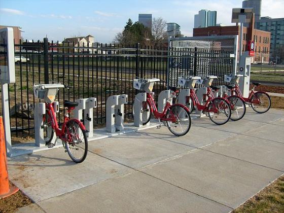
The proposed system does not have station locations set yet but would include 30 stations between the neighborhoods around Downtown, NC State, and the NC Museum of Art. The recommended plan was done in 2014, before the Dix Park deal so reevaluating a few stations may take place.

For me, I’m torn with my support with bike share.

On one hand, I want Raleigh to roll out this 30 station system, no less. With 80% of the launch cost covered by a federal grant and a good portion of the operating cost covered by private companies, I feel it is worth investing in and seeing if it sticks.

There’s so much talk of transit going on right now and I disagree with Councilor Crowder’s statement. The city IS in the bike business only it’s called something different.

The city is in the mobility business. The city does have an interest in allowing people to move around our city in the healthiest, safest, easiest way possible. A bike share system today could expand in the future creating more trips that support sustainable neighborhoods and communities.

Then, the other side of me kicks in.

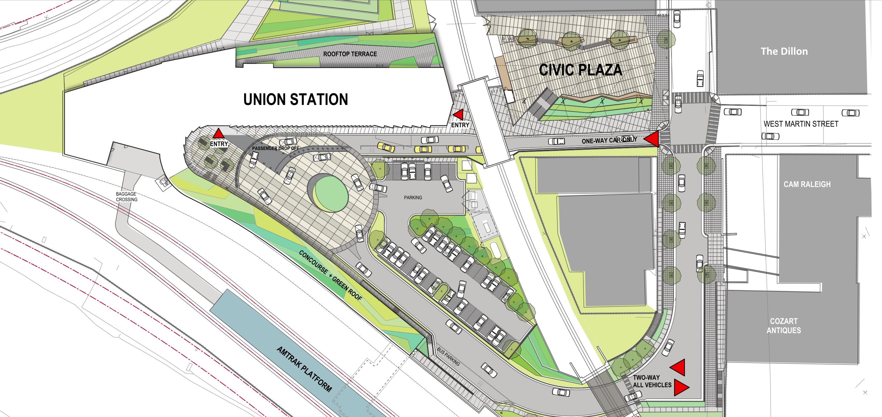
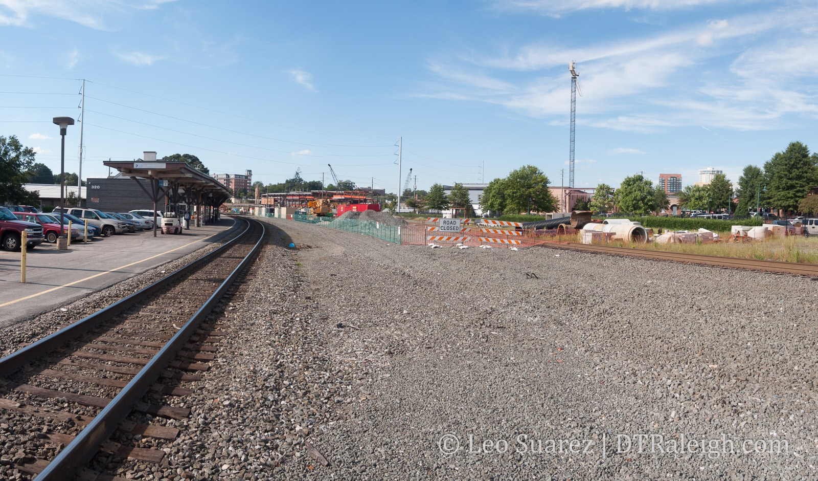
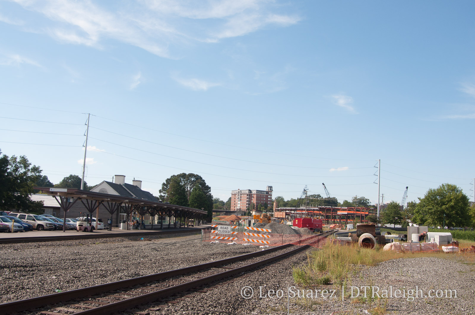
We do have quite a bit of projects going on. I want to see the city get Dix Park right. I want to see them get this Transit Referendum passed this year. I want to see Union Station become a great success. I want to see the expansion of the bicycle network. Aren’t these projects predecessors for a bike share system?

A part of me wants to see transit, the network, and downtown become a little more mature before we try this bike share.

In the end though, perhaps juggling even more projects at the same time is how a bigger city operates. The city did in fact pay a consultant that told us a bike share system in Raleigh is feasible. Plus, it is a recommended action item in the 2030 Comprehensive Plan.

I’d like to see us take that risk. If it doesn’t work, lesson learned and move on.

GoRaleigh Station Renovation Groundbreaking on Feb. 19

From my inbox to yours.

Mayor Nancy McFarlane is the featured speaker for the GoRaleigh Station renovation groundbreaking ceremony at 10 a.m. Friday, Feb. 19, at Moore Square Transit Mall, 214 S. Blount St. She will be joined by City Council member Corey Branch who is also the Raleigh Transit Authority’s Council liaison, and by Raleigh Transit Authority Chairman Jason Horne.

Formerly named Moore Square Station, the GoRaleigh Station renovation is scheduled to take nine to 12 months to complete. Renovations will improve the transit experience for riders in several ways, including expanded passenger waiting areas; new restroom facilities; a new information booth; Wi-Fi; real time passenger information; aesthetic improvements to the reconstructed courtyard and more. Visuals will be on-site to display the final project.

The new GoRaleigh station will be reflective of the new GoRaleigh brand. The goal is to enhance the future of transit in Raleigh and the Triangle by building a positive impression, not only with daily riders and commuters, but with the many visitors who frequent the city.

*Mayor McFarlane to Kick-off GoRaleigh Station Renovation Groundbreaking on Feb. 19

Feedback on the Wake County Transit Plan

I wanted to share the feedback I submitted about the Wake County Transit Plan, which all readers should take a look at. I think a whole discussion could come about the idea of an invisible east/west barrier that goes right down Raleigh. I am hoping that an upgrade to transit could break down that barrier and really expand mobility choices and access to all areas of the city. Does anyone else see these barriers to mobility around our city? -Leo

Feedback

Hello,

I’ve taken a good look through the latest Wake County Transit Plan update and wanted to share some thoughts I had about it. I’ll admit that this may be more detailed than the document shows but maybe it is something that the planning team could consider.

I believe there is this invisible “divide” between east and west Raleigh, where Capital Boulevard, McDowell/Dawson in downtown, and South Saunders create a sort of barrier. Going from parts east to west, and vice versa, by any travel method meets a “resistance” when you hit this divide.

Driving a car across Raleigh, the options are slim due to Capital Boulevard’s lack of cross streets, downtown’s more urban nature, and south Raleigh’s lack of east/west streets. Cycling is in a similar situation. Currently, none of the GoRaleigh bus routes go between east and west Raleigh but rather terminate in downtown’s Moore Square Transit Station for a transfer.

I see this Transit Station as contributing to that same invisible barrier.

My feedback as part of this new transit plan would be for the planning team to discuss this and see if transit could break through this barrier and connect east and west Raleigh more directly. For example, a bus route that does not stop in downtown Raleigh but uses both Hillsborough Street and New Bern Avenue/Edenton Street.

Thanks a lot ahead of time and I very much look forward for the successful implementation of this plan!

Response

Mr. Suarez

Thanks for taking the time to review the Recommended Wake County Transit Plan and for submitting your comment.

Your comment fits very well within the key goal of the Transit Plan to make transit “useful” to as many people as possible. Divides and barriers, real or perceived impact how and if people use transit and the focus of the transit plan is to address and solve these types of issues.

The project team has specifically looked at BRT and bus line corridors that flow through rather than to downtown. The New Bern Avenue to Morgan St /Hillsborough Street alignment has been specifically studied. That said, there are different perspectives on how BRT should flow through Downtown Raleigh and connect with the various destinations. The perspectives differ in how radically they would change existing streets, how vehicles would interact with bus stations and how the different BRT corridors would interact with each other. Moving forward we hope to have a clear community dialogue on the options, benefits and costs of the various ways to implement the different projects shown in the recommended transit plan. We anticipate this dialogue will be open to public ideas and reactions on solutions.

Some of the service realities we are asking decison-makers to consider are: (these parallel your comment)

1) As vehicle frequency increases there is less need to stop and wait at big stations and street based platforms (that allow vehicles to keep moving) make more sense.
2) Routes work best by collecting and combining multiple trips – routes that stop in downtown rather then flowing through downtown limit their usefulness for certain trips.
3) Frequent routes tend to be used for shorter trips and riders on shorter trips tend to have a low tolerance for delay (i.e. they will switch to other modes).

Please keep in mind that the transit plan is positioned to provide vision but also to allow a start and evolution approach if that is needed or best for the community. One question we asked staff from all of our partner agencies to answer on each of the projects was “are there multiple ways to accomplish that and still meet the goal?” The recommended transit plan takes this approach not to get “watered down” versions of everything but to keep an eye toward the larger goal and allow the system to change as needed as community perspectives change. National and local positions on transit, what street should be used for, and what creates a great place to live are changing and evolving in ways we have not seen in previous decades and these positions may/will likely continue to evolve.

If you have further questions on the Recommended Wake County Transit Plan please respond to this email, call 919-856-5477 or visit www.waketransit.com

Union Station December 2015 Update

Future Raleigh Union Station

Not a breaking update but rather, here’s what we know so far. I walked by the site recently and still nothing new since the groundbreaking took place in May. (that’s seven months ago)

It seems we’ve been going through a financial obstacle course with this project. All interested should jump to the project page on the city’s website where you will find this piece of information:

At the March 3, 2015 Council meeting, the Construction Manager at Risk (CMAR) team was authorized to proceed with bidding and finalization of a guaranteed maximum price (GMP) not to exceed $44,737,870.

In July and September of 2015, bids were received on the project which exceeded the estimate. The bid yielded a GMP of $60,000,000, which yielded a project gap of $15,300,000 when compared to the March estimate. Value engineering and steel rebid resulted in project savings, lowering the GMP to $54,700,000, leaving a $10,000,000 gap. Project partners have addressed the funding gap by identifying scope reductions totaling approximately $2,900,000. Remaining additional funding of $7,200,000 is required.

Various options were presented to Council at the Work Session on Oct. 20 and at the Nov. 3 City Council meeting, full funding, no scope reduction for Raleigh Union Station was approved with gap funding of $7,200,000, and a revised total project budget of $54,700,000.

*Union Station: Raleigh’s Multi-Modal Transit Center

The way I read it is that they wanted to do the project for about $10 million less than anyone was willing to do it for but in November, they figured it out.

Let’s have a good holiday season and then build a train station!

Raleigh Bike Plan Update Shows Us The Network

New bike lane on Hillsborough Street

Fresh paint on Hillsborough Street.

In mid 2014, I did a post about the evolution of Raleigh’s bicycle network. It’s been years, it feels slow-moving, but the pieces may be starting to connect and create this thing called a “Network”. I got really into looking at the maps in the latest draft chapter of the Raleigh Bike Plan Update. The complete document should be done before the end of the year and some of the material is available now.

Dive in to the Raleigh Bike Plan Update.

Looking at Chapter 3 shows the recommended network. It includes 126 new miles of greenway, 149 miles of new protected bikeways, and 277 miles of new bike lanes. The full breakdown is in the below table.

Table 3-1

It’s great to see so little sharrows being planned as, in my opinion, they don’t do very much. The recommendation is for more than three times more miles of bike facilities versus what we currently have. That’s a big ramp up in expanding the “Network.”

Protected bikeways are a huge step in the right direction to get riders on to the network. A protected bikeway is described as such:

This plan update defines a protected bikeway as a bicycle facility that is physically separated from motor vehicle traffic within a street corridor. For this Plan, this includes cycle tracks and buffered bike lanes, in addition to the City’s shared-use path and greenway network. The on-road physical separation can be achieved through parked cars, curbs, medians, bollards/traffic posts, planters, or marked buffered space between the bike lane and adjacent travel lane.

The one catch that I don’t like about greenways is that they have, historically, been seen as recreational paths versus effective transit routes. In only a certain amount of cases does a greenway help someone get from point A to B faster than a street.

Speaking of Point A to B, the chapter shows us the recommended network on a map of Raleigh. I decided to take a look at five possible routes starting from downtown Raleigh and seeing how the bicycle network of the future would accommodate versus today.

I have a deep hope that the Raleigh of the near future can make all of inside-the-beltline a bikeable haven for residents to easily zip around on. The network should get folks from their homes to any major destination easily.

I’ve included a doctored-up screenshot of those maps with each route.

Downtown Raleigh to North Hills
From one urban center to another, getting to North Hills and back by bicycle would be a fantastic way to move around. Today, the greenways are just too far away and don’t provide a direct enough route. With Capital Boulevard being a huge east/west barrier, getting to St. Mary’s Street is the best option. Heading North, the ride should cross over to Lassiter Mill Road where it will take you to North Hills.

Recommended route to North Hills from downtown Raleigh

Click for larger

Currently, both of these roads have bike lanes and sharrows for almost the entire route with some sections unmarked. According to the draft plan, a new protected bikeway would go in starting north of Peace Street but wouldn’t be that long. (up to Wade) Along with some new sharrows on Lassiter Mill Road, there’s not much improvement on this route.

Downtown Raleigh to Five Points

The closest two destinations in this list, getting to Five Points is pretty much a ride up Glenwood Avenue. Today, there are no bicycle facilities between Five Points and Glenwood South. The two-lane road isn’t so difficult but that does mean you need to be comfortable riding in traffic.

Sadly, the recommended network has nothing planned for Glenwood Avenue here. Instead, a new route will go in along West Street. A protected bikeway/greenway trail, which we’ve covered before, is recommended form the Warehouse District all the way to Wade Avenue. The route will split with a greenway going northeast along Capital and sharrows along Fairview Road. That will lead you straight into Five Points.

Recommended route to Five Points from downtown Raleigh

Click for larger

This will be a great north/south connection and I’m interested to see if it’s possible to add a connection, somehow, to this greenway along Capital Boulevard from the eastern neighborhoods, like Mordecai and Oakwood.

Downtown Raleigh to Crabtree Valley Mall

Ride to the mall? It’s probably better to just take the bus. Route 6 is a direct shot from downtown Raleigh to Crabtree Valley Mall. You can’t get more convenient then that. Still, riding your bike adds a little freedom. I’ve done this once with the intent to get some exercise and do some shopping. It’s not for every day though but maybe it is for some.

Today, Glenwood Avenue towards Crabtree is pretty hectic and there are some bike lanes but only for a small portion of the route. The recommended network adds protected bike lanes north of Glenwood/Oberlin. Taking the route to Five Points would be how you start. You then would most likely continue north on Fairview, get to Oberlin where bike lanes exist today, and take Glenwood north on the new protected bike lanes.

Recommended route to Five Points from downtown Raleigh

Click for larger

This is a big improvement. The challenge though is pulling into Crabtree Mall once you are there. It would be fantastic to see the spaghetti bowl in that area cleaned up but an easy fix might be a bicycle “off ramp” onto the greenway that goes underneath Glenwood Avenue and goes to the Crabtree Valley Avenue entrance.

Downtown Raleigh to the Fairgrounds

Hillsborough Street is so direct, so straight that using it for cycling transit would be really tempting when going west. Up until just this week, we now have bike lanes starting from the Capital building mostly going up until NC State University. Currently, it then fades out for now but the two lanes west of Faircloth Street might makes things manageable for biking without any lanes.

Recommended route to Five Points from downtown Raleigh

Click for larger

The recommended network continues the bike lanes in front of the university and uses a combination of protected (mostly) and bike lanes to get to the fairgrounds. The plan is actually to extend them all the way out to I-40.

This is a huge improvement for connecting to West Raleigh.

Downtown Raleigh to the Farmer’s Market

Today, getting to the Farmer’s Market by bicycle isn’t the mot difficult as you have a few options. The longer but safest route is by greenway but a few residential streets could get you out there faster without the need for bicycle facilities. Still, a straight shot would be most ideal and that most likely means that Lake Wheeler Road needs a makeover.

Recommended route to Five Points from downtown Raleigh

Click for larger

It is great to see a protected bike lane on the recommended draft map between the Farmer’s Market and downtown Raleigh along Lake Wheeler. A protected lane is probably best as Lake Wheeler has some nice hills and is pretty direct.

Great improvement here.

Wrap Up

For me, connecting major destinations together in a more direct route is what I’m looking for in bicycle improvements. Since this is a downtown Raleigh blog, that’s the approach I took in these five routes.

As always, the draft bicycle plan is still a work in progress and you can submit feedback on what you see up there.