I spent some time this week with a survey from the city about possible plans to reconfigure North West Street between Peace Street and Wade Avenue that could accommodate bike lanes, walking paths, and a different parking layout. If that excites you, jump right on over to that survey here to let them know what you think. If I still got you, I wanted to revisit the plans for more bicycle infrastructure along West Street, how it’s going, and what we might expect in the future.
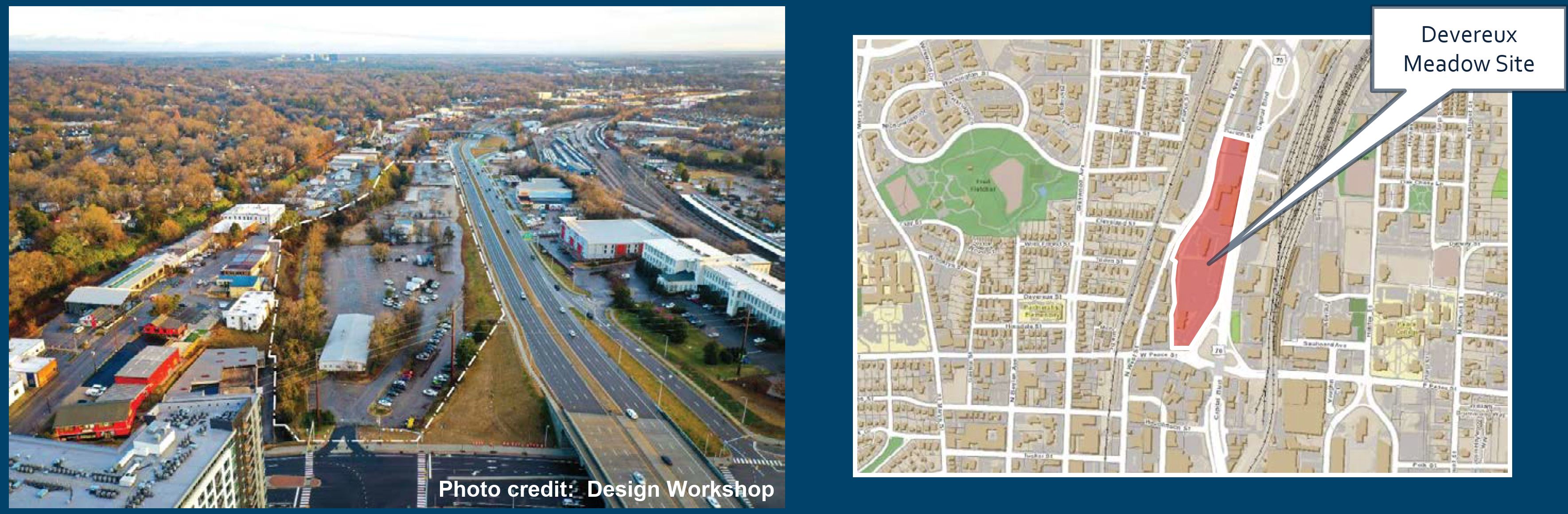
The city held a virtual open house in May, 2021 about a future urban park at the Devereux Meadow site. The site sits just north of Peace Street directly west of Capital Boulevard. It’s currently being used to store city vehicles but that will all be moved soon. Jump into the video above for the full 2-hour details, or 1 hour and 20 min if you watch it at 1.5x speed, the preferred watching speed here at DTRaleigh HQ.
You can also check out the project page on the city’s website for the slides and contact information: Devereux Meadow Project
Devereux Meadow has popped in and out of the blog over the years as the site has been mentioned for future plans going back all the way to a 2011 Capital Boulevard Corridor study. That street is well documented on this site and I even have a post up about the baseball field that was built in 1938 right next to Capital. Finally, the Devereux Meadow site has been planned to become a park as part of the 2015 Downtown Plan which I covered here.
The session and presentation is quite nice and in addition contains some history. Even more history can be watched in an additional video.
Getting back to the present, the plans for the urban park are starting to materialize as the city is in the process of finalizing the schematic design. The construction of the park itself is still unfunded but could be on a future, this year even, parks bond.
The team is presenting three concepts for your review and I’d like to share each one below. The main points of each plan address the Pigeon House Branch creek in different ways and I think everything else kind of reacts around it.
Line Drive
The Line Drive concept is the first one in the list and does the least, relatively, to the creek compared to the other two plans. The creek “is stabilized in place, with stream shelf and instream structures to promote floodplain connectivity and bedform diversity.” A portion of the creek that is currently covered in concrete would remain.
This plans comes in as the cheapest and the report sums up how it stacks up against the rest with:
“Stabilization in place of the current stream. Aqueduct, site access road and Dortch Street culverts remain, leaving no room for stream alignment or grade manipulation. Incorporation of a stream shelf promotes floodplain connectivity, and instream structures develop bedform diversity. Lowest cost, lowest ecological uplift.”
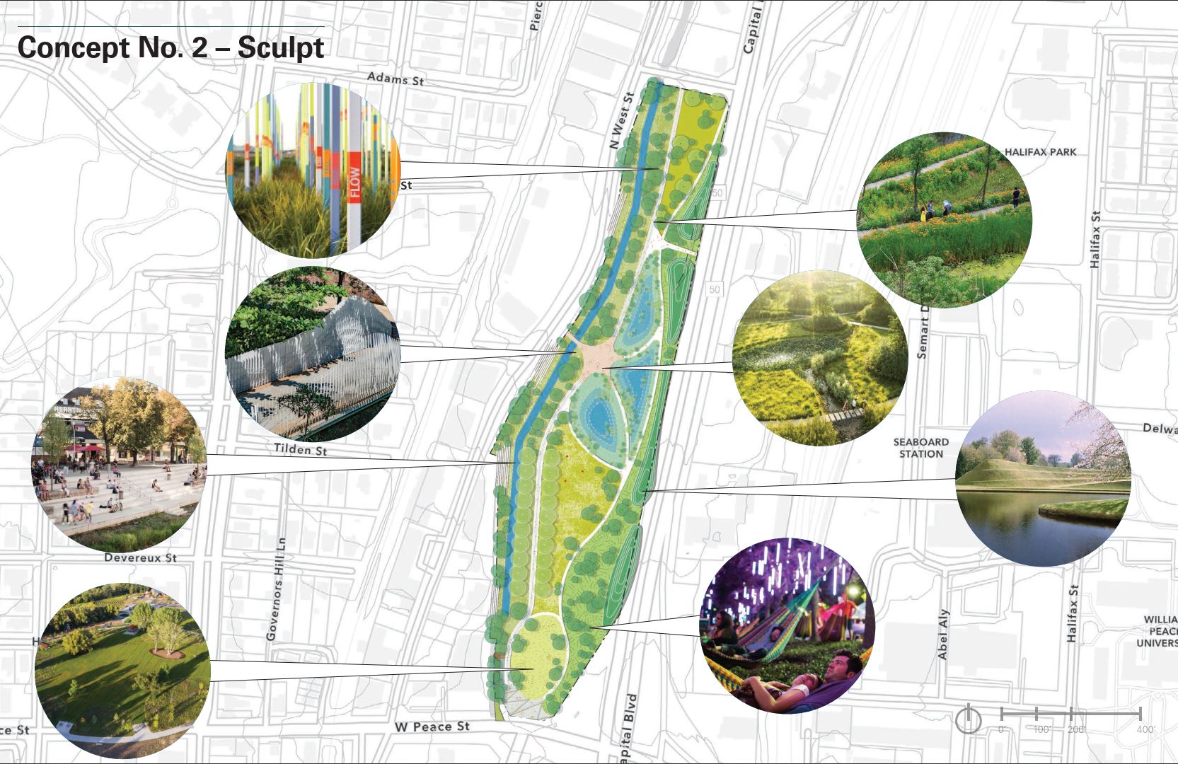
Sculpt
The Sculpt concept is the “middle” option, for lack of a better word, as this one has some work being done to the stream and the cost is in-between the other two. This plan opens up the creek a bit as that concrete cap on the southern end is removed. The creek “is restored in place, with increased stream bench and instream structures for greater habitat and flood capacity and bedform diversity.”
The high-level states:
“Removal of the concrete cap over the aqueduct and limited manipulation of the stream alignment and profile. Increased extent of stream bench for greater habitat and flood capacity. Instream structures develop bedform diversity. Moderate cost, moderate ecological uplift.”
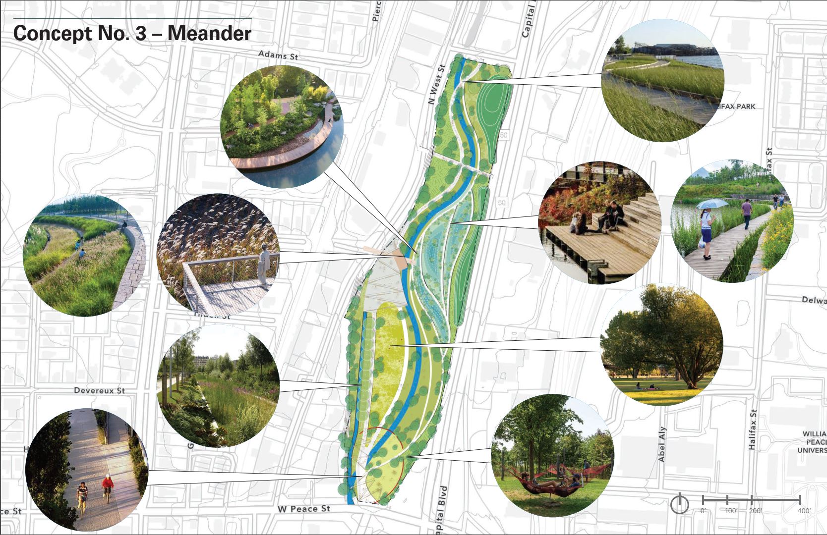
Meander
Meander would offer the most significant transformation. As you can see, the stream is practically reconfigured on the site and would offer flowing walking paths alongside. In this plan, “Pigeon House Branch is realigned, with stream and floodplain designed to maximize floodplain connection, habitat health and visitor interaction.”
There’s also the most opportunities for programming and public uses of the space. As the report states:
“Total relocation of the stream alignment and profile. Stream and floodplain design are based on bankfull hydrology and maximize floodplain connection and function. Greatest potential for visitor interaction, diverse habitat communities, and incorporation of stormwater treatment. Highest cost, highest ecological uplift.”
Which one do you like? Make sure and take the survey and give the city your thoughts.
For me, I go back and forth between Sculpt and Meander but I think Sculpt gets my vote. There’s a line of oak trees, referred to as the Oak Allée, on the western side where new oaks would be planted as part of Sculpt. The other two plans don’t have that. In addition to opening up the stream on both plans, this just seems like a nice element to have in the future, once the new oaks mature.
Finally, I have to share some old photos I took when I lurked around the area in 2012. You can see the concrete cap over the creek and some of the oak trees. These are around the southwestern side of the site.
What positives or negatives do you see? Come over to the Community and discuss it with us.
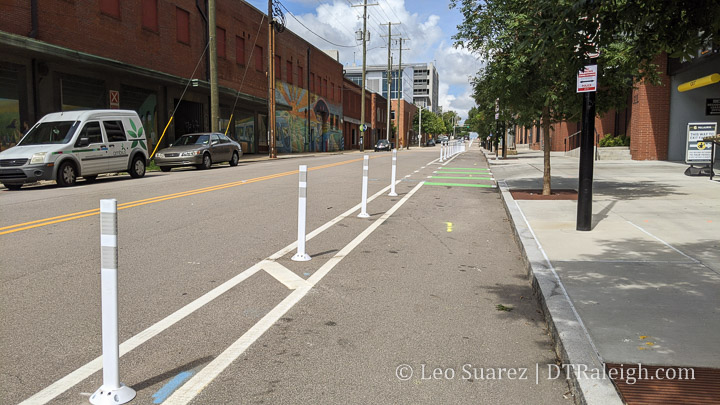
Starting this week, the city is having protected bike lanes installed on West and Harrington Streets as part of the Downtown North-South Greenway Connector. This will be downtown’s first protected bike lane which connects the warehouse district to Smoky Hollow. You can already see parts of it along West, shown above.
Along West Street, bicycle traffic can start from Union Station and head toward Smoky Hollow in the protected lane until North Street. If heading the other way around, you can get back to the warehouse district riding down Harrington Street.
The placement of the lanes is also nice as there are several Citrix Cycle stations along them including Union Station, across from Morgan Street Food Hall, Hillsborough Street, and at Jones Street.
This is excellent to see as it is a foundational route that one day could connect to a greenway heading north along a Devereux Meadows park in north downtown and to a greenway to Dix Park which is to the south. The lanes should be 100% by October.
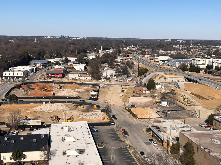
View looking north from the upper floors of the West at North Tower. Photo credit Robert Winchester.
There has been a lot to follow around the Smokey Hollow area of Glenwood South. The reader-submitted photo above shows another view of all the demolition that has taken place. The “Glenwood Green” area has basically been wiped clean and will be rebuilt over the coming years.
The term Glenwood Green comes from the 2015 downtown Raleigh plan and I thought this a good time to see if the planned developments are in line with what was envisioned for the area.
Here’s what we know so far:
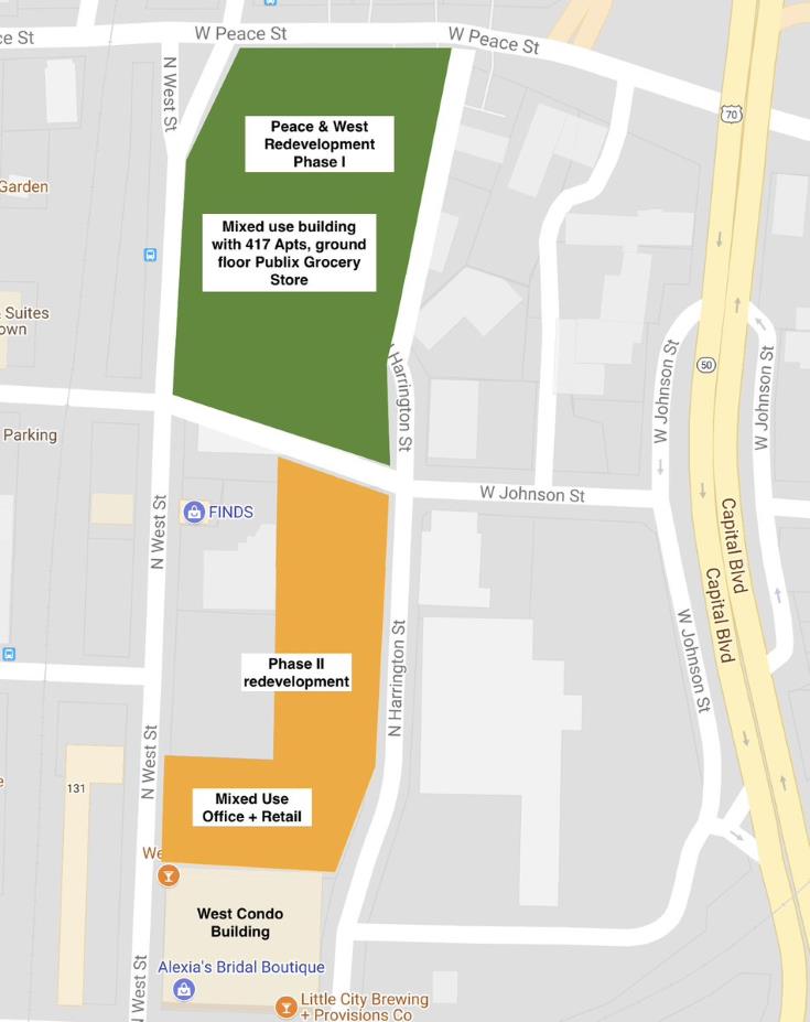
Peace (formerly Smokey Hollow) – 400 unit residential tower with ground-floor retail at the corner of Peace and West Street. A Publix grocery store has been announced so far.
Directly to the south, the same developers have bought land for a phase 2 mixed-use project.
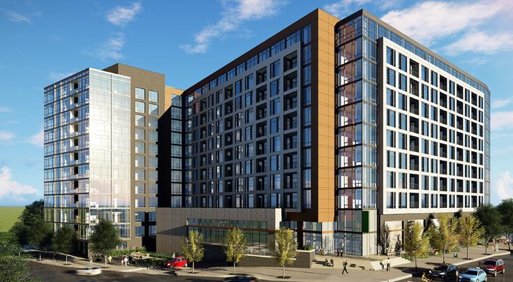
Latest rendering of the development for Peace and West
By the way, the name of the development may have changed from Smokey Hollow to Peace but this blog will always recognize this area and basically any new developments going forward as part of Smokey Hollow.
The Glenwood Green vision as part of the 2015 downtown plan so far is coming along. Granted, not much “green” has been planned in this area but once the Capital Boulevard bridge project (the square loop) is finished in 2019, the city can deliver that green with a planned Devereux Meadows Park north of Peace Street.
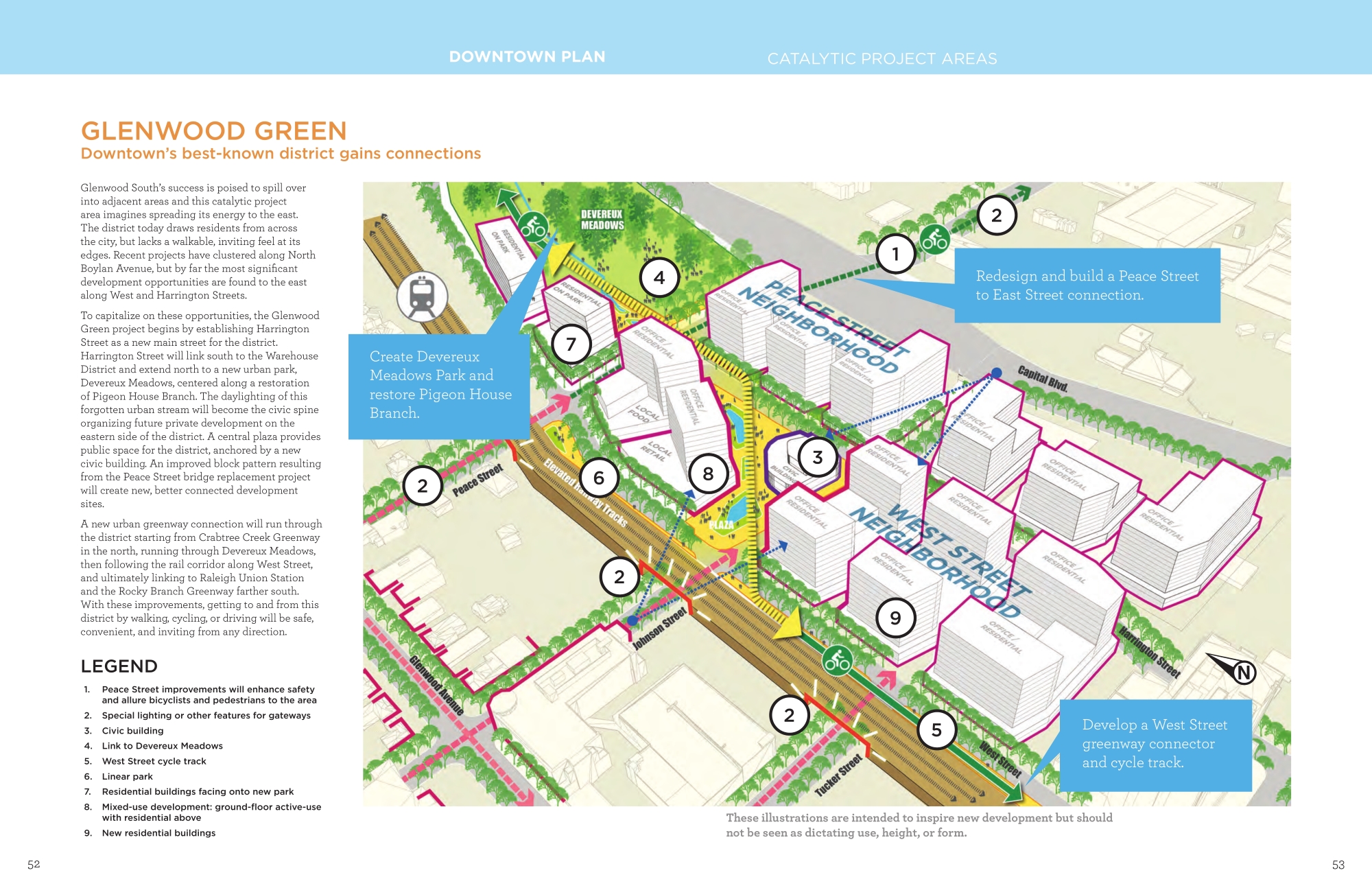
Here’s the two-page overview of the Glenwood Green vision.
Click for larger
The vision overview behind Glenwood Green wants Harrington Street to be a new “main street” for the area. This should be where the majority of retail is located and the planning folks have shown us this in their latest update of retails streets in the 2030 Comprehensive Plan.
Harrington Street has the opportunity to be the gateway from the Devereux Meadows Park through Smokey Hollow and into the Warehouse District.
Notice that Kane Realty has projects at both ends of this street. (All the Smokey Hollow work + The Dillon) Not a coincidence I’m thinking here.
Public Space and Greenway Connections
What still isn’t being talked about is the idea of a central plaza in Smokey Hollow to really give this area a sense of place. In addition, a greenway or urban cycle track connecting parts north and south would run through this area with this public space being the central hub.
The vision in the downtown plan proposes a civic building and plaza but something else could work to make it into a destination. A park could also serve as a meeting place and destination.
When you add up the plans for a greenway through Devereux Meadows, the city experimenting with a cycle-track along West Street, and connectivity from the Warehouse District to Dix Park, you can really see how important Smokey Hollow is to north/south connectivity through downtown Raleigh.
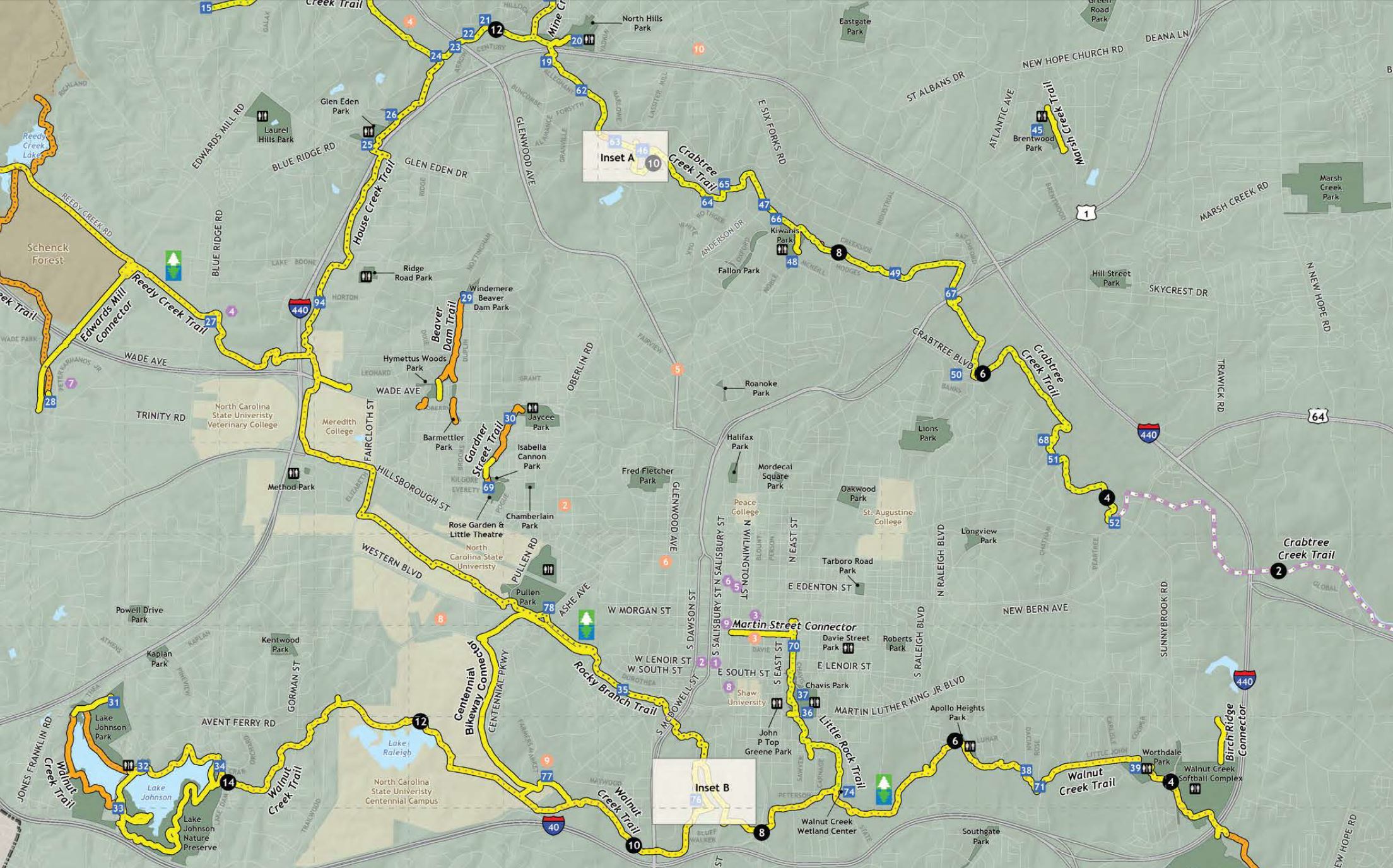
If you look at the latest map of the Raleigh Greenway system, there’s a core loop around downtown and the surrounding neighborhoods. We still don’t have that middle section that cuts through it. The Glenwood Green vision supports this major connection.
Raleigh Greenway system, January 2018. Click for larger
A proposed route from Smokey Hollow to the north towards the current greenway exists. A lot of it would run through Devereux Meadows alongside Capital Boulevard. This was talked about as part of the Capital Boulevard Corridor Study, an effort that took place around 2011. Here’s a map of the proposed greenway route connecting areas north of downtown.
Right now, there hasn’t been talk of incorporating that civic space or greenway into Smokey Hollow. Those interested in creating a vibrant area here should keep an eye out because as all this development starts, the opportunities for the connections decrease.
If all the land is dedicated to buildings then the idea of a public plaza becomes significantly harder to plan for. The greenway connection may also turn into a glorified sidewalk path rather than something unique.
As plans form, I look to the city to work with developers to get this built and see the vision behind Glenwood Green come to full form.
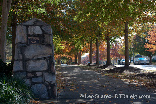
Chavis Way, entrance to the greenway off the 500 block of East Martin Street.
I just did some online searching for information regarding the Raleigh Greenway system. It’s pretty sad that there isn’t an informative, well designed page dedicated to educating people on the expansive network of trails that go all over Raleigh. If you know of one, PLEASE share it.
The city’s website has only a small blurb about it here and you can download pdf maps of the parks and trails too. (links below) The maps are not up to date and the enormous file is cumbersome to navigate without a gigantic, high-resolution monitor.
The best resource out there is a real map of the network which you should be able to pick up at any bike shop around town. The adventurous will learn by just jumping onto the greenways themselves and picking them up as you go.
How does Downtown Raleigh fit into this network of trails? Looking at a portion of the map below, we get…. (click for a larger view)
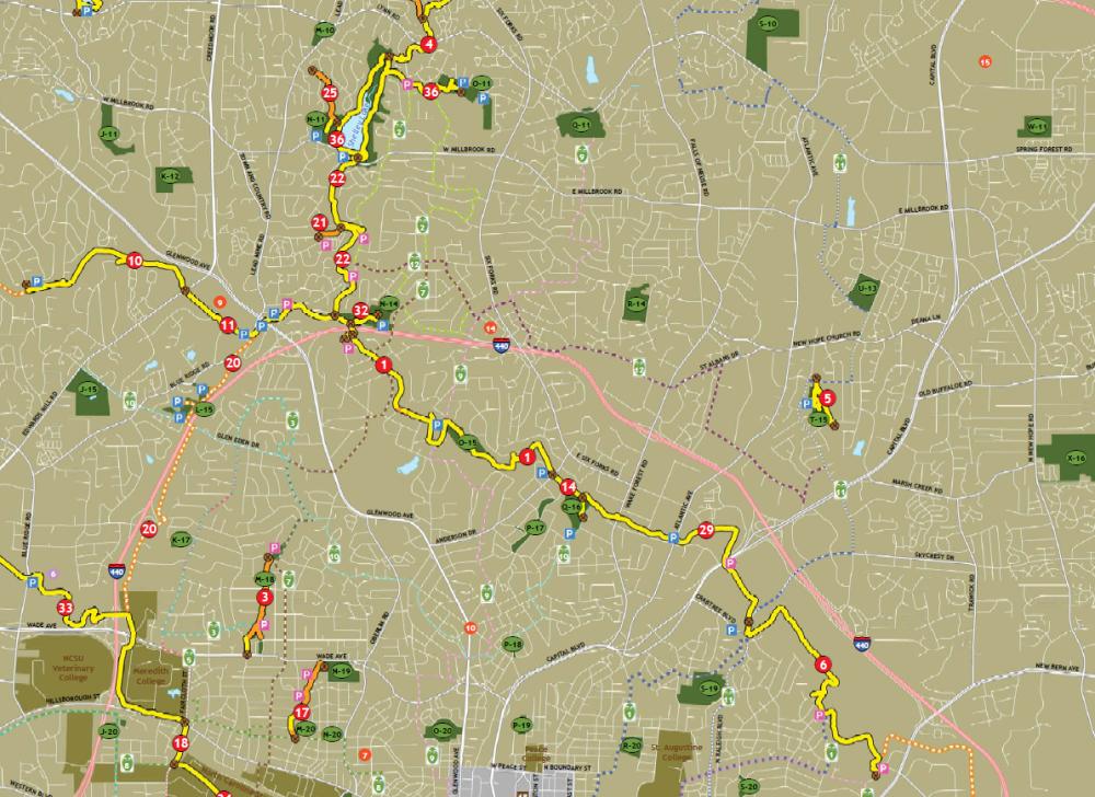
Great Connections
The southern portion of downtown, highlighted in purple in the center, has pretty good access to the greenway trails running along southern Raleigh. If you work your way into Boylan Heights, West of downtown, you can get to the trails that run along Western Blvd very easily, marked by #34 on the map. This is a perfect way to get to Centennial Campus and the rest of NC State University without battling car traffic.
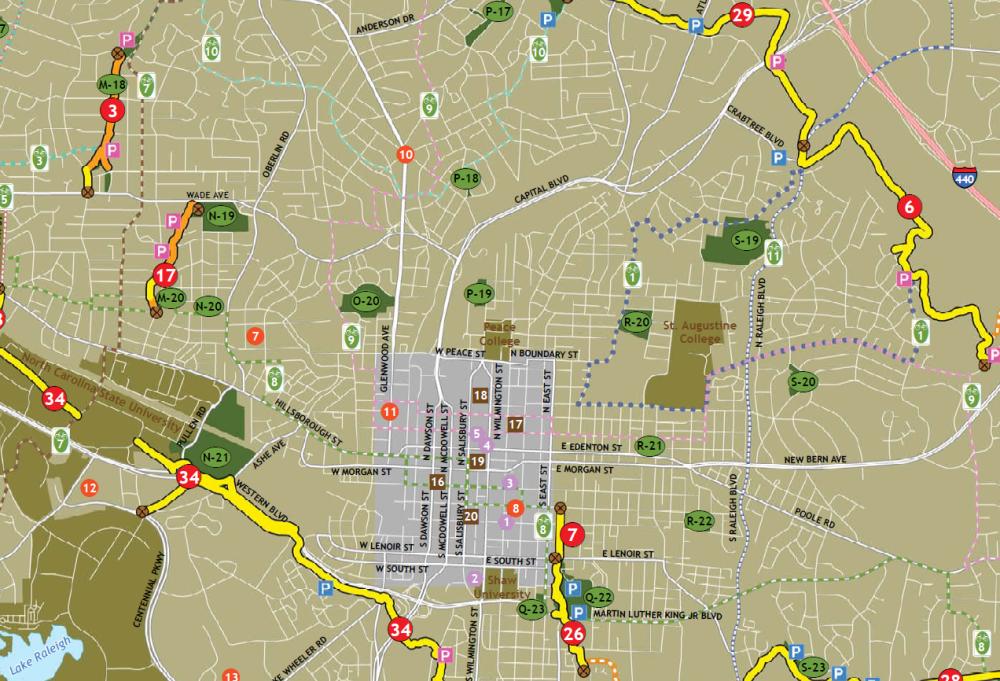
Trail #7 begins on Martin Street to the east of downtown. This trail will easily get you to many different parts of southeast Raleigh. It is possible to use this trail to get to the NC State Farmer’s Market while heading east weaves through secluded woods and wetlands.
But what about going north?
The long trail that runs along the northern arc just inside I-440 is a beautiful path to ride or walk on. I’ve ridden on it many times from one end all the way to Shelley Lake and back. I highly recommend getting out there and seeing it. Here’s the trail: (click for larger)
This is the trail to get to if you want to ride out to North Raleigh. I went shopping once at Crabtree Mall, getting there by bike on the greenways. Also, North Hills is a quick detour on Lassiter Mills Road but I’ve never tried it.
Conversely to the southern trails of Raleigh, the northern trails are harder to get to and is a little intimidating to the average rider. That may change in the future as a few ideas are being thrown around to run a greenway right through the middle of downtown.
Downtown trails for more connectivity
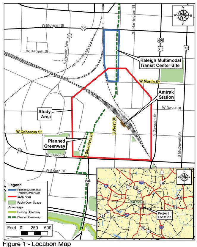
Right now, there are two developments that Raleigh Connoisseurs like yourselves should be aware of; the South West Street extension study and the Capital Blvd corridor study. We will get into the specifics of those topics, especially the West Street extension because I haven’t mentioned it here on RalCon as of today, at a later date but for right now let’s look at where the word ‘Greenway’ comes into play here.
In short, this document has some great details on how planners are thinking about having West Street, which currently dead ends at the railroad tracks after crossing Martin Street, connect to W. Cabarrus Street to support the future Union Station. A planned greenway is drawn up, running along West Street and ending at the current trail near Lake Wheeler and South Saunders Street. Picture below.
This portion will most likely be much more urban then the other trails around the city and the documents suggests that the greenway will be implemented with wider, multi-use sidewalks.
The Capital Blvd corridor study has talks of a possible greenway as part of the new additions to that area. Jim Belt of the Raleigh DLA wrote up a great review of the recent workshop and mentions that a greenway route is on the table. This map shows what a connection from the existing trail on Raleigh Blvd to downtown Raleigh could look like. The trail ends near the intersection of West and Peace Street but hopefully can be shot straight down West Street and into Union Station.
Putting the pieces together
If you add a greenway trail along the Capital Blvd corridor and another along the West Street extension, we now have penetrated downtown Raleigh with a trail and the rest of the network is easily accessible in all directions. Running it right by Union Station is a huge plus for the future of alternative transit around Raleigh as well.
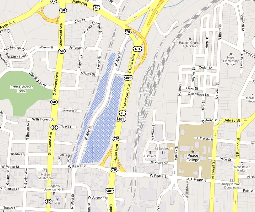
It’s no secret but most people don’t know about the baseball stadium that once stood near downtown. That’s right, at one point in time, minor league sluggers were blasting home runs onto what would eventually become Capital Blvd. The ballpark once sat in the area highlighted in the map below and this is where I’d like to focus the conversation today.
Click image for wider view.
Raleigh’s Team
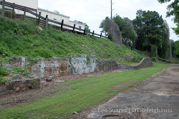
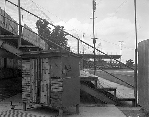
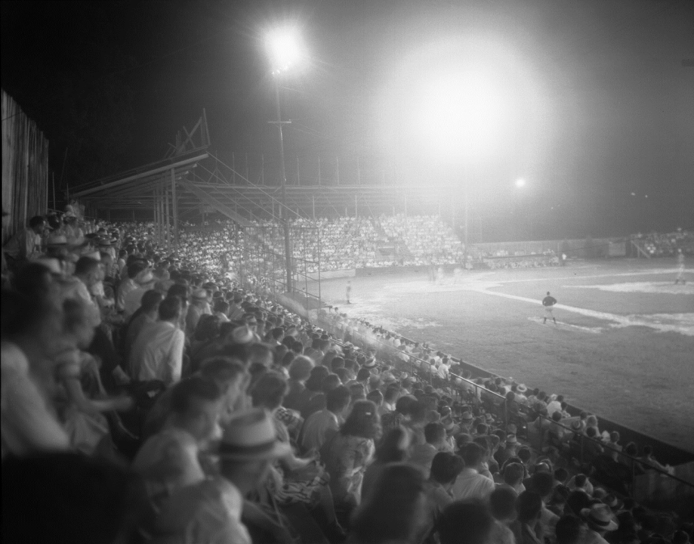
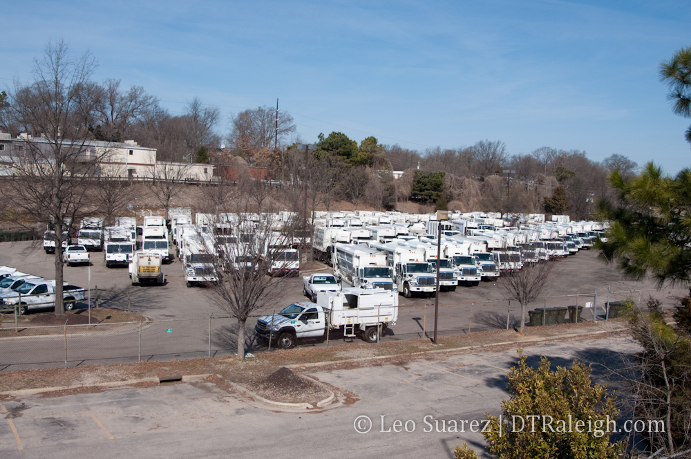
The Raleigh Capitals once played at Devereux Meadow Ballpark which was located along present day Peace Street between West Street and Capital Blvd. The stadium was built in 1938 and baseball had its up and downs here until the site was cleared in 1979. In the name of “progress”, the area was then used for city services, a parking lot for waste disposal vehicles really. I want to highlight two articles I found that mention the stadium meeting the wrecking ball, written around that time.
What is there now?
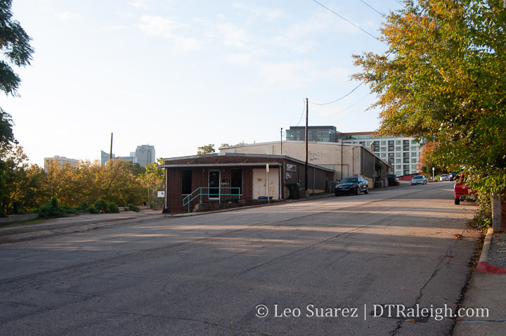
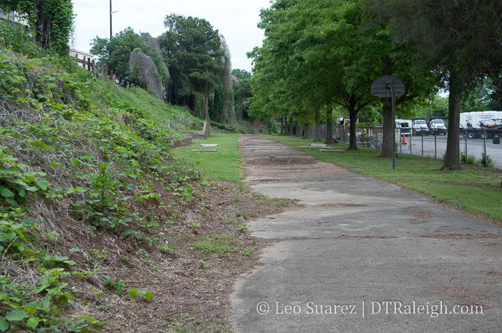
The area today contains few offices or very little of anything representing density or urbanity. The city has been using the lots for parking waste services trucks and other utility vehicles. A few businesses reside off West Street in “off the beaten path” office space with very little car and pedestrian traffic on West Street.
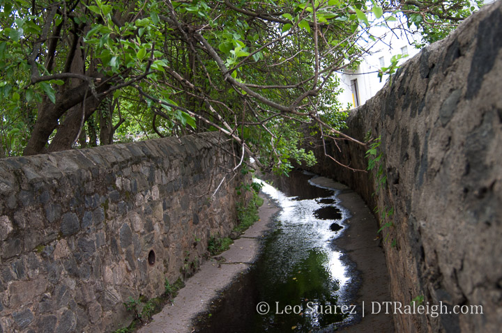
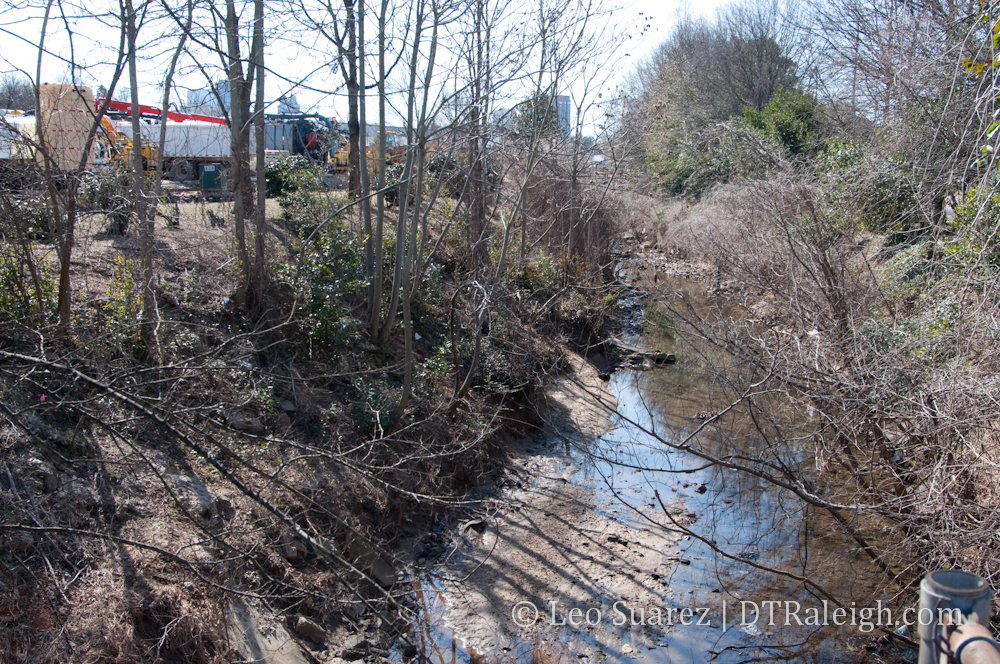
However, the more important resource in this area is the Pigeon House Branch Creek that snakes through the Devereux Meadow site and hides underneath certain streets in downtown. Here’s an excellent blog post tracking the creek through the site. Last I checked, the creek was on the state’s list of impaired waterways and the city is trying to remedy this. One example of a fix has been the water garden at nearby Fred Fletcher park. I bet most readers have driven or walked through this area and never knew that a creek was flowing underneath.
The Future
As far as I know, there are no plans for Devereux Meadow at this moment. Ideas of a river walk have come up but nothing has materialized from that. It’s all talk at this point but that allows the online peanut gallery here to dream up ideas for this large piece of property on the edge of downtown.