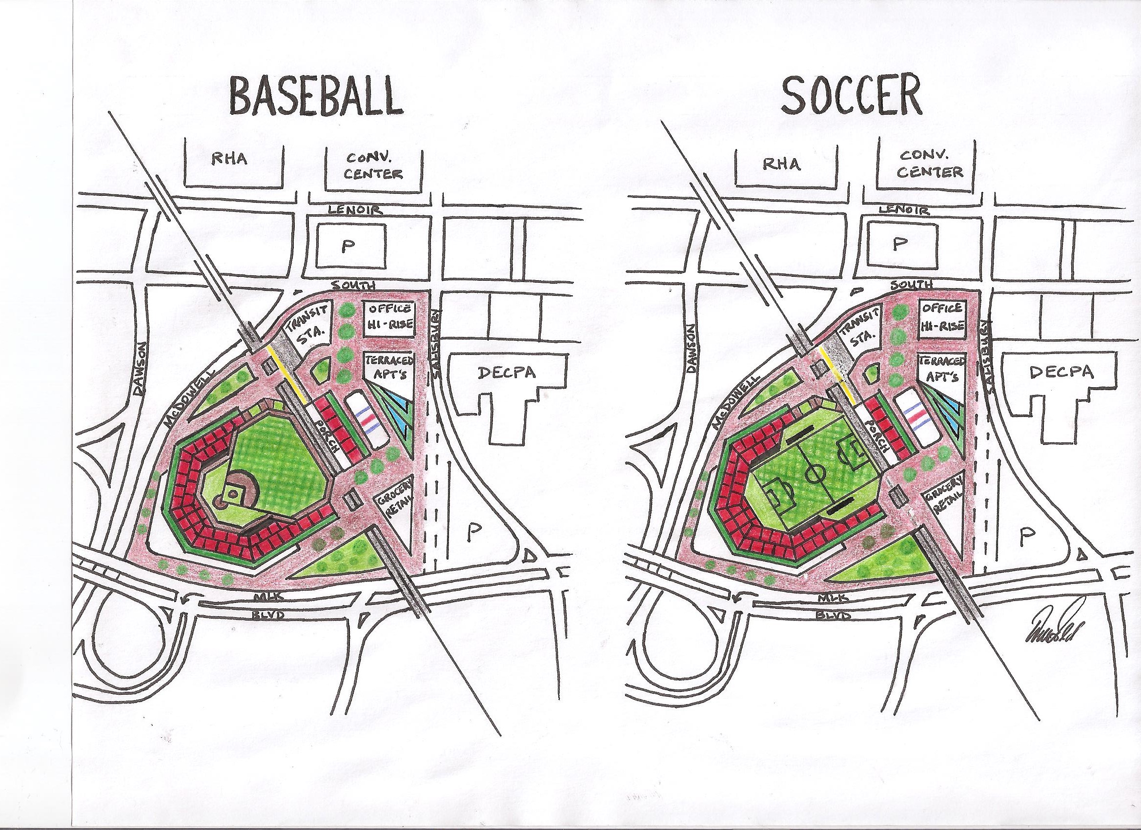
[UPDATE #5: Another submit by Will]
Click for larger
[UPDATE #4: Will has submitted another round of sketches.]
Click for larger
- Railroad tracks remain unmoved, serve as backdrop for center field and soccer goal. (“Railhawks” takes on a new meaning)!
- Single stadium provides for both baseball and MLS while fitting nicely into the footprint.
-Dual-purpose stadium provides building funds from two teams instead of one. - I’ve measured, and both fields are regulation size. The soccer field is exactly the same dimensions as WMSP.
- Multi-modal transit station–train and bus–serving stadium, Red Hat Amp, Convention Center, DECPA, and plaza.
- Baseball stadium is inspired by an amalgamation of other parks: “Boxy” shape (Citizens Bank Park, Philadelphia), sweeping outfield upper decks (Polo Grounds, NYC), home plate rotunda (Ebbets Field, Brooklyn), rooftop stands beyond tracks (Wrigley Field, Chicago).
- Above CF/goal wall will be the tracks. Above and behind the tracks will be restaurants/bars with porch seating. On top of those restaurants/bars is stadium seating a la Wrigley Field.
- Field itself could be artificial turf, as well as the dirt areas. Artificial infields are becoming popular in newer baseball parks (WFU, Duke, Holly Springs), and would make for easy transitioning between sports.
- Backstop netting would also protect spectators from kicked soccer balls.
-Outfield plaza features office and apartment high-rises, restaurants/bars, grocery, retail, and yes, the displaced rink!!
Click for larger
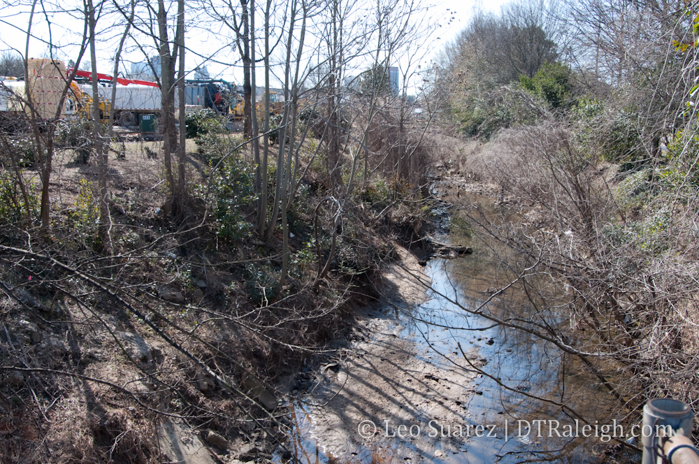
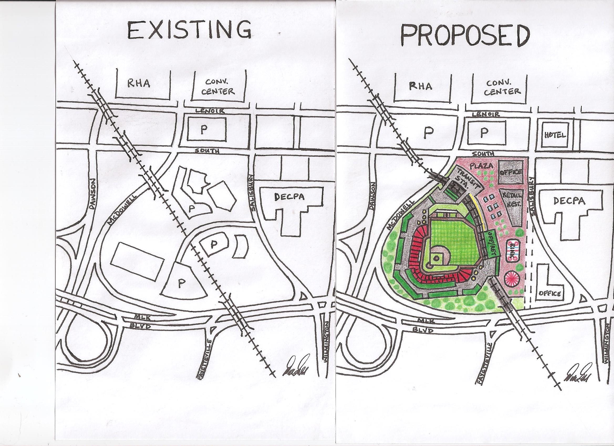
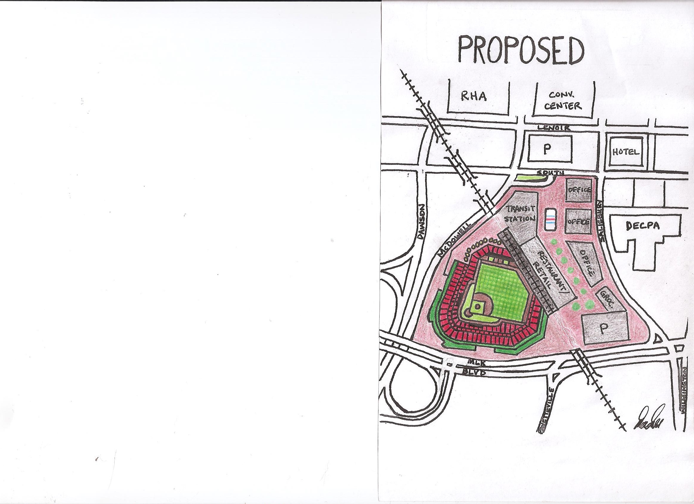
A big thanks to reader Will who submitted this sketch of how to convert the southern gateway site, called Gateway Center in the downtown plan, into a possible baseball stadium. Will adds the following bullets:
- New transit station @ South and McDowell to serve the ballpark, the convention center, RHA, DECPA, new hotels.
- Parking at Union Station or Dillon with some kind of “tram” shuttle service from Union Station to new transit station.
- Utilization of other existing nearby decks a la DBAP in Durham.
- Railroad tracks would be wrapped around ballpark but integrated into the structure itself…imagine the tracks abutting the right field wall just above the fence…”hit train, win steak!”
- Ballpark (capacity 6,000 – 7,000?) is drawn to same scale as other minor league parks, so it would fit here. It would, however, be “cozy” to fit in existing footprint and maximize fan proximity to field and players.
- Grandstands wrap the infield, large patio area down 3rd base line, upper deck luxury boxes would wrap 1st base line for best skyline views.
- Grass berm behind left field bullpens enhance fan access (HR balls, close to warming relief pitchers).
- Outfield plaza would be zoned for restaurant/bar, retail, office (for those offices that would be displaced), and would include other family attractions: ground-based fountains, carousel, and the wintertime skating rink that will be displaced by Charter Square North.
- City’s desired extension of Salisbury St. could still be achieved.
What do you think?
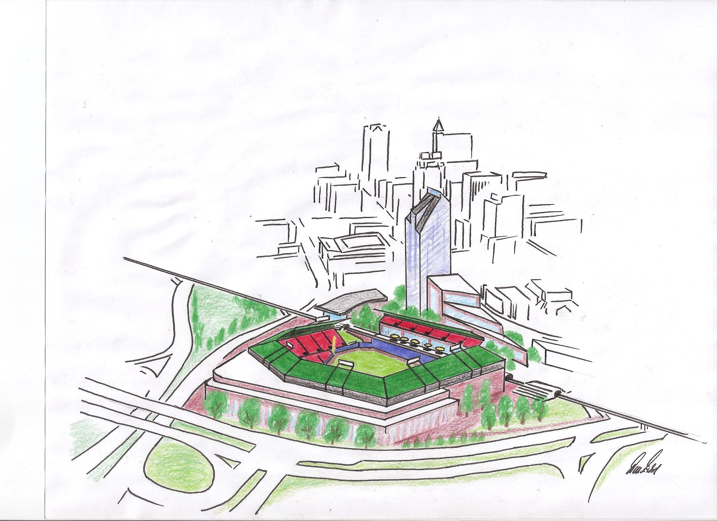
[UPDATE #1: Will has submitted another sketch with the view from South Saunders]
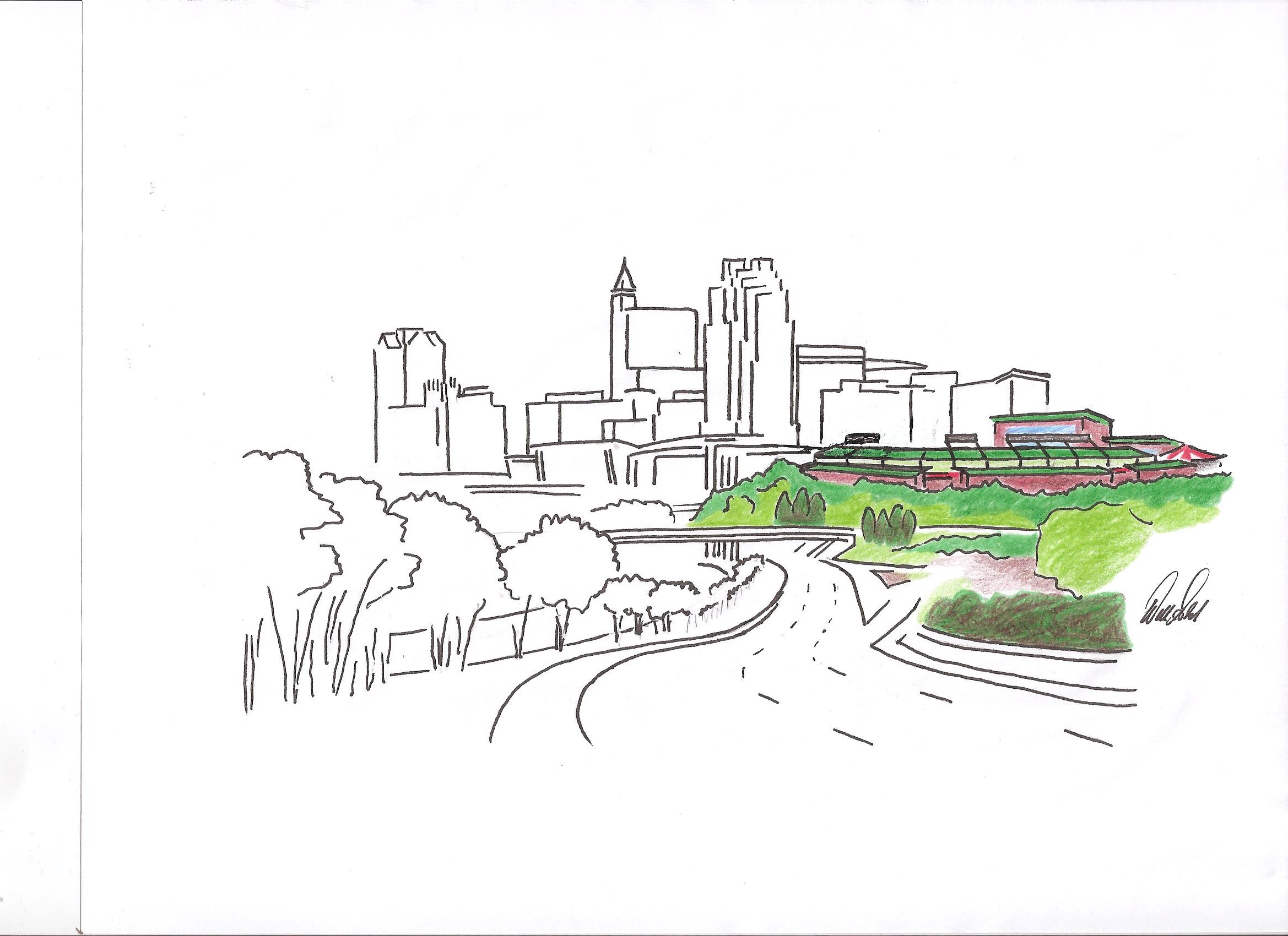
Click for larger
[UDPDATE #2: Will has submitted a revised sketch based on your comments]
Click for larger
-Stadium was moved toward the SW, allowing for the tracks to remain unmoved.
-Stadium was expanded to show what a MLB park might look like in this space.
-I removed the MLK-McDowell on-ramp to make room. Traffic would be re-routed in the following way: westbound MLK traffic wishing to go north on McDowell would instead turn left at the existing light onto the existing ramp, wrapping under the MLK overpass. You see the same configuration in Cary where westbound Walnut St. traffic turns left onto a ramp to enter US-1 north.
-The “home plate” corner would be snug against the MLK/McDowell intersection, a la the new Busch Stadium configuration in St. Louis (picture below).
-Plaza enlarged, more retail, restaurants, new parking deck, and a grocery store.
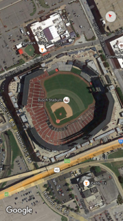
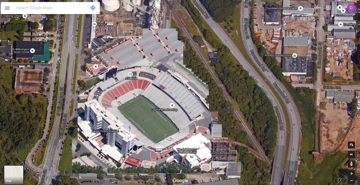
[UPDATE #3: Reader Stew has submitted an overlay of Carter-Finley stadium over the Cargill site, called “Cargill-Finley Stadium. This is similar to an overlay I did awhile back with the PNC Arena over the state jail site. Thanks Stew!]
Click for larger