It’s been a year since I announced the launch of the DTRaleigh Community and soon after shut down traditional comments on this blog. After 365 days, I couldn’t be happier with the results.
In the past year, downtown enthusiasts have been chatting more and even meeting face-to-face. There’s even more eyes on downtown development as residents report in and others ask questions. Answers are found through crowd-sourcing and the conversation is in-depth and respectful.
There are almost 300 registered users and easily hundreds more who read the public-facing topics. Registrations slowly tick up every few days.
As the sole moderator, I’ve found it easy and after users have gotten used to the software, it’s mostly self-policing with rants and flamewars kept to an almost negligible amount.
If you haven’t signed up, I encourage you to do that and jump in with whatever downtown Raleigh topic that’s on your mind. There’s room to grow and who knows where it will go from here.
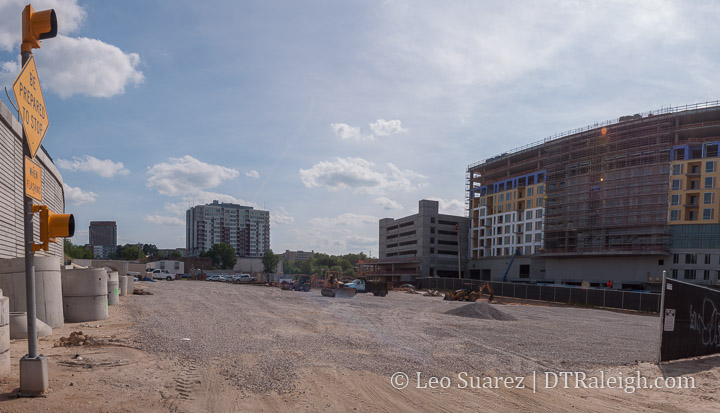
Current site of Smokey Hollow Phase 3 along Peace and Harrington. April 2019.
The Smokey Hollow project along Peace Street is moving right along in waves with plans for phase 3 already coming to council soon. The developers, Kane Realty, are requesting a rezoning for the site called phase 3 and the request is to increase the height limit from 12-stories or 150 feet to 40-stories or 500 feet.
The request, found consistent with our city’s comprehensive plan and land-use map, has already been approved by the planning commission and will be coming to city council for approval in May or June of this year.
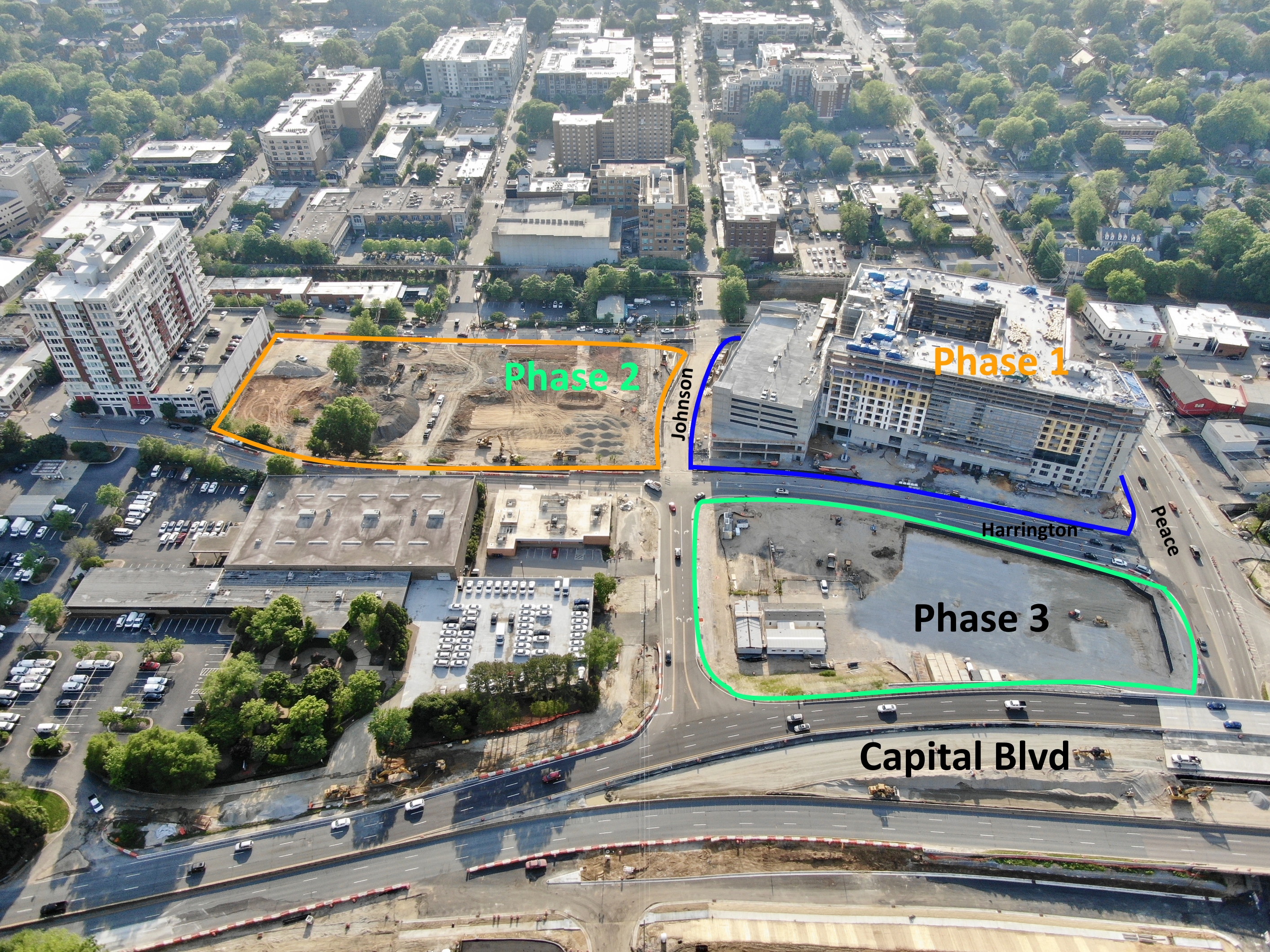
An extremely talented photographer and regular contributor over on the Community provided this aerial of the sites. I’ve reposted with edits and permission to show the scale of everything that’s going on in the area.
Kane Realty’s rezoning jumps from the 12 to 40 story height limit. There’s a 20 story limit as well so we can assume that their plans consist of something between 20 and 40 stories.
For more in-depth, jump on to the Community as we’ve been following everything but at this point in the development process, we can expect:
A large parking deck about 5 or 6 stories tall
The parking deck would be wrapped with apartments facing Johnson, Harrington, and Peace
The parking would be exposed to Capital but screened to make it better from an aesthetics point-of-view
A single mixed-use tower would sit on top with a combination of office and residential
With so much infrastructure here including road capacity, brand new sidewalks, a future cycle-track, and an upcoming bus-rapid transit route, there is a very strong argument for higher-density in this area.
It’s definitely part of a project that will make an impact and is single-handedly multiplying the resident and job count to this area by a factor of 10.
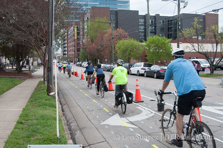
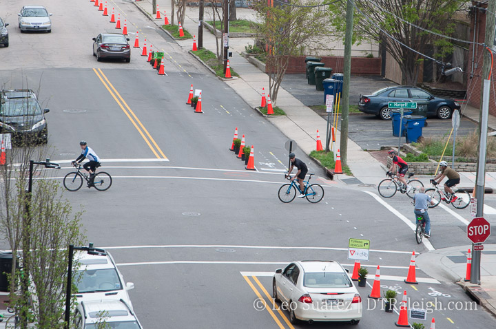
This past weekend, Oaks and Spokes, Raleigh’s loudest and most organized voice for bicycling in Raleigh, set up a cycle track demo for a section of Harrington Street. As a huge supporter, I hung out, volunteered, and just absorbed the street with this temporary cycle track in place.
Having only seen cycle tracks in other cities but never actually ridden through one, it was a pleasure to ride through it in my own city. After giving it some thought, here’s what I took away from this weekend’s demo.
Two-Way is the Right Way
When you compare the suburbs with downtown, one major difference is the mobility scale of each environment. Historically, downtowns that pre-date the car were built at a more human-scale with things closer together while suburban areas planned around cars are more spread out.
In downtown, walking, a human-scale form of mobility, is well accommodated with sidewalks on both sides of the street and no real “direction.” There is no such thing as a northbound sidewalk for example where as Wilmington Street is a one-way street for cars heading north. Wilmington is an example of a road designed for car-scale mobility.
This was fine for awhile but with a street culture obsessed with markings and direction today, when we make space for human-scale things (i.e. bicycles and scooters) they don’t work when the scale is actually intended for cars.
We should strive to make all street space two-way for bicycles, scooters, etc. in order to make on-street, human-scale movement more intuitive and natural.
This probably explains some of the “bad behavior” we have seen with scooters recently because it takes too long to circle the block if the final destination is closer when going up a one-way street.
Consider me an advocate now for having every single downtown street converted to two-way for bicycles alongside existing car traffic flows.
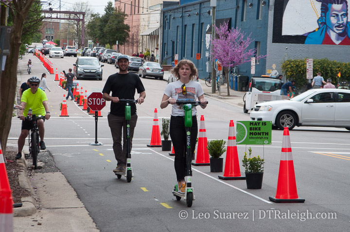
Humans, not Cars, Need Buffers
Similar to the above point, I want to reiterate a solid point that the cycle track gives users above painted bike lanes. Physical separation is the key point here and should be required in future installs.
It’s in plain sight yet few seem to notice that when we drive a car, the car itself is wrapping us with safety features and physical protections. At the human-scale, as a walker or cyclist, those features don’t exist and we rely on our physical environment for safety.
This is true in other areas as well outside of transportation. I think most obvious is with outdoor seating. Outdoor seating is more popular along sidewalks with on-street parking versus active travel lanes. The cars act as a barrier and makes it more comfortable to sit.
We need to familiarize ourselves with a variety of ways we can physically separate our human-scale mobility options away from the car-scale options.
Curb Space Productivity Needs to be Explored
As publicly-owned space, our curb areas and how we are using that space is being brought into the conversation. Alongside plans for future cycle tracks and other new street space like dedicated bus lanes, we need to understand how to make this limited space more productive.
This means objectively challenging the thought that removing on-street parking will be a detriment to nearby businesses. New parking decks are popping up around downtown Raleigh so their use in addition to the loss of the few spaces per block needs to be looked at.
Loading zones also need to be looked at as the streets also need to be a transportation network for our downtown businesses. Are their operating hours set correctly? Can these be consolidated?
I do think it doesn’t necessarily mean that a cycle track gets 24-hour access to the space either. Allowing deliveries to be made inside a cycle track between certain hours may be appropriate. Delivery persons may have to put cones out to redirect riders into the street, as just an idea.
The Cycling Community is Alive in Raleigh!
This past weekend, I met folks who knew about the project and all the work that was going into it as well as those who just came out of curiosity. Others just stumbled on the project and had positive things to say. Advocacy was strong and the community stepped up to support.
I feel like a real community has been built in Raleigh around cycling and the longer we don’t serve that community, the louder and louder it’ll get.
Again, a lot of credit and thanks goes to those behind Oaks and Spokes so if this is something that interests you, reach out and help.
This downtown plan attempts to lay out the groundwork for how our future transit system will work within the downtown area. The future bus network of Raleigh will consist of bus-rapid transit lanes and higher frequency bus routes that are running longer hours. Combined with an expanded bicycle network, the downtown portion presents some pretty unique challenges.
The streets aren’t getting any wider so reallocating space is a community-driven conversation that is currently starting. When we talk about dedicated bus lanes for faster service that means less space for other things on our downtown streets.
Online survey feedback shows a desire for non-car mobility. Click for larger.
Full build out is planned for 2027 and with portions relying on state and federal funding, applications are being prepared right now!
When you look at the plan, you’ll see near, mid, and long-term plans for the downtown portion of the bus rapid network. The routes aren’t set in stone as different variables and decisions that haven’t been made may impact those routes.
Below are the maps for the three plans, meshed together for easier viewing. Click for a larger view.
Planned to be up and running in 2023, the east Raleigh BRT line is the first of the rapid transit lines to come online. Moving east/west down New Bern Avenue and Edenton Streets, this route has the least amount of impacts from a historical and infrastructure perspective.
I also think it’s sort of the most obvious when you look at serving the eastern portion of the city. Plus, the current bus route along this corridor has the second-highest ridership in the system. (only behind the Capital Boulevard route)
Mid-term, the BRT routes serving the west and south will come online connecting at GoRaleigh Station. The route down Western Boulevard is also most direct while a choice still exists for the routes to the south. Saunders, McDowell/Dawson, and Wilmington Street could all be possible entry/exit points to downtown. There are still two many outside variables that need to be determined so this has been left open.
Last, parts to the north have many variables in play here, leaving several options on the table. Integrating Raleigh Union Station’s bus facility and the west street extension could play a role in how this route helps tie the network together.
Along side all of this is a greatly expanded bicycle network. A mix of protected lanes and non-protected lanes will be added as a way to compliment the bus traffic moving throughout downtown. This is shown through another map below.
Full build out bicycle facilities. Click for larger.
There is a lot to consider here when looking at the plan so far. As unpopular as it may sound, I worry about the fact that downtown is on a path to having two bus stations with GoRaleigh’s recent renovations and RUSbus being planned to integrate into train travel (Amtrak and future commuter rail) at Union Station. Won’t this bifurcate the system as it approaches downtown? I fear this may slow things down canceling out the improvements we’ve provided through dedicated lanes.
This BRT plan is still only one layer, one lens of the entire thing though. I’ll be really interested to see the full build out and future plan with all modes coexisting. That means with local bus, rapid bus, commuter rail, and bicycles lanes, the system just might function more robustly and speedier than I think.
What do you think? We have a huge discussion going on the Community. Come share.
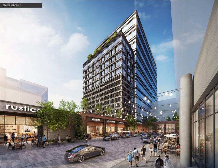
Announced in February with site plans submitted shortly after, Acquisition Group, the developers behind the 3-acre, former N&O property, have released plans that include multiple towers for office, hotel, and residential spaces.
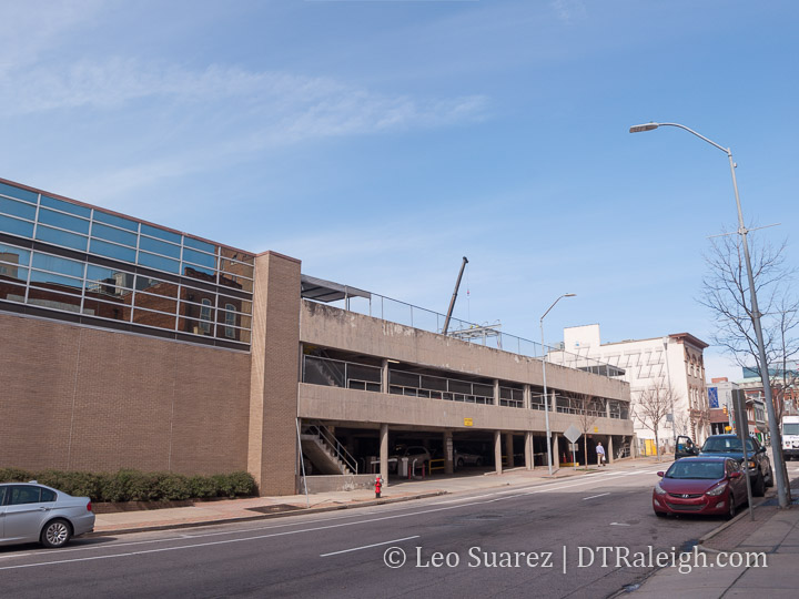
The first phase includes a 15-story, 250-foot office tower called Nexus which will, generally, be replacing the parking deck along Salisbury Street. Plans show a new parking deck below and behind the tower with street-level retail spaces.
Salisbury Street. February 2019.
Future developments after Nexus could be situated along a new internal street for accessing more retail and public spaces. The hotel and residential towers would all have access to these new mixed-use areas.
The future plans are still a work in progress as only the Nexus tower has been submitted. No rezoning is needed and the tower is planned to open in 2021.
With a collection of buildings and new public street, this is a pretty exciting thing to see. The mix of building uses should keep the area lively at different times of the day and week.
Rendering of Nexus Tower
A street that doesn’t really serve as new transportation means the area should be more human-scale. There’s no need to speed through making the area more walkable and bike-friendly. With the right design elements, the developers have an opportunity to make it look special compared to the streets that come straight from the Raleigh Department of Transportation playbook.
Expect to see the area cleared out and demolished sometime this year.
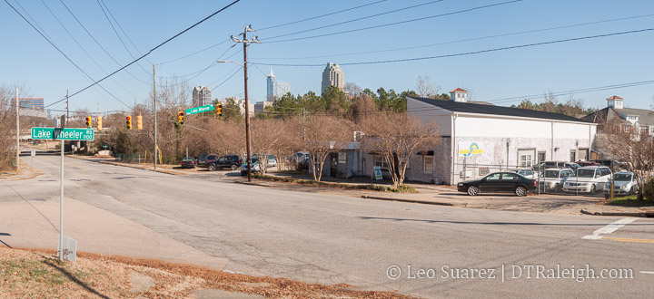
With lots of eyes looking at the future of Dorothea Dix Park, there is sure to be new development and plans to help connect it to downtown Raleigh. Between the two, one of the largest such projects announced so far is along Saunders Street so I thought it a great time to walk the area.
We’ve talked about a lot of new stuff taking place near the intersection of Saunders and South Streets but going away from downtown, there are buildings and land available for new projects.
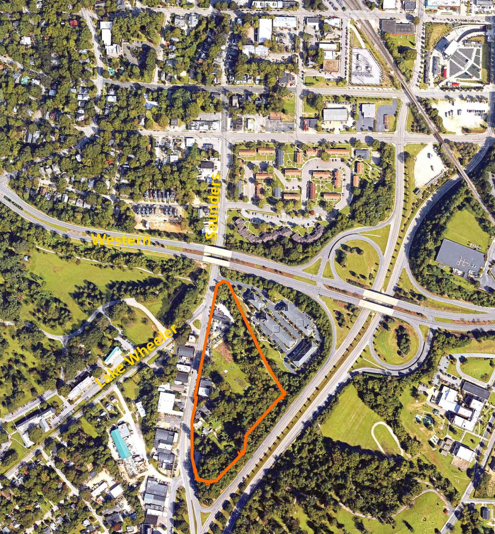
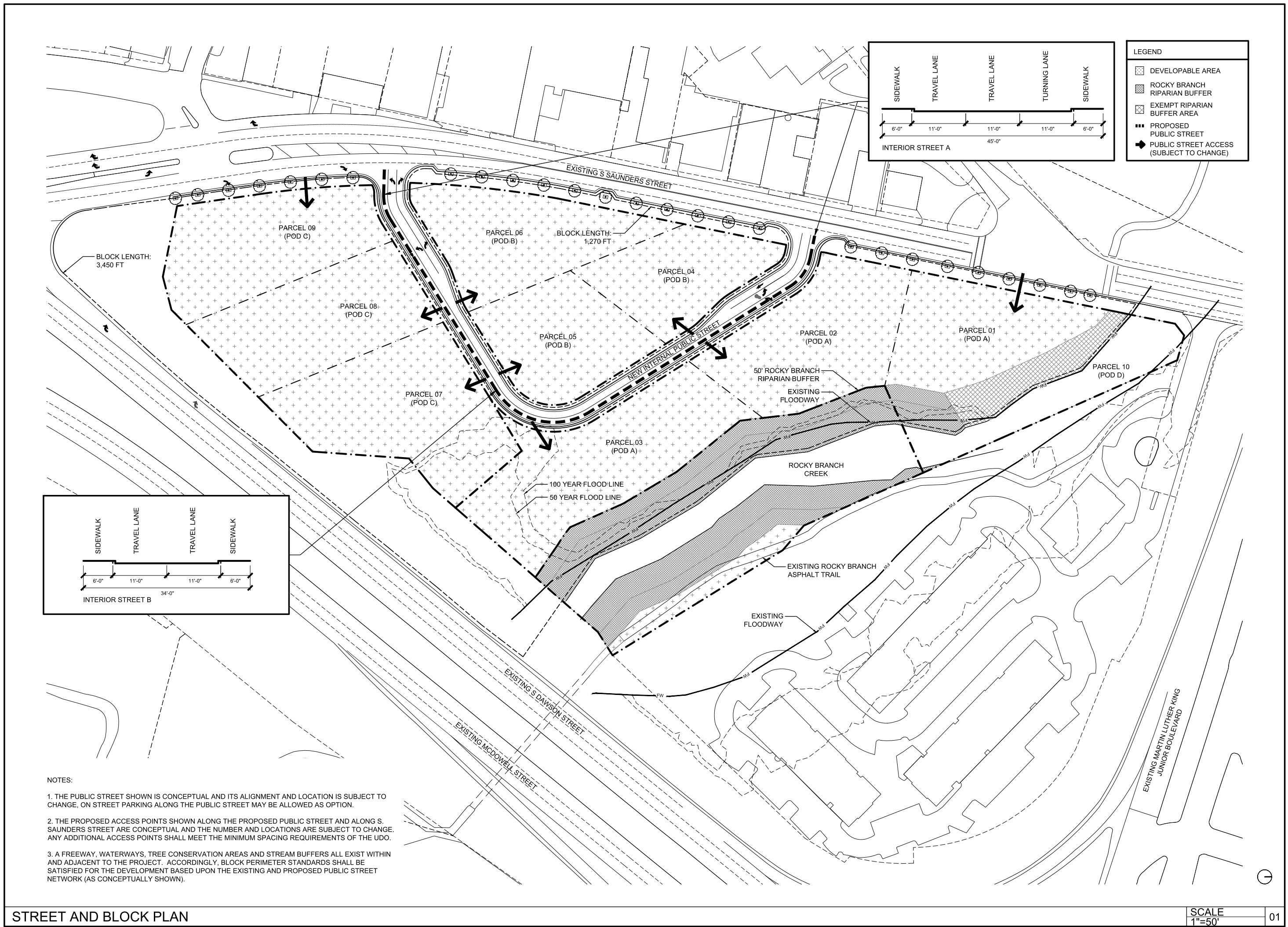
A local development firm, Five Horizons, plans for something special in the mostly wooded area along the eastern side of Saunders. Residential towers with skyline and park views plus ground-floor restaurants may one day make up this area. See the map below to get an idea of where the group is making plans.
Planned development is shown in orange. Click for larger.
Roughly nine acres in size, the area is mostly undeveloped with some businesses facing Saunders and the Rocky Branch creek on the northern edge of the property.
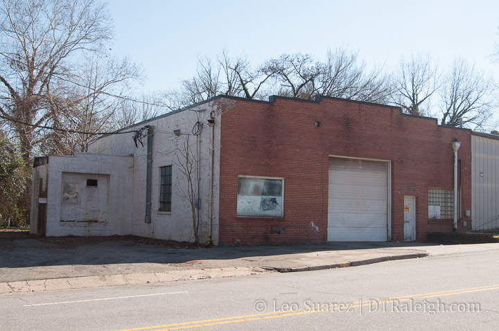
From the intersection of Lake Wheeler to where McDowell Street begins, a series of auto-repair shops and light warehouses line the streets. Some are open, some empty.
For this area, the Five Horizons project will create a transformation.
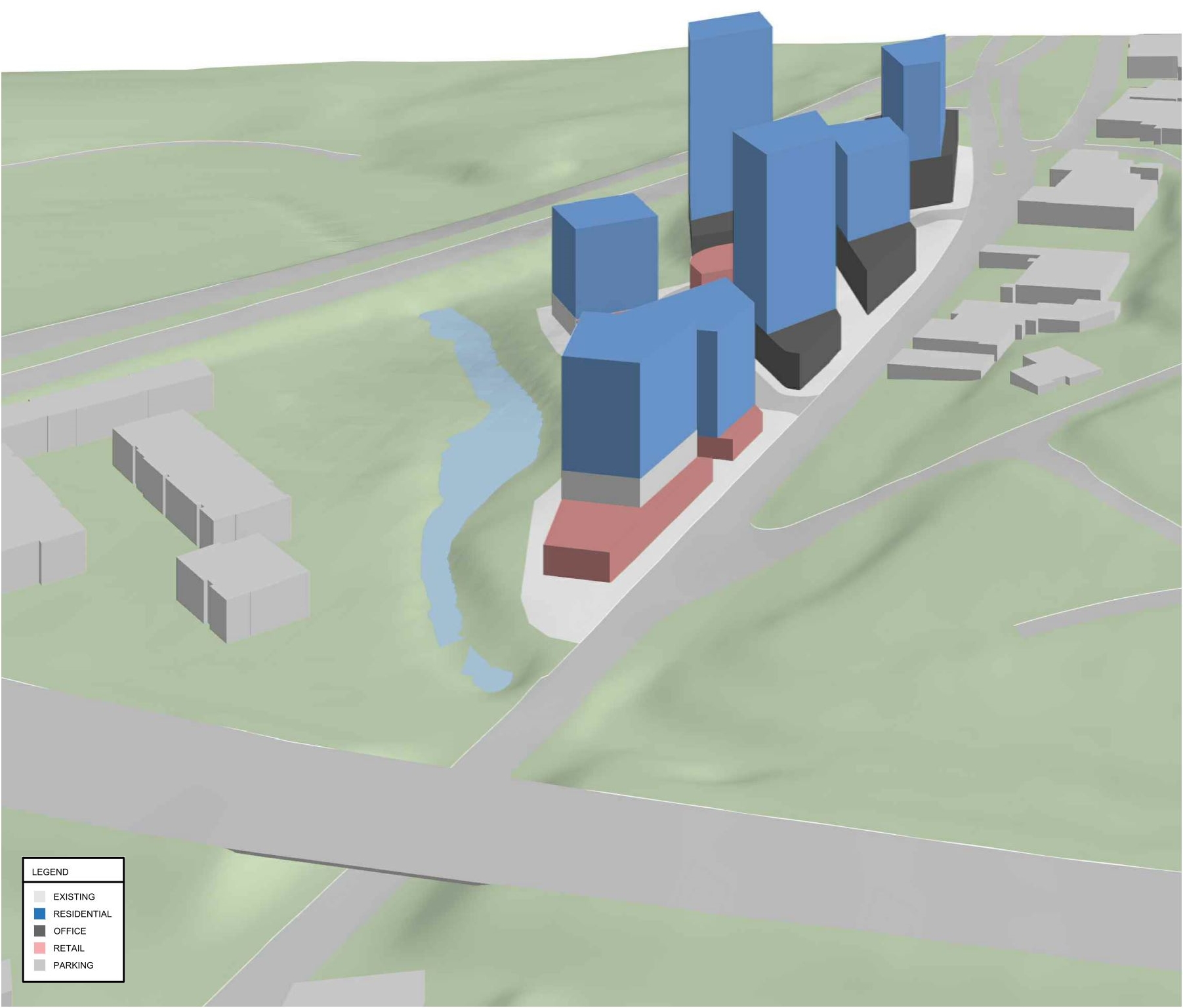
When looking at the currently open rezoning request, the developers are planning for an appropriate zoning that allows buildings between 12 and 20 stories tall with the shortest being in front of the creek.
In addition to a new interior public street, the buildings will be laid out so that every floor has a great view by design. This was mentioned several times from the design team at the CAC meeting I attended.
Starting with the creek, the developers are looking in to ideas to create a public space, such as a boardwalk, here. Bridges from the new development over the creek to the existing greenway could happen as a way to make the downtown skyline view available to all.
Rendering with building massings. Click for larger.
The development could have a mix of residential, office, and retail to create activity throughout the day and night.
The new street will be planned narrower as a way to create more space for people and make it more walkable.
Street and block plan. Click for larger.
After presentations and conversations at the CAC over the last few months, the response has been pretty positive towards this project. This month, the CAC has voted in favor of the rezoning for this project.
Five Horizons say that they are still years away from starting on the first parcel so I imagine this area will certainly take time to be fully built out. I expect that change may also take place nearby so Saunders could become a new downtown district in the near future.
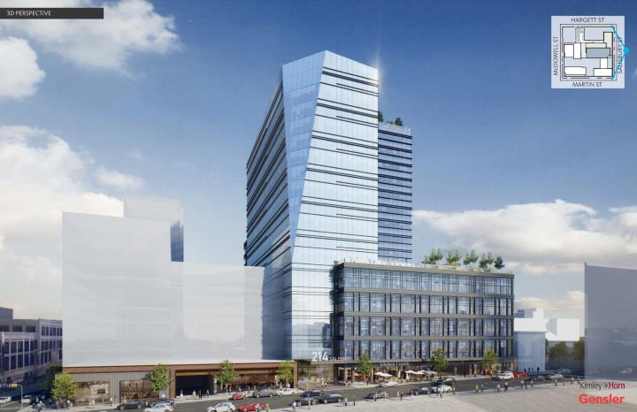
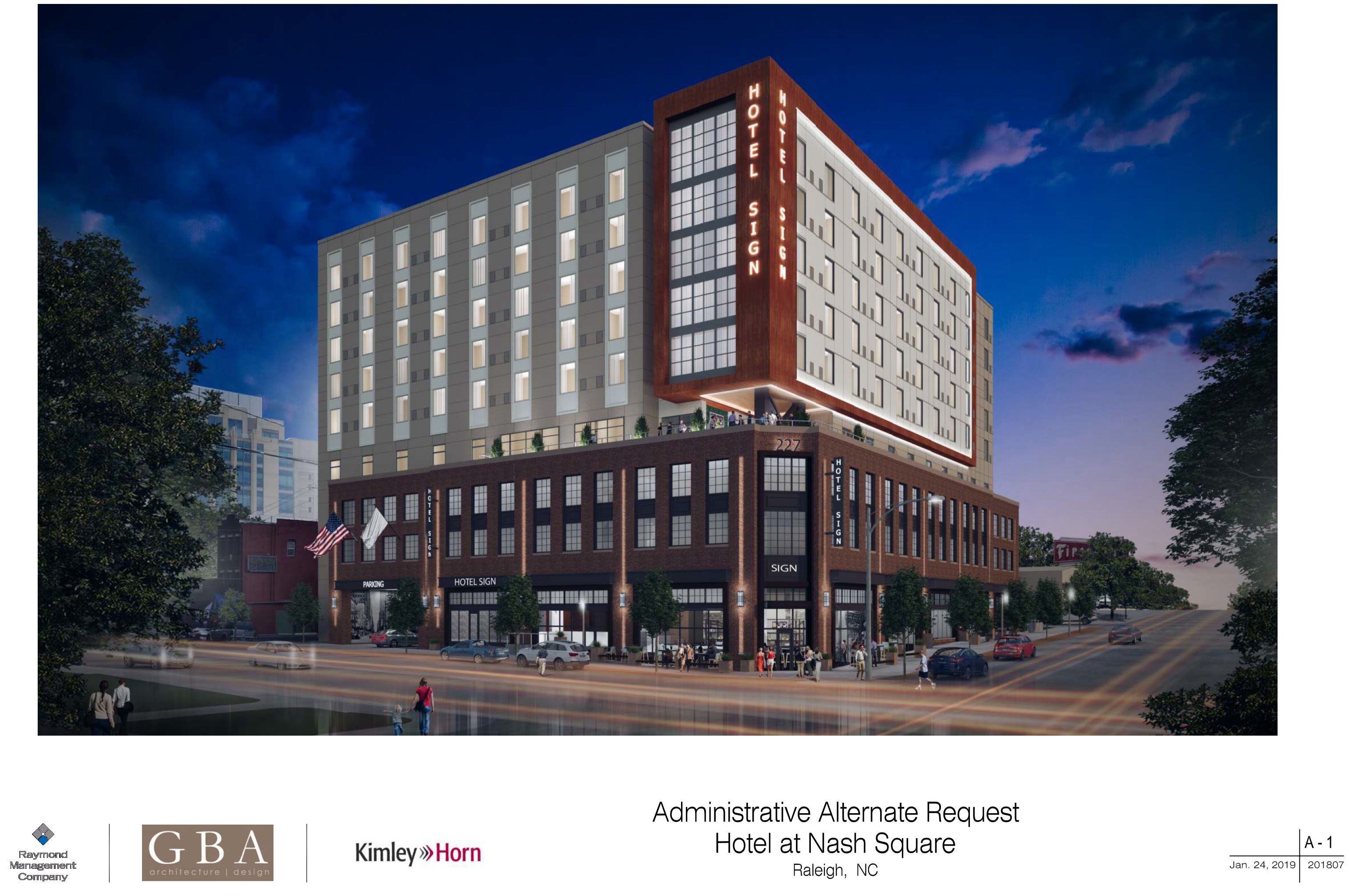
Rendering of the Nash Square hotel. (AAD-4-19) Click for larger.
The hotel planned for the southeast corner of Martin and Dawson is working its way through the approval process. Posted to the city’s website is an Administrative Alternative Request, see AAD-4-19, which shows a nice rendering of the hotel.
The request shows off the setbacks planned above the third floor and suggests some outdoor terrace, possibly for a restaurant or lounge.
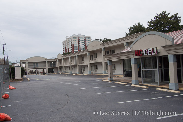
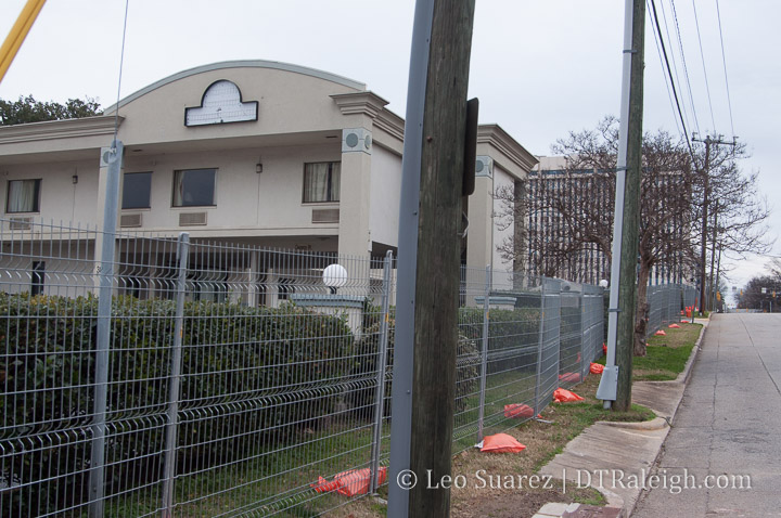
Last December, 2018, the Days Inn on West Lane Street closed. Later, construction fencing went up around the old motor lodge and next-door deli space. A lot of folks took notice and it turns out that local developers have bought the two properties with plans to renovate it all.
Loden Properties plans to create a boutique hotel called The Longleaf Hotel as well as overhauling the former NC Deli into Ish Delicatessen.
The buildings won’t be demolished but the renovation will be pretty deep so I imagine this year we’ll see the lot looking pretty bare. Reports say the job will take around 9 months so hopefully visitors can start booking towards the end of this year.
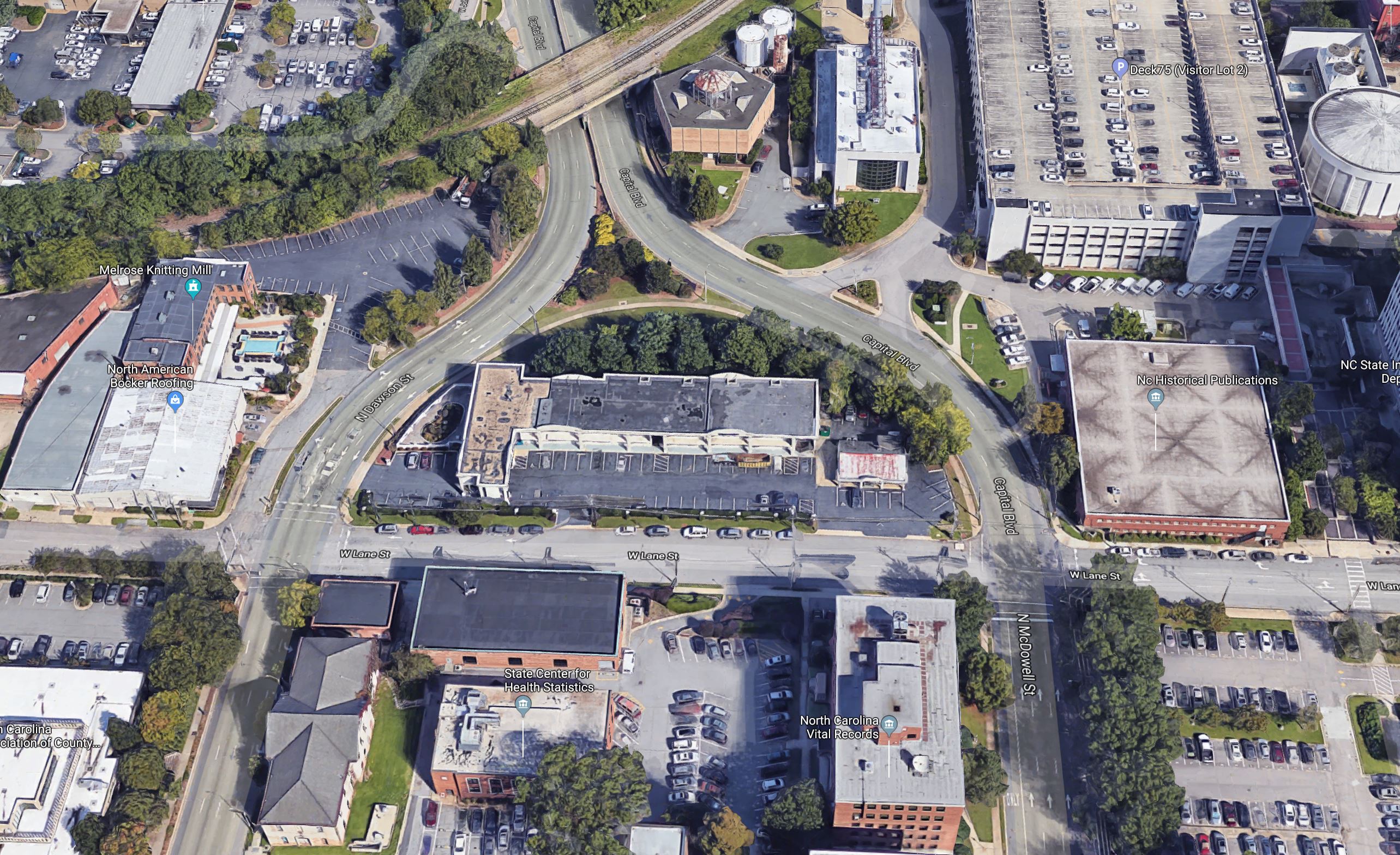
Google 3D image of West Lane Street. Click for larger.
Looking around the area of West Lane Street, the hotel is a few blocks away from some of downtown’s latest developments but nothing exciting is directly nearby. A great location either way and easy walk to Fayetteville Street and Glenwood South, the new hotel would offer a more authentic Raleigh experience compared to a corporate hotel such as the ones near the convention center.
It would almost be good to review some of the street paint on this block of West Lane Street. The street is incredibly wide for the amount of car traffic and a sidewalk is missing right in front of the hotel.
No sidewalks along West Lane Street. No reason on-street parking wouldn’t work here also.
The grassy, shrubby “arch” to the north of the hotel is owned by the state so I expect nothing to change there.
The cool thing to see with a boutique hotel like this is that it is going after a more local, unique experience, trying to attract travelers who want the “Raleigh experience”. That should present well with Ish Delicatessen next door as it’s being run by Matt Fern, a veteran of the Raleigh food scene.
I’m excited to see how this goes and see some new activity to this area on the weekends.