It’s All About That Height in Downtown Raleigh

Things have been slow at DTRaleigh HQ with some recent holiday downtime. (I hope the same for you as well) Also in the background, I’ve been flexing my tech skills a bit and working with maps lately. I went down a rabbit hole with the zoning information on the city’s open data website and started thinking about building heights.

But first, a refresher.

For the longest time, Raleigh’s zoning code had two limits with regards to building height; number of floors and the measured height in feet. To a certain degree, the “height in feet” limit has been removed and today, only the number of floors is the limit we care about. That may not be true city-wide but seems to be for downtown Raleigh, where we see a concentration of floor limits as high as 40.

Since this is a downtown Raleigh blog, let’s look at just that. Downtown is, generally, given the DX zoning type. You can see a map of all zoning in Raleigh here but if I filter on just downtown, it looks something like this.

See the map in arcgis

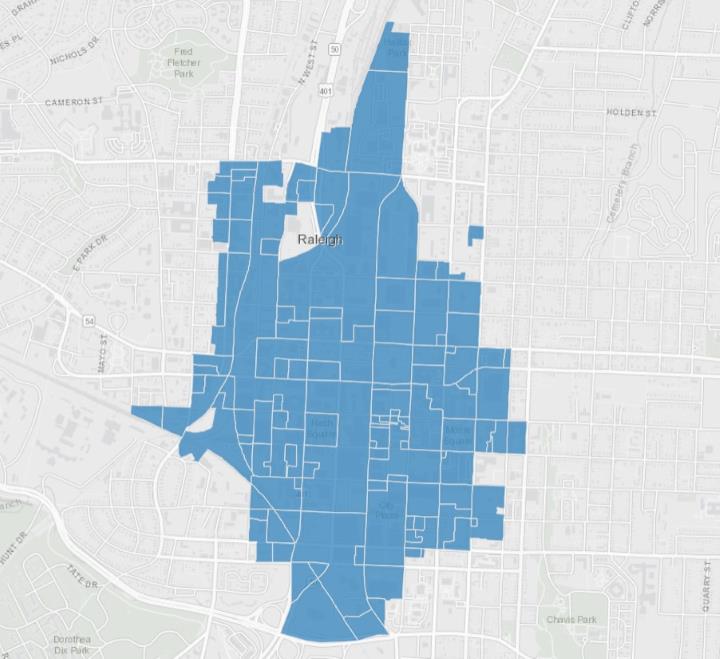
After filtering the dataset and looking only at the ‘DX’ zoning type (DX = Downtown Mixed-use) we can see areas that we generally refer to as Downtown Raleigh and shapes on a map with different zoning. To quickly read zoning labels in Raleigh, the formatting typically goes in this order:

  • Zoning Type
  • Maximum height allowed
  • Frontage type

So for example, when I see ‘DX-5-UG’, that stands for ‘Downtown Mixed-Use with a 5-story height limit, Urban General frontage’ There are a bunch of frontages that are worth going over but that’s for another day. Today, I’m looking at that middle number only.

I wanted to get a sense of what the maximum heights allowed are but the map above doesn’t show it to me easily without clicking every shape and noting the zoning. I went ahead and created this map below which shows darker shading on areas that allow higher heights, such as 12, 20, and 40 story maximums. Conversely, the lighter shading indicates lower heights including 3, 4, 5, and 7 story maximums.

Source: Open Data Raleigh – link. See larger map here.

The map is using the same dataset from the city so it should be up-to-date whenever you look at it.

It’s probably obvious to guess that the tallest height allowances are around Fayetteville Street. Two Hannover, with the newly renamed Truist Bank on its crown, and the Wells Fargo Capitol Center have been around since the early 1990s. When you add in PNC Plaza, opened around 2008, the thought of our city’s tallest towers and where they are doesn’t surprise anyone. Taller towers nearby are allowed and could come to this area in the future.

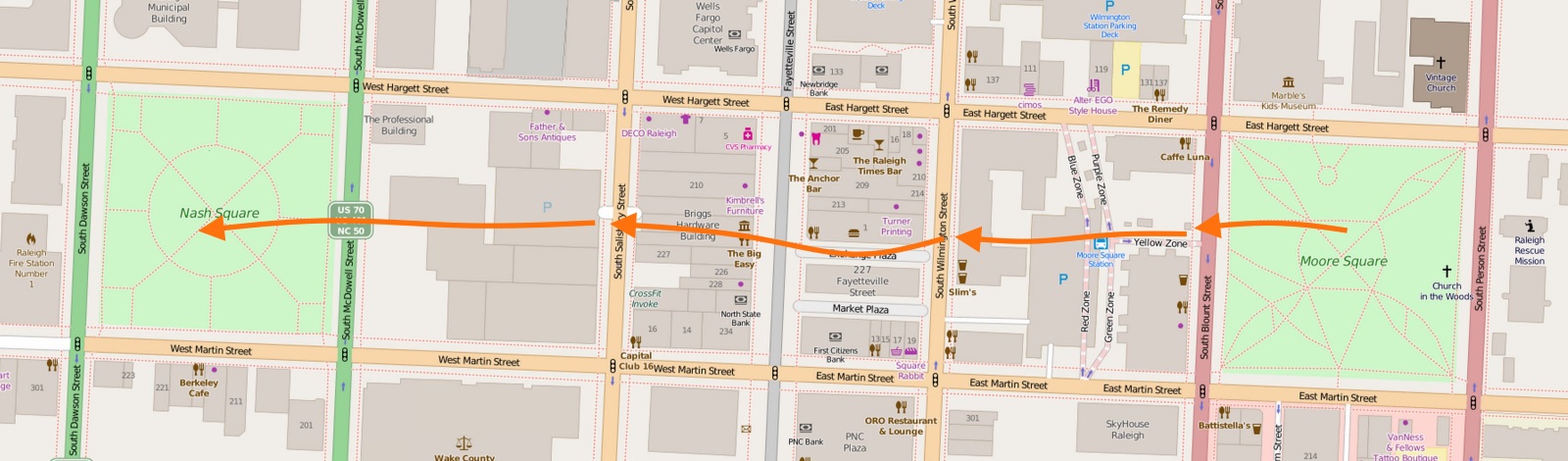
The map does show some easily explained anomalies such as the five-story maximum at Martin and Fayetteville. This is where the historic post office sits and since that’s not going anywhere any time soon, a rezoning just seems silly. Open space on Moore, Nash, and Union Square follows the same principle with their 3-story maximums.

If you are following me so far, you may think that the tallest towers in downtown have always been, and may always be, situated around the core business district around Fayetteville Street. That seems like a trajectory that downtown has been on since we started calling it downtown Raleigh.

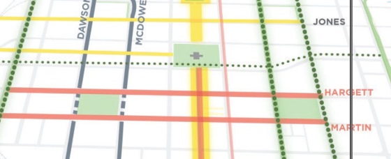
However, there are other districts that now have 40-story maximum zoning. I say ‘now’ as these have been approved within the last few years. If I take my map and filter on only the DX zoning type with max heights at 40, we would get a visual that looks like this.

Source: Open Data Raleigh – link. See larger map here.

In this map, we can see two clusters of 40-story max zoning outside of the traditional downtown core of Fayetteville Street, those being the warehouse district and the northern end of Glenwood South. If we look at the effective dates of the zoning in these two areas, they are all in 2019 or later.

Just a side note, from the data for the whole city, it looks like the rollout of the newest zoning per our development ordinance was throughout 2016 so while we see some zoning in downtown effective as of 2016, there’s a lot of it across the city. I want to say this was the transition from the old zoning codes to the new ones so anything with a 2016 effective date was not a market-driven zoning change more or less.

The maps above show current zoning and doesn’t consider active cases under review. As of this writing in December 2021, we can further show this clustering activity if we consider the in progress rezoning cases in downtown shown in this table.

Zoning CaseLocationCurrentProposed
Z-61-21Glenwood SouthDX-20-UGDX-40-UG-CU
Z-52-21Warehouse DistrictDX-12-SHDX-40-SH-CU
Z-78-21Warehouse DistrictDX-5-SH; DX-12-SH-CUDX-20-CU
Z-43-21Fayetteville StreetDX-20-SHDX-40-SH
Z-69-21Moore SquareDX-3-SH; DX-12-UG-CUDX-12-SH; DX-12-UG
Z-41-21Southeast DowntownDX-3-DE w/HOD-GDX-3-UG-CU

You can see that the first four cases listed above show more height in the same districts with three of them within these new clusters at the 40-story max height. Glenwood South and the Warehouse District are poised to really add much more space.

Why might this be happening? Is this an accident? Actually, it’s all according to plan.

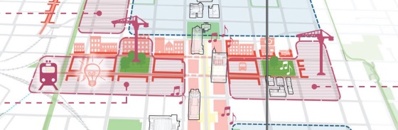
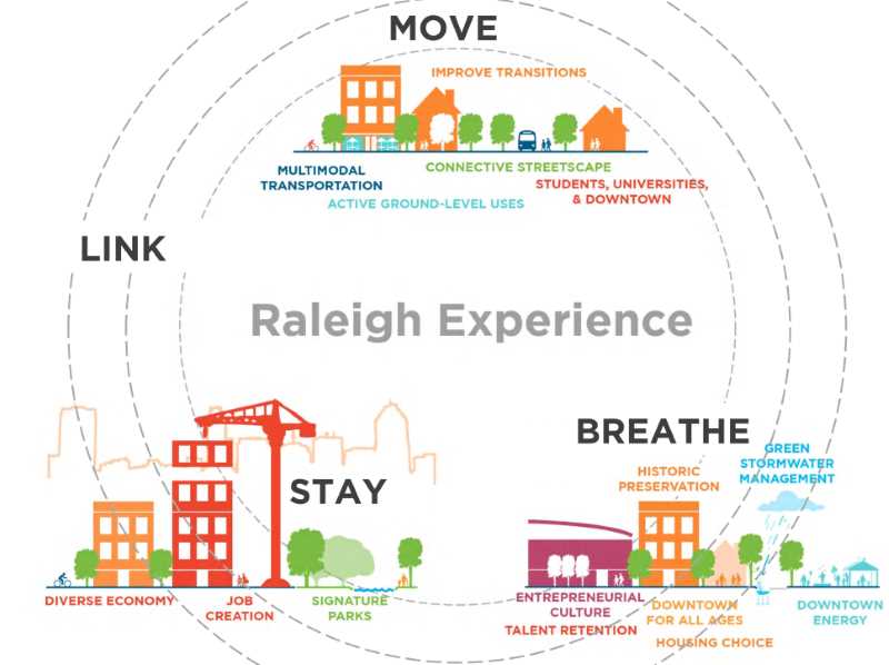
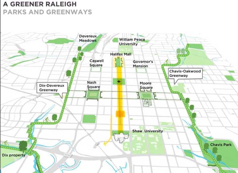
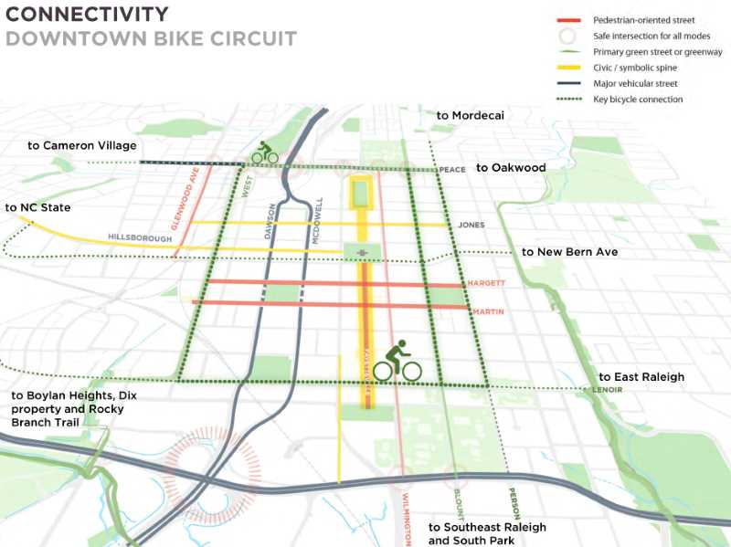
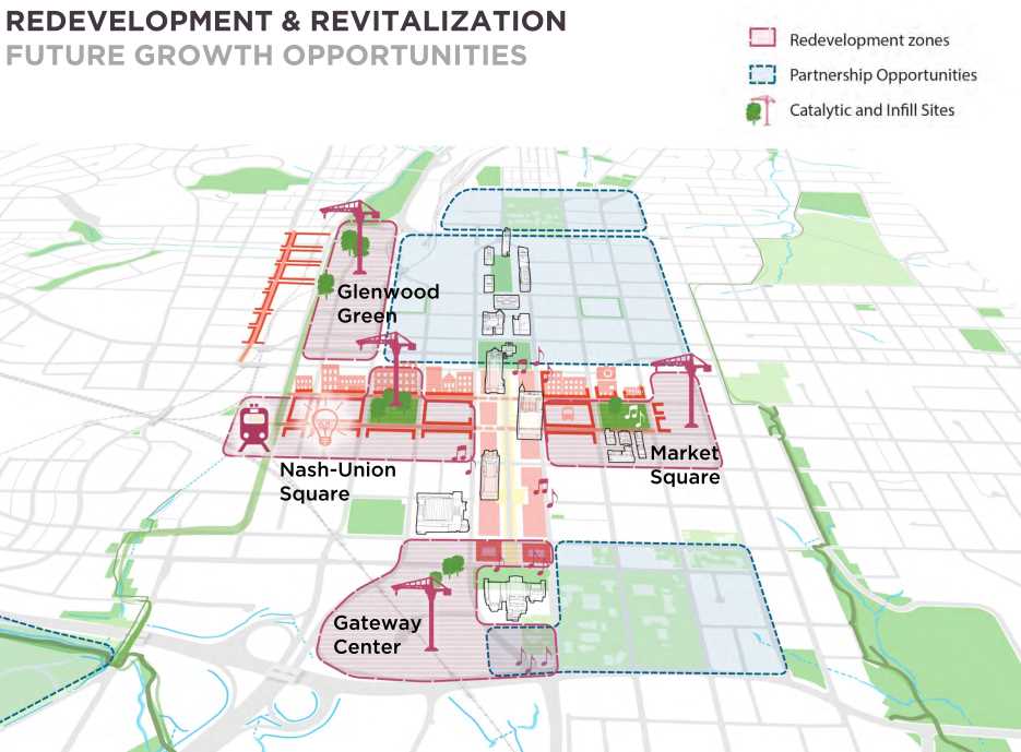
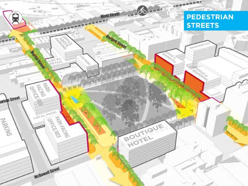
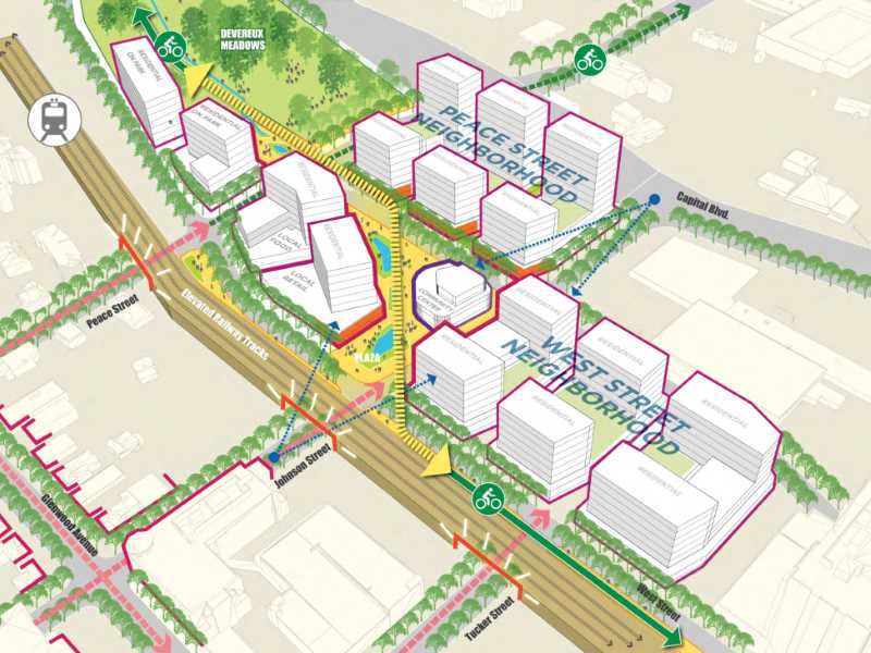
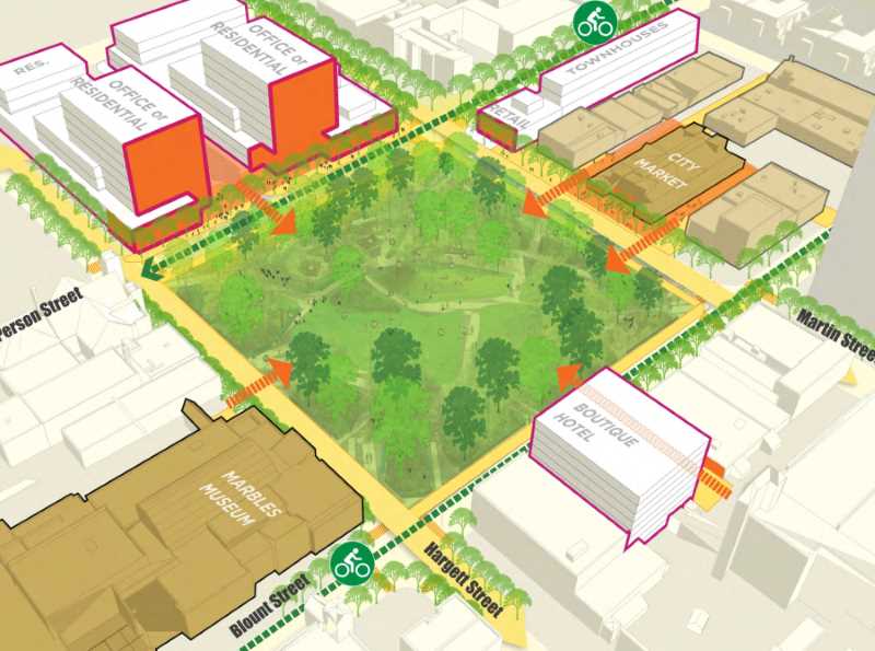
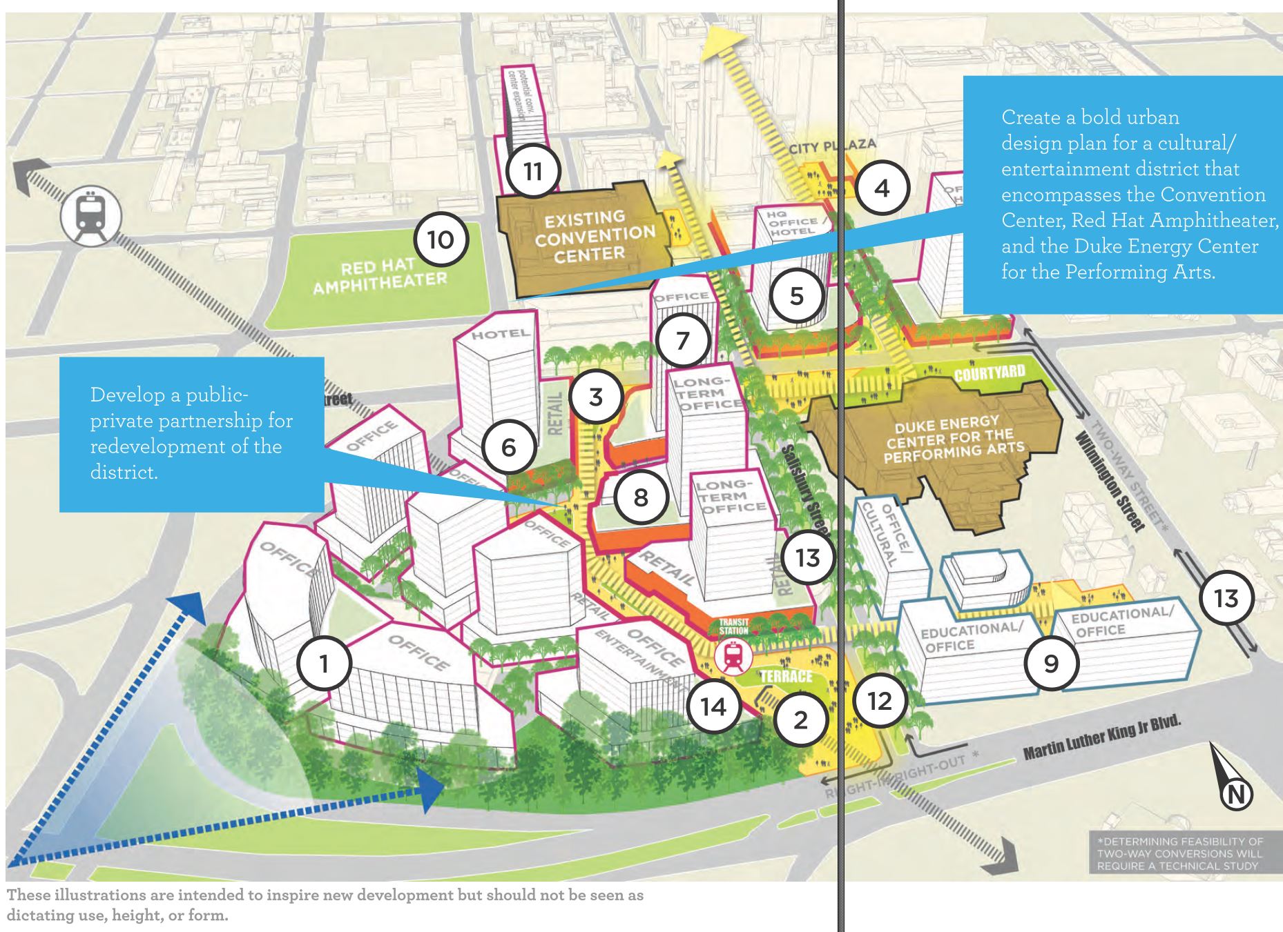
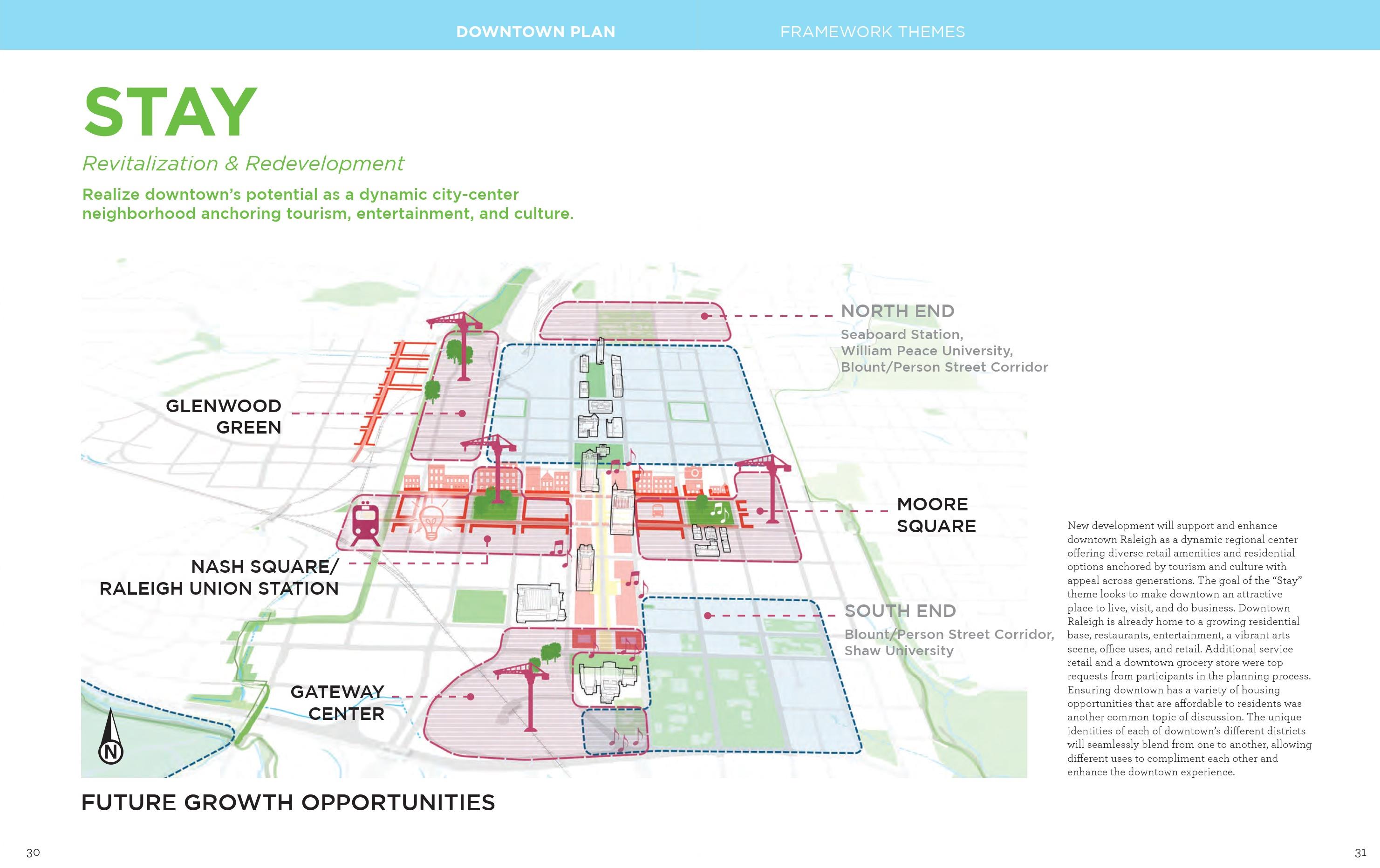
Adopted in 2015, the Downtown Experience Plan has many recommendations in it and a subset of redevelopment recommendations suggest we are right on track. You can dive into the plan here. (pdf link) I mean, this image alone from the plan is spot on.

We have talked plenty about the downtown plan over the years, which you can revisit here, and it’s recommendations say they are for 10 years. Perhaps later this decade it’ll be time for a new one?

I could keep going with thoughts about all this rezoning. Remember that maximum height doesn’t mean the buildings are built that high. Also a 20-story residential tower is shorter than a 20-story office tower. Zoning seems to be enjoyable to the civic geeks out there because of all these nuances, am I right you all?

There’s also a pretty wide gap between the 20-story max zoning and 40-story max. If a developer only wants to build a 23-story tower, they must apply for that 40-story max. Height conditions may be a thing of the future as the eastern most shape on that map above, the one by Marbles, has a condition limiting it to 30 floors. (Nuance!)

The main takeaway that I think I’ve gotten at is that we all need to be watching the Warehouse District and Glenwood South as they may really see a jump in development this decade. If these rezoning cases to new heights seem like a drastic change, just look back and see that it’s all part of Raleigh’s plan.

Municipography, Downtown Raleigh Plan

Municipography is a summary of current issues going through the Raleigh City Council and other municipal departments in the city. The point is to try to deliver any video, photos, and text associated with the discussions happening at City Hall or elsewhere. Since this is a downtown Raleigh blog, the focus is on the center of the city.

I recommend email readers click through to the website to see the embedded video.

Raleigh City Council chambers

At the last meeting of the Raleigh City Council, the latest Downtown Plan was adopted. The final version can be viewed on the city’s website here.

If you can’t see the embedded video, click here to go directly to it.

A process that started in February 2014 has now been adopted. The Downtown Plan is described as a 10-year vision for downtown Raleigh with specific supporting goals and actions on how to achieve them.

The high-level themes are largely the same from an October 2014 post I did so I recommend catching up there. What wasn’t in the plan back then were the goals and action items we have now. There are a lot listed so downloading the plan and reading is the best way to get into it.

Here are some that jump out at me.

Goal: Create strong partnerships with allied public agencies to accelerate implementation of mutually beneficial projects that enhance livability in downtown.

Action: (1 of 7) Assist the N.C. Department of Administration by contributing to a master plan for the Capital District.

Goal: Create a robust retail environment in downtown that diversifies beyond nightlife to include a complement of local and destination retail.

Action: (1 of 6) Identify a toolkit for retail recruitment, such as a retail-specific fund that functions as a below-market interest loan or grant program that assists with construction and up-fit costs.

Goal: Ensure that downtown remains a clean, safe, and hospitable place to live, work, and visit.

Actions: (2 of 5)

  • Update standards for Private Use of Public Spaces (PUPS) to incorporate growing hospitality-related issues.
  • Explore the adoption of a hospitality management district in other areas of downtown,
    or modification of the existing amplified entertainment permit program.

Goal: Accommodate vehicles using a multi-modal grid of complete streets, as well as on- and off-street parking facilities located in areas of high demand.

Actions: (2 of 13)

  • Study Wilmington and Salisbury Streets to consider the restoration of two-way traffic.
  • Improve Peace Street’s accessibility for all modes of travel both along it and through safe intersections across it.

Goal: Extend the greenway system into downtown and use it to connect and integrate downtown’s public open space resources.

Action: (1 of 5) Extend the Pigeon House Creek restoration south of Peace Street by exploring the
opportunity to daylight the creek and make it an amenity in future redevelopment projects.

This is just a small sampling of what is in the document. There really are lots of ideas out there to keep pushing downtown Raleigh to higher levels. There will be tons of things to continue talking about over the next ten years. Let’s hope the council sticks to it.

Comment On The Downtown Experience Plan Until May 13

Hargett Street near Moore Square

The latest draft of the Downtown Experience Plan is now available and the team behind it are seeking public comments. Jump into it here:

Downtown Experience Plan on RaleighNC.gov

One huge addition to this draft compared to the last one is that actions are listed as a part of each stated goal. That should help make the direction clear on how to achieve the stated goals and stay within the themes.

For a quick review, jump back to Downtown Raleigh Plan Presentation Rundown.

While all the project areas in the plan are exciting to see, I think two of them, when looked at together, have the potential to be great. I’m going to make the call now that the Moore Square and Nash Square refreshes will have more of an impact on downtown Raleigh than the Fayetteville Street redesign did back in the 2000s.

To see it, I think you need to look at downtown Raleigh from a new perspective. Fayetteville Street, running north/south, is arguably the epicenter of the downtown core. The Downtown Plan calls it the “civic/symbolic spine” and it will probably be that way for decades.

I’d like to flip your perspective from north/south to east/west and highlight how important the duo of Martin and Hargett Streets will be in the next ten or so years. While Fayetteville Street may be the face of downtown, the prime location, where the action is at, I like to see movements east/west along Martin and Hargett as becoming functional and spontaneous.

Activity around and between the two squares is set to boom. If you look at the plan, we have images like these.

Downtown Plan

Downtown Plan

I think the street grid will fuse these two areas together and create activity pockets all over these blocks. Consider what we have and what is in the pipeline. Going west to east:

  • Raleigh Union Station
  • Development potential at the Dillon Warehouse at 400 West Martin Street
  • 3.5 acre News & Observer site for sale
  • 200 block of Fayetteville Street, highest pedestrian counts in downtown Raleigh. City? (most likely)
  • Market and Exchange Plaza upgrades
  • Moore Square Transit Center upgrades
  • Moore Square Redesign

In addition for Nash Square, straight out of the downtown plan, we have:

Undertake a design study to re-envision Nash Square as an urban green that supports the growth of the Warehouse and Fayetteville Street Districts and to strengthen their connection.

I see that as a string of connect-the-dot projects that could really make a huge difference. It won’t be as obvious as Fayetteville Street is but it’ll be there. It’s possible that we’ll see residents walking east/west while visitors will be walking north/south.

One last thought about this new perspective, kind of a “big idea” as the downtown plan likes to encourage, is that with a little planning we could almost create a pedestrian-only corridor between Moore and Nash Squares. What would it take to walk from Moore Square to Nash Square without using any sidewalks?

It would look something like this.

Click for larger

Of course, a couple changes need to be made but imagine starting in Moore Square and:

  • walking through the upgraded transit station to Wilmington Street
  • walking through the new Exchange Plaza
  • walking through the City of Raleigh Museum to Salisbury Street
  • walking through a plaza around new development that connects to McDowell Street

Finally crossing into Nash Square. How you get through the City of Raleigh Museum, that might be tricky but it’s an idea that’s fun to think about. The historic buildings along the 200 block of Fayetteville would be tough to punch a plaza through but at the same time, the downtown plan says to make new connections, encourage moving, and create new retail spaces…..

…..Just like a pedestrian-only mall!! ;)

Downtown Raleigh Plan Presentation Rundown

2014 Raleigh Downtown Experience Plan

I’m throwing this post up to kind of go over what was presented a few weeks ago at the 2014 Downtown Plan Presentation. I highly recommend watching the video but going over the high-level concepts here works too. There’s no new content in this post if you have already seen the video.

Introduction

At the start of the presentation, the presenters make it clear that at this point, the big ideas are out there but the details and the action items have not yet been finalized. We’ll have to wait for the final report to get into those.

An important keyword to remember is “Abundance” and the presenters use this often in describing what has been put together so far. By abundance, they mean that creating many experiences within close proximity only brings more value to the downtown.

A thriving city is worth more and has more value than the sum of its individual parts.

Some of the main concepts that we’ll see in the upcoming plan are:

  • Ecosystem of startups and new business types
  • Open spaces, parklets, etc.
  • Variety of housing options
  • Abundance of experiences

Importance was placed on making Raleigh unique rather than playing “catch up” with other cities. We’re at a good point in our growth period as we’re not overbuilt and don’t have old, obsolete systems in place that may hinder bringing in the new.

Accessibility was also emphasized. Downtown is great but there is more to the city than just that. Connections to and from downtown Raleigh are important so that all Raleigh denizens can take in the planned experiences.

The vision from the downtown plan’s advisory committee is to celebrate Raleigh as a hub of innovation, creativity, and entrepreneurship while maintaining authenticity and inclusiveness unlike any other city in the world.

Breathe, Move, Stay, Link


“Breathe” is the theme for creating 21st century parks, open spaces, and trails, just to name a few, that allow people to relax and enjoy the city. Focus on Nash and Moore Square as well as greenway trails through Chavis and Oakwood to the east and Devereux Meadow and Dorothea Dix to the west are proposed.


“Move” describes making over downtown Raleigh to be a model for walking, biking, and transit. Martin and Hargett Streets are identified as key pedestrian corridors and a downtown bike circuit is proposed as well.


“Stay” refers to downtown’s culture and being the tourism anchor of the city. This theme will be paired with the future growth opportunities covered below.

And finally “Link” talks about partnering with neighbors in our city. Universities, private business, non-profits, and many others also have a stake in our growing downtown. They should be at the table if not already.

Four Catalytic Priorities


Nash-Union Square is the term for the area around Nash Square and the upcoming Raleigh Union Station. Transit-oriented development and pedestrian streets will be key to bringing new growth to this area. Ground-floor retail and improved streetscapes are tools to help make it happen.

Nash Square is seen as an urban park oasis rather than the underutilized space that it is today. Activating the edges of the square will be important especially along Martin and Hargett Streets.


Glenwood Green is described, almost exactly, as new development for what used to be the old Smoky Hollow neighborhood before the “Urban Renewal” wave of the 1950s and 1960s cleared out this neighborhood. The area to the east of Glenwood South to Capital Boulevard could see new development around an urban greenway, parks, and urban residential buildings.

The plan suggests creating a park at Devereux Meadow as well as making new connections to the east and the south. With a possible light-rail connection nearby, this area could really be the residential epicenter of downtown.


Market Square is a fusion of City Market and Moore Square. Rather than make these two landmarks individual locations, the plan suggests to create a single area that encompasses both assets.

The plan suggests to turn the area into the premier, destination-oriented market with links to the nearby neighborhoods. The plan does tell a little of what we already know and should work on. The City Market building is underutilized, implementation of the Moore Square redesign should take place, as well as the improvements to the Moore Square Transit Center.


Gateway Center may be the grandest proposal in the plan. This involves the very suburban-like area to the south of the convention center adjacent to Martin Luther King Boulevard and South Saunders Street. The plan calls for pure development in this spot for a mix of uses including tourism, cultural, entertainment, and commercial.

Two big ideas are the one shown above, a campus-like setting with offices, educational institutions, and other innovation supporting entities. A second proposal in the plan shows a sporting venue wrapped with supportive retail and mixed-use development.

The R-Line

The plan presentation goes over the current state of the R-Line and possible changes to it that could address concerns. In the plan, we have:

  • Develop an optimized R-Line route to better serve existing and future Downtown riders
  • coordination with ongoing CAT system evaluation
  • Rider concentration is heavy at the Convention Center, Moore Square, and Glenwood South
  • Low ridership in the Warehouse District, New Bern, State Government, Seaboard, and Performing Arts Center

It looks like the plan wants to see the R-Line as part of a whole system, that being Capital Area Transit (CAT), rather than it’s own transit service. The new route proposals are for a shorter loop resulting in higher frequency and being complimentary to CAT bus routes.

Draft Downtown Plan Presentation on September 11

Raleigh City Plaza

Raleigh’s latest Downtown Plan has been in the works for most of the year. Public input has been collected throughout the Spring and we now have an upcoming draft that will be presented on September 11.

From my inbox to yours:

The draft Downtown Plan presentation will highlight Raleigh’s reputation and identity as a creative, innovative, and family-friendly city. Specific attention will be given to actionable catalytic projects that can accelerate economic progress in Downtown and help link the different districts of Downtown together. Visualizations of the catalytic projects will be created by using 3D models. The presentation will be conducted by the consultant team lead by Sasaki Associates.

*Draft Downtown Plan to be Presented Sept. 11

Draft Downtown Plan – Presentation

Date/Time: Thurs., Sept. 11 from 6 p.m. to 8 p.m.
Marbles Kids Museum
201 East Hargett Street
Raleigh, NC 27601
919.834.4040

Draft Downtown Plan – Open House

Date/Time: Fri., Sept. 12 from 9 a.m. to 5 p.m.
City of Raleigh Museum
220 Fayetteville Street
Raleigh, NC 27601
919.996.2220

City Works Through The 2014 Downtown Plan

Downtown Plan kick-off event at the Raleigh Convention Center.

For those that are not aware, city planning is working with a consultant group to create the next downtown Raleigh plan. This plan will consist of a vision for downtown Raleigh and what it could look like in 10 years. Key to it are achievable goals based around a heavy amount of public input.

Recently, the public kick-off event took place at the Convention Center and a good crowd of about 150 residents and business owners met to throw around ideas for the new plan. Downtown as a whole was looked at and from my experience a few themes were clear:

  • Create goals that are achievable in under 10 years.
  • Connectivity between districts and outside of downtown is important.
  • Create more experiences in the downtown.

The achievable goals piece seems to be borrowed from the last downtown plan, The Livable Streets plan from approximately 2002. That plan had 5 clear objectives and a path on how to execute them. Goals like building a new convention center and remaking Fayetteville Street were laid out clearly. Planners wanted to avoid lofty goals, which could sound like “create more meeting space in downtown Raleigh” or “revitalize a core street to be downtown’s Main Street.” The clearer goals in that plan were felt to be part of the success we’re seeing now and is hoped to be repeated in the new plan.

This new plan is being lead by a consultant group, Sasaki Associates Inc. from Boston, and with the help of a local advisory committee, consisting of residents from a variety of backgrounds, as well as public input they will release the plan later this year. Make sure to jump to the city’s website to see more details on the consultants and the local advisory committee.

Coming back to the kick-off meeting, participants were taken through a few group exercises to try and get their ideas for downtown Raleigh. We rewrote the downtown mission statement. We drew all over a map, highlighting areas needing attention, open space, or improved connectivity. Our group also listed our top three ideas for downtown, adding them to a list with the other groups’ and later voting on the best ones.

Downtown Plan kick-off event at the Raleigh Convention Center.

Our group wanted more connectivity across Capital Boulevard.

These ideas and maps will be taken by the consultants for input into the final plan. No need to worry if you have not submitted any ideas yet. Here is how you can participate online now and look out for the next meeting.

Mindmixer
The city has set up a website using Mindmixer to allow you and I to submit ideas, vote on others, and add comments around a few central downtown themes. The site is up right now and there is a fair amount of activity on it. Jump over to it and start submitting.
Planning for Raleigh via Mindmixer.

District Sessions
The next in-person meetings for the downtown plan will be on May 21 and 22. The visioning sessions will consist of similar breakout exercises to the event in early April but focus only on the district being discussed. Here’s the schedule for each session:

District Visioning Sessions for Downtown Plan

Capital District
Date/Time: Wed., May 21 from 8:30 am to 10 am
AIA NC Building, 14 E. Peace St.
Moore Square District
Date/Time: Wed., May 21 from 3 pm to 5 pm
Cobblestone Hall, City Market, 215 Wolfe St.
Glenwood South
Date/Time: Wed., May 21 from 7 pm to 9 pm
Hampton Inn Hotel, 600 Glenwood Ave.
Fayetteville Street District
Date/Time: Thurs., May 22 from 2 pm to 4 pm
The Stockroom, 230 Fayetteville St., second floor
Warehouse District
Date/Time: Thurs., May 22 from 4:30 pm to 6:30 pm
HQ Raleigh, 310 S. Harrington St.
Person Street/Seaboard
Date/Time: Thurs., May 22 from 7 pm to 9 pm
AIA NC Building, 14 E. Peace St.

As always, the city’s main site for this whole project has it all and is constantly updated as new information is available. This is the first place to look for information.

Downtown Experience Plan via City of Raleigh.

Weekend Reel: Downtown Plan

Email readers: This blog post has embedded video. Read the post on the blog to see them.

Downtown Plan on YouTube

In the quick video above, Raleigh Planning Director Mitchell Silver introduces the ongoing Downtown Plan and why the city is undertaking this effort.

In the next video, we have the presentation given by Mr. Silver and the design firm, Sasaki Associates, at the Downtown Plan Kick-Off meeting that took place back in February of this year.

Raleigh Downtown Plan Kick-Off on YouTube

Make sure to keep an eye out for the next public meeting on April 2.

Downtown Plan – City of Raleigh