Fareless Transit Ideas

Here’s an interesting read that I’d like to highlight. Aaron Renn’s blog, The Urbanophile, suggests an interesting concept for smaller cities that are trying to grow transit. Make them free. Well not exactly free but without fares. Renn states:

Why have a fare in the first place? It is odd that we pay per use on transit. We don’t pay to check books out of a library. We don’t pay to visit most city parks. We don’t pay when the police or fire department come to our house for a legitimate emergency. Most non-utility municipal services are provided for free to users and funded by taxes. So why is transit different? I suspect it is rooted in the origins of public transit systems when they were private, for-profit companies. But they aren’t that today so why adopt those legacy practices?

Read the rest of his post for some solid ideas supporting the use of fareless transit.

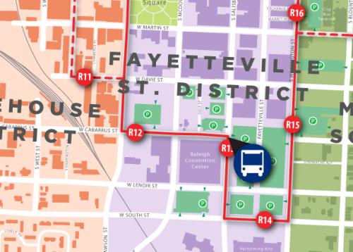
There’s actually nothing too radical suggested here as Chapel Hill has been fare-free for over eight years as well as downtown’s R-Line. This may or may not be something to consider as the transit section of the 2030 comprehensive plan is concerned.

Big Drafts at Natty Greene’s In Downtown Raleigh

The landmark of powerhouse square in Glenwood South, the Raleigh Electric Company Power House building, has been empty for over a year now but that will all change soon. Greensboro based Natty Greene’s has moved in and will open very soon. The furniture is in place, the beer tanks are brewing, and staff training is currently underway.

For those that have been to this beautiful space at 505 West Jones Street when Southend Brewery was open, you will be familiar with the restaurant setup. Left of the entrance is the restaurant with space for couples, families, and large groups. To the right is the bar area with high tables and chairs. Each are separated by the huge beer tanks in the center, on display for everyone to see. The upstairs “loft” will be used for private parties or large functions. The back room through the bar is the game room with another bar, pool tables, dart boards, and a shuffleboard.

Natty Greene’s is open now but look for an official opening date around St. Patrick’s day.

Tracking Buses Online and On Your Phone

Recently, the city has created some online and mobile tracking services for the buses in Capital Area Transit. The best part is that they all have maps associated with them. I love me some maps.

For downtown, this includes the R-Line, which is technically part of CAT and is shown on the CAT tracking page. The Downtown Raleigh Alliance (DRA) tracks the R-Line on their page as well. Below is the link rundown so update your bookmarks.

DRA live map
www.godowntownraleigh.com/get-around/r-line/status

DRA live map mobile version
m.yourhere.com/rline-map.php

CAT Bus tracking
raleighrides.org/

NCSU Wolfline Tracking
ncsu.transloc.com/

I’m mentioning the Wolfline tracking system because it has been around for years and is still the better service of the few, in my opinion. Take a look at it to see what all the services should work towards becoming one day.

The R-Line mobile site is easy and straight to the point. If you have a smartphone, you can pull up the maps with the location of the buses pinpointed on the route in real time. The bus stops are marked by their appropriate names so finding where you are on the map is easy once you are at an R-Line stop. Streets and their names are also displayed so the map now becomes a personal guide to navigating downtown on your phone. It’s a great start for making the experience of riding a bus slightly easier and puts a system in place that can be easily updated and scaled out as transit in Raleigh grows.

Buried Tracks In The Warehouse District

High-speed rail and train travel out of downtown sounds like a thing of the future to some people. To others, its a thing of the past now that cars are king and planning of our cities happen around it. It’s no surprise that cities across the country have demolished or abandoned their train stations.

In case you missed it, we’ve mentioned before that Raleigh actually still has its Union Depot, now re-purposed as an office building. It will probably never see trains again but the warehouse district around it continues to have trains roll by. Its possible to uncover some of the older tracks that once ran through here. Let’s jump straight to the maps.

Above is a map of the area around Nash Square in 1914. Union Depot is marked on here as ‘Depot’ and you can see the old tracks leading up to the back of the building coming from the west.

This is a current map overlaid on top of the previous and it is obvious to see that the tracks are not there anymore. You can use a more interactive old/new map overlay at the North Carolina Maps site where I got them from. They set up a very slick Google Map to show this.

The truth is that the tracks were never torn up and are blatantly noticeable if you walk around the warehouse district. The tracks that used to lead up to Union Depot can be seen on West Street, they continue through one of the Dillon warehouses, and there are suspicious cracks along the asphalt leading up to the office buildings behind the old depot.

Click on the pictures for a larger view.


Tracks crossing West Street.

Tracks running through the Dillon Warehouse.

Harrington Street. Look for the cracks in the asphalt in neatly spaced, parallel lines.

The tracks lead up to the offices and disappear underneath.

Next time you are walking in the area, look for the tracks and imagine that at one time passenger trains were unloading people right into Nash Square and a few blocks from Fayetteville Street.