Bigger, Bolder Signs In Downtown

I finally made it through the Downtown Raleigh Alliance’s analysis and strategy report on retail, read the whole thing here, and there are lots of topics to go over. I thought their recommendations on signage was something I hadn’t thought of since I can’t view downtown through a first-time visitors’ eyes. The report suggests:

If the Downtown core is to become a truly alluring and exciting visitor destination, one that, for example, beckons conventioneers to head northward on Fayetteville Street, the City Council will need to be willing to accept bolder, more dynamic signage appropriate to this goal, as recommend in the Comprehensive Plan. Indeed, this will be critical to the fate of Fayetteville Street as a retail location, which rests partly on its ability to lure conference attendees and daytime workers from its southern end.

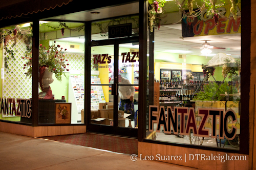
The report mentions that the 100 block of Fayetteville Streeet is not as active as the higher ones and that signs could attract visitors from the convention center and hotels down towards it. I always thought the grand capitol building standing right at the end in plain sight was reason enough for people to walk all the way down but maybe not. On a walk yesterday I made a point to look out for the signage along Fayetteville Street to see what our current situation is like.

From a pedestrian view, Fayetteville Street does lack some signage. As you walk down the street, it is a mystery as to what the next shop may be. I think some may still like this approach, it would be like exploring the street to see what it can offer you. However, with signs coming out over the sidewalks, a pedestrian could view many options and possibly make a better decision on where to go.


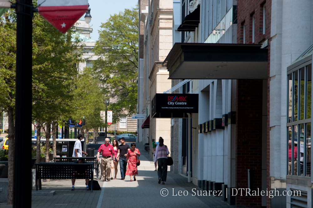
A pedestrian looking down the street here can’t see much.

It’s kind of like the difference between ordering the buffet or ordering off the menu. At a buffet, most new people look around to see what is available then decide what to eat. A menu shows you everything available easily, then you decide what you want. Signs that can be easily seen by pedestrians can be the “menu” along Fayetteville Street.

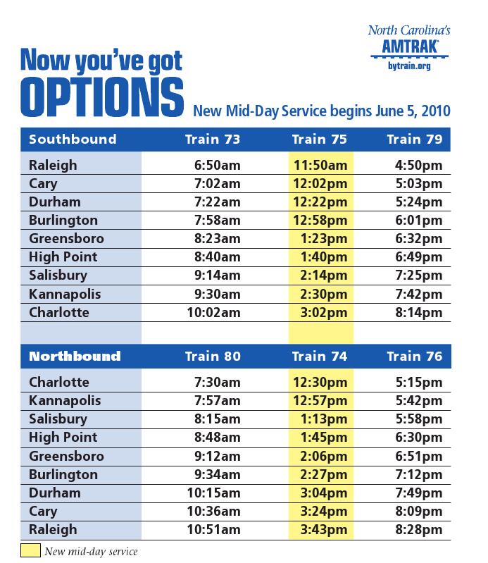
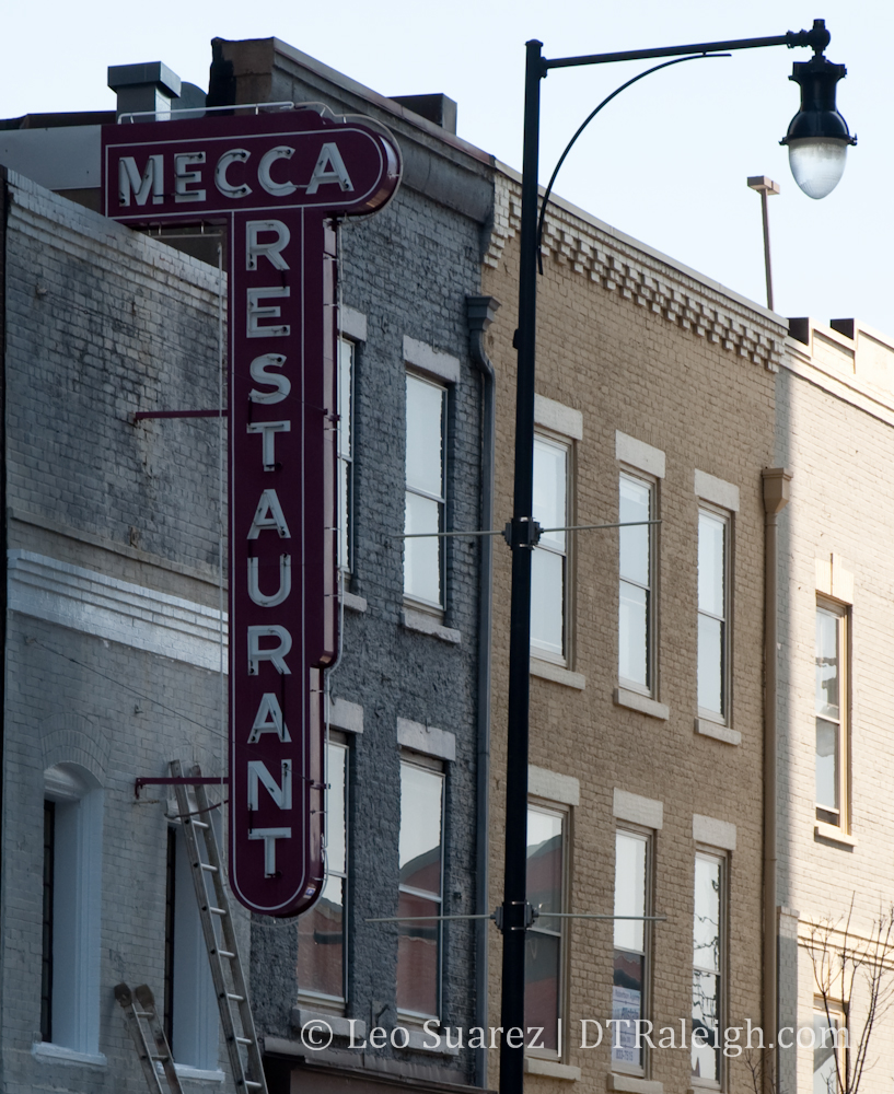
But presenting this “menu” is probably the real touchy part of this conversation. They definitely don’t make signs like they used to (see the Mecca picture) and in my opinion, you’ll hear a big outcry against anything that’s too bright and bold. If left unchecked, a busy street would be overwhelmed with large, bright signs competing with each other to get your attention. So we need to reach a balance here. At the bottom of the Downtown Raleigh section of the comprehensive plan are some suggested guidelines for signage: (page 49)

Signage should be compatible in scale, style, and composition with the building or storefront design as a whole.

Diverse graphic solutions are encouraged to help create the sense of uniqueness and discovery found in an urban, mixed-use environment.

All mechanical and electrical mechanisms should be concealed.

Signs should not obscure a building’s important architectural features, particularly in the case of historic buildings.

Signs should be constructed with durable materials and quality manufacturing.

Sign bands above transom and on awnings are preferred signage locations.

Only the business name, street address, building name, and logo should be on an awning or canopy. The lettering should not exceed 40 percent of the awning area.

Illuminated signs should avoid the colors red, yellow, and green when adjacent to a signal controlled vehicular intersection.

Allowed sign types: channel letter signs, silhouette signs (reverse channel), individualized letter signs, projecting signs, canopy/marquee signs, logo signs, awning signs, and interior window signs.

Discouraged sign types: signs constructed of paper, cardboard, styrofoam-typematerials, formed plastic, injected molded plastic, or other such materials that do not provide a sense of permanence or quality; signs attached with suction cups or tape; signs constructed of luminous vacuum-formed plastic letters; signs with smoke-emitting components. Changeable copy signs are prohibited.

I’m sure these guidelines can be interpreted in many ways. Too restrictive? You be the judge.

I believe that word of mouth is still more powerful then an attractive sign that lures someone in but thinking about new visitors to downtown, proper signage is important for Fayetteville Street. New visitors may feel more comfortable knowing about all the options in downtown and it only helps to land repeat visits in the future.

NCDOT Announces Mid-Day Service Between Raleigh and Charlotte, June 5th

From my inbox to yours.

Raleigh— State Transportation Secretary Gene Conti today announced that two additional trains providing mid-day service between Raleigh and Charlotte will begin on Saturday, June 5, increasing the state-sponsored passenger rail service to six trains operating daily between the state’s two largest cities.

“As our population continues to grow, we must provide people with travel alternatives,” said Conti. “Train travel also provides environmental and energy benefits through reduced congestion and improved air quality.”

Currently, the state sponsors four trains daily, the Piedmont and Carolinian, as North Carolina’s Amtrak. Each train makes a morning and evening run between Raleigh and Charlotte, a trip that is auto competitive at 3 hours and 7 minutes, including intermediate stops at Cary, Durham, Burlington, Greensboro, High Point, Salisbury and Kannapolis.

The new service will add two additional trains in the mid-day giving business travelers, families and college students more options to travel via rail. (See attached schedule.)

The Carolinian also provides daily service to Selma, Wilson, Rocky Mount, to Richmond, Virginia and to the northeast including Washington D.C. and New York City.

Federal Rail Administration Deputy Administrator Karen Rae will address the N.C. Board of Transportation at its meeting Wednesday, March 31 regarding the Obama Administration’s policy on transportation choices as a part of building more livable communities and sustainability.

Rae, Conti and Rail Director Patrick Simmons will be available for media interviews regarding the North Carolina’s new mid-day train service between Raleigh and Charlotte; the $545 million in American Recovery and Reinvestment Act funds awarded to the state in February; and the FRA inspection of NCDOT rail equipment, facilities and capabilities from 2:45 p.m.- 3:15 p.m. via telephone by dialing 1-877-531-0014 and then access room# *8569289* and onsite in room 117 in the Transportation Building at 1 S. Wilmington St. To view the live Board of Transportation Web feed, visit http://wms.its.state.nc.us/dotlive.


Click for larger.

Two-way Conversion on Morgan Street

It may have gone unnoticed since the construction work was at night but Morgan street is well underway to becoming a two-directional street. This applies to the section west of downtown, as the city’s press release states.

On a recent walk up and down the street, I noticed some new pedestrian crossing signals at the intersection of St. Mary’s Street and Boylan Avenue. Looking at it now, the roundabout at Hillsborough and Morgan is also very pedestrian friendly. This is a nice plus for the downtown walkers coming in and out from the west.

Downtown to the NC State Bell Tower should be a very nice walk once the construction is done.

RDU to DTR Bus Connection Proposed by Triangle Transit

Triangle Transit is proposing a couple changes to its routes and one could result in a direct bus ride from downtown Raleigh to RDU airport. The route would also include the Research Triangle Park. (RTP) Try to keep up with all the acronyms.

Currently, the easiest way to get to the airport using Triangle Transit from downtown is to ride route 105 to the Regional Transit Center (RTC) in RTP. Then from there, you transfer to the 747 route and your way to the airport. 747, get it?

The proposal attempts to eliminate the transfer and offer a direct ride from the Moore Square station, up Hillsborough Street to Wade Avenue, and down I-40 to the airport. The route would run Monday through Saturday at these proposed times [broken link]. Check the Google map below for more details about the route and proposed stops.


View RTC – Moore Square via RDU Airport in a larger map

The current schedule of events puts this route and other changes into affect in August 2010. These changes are open for comment so click on over to their site and let them know what you think.

The frequency of trips has me most interested. A 30-35 minute ride from downtown to the airport at 30 minute intervals during the AM and PM rush hours is a nice improvement. Make a note that the bus route stops at each terminal for easy access. The downtown Marriott and Sheraton are only a five or so minute walk away and the Clarion is right on Edenton Street where the route will go. You can’t say its not tempting to spend the $2 one-way ticket for a bus ride to the airport terminals compared to a $20 taxi.

Baseball In Downtown, Devereux Meadow Meets Progress In Raleigh


Courtesy of the North Carolina State Archives

It’s no secret but most people don’t know about the baseball stadium that once stood near downtown. That’s right, at one point in time, minor league sluggers were blasting home runs onto what would eventually become Capital Blvd. The ballpark once sat in the area highlighted in the map below and this is where I’d like to focus the conversation today.


Click image for wider view.

Raleigh’s Team
The Raleigh Capitals once played at Devereux Meadow Ballpark which was located along present day Peace Street between West Street and Capital Blvd. The stadium was built in 1938 and baseball had its up and downs here until the site was cleared in 1979. In the name of “progress”, the area was then used for city services, a parking lot for waste disposal vehicles really. I want to highlight two articles I found that mention the stadium meeting the wrecking ball, written around that time.

Sentiment Surrounds Wrecking Of Park – The Time-News June 27, 1979.

Wrecker’s Ball Puts End To Ballpark – The Tuscaloosa News June 27th, 1979.


Courtesy of the North Carolina State Archives

What is there now?
The area today contains few offices or very little of anything representing density or urbanity. The city has been using the lots for parking waste services trucks and other utility vehicles. A few businesses reside off West Street in “off the beaten path” office space with very little car and pedestrian traffic on West Street.

However, the more important resource in this area is the Pigeon House Branch Creek that snakes through the Devereux Meadow site and hides underneath certain streets in downtown. Here’s an excellent blog post tracking the creek through the site. Last I checked, the creek was on the state’s list of impaired waterways and the city is trying to remedy this. One example of a fix has been the water garden at nearby Fred Fletcher park. I bet most readers have driven or walked through this area and never knew that a creek was flowing underneath.

The Future
As far as I know, there are no plans for Devereux Meadow at this moment. Ideas of a river walk have come up but nothing has materialized from that. It’s all talk at this point but that allows the online peanut gallery here to dream up ideas for this large piece of property on the edge of downtown.

More on that later….