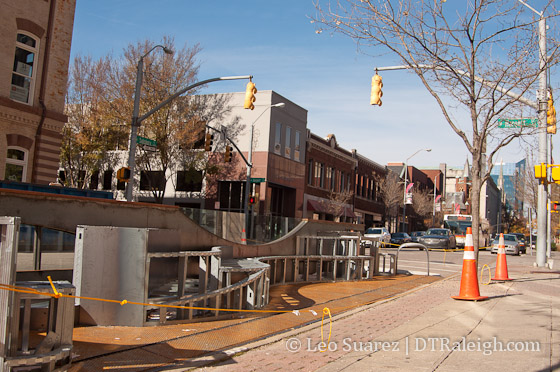
The Raleigh Space parklet on Salisbury Street continues to evolve and the team is still working on it. The parklet was installed in early October and is Raleigh’s first.

The Raleigh Space parklet on Salisbury Street continues to evolve and the team is still working on it. The parklet was installed in early October and is Raleigh’s first.
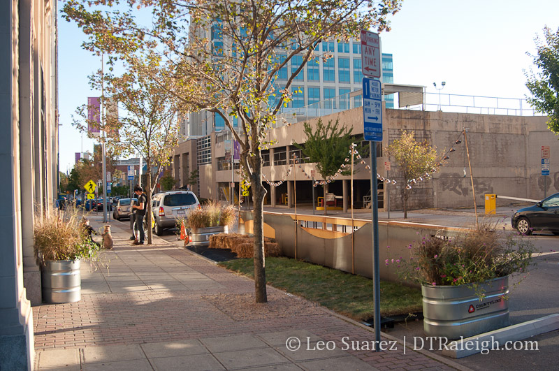
Raleigh’s first parklet at Salisbury and Hargett Street opened last week during the city’s Wide Open Bluegrass, an event that was part of the IBMA’s World of Bluegrass. They opened it up with live music and now the parklet is open for use.
Come check out @raleighspace and listen to some Kickin' Grass band! pic.twitter.com/Cr514GdtQY
— Tyner Tew (@tynertew) October 3, 2014
Also, check out this fun video of the team behind the parklet putting it together. Congratulations to all of them and thank you for bringing something unique to downtown Raleigh!

Approved last year, Raleigh folks are now working to bring the first parklet to downtown this year. Raleigh [ ] Space is a new initiative consisting of downtown business owners and members of the NC State College of Design to bring the first parklet to the city. The project is still coming together so make sure to keep an eye on it as they work towards their Fall 2014 completion date.
An excerpt from the Raleigh [ ] Space site.
Our logo reflects our vision. This parklet is a space with endless possibilities. It used to be a parking space, and it will be even more than a space to be enjoyed by pedestrians, bike riders and motorists; we envision a space that will house an ever-changing array of design installations. At the same time, we envision functional components that are in high demand on this corner: a place to park/lock bicycles and strollers, a dog-watering station, and possibly amenities for alternative vehicles. Insofar as it is possible, the parklet will be self-sustaining (reclaimed water, solar power).
*Making Space – Ralegh [ ] Space
Follow them on Twitter and stay tuned for a kickstarter that will help the team get to their funding goal.
Also, make sure to walk down to Salisbury Street this week during First Friday for a teaser of the new parklet.
Date/Time: Fri., June 6 from 6 p.m. to 9 p.m.
19 West Hargett Street
Raleigh, NC 27601
919-828-5484
State of Downtown Raleigh 2014 – video link
Note: I hope the video works for you as Granicus didn’t have a download option and their embedded video isn’t the greatest out there.
In the video above you can watch this year’s State of Downtown Raleigh. There’s a good panel discussion that includes O’Hara Macken from Ipreo, Andy Andrews from Dominion Realty Partners (Charter Square), James Sauls, Raleigh’s economic development manager, and Mitchell Silver, our former Chief Planning Officer.
There’s a lot to celebrate with regards to what has been accomplished over the last 15 or so years. One underlying point that I’m hearing in watching this video is that we still need to continue to grow, compete, and keep that quality of life factor high. Great spaces and places, the Dorothea Dix park, and creative energy are the big things being talked about in this video.
Enjoy.
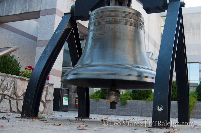
Just a quick one today. On a recent walk around downtown Raleigh, I saw that our Liberty Bell replica, located on the bicentennial mall, has been muffled. Hopefully this isn’t a permanent thing. There’s a bad joke out there, for some anyway, because the liberty bell is located across the street from the state legislature building. :P
While looking up some history about the bell, I found this nice WRAL segment about it. If the video doesn’t load for you, jump to the source.
[UPDATE: 11-10-13]
On a recent walk today, I noticed the bell was not muffled anymore. So we rang that thing as loud as we could.
I know I posted about taking some time away from the blog but I haven’t left Raleigh just yet and I had some time to put some thoughts together on something that I’ve been thinking about.
I went to lunch with a friend this week and we got to talking about the many events that come to downtown Raleigh. Now is a great time to talk about events because if you aren’t aware, downtown Raleigh ROCKS in September. We are at the start of the weekend after weekend after weekend event marathon and for residents like me, you notice all that activity taking place.
From my point of view, talking to other downtown residents, the vibe is a “hesitant welcome” to these events. On one side, all that activity leads to a better downtown with more restaurants, more retail, and more entertainment. On the other, it can bring fatigue when streets are closed every weekend, droves of people buzz around the streets, and noise vibrates the buildings all around us.
Here’s a schedule of some of the larger events, ones that shut down streets and such, that took place already or are coming up.
Quite a bit of activity going on in and around September. That’s six weeks of Fayetteville Street closures. I didn’t even mention other events taking place like La Fiesta del Pueblo (9/8) in Moore Square, The Raleigh International Festival (10/4-10/6) at the convention center, and numerous Innovate Raleigh related event like Triangle Entrepreneurship Week, CED Tech Venture Conference, and DataPalooza. These events take place indoors but still bring activity to downtown.
There’s also a similar event string in the Spring with lots of others sprinkled throughout the year. Road races, corn hole tournaments, food truck rodeos, parades, the list goes on and on.
However, the diversity of these events must be appreciated greatly by residents, and all Raleighites really. It keeps downtown interesting and inclusive to everyone. There are hundreds of other events throughout the year and we’re getting close to having at least one of them touch anyone’s interest no matter how niche it may be.
I remember talking to an area music club owner years ago. He told me once, “If you run a club like it’s your own personal jukebox you’re going to fail.” That sentence has stuck with me for awhile and I think it applies here.
In my opinion, our success in downtown is in part due to the diversity of events taking place. I hope for a long time that downtown continues to be a jukebox with a variety of tunes. If our jukebox starts to sound the same, we know we’re in trouble. If a tune is playing that you don’t like, then sit that one out because one you will like is bound to play soon.
Raleigh, the jukebox of the south!
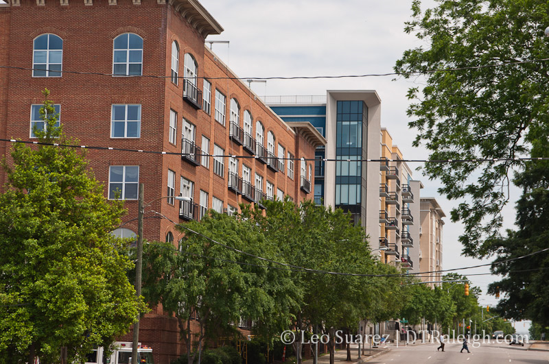
Last week, the latest edition of the Triangle Downtowner came out and my article about downtown living is there for your reading pleasure. In it, I talk about how residential living is really in its infancy in downtown Raleigh and how what we have today came from almost nothing.
In its entire history, downtown Raleigh never had the building stock to support the tens of thousands of urban residents needed for a critical mass. Oakwood, Boylan Heights and other surrounding neighborhoods of single-family homes were where the majority of close residents lived.
“Twenty years ago, Raleigh didn’t have any residential real estate in the city center” says Ann-Cabell Baum Andersen, owner-broker at The Glenwood Agency. “We’re just beginning the process of building out core but you can already feel the electricity on the streets.”
*Downtown Living, Vol. 9 Issue 6 Triangle Downtowner
Grab a paper copy of the latest Triangle Downtowner at a kiosk around downtown Raleigh or read it on Issuu, here.
I had a few exchanges on Twitter recently and the question being discussed was simple. Do you consider Glenwood South to be a part of Downtown Raleigh? This followed with more conversation of what is and isn’t consider to be in downtown.
In cases of real estate or jurisdiction, hard lines specifying what’s in or out are needed. For awhile, I’ve felt that this doesn’t work with locals and visitors. I may have a new way of thinking about this that I want to put on this blog.
I chimed in to the Twitter conversation and gave my personal definition of what areas make downtown. Here’s the short, dictionary-type definition.
Downtown Raleigh is a patchwork of unique, urban districts and the neighborhoods that border them where easy accessibility is possible by all users.
I realize the “downtown or not?” question will always exist but I want to try a different approach to this rather than the traditional “lines on a map” method.
For background, let’s start with the city’s definition. According to iMaps, I’ve redrawn the Downtown Overlay District on this Google Map.
View Downtown Overlay District in a larger map
The railroads must have some influence on this map in some way as most of the west and southern borders are train tracks.
Most of Glenwood South is not considered in downtown but rather a different section called the Pedestrian Overlay District. Not quite the same ring as Downtown but ok.
Next, we have the Downtown Raleigh Alliance and they have broken up the area into districts. The idea of districts have become part of their branding, it’s even in their logo, and terms like Warehouse District and Government District are catching on.
Their site consists of a nice map and with the districts clearly specified. If you are in one of the five districts, you are in downtown.
So finally, I want to remove the maps, remove the boundaries, and try to humanize this a little more.
Downtown Raleigh consists of any areas, blocks, neighborhoods, and buildings that are within the core and around it. I’m loosening the definition a bit because the situation changes for everyone. If you can get out and feel comfortable walking from within the neighborhoods to Fayetteville Street, for example, then you are in downtown. However, if you are at a point where that walk is just a little too much then you are probably located on the fringes or just outside.
This could make a great data visualization project. If the data could be gathered, it would be possible to “draw” what downtown is by the method of how people travel to and within it. Walkers, cyclists, transit riders, and drivers are coming from all over. As you travel away, each method starts to decrease. There are less walkers the further you go. Beyond that, cyclists drop off. Last transit riders aren’t there and only drivers are within reach.
This blog considers downtown Raleigh to be the theoretical area drawn up by all of these travelers together.
I wanted to put this out there as some of you may be interested in a new way of defining Raleigh’s downtown. I also wanted to get this up because I have a feeling I will be referring back to it in future conversations.
Oh, the answer to the original question is yes, Glenwood South is in downtown Raleigh.