Big Drafts at Natty Greene’s In Downtown Raleigh

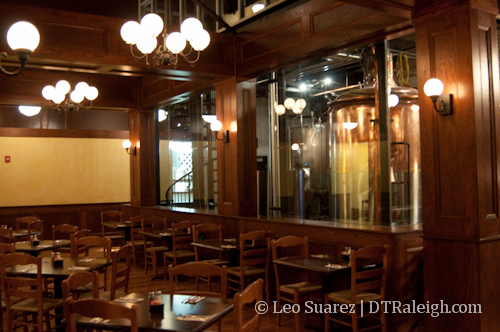
The landmark of powerhouse square in Glenwood South, the Raleigh Electric Company Power House building, has been empty for over a year now but that will all change soon. Greensboro based Natty Greene’s has moved in and will open very soon. The furniture is in place, the beer tanks are brewing, and staff training is currently underway.

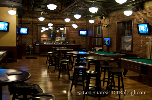
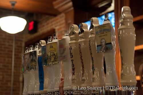
For those that have been to this beautiful space at 505 West Jones Street when Southend Brewery was open, you will be familiar with the restaurant setup. Left of the entrance is the restaurant with space for couples, families, and large groups. To the right is the bar area with high tables and chairs. Each are separated by the huge beer tanks in the center, on display for everyone to see. The upstairs “loft” will be used for private parties or large functions. The back room through the bar is the game room with another bar, pool tables, dart boards, and a shuffleboard.

Natty Greene’s is open now but look for an official opening date around St. Patrick’s day.

Tracking Buses Online and On Your Phone

Recently, the city has created some online and mobile tracking services for the buses in Capital Area Transit. The best part is that they all have maps associated with them. I love me some maps.

For downtown, this includes the R-Line, which is technically part of CAT and is shown on the CAT tracking page. The Downtown Raleigh Alliance (DRA) tracks the R-Line on their page as well. Below is the link rundown so update your bookmarks.

DRA live map
www.godowntownraleigh.com/get-around/r-line/status

DRA live map mobile version
m.yourhere.com/rline-map.php

CAT Bus tracking
raleighrides.org/

NCSU Wolfline Tracking
ncsu.transloc.com/

I’m mentioning the Wolfline tracking system because it has been around for years and is still the better service of the few, in my opinion. Take a look at it to see what all the services should work towards becoming one day.

The R-Line mobile site is easy and straight to the point. If you have a smartphone, you can pull up the maps with the location of the buses pinpointed on the route in real time. The bus stops are marked by their appropriate names so finding where you are on the map is easy once you are at an R-Line stop. Streets and their names are also displayed so the map now becomes a personal guide to navigating downtown on your phone. It’s a great start for making the experience of riding a bus slightly easier and puts a system in place that can be easily updated and scaled out as transit in Raleigh grows.