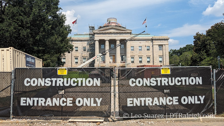
It looks like the renovation and restoration work on the NC Capitol building is wrapping up. The construction fencing is down and you can now walk around the square, mostly. This is a good time to snap a photo of the historic capitol while the new copper roof is still showing some shine. Pretty soon, it’ll oxidize and turn that green color we all know.
Above is a video recording (watch it directly on YouTube) of a virtual meeting hosted by the Downtown Raleigh Alliance and Interface Studio where they take attendees through some of the things coming out of the Downtown Raleigh Economic Development Strategy project currently in progress. We’ve mentioned this project earlier in the year and this video is worth watching as it focuses mainly on Fayetteville Street. The team shares ideas that may lead us to new ways to reinvigorate the street.
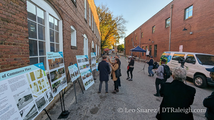
The city is making plans along Commerce Place and had it closed down for November’s First Friday to give citizens and visitors a light taste of what it could become in the future. They envision a more people-centered place where cars are either allowed as “guests” or restricted all-together.
Have you been by the North Carolina Capitol lately? The classic looking blue dome (although I sometimes think it’s green at certain times of the day) is being replaced right now with new copper panels. That’s just one of a few other renovations that are coming to our modest, yet architecturally significant, capitol building.
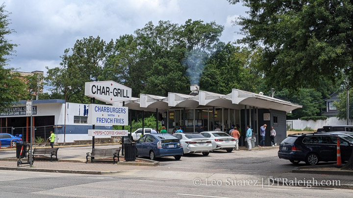
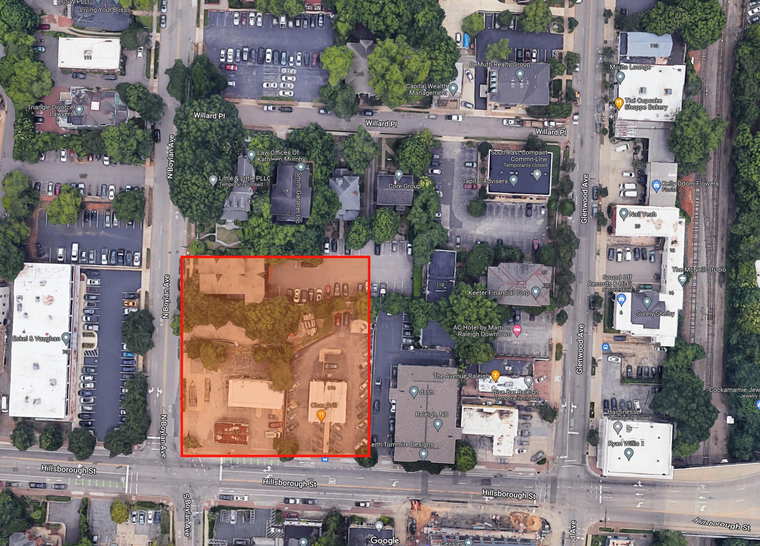
In June, the city’s neighborhood meeting calendar posted an update for a possible rezoning for properties along Hillsborough Street including the beloved local spot, Char Grill. The news picked it up. Comments were made. Opinions were everywhere.
To be clear, the rezoning request has not been submitted as of this writing but I want to mention two items right up front:
Char Grill owns their lot and plans to incorporate a Char Grill location in any new development
Comments from them suggest a thoughtful development with respect to any historic structures nearby
Instead of typing out comments online and looking at Google Maps (well I did some of that) it was time to get a steak junior and walk the block.
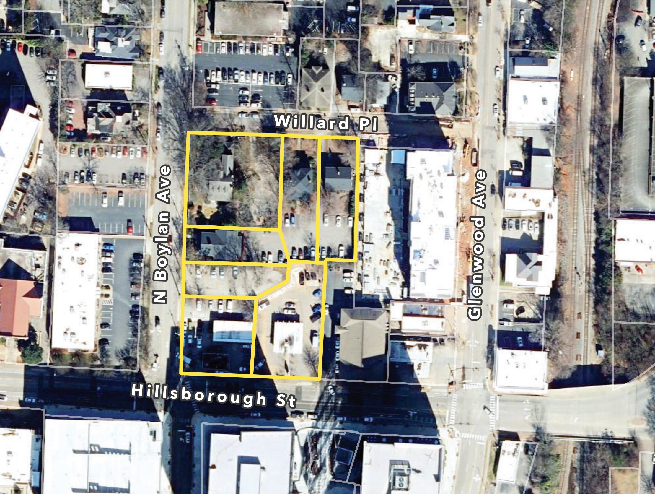
NOTE: I call it the “Char Grill Block” since that’s the most important thing there (let’s be honest) but not all properties are planned for a rezoning.
From the neighborhood meeting notes, the following properties seem to be targeted for rezoning. Char Grill is on the southern end about midway between Boylan and Glenwood.
Walk the Block
Let’s start with Char Grill and go clockwise around the map shown above. Since the rezoning application hasn’t been submitted yet, I’m also not going to get into possible heights and conditions today. Let’s just look at buildings.
Char Grill doesn’t need an introduction here. Open since 1959, the burger and fries spot has one of the best walk-up windows in downtown. It’s not exactly a drive-thru in the modern sense but plenty of space is given to parking also.
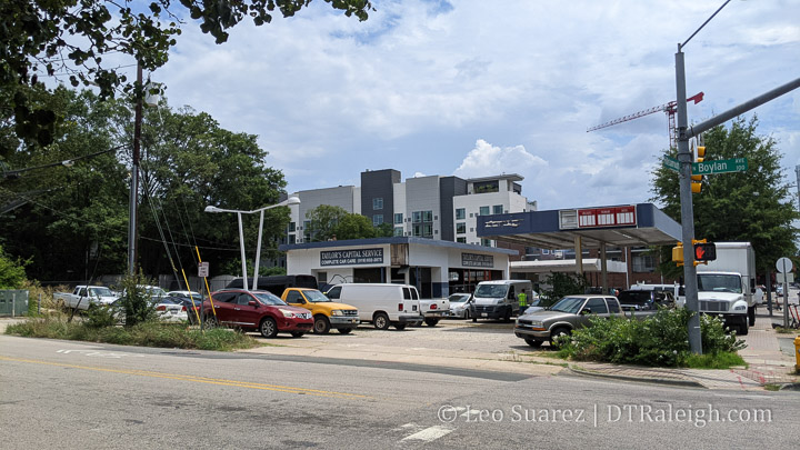
On the corner of Hillsborough and Boylan is a closed gas station. Built in 1952, it has gone through a variety of gas and car service brands. Today, it seems to be used for parking for nearby construction projects. When I was walking around, there is work going on for something in a retail space across the street at Bloc 83 and the workers were parking here.
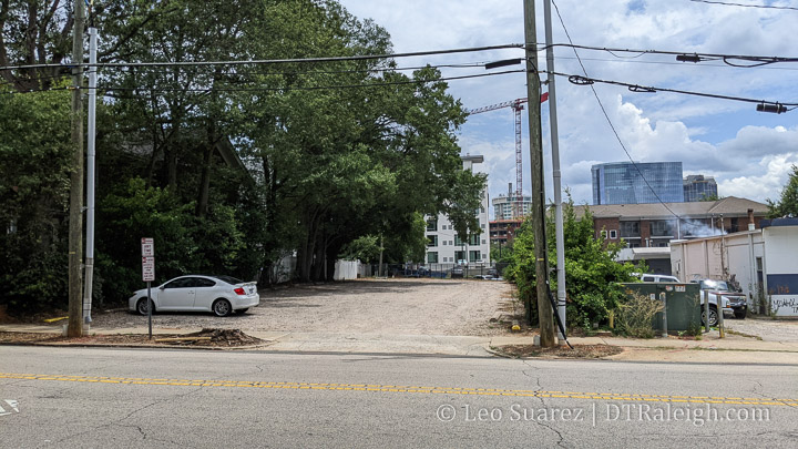
Next is a gravel parking lot. Not much else to add here.
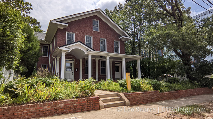
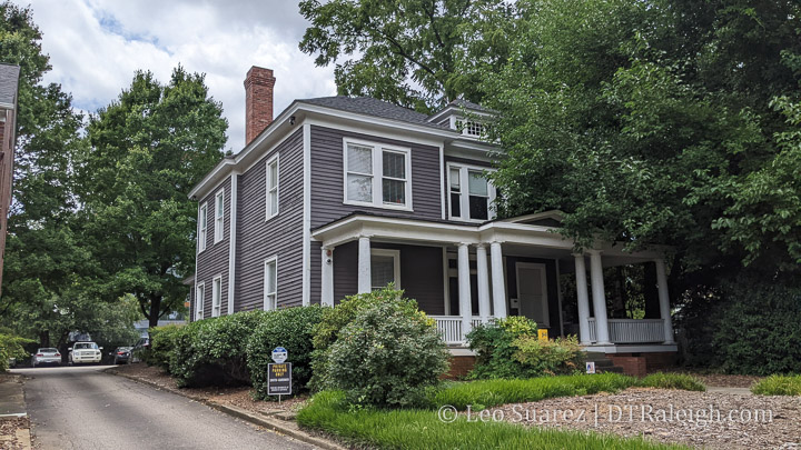
The environmental engineering firm Smith Gardner operates out of a few houses on this block also. Along Boylan, is this red brick house from 1910. Employees probably park in the adjacent lot.
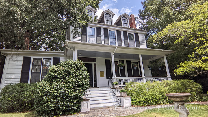
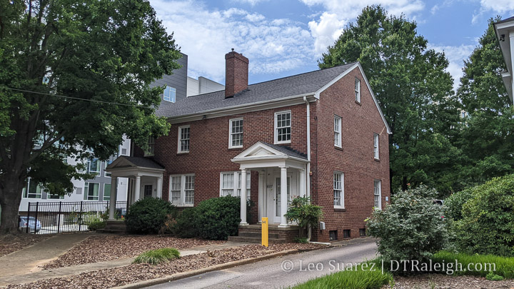
At the corner of Boylan and Willard, we have Elmwood. Elmwood is a beautiful house from 1813 and is currently used as office space. Elmwood sits on the National Register of Historic Places. The side yard along Willard is a gravel parking lot.
Finally, there are two more 1910 homes along Willard being used as offices by Smith Gardner, shown above. Their backyards are basically gravel parking lots also. Turns out, all three houses that Smith Gardner is using is owned by the same company.
Speculation
No details are out there of what is going to be built, we’re not at that stage yet. I feel in the minority here as Elmwood, not Char Grill, is the property I’m most interested in with respect to any new developments. Of course, people are most distracted by the Char Grill being demolished, the youngest building mentioned in this post, but I’m in the camp that honestly thinks they could use an upgrade. (or at least a serious power wash)
For me, Char Grill’s walk-up window is fantastic. If the new development can get a Char Grill in there with an active walk-up window, some outdoor tables, and indoor seating like their newer locations, it’ll still be a hit.
Focusing on the older homes behind Char Grill, you can’t help admit that there is a lot of gravel parking spaces that could be used more efficiently. The brick building at 14 North Boylan could be moved to sit on Elmwood’s gravel lot. If you do that, you square up a nice property for some taller development. It could look something like this.
Again, just speculation but the houses can be saved and the red square in my sketch up here can be developed. If the houses continue to be office space, parking can be tucked inside the new development.
We’ll get back to this once the rezoning is submitted and discussion by planning commission and city council takes place. Until then, keep eating steak juniors.
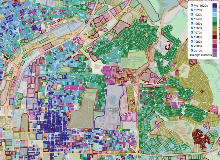
Lately, I’ve been less active on the front-side of the Raleigh House of Connoisseur but have been heads down working with creating a new map. I don’t think I’m finished and honestly, haven’t even started any type of analysis, but I wanted to put an update out there and share something with readers.
I was inspired when I stumbled on this map of Paris, introduced by the tweet shown below. Technically, it was something I wanted to see if I could build for Raleigh but also, it would be interesting to see how the buildings of today have held up. Are we seeing “mass teardowns” as some people think? What other questions might we begin to answer?
Buildings of Paris from before 1800 vs 1800-1914. A reminder of how overwhelmingly what is widely celebrated in Europe's urban heritage is really the heritage of the long nineteenth century. From this brilliant database: https://t.co/fzXP1SFIQ0pic.twitter.com/8VAwR41mMK
I then found the “ingredients” on the city’s open data websites around Raleigh parcel data and using the “year built” field, I starting analyzing over 130,000 pieces of data.
The Map
The map I put together shows Raleigh’s existing stock of buildings as of May 2022. It’s important to note that this is a snapshot in time, not buildings constructed over time. For example, if a home built in the 1950s was torn down for a new construction home in 2015, the parcel would show in the 2010s decade, not the 1950s.
Please note that the property shapes have been optimized so that the map is somewhat usable. Don’t take them literally.
I grouped properties by decades with an additional “Pre-1920s” category. This was driven mostly by number of buildings as the counts before 1920 is pretty low. Here’s a bar chart.
That it?
Probably not. I’m releasing it into the wild and see how it sits for awhile. We are discussing it on the Community on this thread so if you have any questions or thoughts, please join us.
I’m hoping to continue tinkering with this map and see what we can extract from it. Questions I have could be:
Are there neighborhoods that have been completely turned over?
Are certain neighborhoods less susceptible to teardowns than others?
Where do you see a mix of buildings being produced at a constant rate?
Why is the building count in the 2010s so much lower?
How might annexations and border expansions played a role over time?
How might protectionist overlays, like NCODs and historic overlays, played a role?
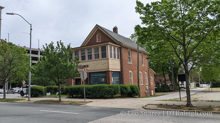
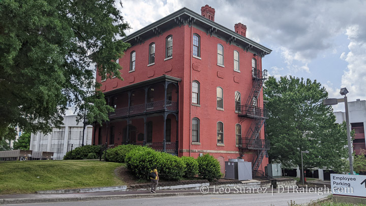
Pictured above is the Pope House on South Wilmington Street. Currently a museum run by the city and registered historic landmark, the house belonged to Dr. Manassa Thomas Pope, a doctor and prominent businessman in Raleigh who would later run for mayor in 1919. It is also the only African-American house museum in the state of North Carolina.
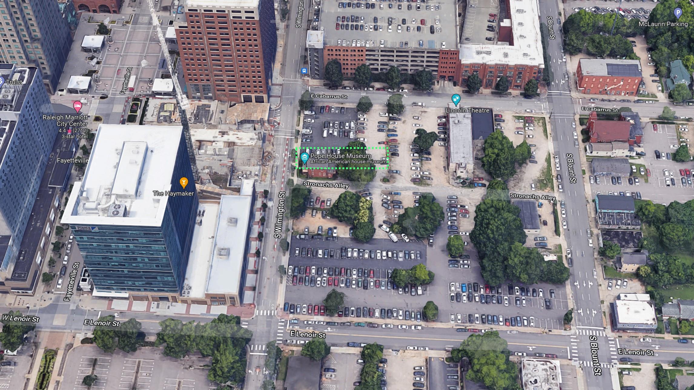
100 years ago, this block of South Wilmington Street was covered by homes and the Pope house fit in nicely. Today, it’s floating in an ocean of surface parking with high-rise office towers nearby.
A collection of lots on the southern half of the block is currently going through a rezoning. (Z-1-22, pdf link) The request is to increase the height allowed from the current seven stories to a new limit of 20.
Construction in the area is taking its toll on the Pope House.
During a meeting with the Raleigh Historic Development Commission in March 2022, it was reported that construction from nearby Charter Square probably contributed to some structural damage to the house. To help with this rezoning case, it was asked if other construction techniques could be used that would not damage the historic structure.
The rezoning has not reached the city council for ultimate approval yet but it may be time to consider a serious move and uplift to the Pope House Museum.
A case NOT to move houses
I recognize that buildings and structures that remain on their original locations is a far-superior representation of the time that they once served. I can’t imagine what the 500 block of South Wilmington Street could have looked like with a variety of single-family homes. The Raleigh of the 1920s is practically another reality compared to today and at least for me, during my visit of the Pope House a few years ago, you could get a sense of it’s prominent location.
Dr. Pope’s house was close to East Hargett Street, or Black Main Street, which he and his family frequented. He also graduated from nearby Shaw University. You can kind of “travel back in time” and get a sense of the connectedness that his family had in the area.
If the house was moved a few blocks to the east, for example, placed between new construction homes of the 2020s, that history and sense of place, even if you have to really imagine it, is pretty much lost.
There are also practical issues such as major damage during a move, the cost of moving a house, and securing a new location. Think of the logistical challenges of moving a historic home through the streets of downtown Raleigh.
A case FOR moving houses
It just seems so simple. Move a house away from a site and you save it from demolition. We’ve done this before and it happens all over the country.
The house that once was a home may be reused as an office or even hotel. There is of course the risk and the cost but if a house is moved, it may stand for a hundred more years, continuing to tell its story.
Demolishing a house, or any structure, can also be seen as disrespecting the value that it currently brings. The materials and work that went into the house just vanish and end up in a landfill, most of the time anyway. To move a house, it saves that value and transfers it to another location. There’s a sense of sustainability here.
The List
When it comes to the Pope House, there are no plans to move it as of this writing. At the same time though, I did want to create a list of notable house moves around downtown Raleigh to kind of show that it’s not a far-fetched idea. If there is anything that I may have missed, let me know and we’ll get it added.
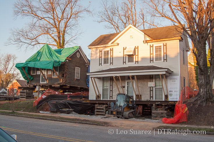
Guest House Raleigh
The boutique hotel, Guest House Raleigh, was originally located at 114 East Lenoir Street. On a cold Sunday in February 2017, along with its neighbor at 112 East Lenoir, the houses were moved to their current locations on Bloodworth Street.
For more, I’ll pass you over to an article in Walter Magazine as well as some great photos on the hotel’s Instagram page, the best being the one embedded below.
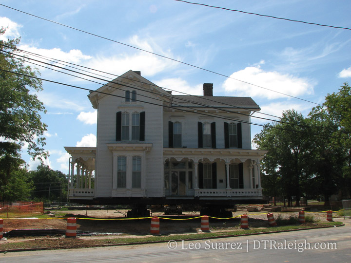
In 2008, the Merrimon-Wynne house was moved from it’s location on North Wilmington Street to its current location on Blount Street. It was only a two block move but the house has some considerable size and is one of the largest house moves to take place in Raleigh. It used to sit about where the Elan Apartments are today.
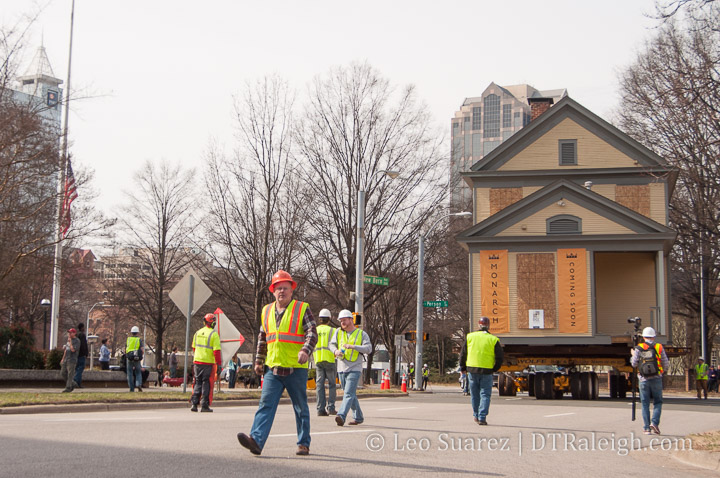
Seaboard Coast Line Railroad Building
Probably the largest move to take place in downtown was that of the Seaboard Coast Line Railroad building shown above. The building was used as offices for the railroad for a long time and sat on the 300 block of Halifax street. Note, this street doesn’t exist anymore as the state government complex built over it all.
They did move the office structure to the west onto Salisbury Street sometime in the 1970s to where it sits today. More on that, with older photos, in this post on Goodnight, Raleigh.
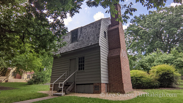
Andrew Johnson Birthplace
North of downtown is Mordecai Historic Park which contains a house that is the birthplace of President Andrew Johnson, born in 1808. It’s original location was somewhere on the 100 Block of Fayetteville Street and has been moved three times.
In 1975, it found it’s way to Mordecai Park where it still stands today. More on that story here.
Levin-Tarlton House
I actually have a post on this move. This house was moved off of 208 North Harrington Street before The Metropolitan apartments were built. The house currently sits at 414 New Bern Avenue. There is some fun video from Instagram in the post so do check it out.
Quick Mentions
The Lincoln apartments on East Hargett Street was built on a block that only contained single-family homes. I talked to the developer of that project once and he told me that many of the homes there were actually moved instead of torn down. They sit in various spots south and east of that building.
Several of the elegant mansions on Blount Street were actually moved from a spot nearby to their current location including the Capehart House and Lewis-Smith House.
The Hume House and the Tucker House on Person Street are also not on their original locations.
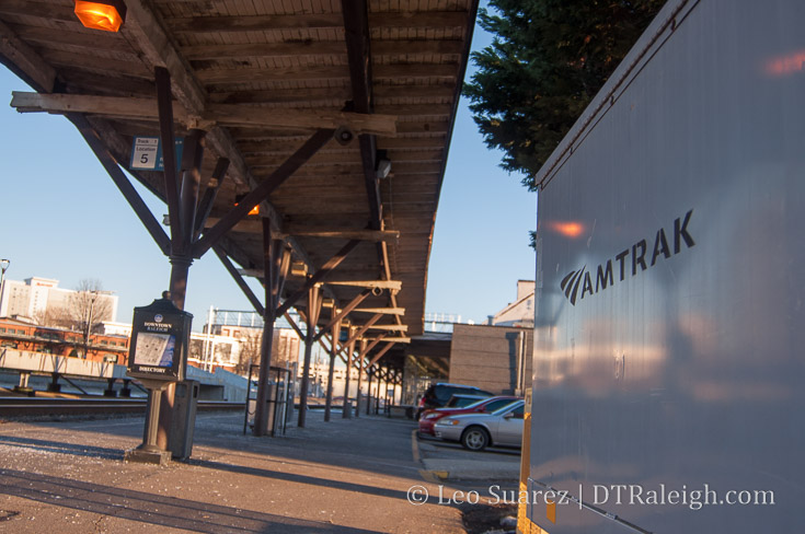
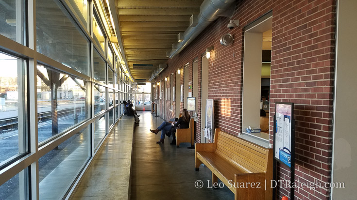
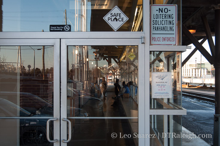
Outside waiting area of Raleigh Station. January 2018.
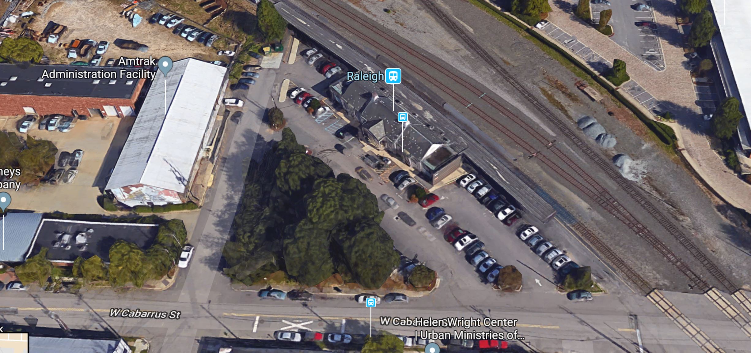
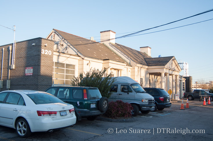
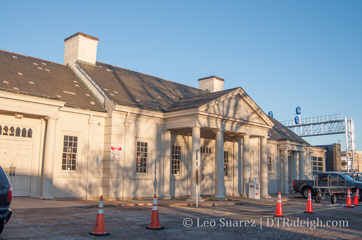
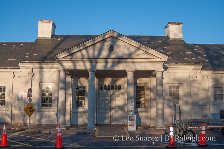
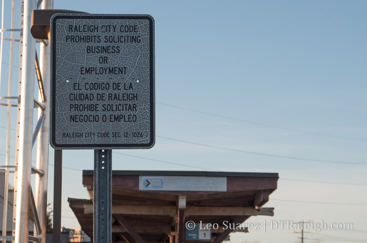
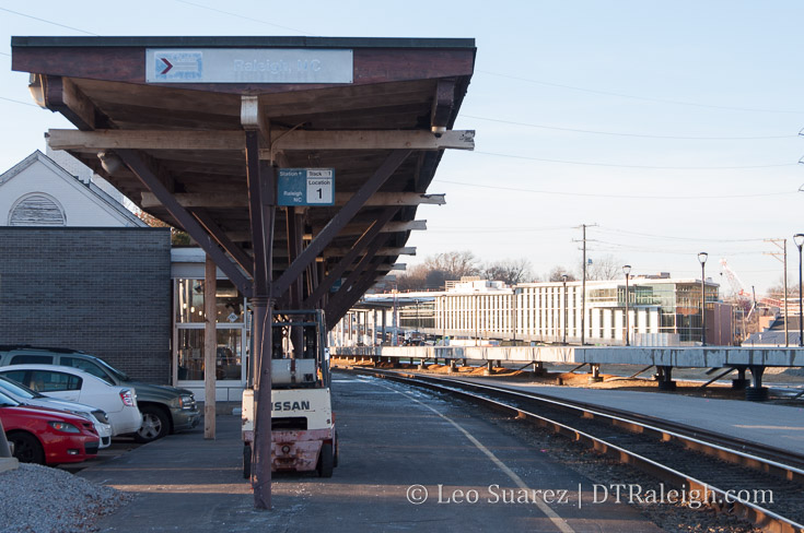
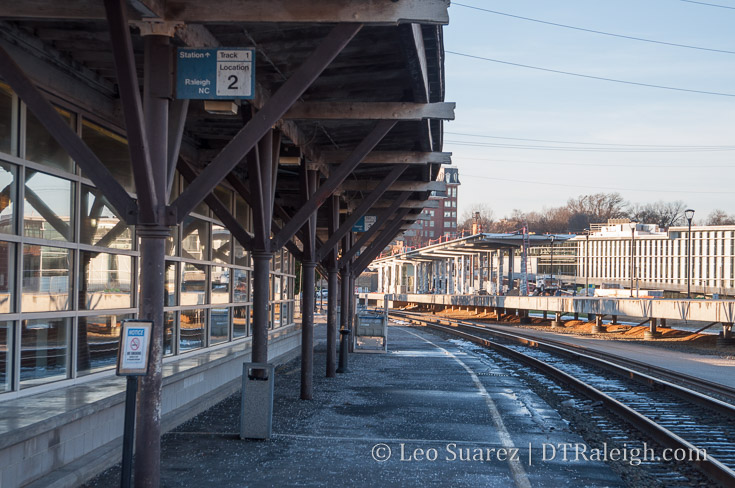
With the opening of Raleigh Union Station only a few months away, I just had to capture the look and feel of Raleigh Station, our current train station on Cabarrus Street. This post is basically just a bunch of photos for posterity to show the station that has served Raleigh since 1950.
If you can make it down there in the next month or two, it is such a drastic difference between the upcoming station and the current one. It really feels like Raleigh leapfrogged our next train project and just went two levels higher instead.
The splintering wood, the rusty metal, and the washed out signs basically show a station that has reached its end-of-life. The interior is nothing but functional however you can’t help but admire the downtown view.
I’ll be referring to this post in the future but for now, enjoy the photos.
Google maps aerial of Raleigh Station.
Exterior of Raleigh Station. January 2018.
Exterior of Raleigh Station. January 2018.
Exterior of Raleigh Station. January 2018.
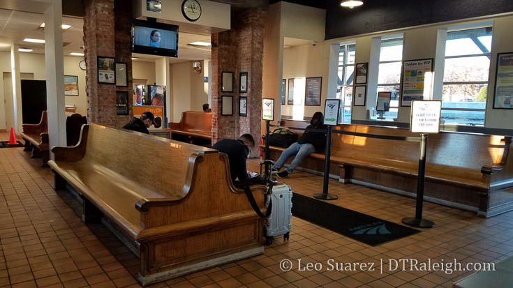
Interior of Raleigh Station. January 2018.
Interior of Raleigh Station. January 2018.
Interior of Raleigh Station. January 2018.
Interior of Raleigh Station. January 2018.
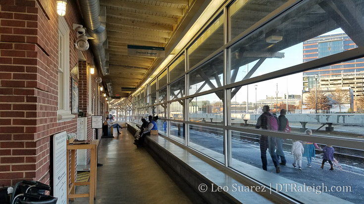
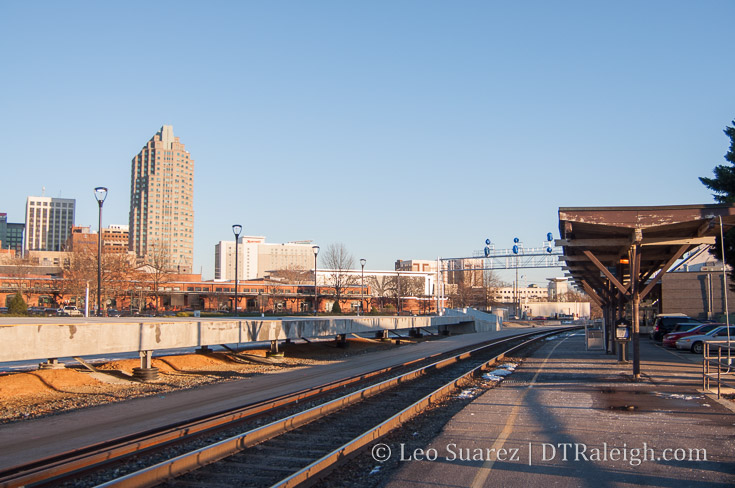
Skyline view from the boarding area of Raleigh Station. January 2018.
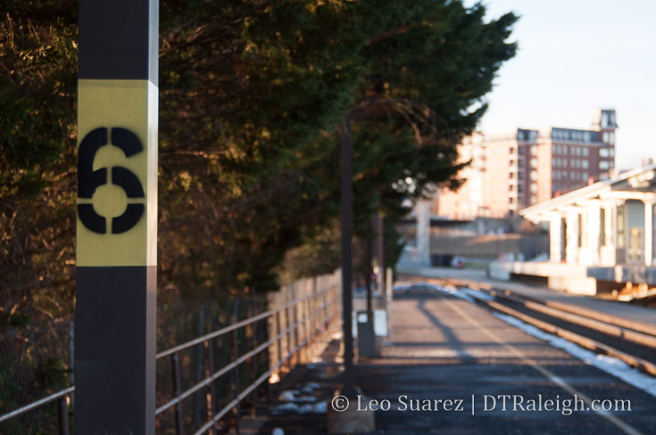
Signs of Raleigh Station. January 2018.
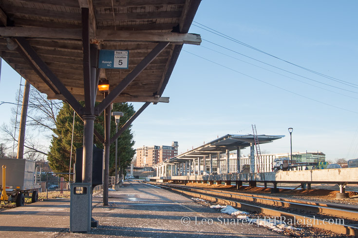
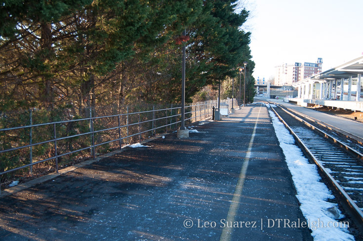
Boarding area of Raleigh Station. January 2018.
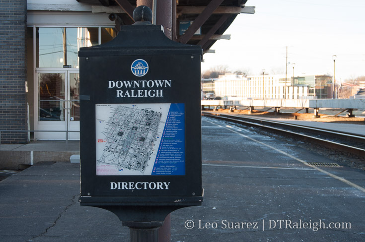
An out-of-date map of downtown Raleigh outside of Raleigh Station. January 2018.
Boarding area of Raleigh Station. January 2018.
One of the entrances to Raleigh Station. January 2018.
Current boarding area of Raleigh Station with new platforms for Raleigh Union Station in the background. January 2018.