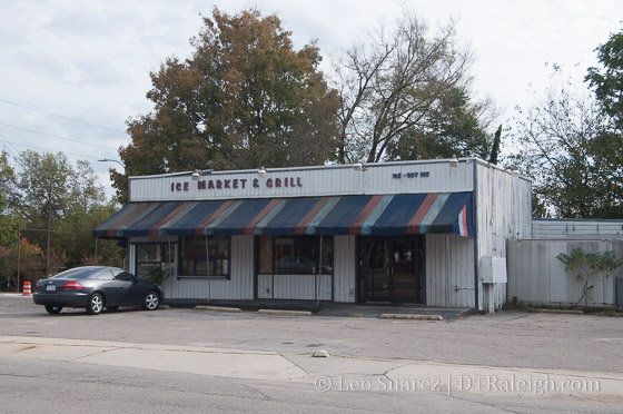
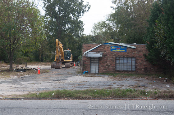
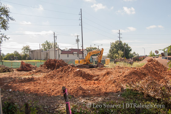
The sites of various car repair shops and the former Ice Market and Grill building have been cleared along West South Street. 42 units of residential are planned for this land, which were covered in more detail in this post.
The sites of various car repair shops and the former Ice Market and Grill building have been cleared along West South Street. 42 units of residential are planned for this land, which were covered in more detail in this post.
The end of South Harrington Street. November 2016.
We just can’t seem to get away from the South Street area.
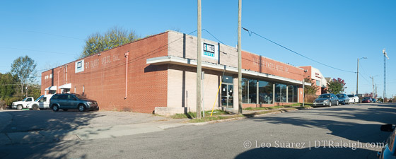
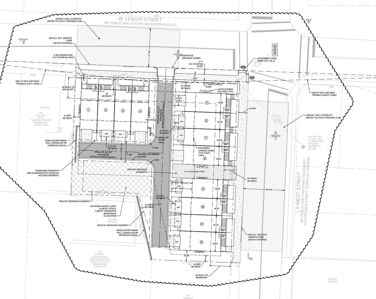
Recently submitted site plans for 522 South Harrington Street are for a “47 unit mixed use residential building with structured parking and street-level commercial space.” The building will be 5 stories tall at 75 feet in height.
The address puts it at the dead end of South Harrington, near the current Amtrak Station, but the development also faces Lenoir and West Street. The reason Harrington dead ends rather than connects to Lenoir is because of a drastic elevation change. You can walk down stairs off Harrington to Lenoir though.
The new project looks like it will take out the auto parts warehouse at the end of Harrington. Parking for that building is located at the very end of the street and faces Lenoir before the elevation drops downward.
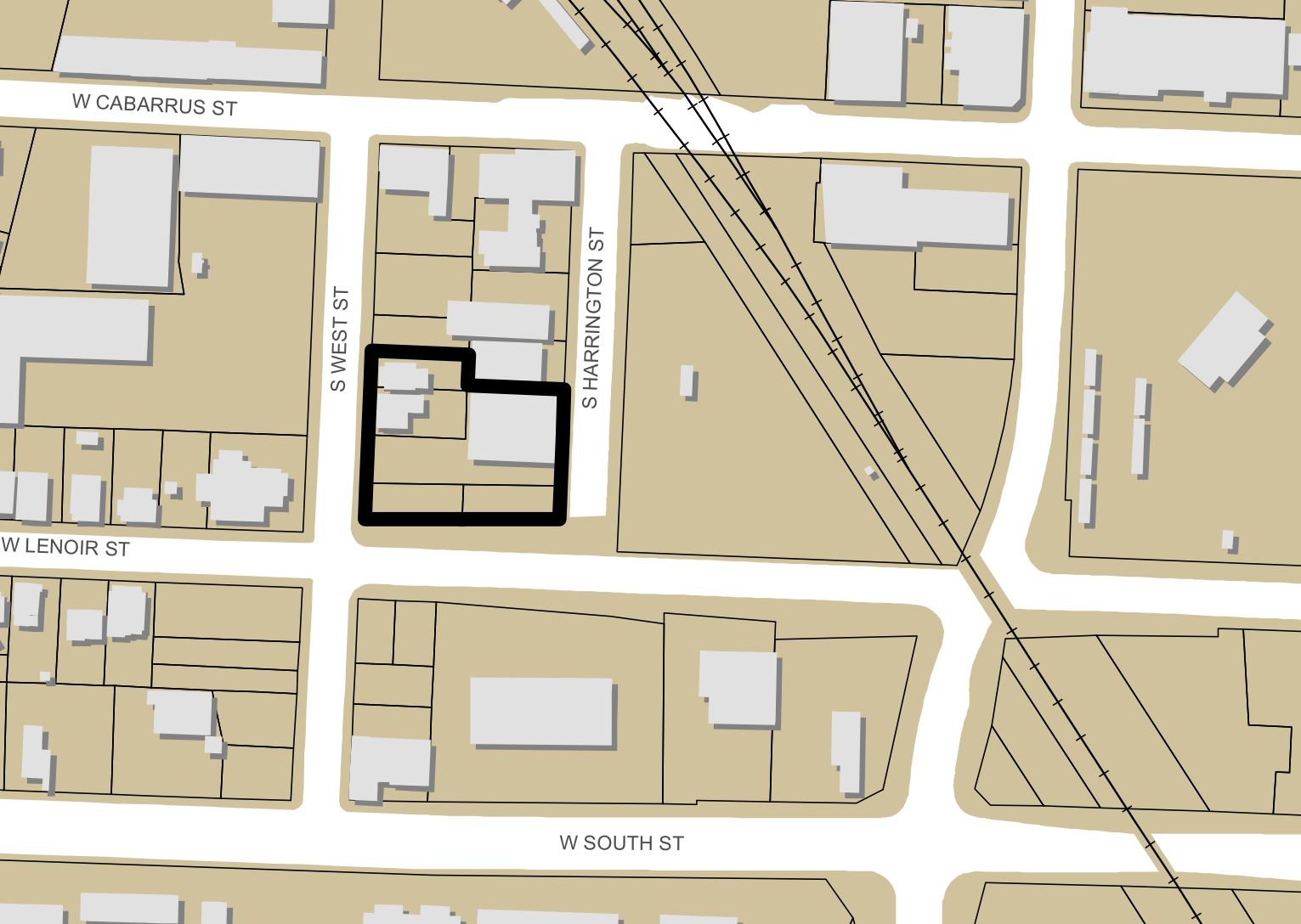
Site Plan map of 522 South Harrington
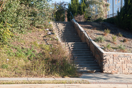
The stairs from South Harrington Street to Lenoir Street

Lenoir Street
Around the intersection of Lenoir and West Street, the development will also take out two houses on West. Perhaps there’s an opportunity to move the houses? The corner is mostly an empty lot and surface parking.
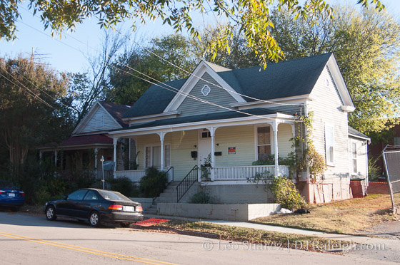
Houses on West Street
With this end of Harrington sitting on higher ground, the units will have a fantastic view of the downtown Raleigh skyline. It’ll be through the power station across the street but it still should be pretty nice.
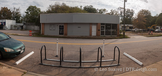
Sticking with South Street this week, a new bike corral has been installed outside of Boulted Bread at 614 West South Street. To my knowledge this is the second one after the widely popular install of the one on Hargett Street outside of The Raleigh Times.
There will also be more corrals installed according to this tweet.
@NewRaleigh it's the next phase of rolling out new bike parking facilities downtown. 3 bike corrals going in this round.
— RaleighMoves (@RaleighMoves) October 4, 2016
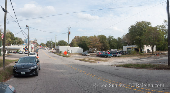
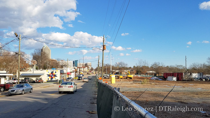
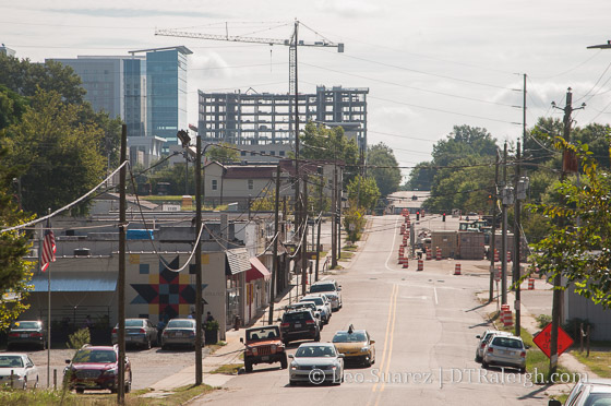
Looking East on West South Street, October 2016
That momentum thing? West South Street seems to have it.
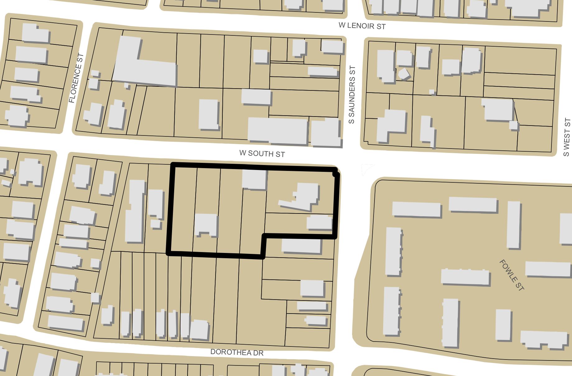
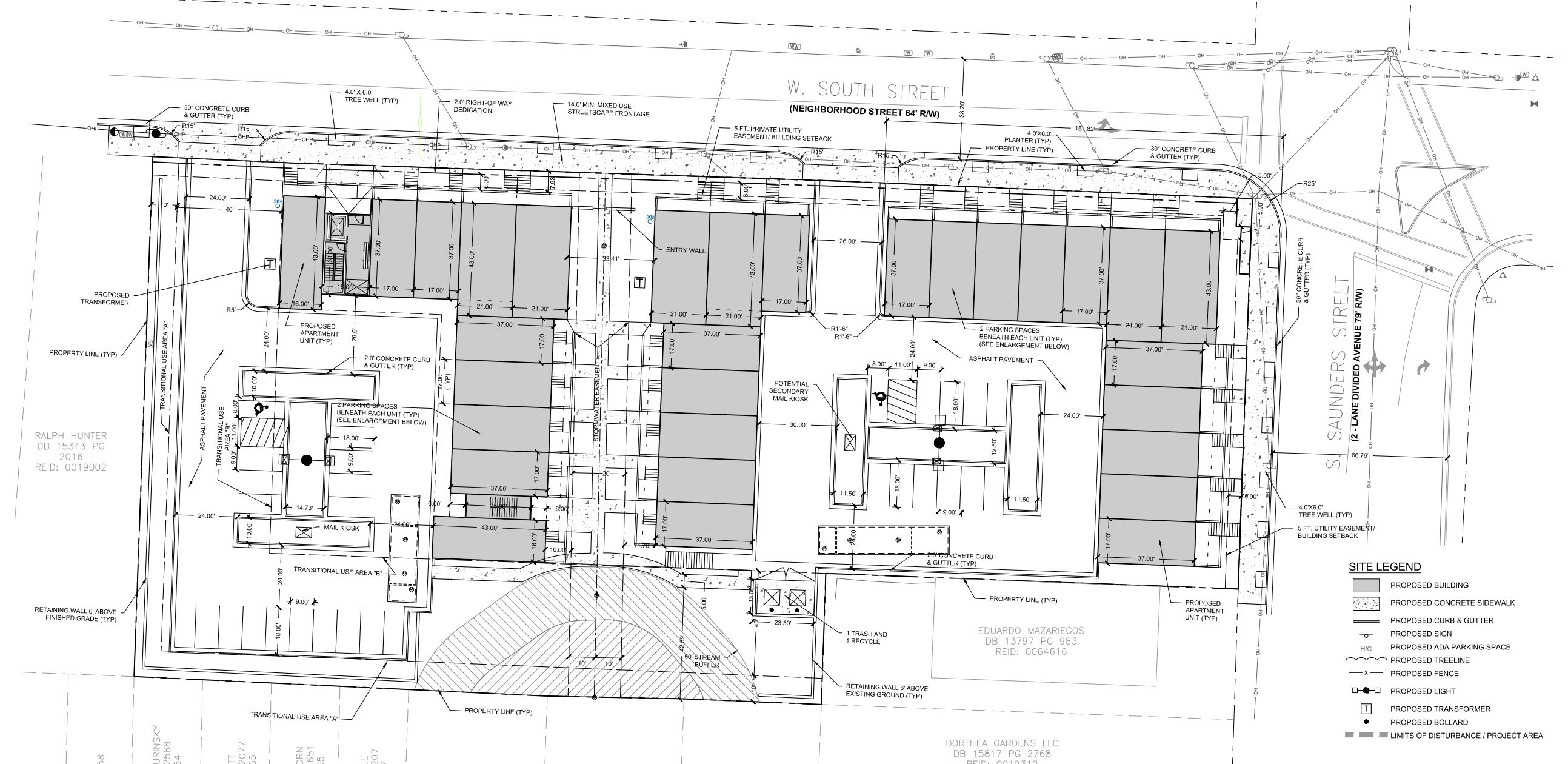
We’ve taken a look at the area before and now new site plans at the city show 42 residential units for a fairly large, combined parcel at the corner of Saunders and South Street.
Lambert Development South Street LLC will clear out most of the properties from Saunders to Florence Street and bring two new residential buildings. At 3-stories in height and a combination of surface and covered parking (covered by the units) it looks like townhomes and/or apartments are planned.
Click for larger
Click for larger
Simply called 611 West South for now, the plan will take out the Ice Market and Grill building, some empty lots, older homes, and auto-oriented business buildings on that side of South Street.
West South Street, October 2016

West South Street, October 2016
West South Street, October 2016

West South Street, October 2016
This area of South is a hugely neighborhood retail area so the lower-scale apartment/townhome combination (or whatever it ends up being) seems like a good transition out of the Boylan Heights neighborhood heading towards downtown Raleigh.
I enjoy seeing units brought up to the sidewalk as well. With 42 units and 78 parking spaces provided, it isn’t the most urban of setups. However, some residents might prefer a quick trip down Saunders and to I-40 for commuting by car.
As the two-way conversion of South Street continues, more residents may find that the 600 block of West South becomes closer to destinations that it was in the past.
West South Street, August 2016
On a warm Sunday morning, I took a walk along South Street, an area of downtown Raleigh that has a lot to talk about. South Street used to be the original southern boundary to the entire city.
Today, you could argue it’s the southern boundary of downtown but generally Western Boulevard/MLK Boulevard holds that title. South Street could just be the boundary of the “walkable downtown” as points south of it have no real business concentration and the area transitions to neighborhoods and wider streets.
The main point of the walk was to get a sense of the two-way street conversion that is currently under construction. With it’s pair, Lenoir Street, the streets have been pointing people in one direction for a few decades. The change may have a significant impact on the area.
Below is a map of points of interest and spots mentioned in this post.
If you don’t see the embedded map, click here.
East South Street at South East Street, August 2016
Going east to west, South starts at East Street in the South Park neighborhood. (You guessed it, the southeastern corner of the original city) There is a mix of single-family homes, some newly renovated with others in varying states of age.
Nearby Lenoir Street makes for a great entrance to Chavis Park. When the two-way conversion of Lenoir is finished, eastbound traffic can come from downtown and into the entrance along Lenoir. Bicyclists can also exit the Little Rock Trail on Lenoir to get into downtown, and vice versa. It’s just a more direct route.
The pull of the park should increase over time as the master plan is carried out. You can read more about it on the project page on the city’s website. While Dix Park is exciting and getting all the attention, Chavis Park will be downtown Raleigh’s true park in my opinion.
East South Street, August 2016
Walking along, the area transitions into Shaw University and for a few blocks, there is a mix of single-family homes and collegiate buildings. Renovations on housing continue here as well with Shaw working on internal changes at the moment.
Recently, Shaw has shown positive signs of getting their books in order as this TBJ article (subscription required) states that employee pay is going up. I wrote about Shaw for Raleigh Magazine as well if you are interested in additional reading on the subject.
As you head past Shaw, you start to enter the Downtown Overlay District according to our development ordinance. While not quite exciting at this time, the area is zoned for urban development at much higher heights.
Standing on the edge of the district at Wilmington Street is a McDonald’s restaurant. I think it’s worth mentioning here as our newest development ordinance may make a big change here.
This particular McDonald’s hasn’t been updated like the ones in the rest of the city and I want to think I know why. If I recall correctly, the owner of this McDonald’s was against the new development ordinance, seen during the public comment period last year, and claimed the ordinance would prohibit him from making renovations.
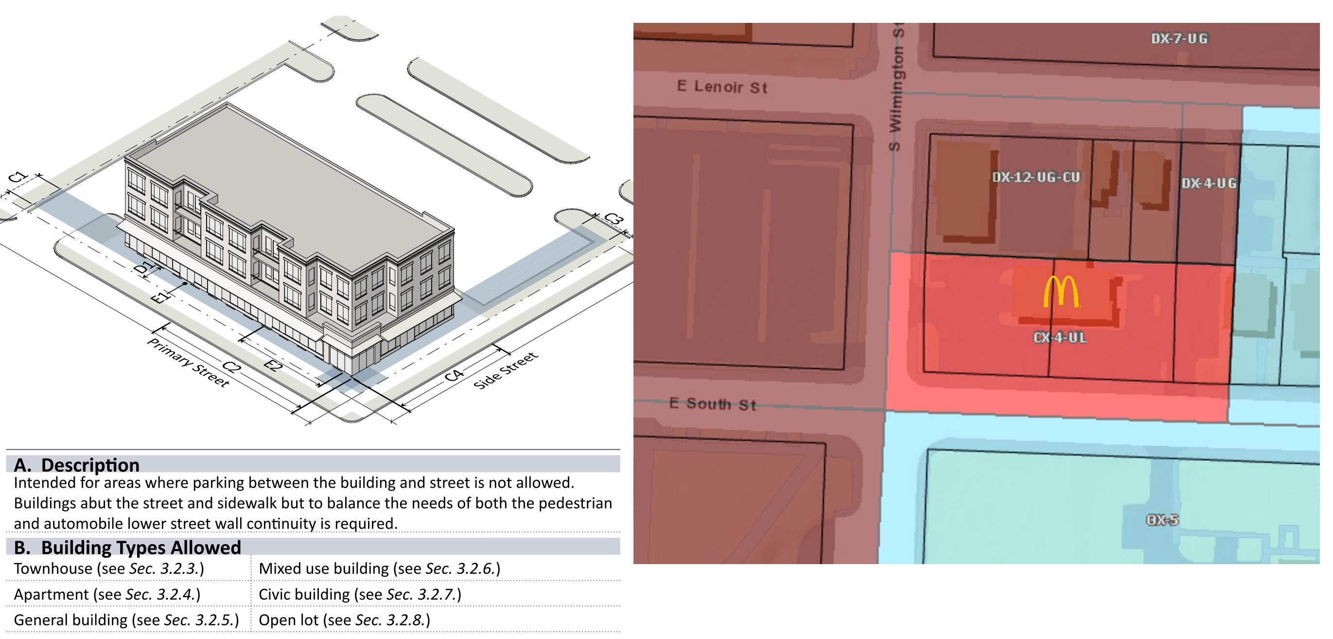
Snapshot of the UDO and zoning of the area from iMaps, August 2016. Click for larger.
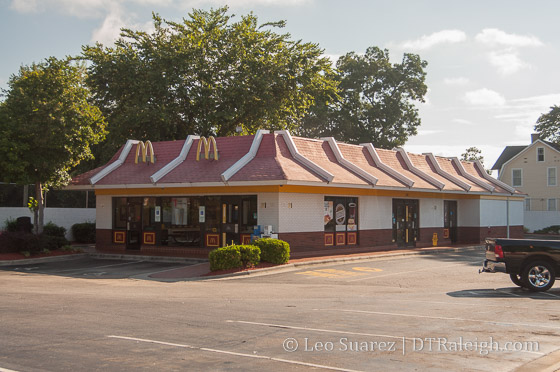
McDonald’s at Wilmington and South Street, August 2016
The “Urban Limited” designation of that property dictates that parking is not allowed between the building and the street. I guess you can’t level the building and bring in a “McDonald’s in a box” like others have in Raleigh.
For now, we have an antique at the corner of Wilmington and South until an entirely new development comes about. I’m sure there are other examples of this coming change on the fringes of downtown due to the new development ordinance.
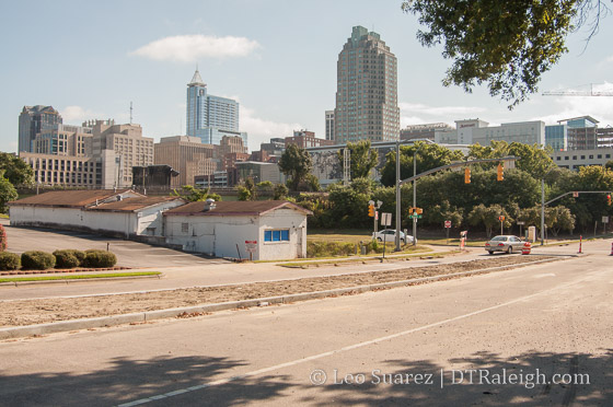
Parking lots along South Street, August 2016
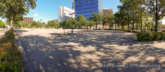
Next, you have the city-owned parking lots in front of the performing arts center. The city is thinking about how best to dispose of or use these properties, along with many other ones in downtown. Raleigh Agenda was at a recent public meeting about this and has more:
The most enviable property the city owns downtown may be the two-and-a-half acres at the south end of Fayetteville Street. Now a parking lot, the site sits directly across the street from the Duke Energy Center for the Performing Arts. It is zoned for forty stories.
*The Best Ideas We Heard for the Ten Downtown Properties the City May Sell
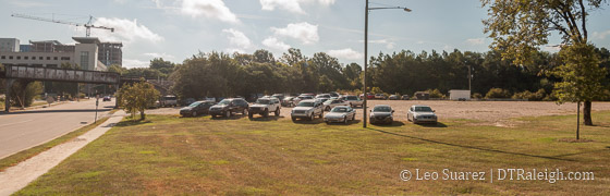
Parking lots along South and McDowell Street, August 2016
Parking lots along South and Dawson Street, August 2016
The same conversation also includes some of the gravel parking lots around McDowell and Dawson Streets. All I’ve seen them used for now are parking for amphitheater events, storage for convention center events (trailers, etc.), and fireworks viewing during July Fourth and First Night.
Here are all the properties that the city owns in this area.
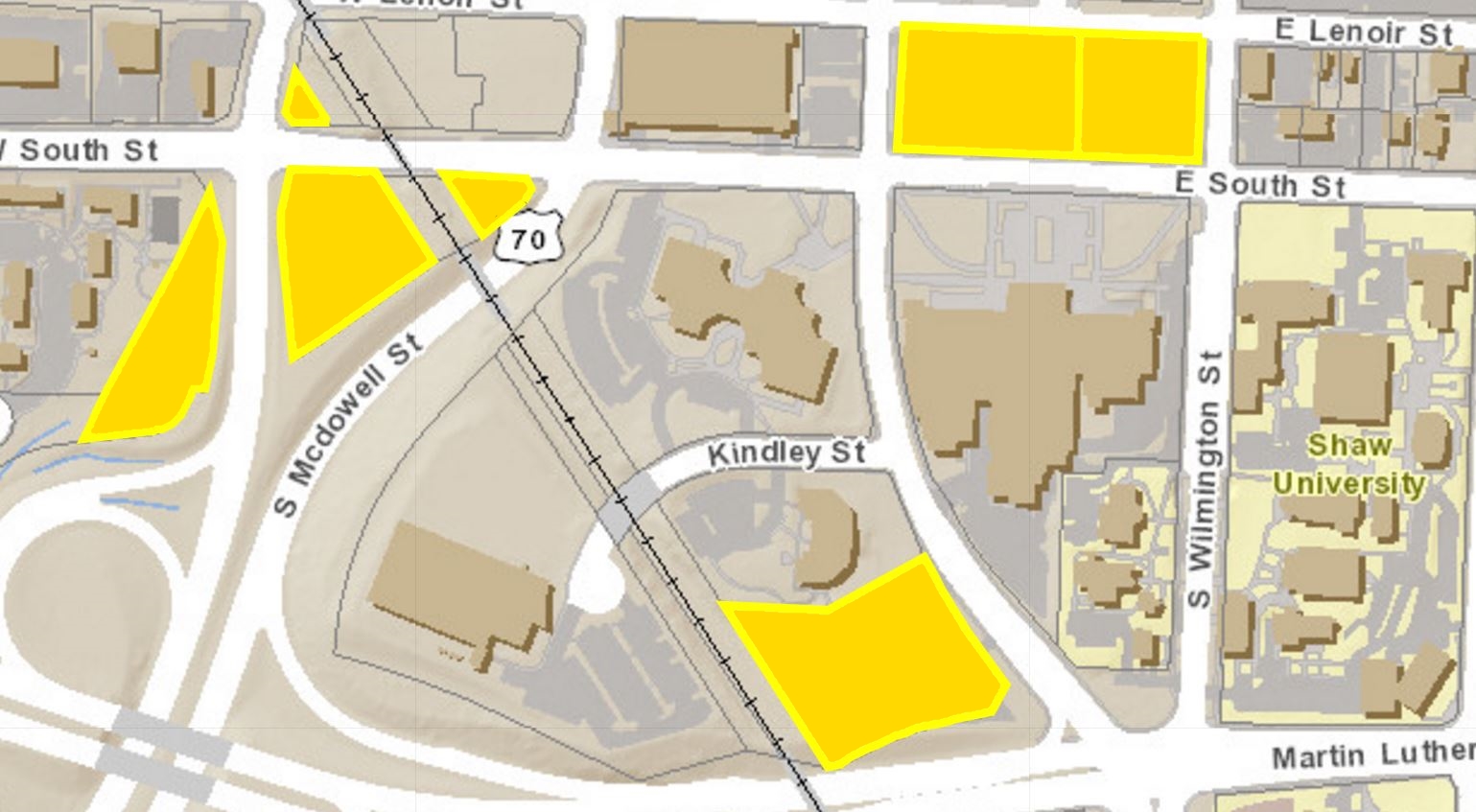
City-owned properties along South Street, August 2016. Click for larger
No surprise to frequent readers but the Residence Inn hotel along Salisbury Street has topped out and is moving right along. I’m sure it will support the convention center but being under the 400 room magic number, it may or may not help book very large conventions.
Continuing east, the view of downtown from South at Dawson Street starts to get more and more prominent. You start walking uphill and the view is really photogenic.
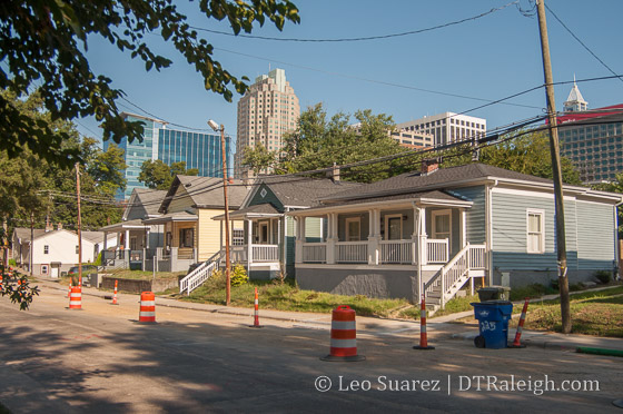
West South Street, August 2016
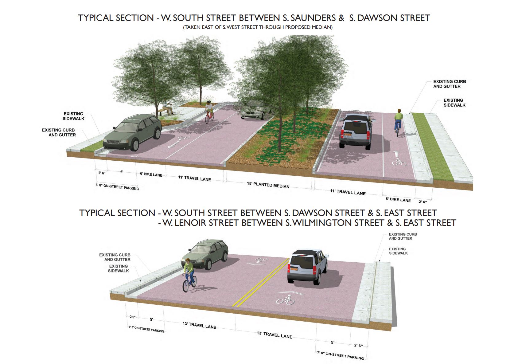
The Heritage Park neighborhood spans from Dawson to South Saunders here along the southern end of South Street. Across South, long-time businesses and buildings have been operating. The South Street two-way conversion is taking a very wide South Street and adding bike lanes and landscaped medians here.
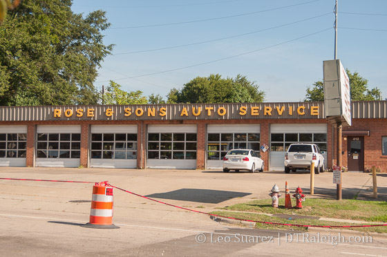
The TBJ reported earlier this month of a new development. NitNeil Partners, a builder of high-end storage, plans to put a four-story building where Rose & Sons Auto Service is currently located. The article states that they want to break ground this Fall.
The property is actually quite large and also faces Lenoir Street. The new storage facility will certainly have a major presence on this block.
West South Street, August 2016
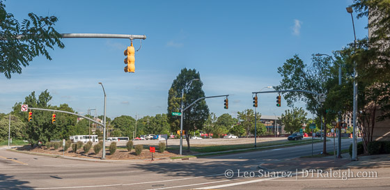
West South Street at West Street, August 2016
Hopefully you’ve gotten a lesson on our historic street names as South West Street then intersects with West South Street. (The southwestern corner of the original city)
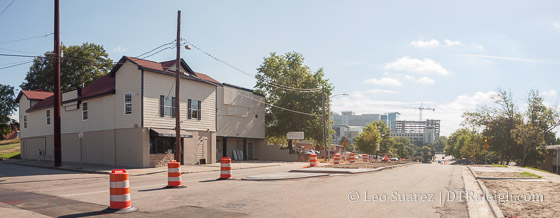
Around the intersection with West Street, older buildings contain convenience stores, a tattoo shop, and a club. Land is being cleared for 12 new townhomes along West between South and Lenoir. According to the site plans, there will be three four-unit buildings on the site with vehicle access to the alleys on Lenoir Street.
Land clearing for townhomes, August 2016
Click for larger
A convenience store on South Street, August 2016
The hub of West South Street is probably found at Saunders and South, where a line of urban-facing buildings create a cluster of retail space. Shops such as Holder Goods, Boulted Bread, and Artikle 74 have moved in recently creating some neighborhood urban-scale activity.
Urban-scale retail shops, August 2016
The walk finally ends as South Street heads into the Boylan Heights neighborhood, the western bookend to South Park’s eastern bookend. The view looking back is the header image of this post.
South may become a strong artery for neighborhoods to get into and out of downtown. The residential elements already seem to be there with some institutional aspects, like Shaw, adding a different element that other streets may not have.
There’s certainly a lot to follow on the southern edge of town.
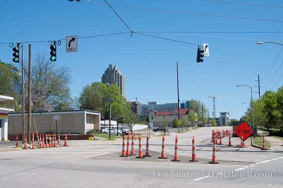
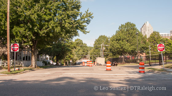
South Street at South Saunders Street
The two-way conversion of South and Lenoir Streets have begun. You could loosely call this a phase 2 project as parts of Lenoir and South were converted to two-way years ago when the Raleigh Convention Center opened. Now, the city is finishing the conversion so that the streets operate as two-way from end-to-end.
For all the details, jump over to the Lenoir & South Street Two-Way Conversion project page on the city’s website.
Going west to east, South Street is two-way in Boylan Heights but flips to one-way (east bound) at South Saunders. Shown in the photo above, utility work is taking place and throughout the year the street in this area will contain bike lanes, landscaped medians, and travel lanes going in both directions (of course) up to Dawson. At Dawson is where South flips back to two-way.
Along South through downtown, the street flips back to one-way (east bound) at Wilmington Street. There will be one travel lane in each direction from here all the way to East Street. The traffic light at Bloodworth Street will be removed and replaced with a four-way stop.
Lenoir Street looks less complicated. No conversion work is needed on the west side of downtown and the work begins at Wilmington Street. The east bound one-way street between Wilmington and East will be converted to one-lane in each direction. The traffic lights at both East and Bloodworth will be replaced with four-way stops.
Click for larger
As someone who travels in this area by car and bicycle, this conversion is very much welcomed. It’ll also be a nice alternative when Fayetteville Street is completely closed during event season.