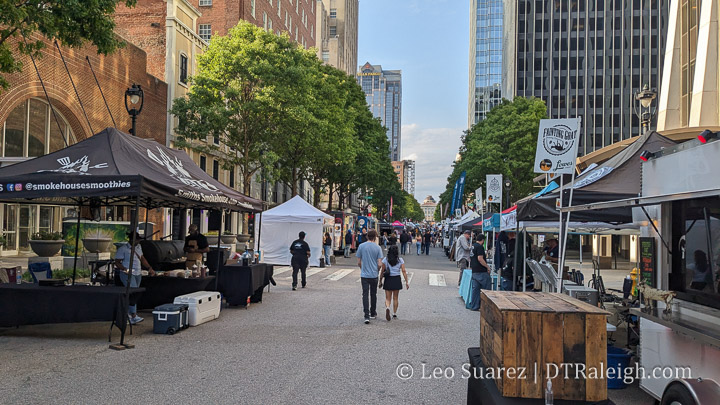
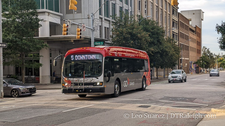
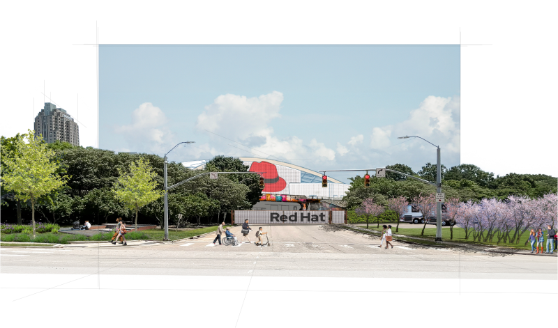
North Carolina Railroad Working to Rezone The Depot, Offer a Mix of New Uses

A rezoning case (see Z-9-22 here) that’s been in progress throughout the year involves The Depot, the long warehouse situated at the end of West Davie Street fronted by the delicious Videri Chocolate Factory. Owned by the North Carolina Railroad, a desire to develop more of their properties seems to be part of their future. The rezoning would allow for up to 20 stories of new development and could possibly alter the layout of the existing Depot building.

To dive right into things, the presentation and discussion from the August 9, 2022 meeting of the planning commission, embedded below, (or watch it on YouTube) is the best place to start. The commission has recommended approval of the rezoning and it next goes to city council for overall approval.

Earlier in the year, the rezoning started at the Raleigh Historic Development Commission and that group recommended to deny this rezoning request. However, throughout the year, conditions have been added that would save some of the historic structures and possibly make the rezoning more palatable to city leaders.

Looking at the aerial photo from Google Maps as well as Exhibit A (above) from the commission presentation, we are actually talking about the The Depot building and the parking lot. The section where Videri is located currently is the head house of the building and plans are for it to remain. The rest of the Depot building could be partially or entirely removed as part of the future development.

For completeness, the request also wants to rezone a property on the other side of the tracks. If you look at the Google Maps aerial, you’ll see the former train station site. It has since been demolished and is a gravel parking lot now.

If approved in its current form, the rezoning conditions around the Depot would preserve the head house as is and any new additions to it must have complimentary materials. There also must be a 30 foot wide pedestrian walkway between Davie and Cabarrus street. That could look something like this.

The architect, Gensler, proposes a mix of uses and buildings that compliment the Depot as well as the rest of the warehouse district. A “strong retail base” was mentioned in order to support active uses along the pedestrian walkway, shown in the proposed site plan above.

The rezoning hits the city council starting at their meeting on September 20.

My thoughts on this are evolving. If you watched the commission video above, members of planning commission were definitely feeling emotional trying to find a way to preserve the building that the entire historic district is named after. It is called, “The Depot Historic District” after all so demolishing most of it seems unfortunate.

I have however always disliked the surface parking lot and welcome the new buildings and the pedestrian walkway. The Depot can be pretty active on nights and especially on weekends but I’m just not sure it’s being used to its full potential.

It always seems like it’s the parking in new developments that take up the most space and cause older buildings to be demolished. The new proposed site plan replaces the majority of the Depot with structured parking underneath new apartments. I can’t help but to continue to roll my eyes at the thought of this. Realistically, even though we don’t require any parking in downtown Raleigh, the city is just too car-dependent for new projects to offer less parking or none at all.

I do think that nearby project The Dillon gives me hope that a new development could be built that keeps some of the character in place and creates a whole new pedestrian experience with active uses. I also think being such a big transit supporter that I can’t fight more density near our Raleigh Union Station.

You also have to consider that as of today, if they wanted to, North Carolina Railroad could demolish everything and build from scratch. There are no protections in place. However, in exchange for an increasing in zoning allowances, the head house would be incorporated into the new development.

It’s not great but it feels like a strong compromise.

A Walk Around the Char Grill Block

In June, the city’s neighborhood meeting calendar posted an update for a possible rezoning for properties along Hillsborough Street including the beloved local spot, Char Grill. The news picked it up. Comments were made. Opinions were everywhere.

To be clear, the rezoning request has not been submitted as of this writing but I want to mention two items right up front:

  • Char Grill owns their lot and plans to incorporate a Char Grill location in any new development
  • Comments from them suggest a thoughtful development with respect to any historic structures nearby

Instead of typing out comments online and looking at Google Maps (well I did some of that) it was time to get a steak junior and walk the block.

NOTE: I call it the “Char Grill Block” since that’s the most important thing there (let’s be honest) but not all properties are planned for a rezoning.

From the neighborhood meeting notes, the following properties seem to be targeted for rezoning. Char Grill is on the southern end about midway between Boylan and Glenwood.

Walk the Block

Let’s start with Char Grill and go clockwise around the map shown above. Since the rezoning application hasn’t been submitted yet, I’m also not going to get into possible heights and conditions today. Let’s just look at buildings.

Char Grill doesn’t need an introduction here. Open since 1959, the burger and fries spot has one of the best walk-up windows in downtown. It’s not exactly a drive-thru in the modern sense but plenty of space is given to parking also.

On the corner of Hillsborough and Boylan is a closed gas station. Built in 1952, it has gone through a variety of gas and car service brands. Today, it seems to be used for parking for nearby construction projects. When I was walking around, there is work going on for something in a retail space across the street at Bloc 83 and the workers were parking here.

Next is a gravel parking lot. Not much else to add here.

The environmental engineering firm Smith Gardner operates out of a few houses on this block also. Along Boylan, is this red brick house from 1910. Employees probably park in the adjacent lot.

At the corner of Boylan and Willard, we have Elmwood. Elmwood is a beautiful house from 1813 and is currently used as office space. Elmwood sits on the National Register of Historic Places. The side yard along Willard is a gravel parking lot.

Finally, there are two more 1910 homes along Willard being used as offices by Smith Gardner, shown above. Their backyards are basically gravel parking lots also. Turns out, all three houses that Smith Gardner is using is owned by the same company.

Speculation

No details are out there of what is going to be built, we’re not at that stage yet. I feel in the minority here as Elmwood, not Char Grill, is the property I’m most interested in with respect to any new developments. Of course, people are most distracted by the Char Grill being demolished, the youngest building mentioned in this post, but I’m in the camp that honestly thinks they could use an upgrade. (or at least a serious power wash)

For me, Char Grill’s walk-up window is fantastic. If the new development can get a Char Grill in there with an active walk-up window, some outdoor tables, and indoor seating like their newer locations, it’ll still be a hit.

Focusing on the older homes behind Char Grill, you can’t help admit that there is a lot of gravel parking spaces that could be used more efficiently. The brick building at 14 North Boylan could be moved to sit on Elmwood’s gravel lot. If you do that, you square up a nice property for some taller development. It could look something like this.

Again, just speculation but the houses can be saved and the red square in my sketch up here can be developed. If the houses continue to be office space, parking can be tucked inside the new development.

We’ll get back to this once the rezoning is submitted and discussion by planning commission and city council takes place. Until then, keep eating steak juniors.

New Office Developments Planned as part of Latest NC Budget

Adopted this July, the North Carolina Legislature’s 2022-2023 budget has a few items worth noting for the downtown government office complex. Probably the quietest part of downtown Raleigh, the government complex is a collection of office buildings housing many departments that work and support the state-level government.

In addition to a few museums and the legislature building itself, the complex still operates on a 9-5 kind of mentality compared to the mixed-use nature of Fayetteville Street for example. There’s zero ground-floor retail and very few adjacent housing units. Buildings are spread apart with generous front plazas and setbacks from the sidewalks.

Re-visiting the government complex is probably for another day. With the new NC budget, which you can view in great detail as part of House Bill 103 here, we may be seeing new buildings as well as the demolition of existing ones.

Downtown Education Campus

Talks of moving the UNC School System’s headquarters have been going on for a few years now. The move would put the offices into downtown Raleigh and out of Chapel Hill in a sort of Downtown Education Campus.

As the budget states, a new building would be built to house offices for the UNC system, Community Colleges System, Department of Public Instruction, and the Department of Commerce. On the surface, the rationale is to bring these departments closer together for operational efficiencies.

The targeted location for this building would be the Administration Building at 116 West Jones Street, shown above. Not only that, the existing building would be demolished with a new one built for the future education campus.

With the adoption of this budget, I take it plans are already underway to vacate this building with a deadline of July 1, 2023 and a demolition date before Oct 31, 2023.

The Administration Building was built in 1967 and is the only building on this block. It has surface parking on the northern end and is predominantly office space across its five floors. I don’t have a sense of how much space the new education campus needs but with an entire block zoned for 12 stories, there should be plenty of space for a mix of uses, even a green, outdoor space.

Executive Headquarters

Requiring no demolition, a new building for the governor’s staff is also mentioned in the budget. The building for “the governor’s staff, state agency personnel and operations and chamber for Council of State meetings” should land somewhere in the parking lot across from the History Museum along Wilmington Street.

Planning and design will start soon because the budget also has a construction start date of July 1, 2023. The surface parking lots are zoned for up to 12 stories of development.

I also want to add that these initiatives executed by the state seem to follow a different development path than what I’m used to. Will we actually see demolition and construction on these dates? I have no idea.

On one hand, it’s a big budget machine that probably just executes without thinking so it’ll likely get done no matter the economic, political, or financial status of the day. On the other, I feel there’s always some way to delay or cancel things. We’ll just wait and see.

In addition to these bigger developments, instead of renovations, the Bath Building on Wilmington Street (shown in the top photo) is set to be demolished. Now I’m no architect but I’m told that the Bath building may be Raleigh’s best example of brutalist architecture. Worth saving? I’ll let you decide but the state doesn’t have a good track record here I feel.

There’s also about $5 million for renovations for the Old Revenue Building on Salisbury Street. I bet that’s for interior work as the outside is still looking pretty classic.

Mapping Raleigh: Buildings by Year Built

Lately, I’ve been less active on the front-side of the Raleigh House of Connoisseur but have been heads down working with creating a new map. I don’t think I’m finished and honestly, haven’t even started any type of analysis, but I wanted to put an update out there and share something with readers.

TLDR? Just go here to the map.

The Background

I was inspired when I stumbled on this map of Paris, introduced by the tweet shown below. Technically, it was something I wanted to see if I could build for Raleigh but also, it would be interesting to see how the buildings of today have held up. Are we seeing “mass teardowns” as some people think? What other questions might we begin to answer?

I then found the “ingredients” on the city’s open data websites around Raleigh parcel data and using the “year built” field, I starting analyzing over 130,000 pieces of data.

The Map

The map I put together shows Raleigh’s existing stock of buildings as of May 2022. It’s important to note that this is a snapshot in time, not buildings constructed over time. For example, if a home built in the 1950s was torn down for a new construction home in 2015, the parcel would show in the 2010s decade, not the 1950s.

https://develop.dtraleigh.com/buildings/

Please note that the property shapes have been optimized so that the map is somewhat usable. Don’t take them literally.

I grouped properties by decades with an additional “Pre-1920s” category. This was driven mostly by number of buildings as the counts before 1920 is pretty low. Here’s a bar chart.

That it?

Probably not. I’m releasing it into the wild and see how it sits for awhile. We are discussing it on the Community on this thread so if you have any questions or thoughts, please join us.

I’m hoping to continue tinkering with this map and see what we can extract from it. Questions I have could be:

  • Are there neighborhoods that have been completely turned over?
  • Are certain neighborhoods less susceptible to teardowns than others?
  • Where do you see a mix of buildings being produced at a constant rate?
  • Why is the building count in the 2010s so much lower?
  • How might annexations and border expansions played a role over time?
  • How might protectionist overlays, like NCODs and historic overlays, played a role?

Expect follow up posts in the future.

Taking A Deeper Look Into Glenwood South Crime Data

Embedded above (or here on YouTube) is the video of Raleigh Police Chief Estella Patterson presenting some data and observations about crime in Glenwood South for this year. The numbers are up and it’s been leading to concerns from nearby residents and the council overall.

The News and Observer started things off nicely:

The chief showed crime data comparing the 10 months leading up the pandemic and the last 10 months. Since June 2021, there have been 76 weapon violations, including 64 concealed weapon violations. That compares to 16 violations from June 2019 to March 2020.

There also is a sizable increase in traffic-related violations, but Patterson said the department increased enforcement and the number of traffic stops during that time.

Raleigh police chief makes recommendations to address rising crime in Glenwood South via newsobserver.com

The N&O article also has a graphic showing year-to-date (Jan 1 to Mar 20) figures from 2019 to 2022. Drug-related incidents are up as well as larceny and assaults. As expected, there is a dip in 2020 and 2021 due to pandemic restrictions and lockdowns.

Looking at these figures, I just had to see more as data from 2019 to 2022, with a pandemic right in the middle, may not tell us the whole story.

The Data

I went to the dataset, showing datapoints from June 2014, and built up my own app with charts and tables. You can dive into that here.

The site I built does the following:

  • Shows the Glenwood South map and only takes in incidents that occur inside the boundary area
  • Year-to-date figures for top crime categories from 2015 to 2022
  • Displays Total Yearly Incidents by top crime categories
  • Displays Total Yearly Incidents for all crime categories
  • Pulls data nightly and updates the year-to-date figures

What I’m calling “Top Crime Categories” are the types of crime, as identified by the data, that when summed up, represent about 2/3 of the total incidents. The remainder incident types seem to be so few in occurrence that it’s hard to know if a trend is taking place. I’ll just remove those from the “Top” charts for now.

Top Crime Categories include:

  • Assault
  • Larceny
  • Drugs
  • Weapons Violation
  • Vandalism
  • “All Other Offenses”
  • Drug Violations

I guess I could have added up Drugs and Drug Violations but I kept the data “pure” for now. Also, I’m not sure what “All Other Offenses” means exactly so this one might qualify to be ignored. Take it for what it’s worth.

Last thing to point out, I start with 2015 as the dataset starts in the middle of 2014 so a partial year isn’t helping that much. 2015 is great as we get five full years before the pandemic lockdowns took place starting in March 2020.

Yearly Totals

Indeed, when we look at just the top crime categories as well as all crime categories, the number of incidents has been increasing since 2015. It actually went down in 2018, not by much, but continued on its trajectory in 2019.

Again, the big drop in 2020 is most likely due to the pandemic lockdowns and we can see the recovery in 2021. If we remove 2020, some items to note:

  • number of assault, larceny, and weapons incidents have increased
  • number of vandalism and drugs are more of less the same
  • “all other offenses” has gone down

I’m not sure we can figure out what’s going on but there are some things to note. Consider that since 2015, more development has taken place. The number of residents have increased and the number of restaurants and bars opened has increased.

A good figure to share is from the 2021 State of Downtown Raleigh report which I’ll add here.

Does increased food and beverage sales lead to more crime? Not necessarily but if we think for a moment that there are more people in Glenwood South, leading to more F&B sales, we could argue that more people in a district could lead to more crime. The above figures show a 29% growth in F&B sales from 2015 to 2021 for Glenwood South. In addition:

  • From 2015 to 2021, Glenwood South had an 18% increase in crime incidents overall
  • From 2015 to 2021, Glenwood South had a 36% increase in TOP crime incidents

The real comparison, saved for a later post most likely, is to compare this activity with other districts.

Year-to-Date Figures

The app tracking the data runs nightly so if you want to check back later this year to see how we’re doing, you can do just that. Here’s the snapshot up until April 12, 2022.

Year-to-date figures are pretty much in-line with everything stated above so I’ll leave it right there.

Final Thoughts

The police chief had some suggestions to try and curb this increase in incidents including adding metal detectors at bars as well as changing Glenwood Avenue to a one-way street to keep car traffic flowing more smoothly. A catastrophic incident is not something anyone wants so it’s a good idea to keep an eye on the trends.

We’ll see if any changes come from the city to try and smooth down these numbers. What I really want to see is a comparison of this activity and the number of incidents to other areas to get a sense of context. That’s a post for later this year perhaps.

If you’d like to discuss more about Crime in downtown Raleigh, we have a thread for this on the Community.

A Walk Around Nash Square

I have a soft spot for Nash Square. It’s an urban oasis with city views throughout the winter, leafless months but then becomes an umbrella during the warmer months. It’s also where I got married so there’s that.

Nash Square is more of a ceremonial park rather than one for play and big events. The firefighter’s memorial in the center generates a feeling of pause and reflection. Also, I can’t name a better spot for an outdoor lunch on a park bench than here. It’s just lovely.

While Nash Square isn’t changing any time soon, the blocks around it have some big plans or construction underway. Nash Square bridges the Warehouse District with the Fayetteville Street District. There’s plenty of topics to look at here that I had to map it out. (as I do)

Let’s look at the eight blocks around Nash Square in a clockwise order.

Block #1: Raleigh Municipal Block

The municipal block, or city government block, has the current city council chambers and the Raleigh Municipal Building, shown above. It’s more or less the center of the city government offices and there are big plans for a new municipal campus on this block.

A multi-phased project to put larger towers on the site in order to consolidate the offices of our city’s government has been in planning for a few years. This would most likely see the demolition of the building above and the former Police Headquarters, now empty, next door.

I’ll leave it there but will drop this link to the city’s website for more information. The site lists construction starting in “Late 2022/early 2023”. raleighnc.gov/projects/civic-campus

Block #2: AT&T Building

There are no updates on this block. The AT&T building facing the square has a real nice mural but for the most part, this block is business as usual. I don’t expect much from this block with most of it being the AT&T infrastructure building, First Presbyterian Church, and nice, two-story retail buildings dating from the early 1900s.

Block #3: The Nexus

To the east of Nash Square is the former location of the News & Observer. The Nexus was a multi-tower development planned for this sizeable property but the timing may have been unfortunate as the 2019 plans seemed to be put on hold due to the pandemic.

In March 2022, a rezoning request for the same property was approved, to increase the height limits from the current 20 up to the next allowable limit of 40. (see Z-43-2021, pdf link) Perhaps this suggest even grander plans from the developer? We’ll have to wait and see.

Block #4: Wake County Offices

No plans here, just Wake County office buildings including courtrooms and jail spaces as part of the Wake County Justice Center. The latter being a pretty nice building actually. I love those art deco fins lit up at night.

Block #5: Hotels Incoming

To the south of Nash Square, within the sounds and smells of Whiskey Kitchen, there are three lots worth mentioning. The first has a big crane over it today as a dual-brand hotel is coming soon. A Hilton Garden Inn and Homewood Suites hotel is planned to open next year.

On the opposite corner, we have an empty lot for another planned hotel. Demolition of buildings took place in early 2020 and the lot has sat empty ever since. However, a rezoning is in underway for this lot (see Z-12-2022, pdf link) to increase the height limits from the current 20 stories to the next allowable limit of 40. That likely means construction won’t happen this year as new development plans may be in the works.

Finally, the third lot is the former Firestone lot. It too went through a rezoning in 2021 to increase the allowable height from 20 to 40. (see Z-24-2021, pdf link)

Block 6: Warehouse district historic

The block of 300 West Martin Street is the Warehouse District gem. I feel that without it, there’s just no point in using that name anymore. There are no projects underway but another rezoning is worth watching.

Former plans to build a residential tower behind the buildings shown above haven’t materialized. However, rezoning Z-78-2021 (pdf link) asks for more height and includes conditions to keep the buildings above. The developments are more for the surface parking lots behind the old warehouse buildings. This seems like a nice mix of uses so we’ll see how it goes if the rezoning is approved later this year.

Block #7 and #8: Highwoods Bets on Parking

The block to the west of Nash Square is mostly a mish-mash of surface lots and short buildings. From the square, the Park Devereux condos are the standard for park-side views. I love that building. As for the rest of the block, it’s mostly the same as it was ten years ago.

One exception is the demolition of buildings on the northwest corner for a surface parking lot. Highwoods properties owns this lot and as is their style, they love to sit on parking lots in urban areas.

There are other rezoning cases in place but I’ll punt this one to a July 2021 post that covers this piece of the Warehouse District more in depth.

A 2022 Dive Into Seaboard Station

I’m kind of piggybacking off a post from two weeks ago but either way, I decided to dive deeper into Seaboard Station this week. There’s a lot of moving parts there with a project under construction as well as plans making their way through the approval process for more development. Consider this post a quick catch up and overview of the northern side of Downtown Raleigh.

As always, we’re following Seaboard Station in-depth on the Community, thread is here, so lurk as much as you want but all are welcome to join the conversation.

For me, it’s got to start with a map and I’ve doctored up one such map that I think will help show where we’re at here.

It’s also important to list out what we’re talking about as well as what we are NOT talking about. The map above, modified from the Seaboard Station website itself, shows five key components as to the future development of Seaboard Station. Let’s put a chart together.

LocationWhat’s There NowFuture Plans
Block AFormer Sunflower’s location has been demolished. Empty lot todayHotel, Apartments, Retail
Block BCurrently under constructionHotel, Apartments, Retail
Block CRestaurants and Retail including Galatea, Night Kitchen, and Marigold ParlourHotel, Apartments, Retail
Block DRestaurants and Retail including Ace Hardware, O2 Fitness, and Peace ChinaNone
Logan’sLogan’s Garden ShopRezoning request in progress

As of this writing, these are the only properties we’re talking about. What’s NOT included is the single-story retail strip with shops like Mon Macaron, Hunky Dory, and Sola Salon as well as the Shell gas Station that faces Peace Street. There are also some smaller buildings and lots that are either owned by others or next door William Peace University. There are no plans for those properties as of this writing.

Block A

Block A kind of started things off in 2018 after the sale of Seaboard Station from nearby William Peace University to a developer. Plans included a hotel and apartments, which the website still states is the case. Construction hasn’t started on that however as the pandemic of 2020 made new development take a pause. What was a more solid bet, and still is, was housing which made Block B, with plans for only apartments, more attractive.

I’m speculating here but that seems to be what’s happening now. The former location of Sunflower’s was demolished and Block A is basically a storage yard for nearby construction.

Block B

Block B is close to topping out. About 300 apartments with ground-floor retail should open later this year. This is the first development of the new era of Seaboard Station. The units on the east side looking at the university should have a nice view.

Block C and Block D

Block C and D are still in the planning phases. I got nothing on Block D as the attention has mostly gone to the other areas.

Site plans have been submitted (see ASR-0033-2021, pdf link) to the city for Block C showing another apartment over retail building with around 220 units. However, there is still active retail on this block. I’m hoping that spaces in Block B are offered and time is given to the local businesses to move over.

Logan’s Garden Shop

Logan’s has hit the news recently with an announcement of moving their business in the future. This is a “years from now” announcement and no changes will take place soon. However, in the background, the developer has filed for a rezoning. (see Z-5-22, pdf link) The current zoning has a seven-story heigh limit and the owners want to increase that to 20.

The local controversy here is the train depot building that once served the Seaboard rail line. The new development suggests the replacement of this building. However, no site plans have been submitted as the rezoning really dictates what can be built here or not. It’s my understanding that the building has no historic status and therefore can be demolished today, rezoning approval or not.

At the same time though, the building is in great shape from what I can see and would be a nice touch to an area that will mostly feature “by-the-book” 5-over-1 generic buildings.

The Logan’s property is mostly surface lots around the station including the train canopy and yards that currently serve the garden shop. New development would be a significant boost to the area. Building massings, such as the one below, are being worked on but no definitive plans have been put out there.

I tend to take the contrarian route on most “historic preservation” issues. I say we give them all the height allowances with the stipulation that the station must be preserved. At the same time, if hundreds more residential units or office spaces are built at the expense of the station then I won’t cry over that. I see no way Downtown Raleigh loses here.

Seaboard Station, a glorified shopping center really, is going through an urban transition. The residential units are welcome, especially at a time when there’s a housing crunch in Raleigh, and I can’t think of any better way to make urban retail work then to stack hundreds of residents on top and around you. That’s really what the downtown Raleigh of the future looks like to me.

You can also insert a lengthy argument about putting tall buildings around future transit lines here which I’ll save for another day.

Seaboard Station is on the path for more people spaces with less car spaces. I think this future Seaboard is going to look great.

Parking Minimums Removed Across the City

This week, the Raleigh City Council voted to remove all parking minimums for new developments across the entire city. This extends a previous parking reduction that was done in 2020 that mainly affected the downtown area. You can watch the discussion and vote in the embedded video above or directly on YouTube here.

It is worth reiterating that parking is not banned city-wide. It only removes the minimums required and, generally speaking, allows new projects to choose the amount of parking to be built. In some cases, there are maximums in place.

From what I’m seeing, right now new buildings in downtown are building above the minimums anyway. In the future, as transit options come online and our city adds more people, those who prefer to travel car-light or even car-less will benefit from a city that doesn’t dedicate so much space to parking vehicles.

Indeed, climate impacts and sustainability is a big driver of this change, as written out in the text change itself.

SUMMARY OF IMPACTS

Adoption of TC-11-21 would:

1. Because it removes subsidies and incentives for car ownership (because rent typically does not vary depending on whether a car is stored on a property or not, so there is no extra cost for car ownership) it would tend to reduce vehicle miles traveled and associated air pollution and carbon
emissions.

2. Mitigate the climate change, stormwater, and other impacts created by large areas of paved parking.

3. Tend to reduce the cost of housing and goods and services by requiring less land to be used for vehicle storage. It would prevent households without cars from paying for parking they do not use.

4. Potentially lead to increased demand for on-street parking in some locations. If issues arise, excessive demand can be addressed through the creation of new residential parking permit areas, adjusting on-street parking pricing, and providing additional public parking.

https://go.boarddocs.com/nc/raleigh/Board.nsf/files/CC5L9Q54981F/$file/20220315PLANDEVTC-11-21StaffReportandDraftOrdinance.pdf

From a sustainability and land-use point-of-view, I think it’s great to address problems of having too little parking on a case-by-case basis (point #4) rather than the problems of having to much. Well managed on-street parking programs are common in larger cities and it’s probably time Raleigh get into that game.

The change is a great, incremental step in the right direction and it’ll take time for the city to adjust. The next step will be to give Raleighites a transit system that allows for all of us to get around while putting less miles on our cars. That kind of Raleigh may lead to shorter buildings (less floors for parking), more destinations closer together, and more vitality to neighborhoods.