Upcoming NCDOT Public Meeting To Show Off Latest Peace Street, Capital Boulevard Bridge Designs

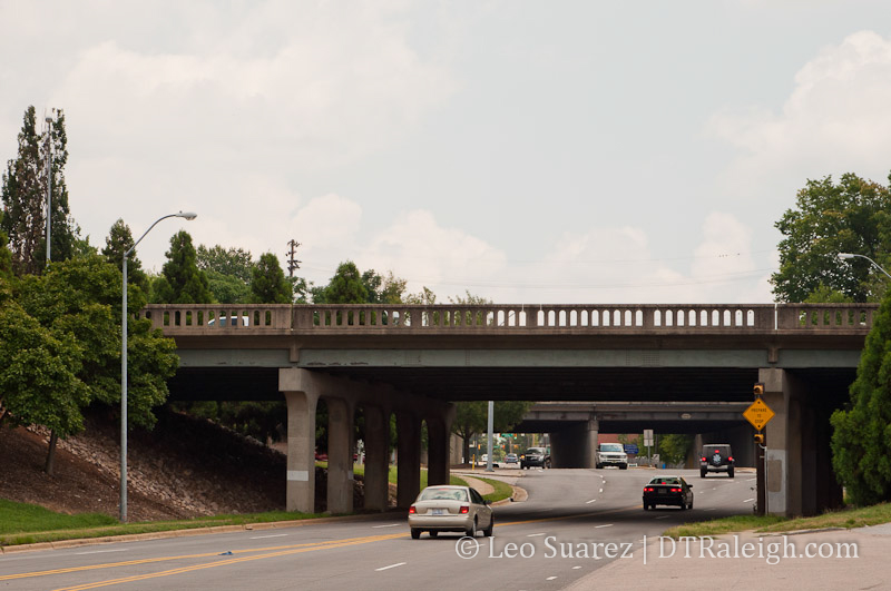
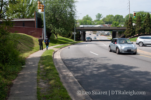
Peace Street at Capital Boulevard

Capital Boulevard bridge over Peace Street

It’s been almost a year and a half since there’s been any major news on the re-design for the area around the Capital Boulevard bridge that goes over Peace Street. On November 19, the NCDOT wants to show off the latest designs for that area.

Public Meeting for the proposed replacement of the Capital Boulevard bridges

Date/Time: Tues., Nov. 19 from 5 p.m. to 7 p.m. (Open House)
Duke Energy Center for the Performing Arts, Meymandi Hall Lobby
2 East South Street, Raleigh

This project comes up because the current bridge is nearing the end of its useful life and needs to be replaced before safety is put at risk. The city is working with the state to find a working solution and this project falls inline with the Capital Boulevard Corridor Study, a much greater strategy to re-invigorate the entire corridor from downtown Raleigh up to I-440.

Project website: Peace St. /Wade Ave. Bridge Replacements on Capital Blvd.

We’ll see what is shown at the meeting and the public can certainly comment on the new designs as we’re still in the planning phases.

On a related note, a friend of mine shared an interesting article with me where a similar bridge replacement was done up in New York state on I-84. Watch the video (shown below or in the linked article) and read about the technique called accelerated bridge construction. Makes you curious as to why this couldn’t be done here at Capital and Peace to save a little money. (and upsetting nearby businesses)

This Ingenious Way to Build Bridges Will Fix Our Crumbling Infrastructure via Wired.com

Breaking Apart The Wishbone Intersection At Peace Street

Email readers: This blog post has image galleries. Read the post on the blog to see all the images.
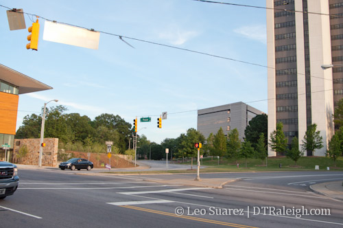
The intersection of Peace, Wilmington, Halifax, and Salisbury.

Talks, visions, and plans for lots of places in downtown Raleigh exist if you know where to look. Solving problems like traffic congestion or providing new amenities for pedestrians and bicyclists are driving factors for new plans. The intersection on Peace Street with Wilmington, Salisbury, and Halifax Streets is being looked at and I thought it might be fun to go over some points that I see in the Peace Street Visioning Study, a sub-topic in the Capital Boulevard Corridor Study.

No plans are final and the report mainly discusses topics for future exploring. One highlight mentions:

The Wilmington/Halifax/Peace Street intersection represents a second opportunity to improve traffic flow and reduce congestion. A two-lane roundabout is recommended for feasibility analysis by the City transportation engineers. This intersection continues to be a bottleneck which may be improved with more conventional traffic engineering solutions. However, there is some prospect that a two lane extended roundabout might provide free-flowing traffic while establishing a signature open space at this important gateway into the state government center and downtown. The roundabout would extend south in to the Wilmington Salisbury loop, with the roadway geometry offset to the south.

Here’s a screenshot of a map of that section and what it might look like from a conceptual level.
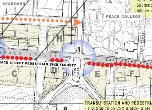
Peace Street Visioning Study, intersection of Halifax, Wilmington, and Peace Streets.

Seems like Raleighites either love or hate these larger roundabouts. It will be interesting to see the analysis and if the plan has merit.

The civic space within the center of the roundabout has potential but I question whether pedestrians will use it. Could an active public space exist within a busy roundabout of this small size?

I’d like to see another plan for this area, one Raleigh has already had, and that is to return the streets to their original configuration. The wishbone piece of the intersection could be removed and Wilmington and Salisbury Streets can be straightened out up to Peace. A map of Raleigh in 1914 shows this configuration including Halifax Street making it’s way up to Union Square as it has always been before the state government complex was built. (yay, urban renewal?)

It’s possible that this idea takes a busy intersection and splits it into two smaller ones. Here’s a mock up in Google Maps of what it could look like.


View Peace/Salisbury/Wilmington Intersection Idea in a larger map

Current properties in the map, shown in blue, are the AIA NC building and a Department of Administration building. In orange, you can see the returned street extensions and the green covers the wishbone piece of the current intersection. I also highlighted two service entrances in purple that are needed for the government complex.

The new green space is wide open in terms of future uses. Possibilities for it are new mixed-use developments, completely open green space, or a balance of the two. If a civic plaza is desired, the complete road removals would allow for more space.

In terms of traffic flow, I’m also curious what would happen if Salisbury Street were changed to a two-way street. With it connecting directly into Seaboard Station Avenue, bicycles and vehicles would have a direct connection from the core downtown to Seaboard Station.

There is also a really great view looking north at Seaboard Station that anyone driving, pedaling, or walking on Salisbury would feel more welcomed to a different downtown district. If you notice on a map, Vaughn Court is the current “extension” of Salisbury Street. Here’s a view looking north from that street. Click for a larger view.
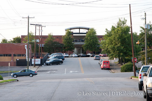
Seaboard Station entrance from Vaughn Court

I feel that this should become a “main entrance” to Seaboard Station in more of a way that it is today. With a two-way Salisbury Street, there could be better connections from Seaboard Station to downtown. You also get the visual bonus in that drivers and pedestrians can see their destination a few blocks away. Currently, you have trees and parts of the government center parking deck in front of you.
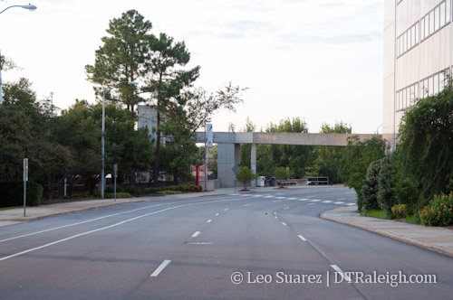
Looking North on Salisbury Street.

Wilmington Street already has a great view with the William Peace University main building front and center to traffic. An extension to the road could make the new intersection of Wilmington and Peace a more interesting place, brought about with any future developments that come from the Blount Street Commons project.
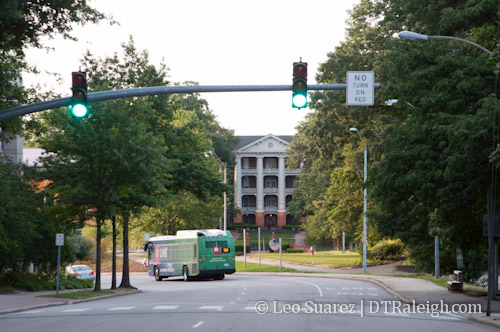
View of William Peace University down Wilmington Street.

With more development coming, an improved road network may make for more successful redevelopment in this area and who knows, maybe the government district could begin to grow some life during the off hours.

Click on the image below for a gallery of more images of the area.
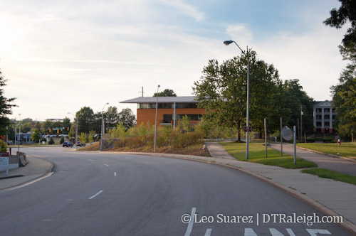
View of the AIA NC building and William Peace University main building from Wilmington Street.

Introducing Link Peace Street, A Resident Backed Alternative For Capital Boulevard and Peace Street

Peace Street with Capital Boulevard bridge

There’s a new project that’s growing some legs in downtown Raleigh. Link Peace Street is a vision from Raleigh residents for a more walkable environment on Peace Street. It coincides with the Capital Boulevard Corridor Study and hopes to put another alternative onto the table that is currently not being considered. I’m helping out with the effort and the core focus of it revolves around creating a plan for an at-grade intersection at Capital Boulevard and Peace Street.

Over the next few days, more information will be put onto the vision website of Link Peace Street so I encourage readers to check out the site we’ve built and sign up for updates.

Link Peace Street revolves around three main goals,

  1. Economic development in a form that fits into downtown Raleigh.
  2. Strengthen the connections between neighborhoods.
  3. Deliver on the 2030 Comprehensive Plan.

The Capital Boulevard Corridor Study, taking public comments at this time, targets private investment in the area using several projects. Some of those include an expanded greenway, a park at the old Devereux Meadow site, and multiple tweaks to Capital Boulevard itself. We’ve mentioned here before that the state of North Carolina is going to replace the bridge over Peace Street within a few years. The study wants to piggyback on that project and is considering some alternative routes to getting on and off of Peace Street. You can read about those alternatives on the Peace Street Vision document in the sidebar on the city’s website. These ideas are what planners think will help spur private investment in the area.

All plans being considered so far include the new NCDOT designed bridge and Link Peace Street wants them to consider the ‘no bridge’ option. We feel that the upgrades to Capital Boulevard, outlined in the study document, only promote more speed and will continue keeping vehicles moving through the area rather than stopping at a destination. Peace Street is the northern border of downtown Raleigh but most people don’t see it that way as the built landscape is not meant for a downtown at all. It’s possible that an environment that balances pedestrians, cyclists, and vehicles can promote development that is appropriate for downtown Raleigh and is a much better use of land.

With vehicles speeds kept the same and not increased, a walkable Peace Street will connect the neighborhoods rather than be an obstacle between them. In March, the Blount Street Commons project was asking the Raleigh City Council for a zoning change to allow for more density. At the same time, there is an apartment boom near Glenwood South. Both neighborhoods are so close yet feel much farther because of the uneasy walk down Peace Street in its current state.

It is a half mile walk from the Mellow Mushroom to Tyler’s Taproom yet so few people make that walk. In comparison, Fayetteville Street from one end to the other is a half mile. Peace Street may never have the towers and historic structures of Fayetteville Street but we think that we can atleast set up Peace Street for the same walkable experience. To have it, it starts with people and not vehicles.

The 2030 comprehensive plan specifies that this area is in the Core Business District category. It states:

This category applies to the Raleigh Central Business District, and is intended to enhance Downtown Raleigh as a vibrant mixed use urban center. The category recognizes the area’s role as the heart of the city, supporting a mix of high-intensity office, retail, housing, government, institutional, visitor-serving, cultural, and entertainment uses. Multiple zoning districts apply within the CBD, corresponding to the different character and vision for its various neighborhoods. The maximum residential density in this area would be 320 units per acre with densities tapering off towards edge areas adjacent to established residential neighborhoods, but not falling below 40 units per acre.

The Capital Boulevard study wants to widen lanes and help the flow of traffic. This does not fit with the description above and Link Peace Street feels that goes against the plan adopted just a few years ago.

How can we continue to do what we’ve been doing here in the corridor and expect different results?

Insanity: doing the same thing over and over again and expecting different results.

-Albert Einstein

We’re hoping to build support for the idea before the study is brought to the city council before the May 1st meeting.

Bridge Replacement Projects On Capital Blvd

Capital Blvd is getting a little planning love from NCDOT. The bridge over Peace Street and the Wade Avenue flyover are in pretty bad shape. Both are on the books for an upgrade. From the NCDOT’s project page:

The bridge on Capital Boulevard over Peace Street (Bridge No. 227) was built in 1948 and has a sufficiency rating of 42.9 out of a possible 100. The bridge on Capital Boulevard at Wade Avenue was built in 1954, has a sufficiency rating of 34.1, and is posted with a weight limit. Both bridges are structurally deficient and functionally obsolete. While the existing bridges are still adequate to support traffic, they are nearing the end of their design lives and need to be replaced in a timely manner.

I’d like to thank the NCDOT for wanting to upgrade our “structurally deficient and functionally obsolete” infrastructure.

The project is in collaboration with the city’s Capital Blvd Corridor study which is still ongoing. This fall, expect a public workshop on the bridge replacement.

Capital Blvd Corridor Study via RaleighNC.gov

Peace Street Streetscape Project

Here is a little project that is needed and will help extend the Glenwood South district further north along Peace Street. The area I’m talking about is along both sides of Peace Street between St. Mary’s Street and West Street. The Raleigh City Council has recently approved to extend the scope of the project that will improve the streetscape along this corridor. The contract with the city’s consultant has now increased to $184,900 to develop a plan along the lines of the Peace Street Streetscape Project.

In a nutshell, the area’s sidewalks will be re-done, pedestrian friendly furniture will be added, parking will be organized, and utility lines will be buried. The outdoor furniture includes things such as bike racks, benches, and trash cans. New lights will be added and hopefully they will match the lights that are currently on Glenwood. Certain aesthetic features will be encouraged on the businesses nearby such as awnings, facade materials, and signage. Trees will also be planted along the side of the streets.

A great project and I hope there are no bumps along the way to slow it down. If anyone has driven through that light at Glenwood and Peace, you may have seen some birds tangled up in that web of wires. No date for a proposed start of construction just yet.

Click here for an overhead map view of the target area.

Click here for a lot more links and details of the project on the city’s website.