Raleigh Grit by dtraleigh, on Flickr
Pic of the Week
The banners are now up at the Wake County parking deck. Instead of an office building, called The L, these banners are only temporary until funding can be obtained to finish the development that was planned over three years ago. To see some old photos and renderings of what could have been, jump back in time here.
The Food Truck Placement Issue Visualized and Mapped
Map of downtown Raleigh with surface lots is an academic project created by the Downtown Living Advocates’ Streetscape Committee and Andrew Campbell of NC State.
Click the image for large or here for a full size.
In case you haven’t been following closely, the last time the food truck issue has been looked at by the city was at the Law and Public Safety Committee’s July 26th meeting. (meeting minutes here) No recommendation was made by that committee and it will next be discussed at their August 30th meeting. Once they make a recommendation it goes to the city council where they can approve it or pass it along for more review.
One of the restrictions that is being discussed is for the food trucks to be no less than 100 feet away from a restaurant’s front door. This restriction probably comes from a few restaurant owners that are against food trucks in downtown Raleigh. While I don’t agree with some of the arguments made by these owners, I feel there is a way to compromise in order for us to finally have the food trucks up and running.
I’ve modified a map of downtown Raleigh in an attempt to visualize what the 100 foot rule may look like. The map above shows a few things.
- The purple area is Downtown Raleigh
- The yellow areas show surface parking lots
- The red areas represent where a food truck cannot operate under the 100 foot rule. These are 100 foot radius circles with the center being over a restaurant’s front door
The red areas’ locations are approximate and not every downtown restaurant is shown on the map, rather a majority is represented as I can still make my point with a few missing. Click on the image above to see a larger view or the link below it for a full size image for larger screens.
The Compromise
First off, I think the map is pretty powerful in showing the amount of surface parking we have in downtown Raleigh. I’d love to dive into this topic but I’m going to save it for another time. Instead, the point of overlaying the surface parking with the red circles shows us something else completely. There is a perfect opportunity, in my opinion, to have this food truck issue closed and all businesses can operate fairly.
The 100 foot rule is perfectly adequate to give the restaurants some breathing room from the trucks they are against. If you look at the map, the two sections of downtown with the most activity, Glenwood South and Fayetteville Street, are naturally buffered from any available spaces for food trucks to park. Restaurants claim it is unfair competition since they pay high rent and more overhead. The way I see it, those higher rents are getting these restaurants prime lots in downtown, which the food trucks can’t park in with this 100 foot rule.
With the map above, you can also see which areas have no food at all, mainly the government district north of the State Capitol. Food trucks can then provide a convenient service to a workforce that currently drives to get their lunches if they didn’t bring it with them.
The next issue that has been brought up is the affect of food trucks on traffic flow. The high amount of surface parking presents an opportunity for re-use and for us to energize these static, barren spaces. Food trucks can be kept off streets and parked on lots rather than in parallel parking spaces. They bring people to them and therefore the lots will have a new type of use by the pedestrian that it hasn’t had before. Collaboration between private lot owners, public lots and food trucks owners can work out a system, perhaps in the permit which they need to pay for anyway, so that certain spaces are designated for the trucks. Imagine private lot owners competing for food trucks to park in their lots because it gives them more exposure and more regular parking revenue from the trucks. It may just encourage some to clean up those desolate looking lots.
Some more official form of this map may end up being made by the city, as they are discussing perhaps raising the distance to 150 feet. According to the minutes of the July 26th Law and Public Safety meeting:
Chairman Baldwin asked:
7. What are the implications of an increase in the distance requirement from 100 to 150 feet?
Senior Planner Crane stated it is another 50 feet of distance. This was sorted out at the public hearing in April. He pointed out if you take this question with question #8 what are the implications of an increase in the distance requirement from residential areas to 200 feet? You will find along very narrow corridors like Glenwood South they will have a much smaller narrower area to locate these food trucks.
Assistant City Manger Howe stated they have not done enough specific analysis to see exactly how many spaces this may allow. It is possible to do this but would take some time. Ms. Baldwin asked how long it would take to do an analysis. Mr. Crane stated they would need a week to ten days. Mr. Howe stated they would still have to identify where the door is. A lot of the work can be done on GIS but you cannot tell on GIS where the door is. The group discussed this issue extensively as it relates to distance, mistakes that could be made, area sizes, doorway identification, industrial zoning, etc.
I haven’t seen this data yet so for now, we have the map that I put together in just twenty minutes. A more official map, I’m hoping, will help decision makers visualize the food trucks in downtown and help bring this case to a close. A compromise is all we need.
Municipography, Light Rail Moving Forward in Downtown Raleigh
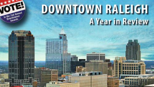
Municipography is a summary of current issues going through the Raleigh City Council and other municipal departments in the city. The point is to try to deliver any video, photos, and text associated with the discussions happening at City Hall or elsewhere. Since this is a downtown Raleigh blog, the focus is on the center of the city.
Light Rail Alternative Discussion
The video above is not the entire Monday night public hearing but just the thoughts of each member of the council on the different light rail alternatives said at the end of the meeting. This was then followed by the council decision. Go here for the link to watch the meeting in its entirety.
Monday night’s public hearing about light rail in downtown Raleigh was short and sweet. Opening up the discussion was Triangle Transit with their pitch about light rail and the process they have been going through over the last few years. Next, the Passenger Rail Task Force (PRTF) presented their thoughts about their recommended light rail plan, the D6A plan, to the council and took their questions. Finally, members from the city staff presented their recommendations to the council, that being the D6 plan.
For some background reading, jump back to this post that talks about the two alternatives along with some good discussion afterwards from readers.
Very few citizens spoke after the presentations and afterwards each council member voiced their support for a light rail alternative, shown in the video above.
By a 6-2 vote, the D6 plan is now the city’s locally preferred alternative. The video ends with a nice quote from Mayor Meeker.
Let’s go ahead and get this system built as soon as we can.
Petition For R-Line to Cameron Village Circulates
I saw this link on Twitter of a petition by some Raleigh residents that want the R-Line to be extended to Cameron Village. The petition states:
Lets bring the bus closer to us and bring new crowds over to Cameron Village at the same time. This petition is to help bring the R-line to Cameron Village for a closer and less hassle way to get downtown and back so you don’t have to worry about finding downtown parking spaces and/or of walking long distances. Together lets bring the bus to us so that we have a faster connection to downtown Raleigh.
As of this writing, there are over 110 signatures, probably more since I’ve now helped spread the word by blogging about it.
The twitterverse was quick to point out the already running bus routes to Cameron Village, the #12 and #16, and how this is really not needed. I kind of agree with this thinking as having a transit network with redundant services competing for riders is a waste of money and just plain inefficient.
Take a look at the RaleighRides site and check #12 and #16 so you can see the route maps overlaid with each other. The coverage is perfectly adequate to get people from downtown Raleigh to Cameron Village. Here are the hours of each route.
Route 12 Operates:
Monday – Friday from 5:45 AM – 11:00 PM
Saturday from 6:45 AM – 11:00 PM
Sunday from 8:00 AM – 8:00 PM
Route 16 Operates:
5:45 AM – 7:45 PM Monday – Friday
6:45 AM – 7:00 PM Saturday
The bus frequency is where the R-Line wins out over the CAT routes. Most of the time, the R-Line has two buses running resulting in 15 minute frequencies. That’s an average wait time of 7.5 minutes. At peak hours, the two CAT routes operate at a 30 minute frequency, off peak 1 hour frequency, that’s a 15 and 30 minute average wait time respectively.
Now what we have to consider is an added wait time to the R-Line if it was extended to Cameron Village. The city owns three R-Line buses, two for operation and one as a backup when one goes down. Running three is most likely not a good idea so the extended route would be run with two unless a new hybrid-electric bus is bought to up the R-Line fleet to four.
Using my Google Map skills, I calculated that the current R-Line route is 3.9 miles (the after 6:30pm) route. Let’s assume two buses can handle a 15 minute frequency with a 3.9 mile loop.
If the R-Line were to be extended to Cameron Village, the most logical route would be what the CAT #12 does today. I extended the Peace Street piece of the R-Line up to Bellwood Drive and Cameron Street. A left on Oberlin and some roundabout action could shoot the bus back down Hillsborough or Morgan into downtown. This fictional route creates a 5.6 mile loop.
So for a review, the current system has 2 buses serving a 15 minute frequency over 3.9 miles. The fictional route to Cameron Village will have 2 buses running a loop that is 5.6 miles. What frequency will this route be?
Math people check me on this one but I calculate a 21.5 minute frequency and therefore an average wait time of 10.8 minutes. Again, this is assuming a lot but interpret the numbers however you like.
Now according to it’s schedule, the #12 and #16 CAT bus both take 10 minutes to get from Cameron Village to the Moore Square station in downtown Raleigh.
So with all that laid on the table, extending the R-Line would create a redundant service in the city transit network. But what do I know, I’m not a transit expert.
In my opinion, the petition just shows this area’s readiness for an upgrade in transit and Wake County officials should perhaps reconsider delaying the referendum on the 1/2 cent sales tax for transit. The changes this tax will fund in the short term are bus upgrades so it’s possible the #12 will operate in 15 minute intervals in the near future with this new revenue source and that would be the better solution.
Suds and Speculation: Light Rail Alternatives and Hybrids
Suds and Speculation posts are ideas I came up with usually while drinking and socializing with friends or people I meet. It is usually paired with real data leading to some idea, or dream, that we can speculate on for downtown Raleigh.
I attended this month’s Downtown Living Advocates meeting and trains were a hot topic. The timing was nice cause it came after the city’s passenger rail task force (PRTF) made their recommendation to the Raleigh City Council on which light rail alternative they prefer for the downtown Raleigh section. To watch the presentation, jump back to this Municipography post on July 6th, 2011.
To continue my intro on this, take another step back to March 2011 where many alternatives for the downtown Raleigh light rail route were on the table. At this point, planners and citizens could weigh in on each plan. Around that time, there were four alternatives that were being seriously considered and have moved on to the next round. Those four alternatives, D2, D3, D5 and D6, are shown on this map. (click for larger)
It has been a couple of months now and decision time is coming up. The city, Triangle Transit and the PRTF all have opinions on this and the city council will narrow things down to a final winner with their approval. So far, of the four plans that moved forward earlier this year, we seem to have support behind just two plans. The alternative called “D6” looks tempting because it involves no elevated flyovers, a stop for the government district a short walk away and is projected to be the cheapest alternative. The second alternative with some backing is the PRTF recommended “D6A”, called that because it is a hybrid of two routes. Let’s add D6A to the map of alternatives.
If you can’t already tell, D6A was not on the list and now makes it five possible alternatives to choose from at this point. After some initial study, if deemed feasible then D6A gets a chance in the ring and we’ll go through a process of analyzing it against the other recommended alternatives.
Now here’s where you come in. There will be a public workshop and lecture about this plan and the others. Don’t comment on this blog post about your thoughts until after you have sent them in to the city for or against D6A. You can attend this lecture to hear more about the plan and drop some comments about it. Details are:
Monday August 1st, 2011
5:30pm – Workshop
7:00pm – Public hearing
Council chamber, Upchurch Government Complex
222 W. Hargett St.
Now that the info is in front of you and I’ve passed along the details for the meeting, we can move on to some thoughts and discussion. It’s D6 versus D6A at this point. The D5, D2 and D3 alternatives are more expensive than D6, most likely because of the flyovers that need to be built. I also want to remind readers that the vehicles of choice here are three vehicle, 90 foot train cars for a 270 foot long train set. A typical city block is about 400 feet so the trains would take up half the length when rolling on downtown streets. Here’s a map of just the two alternatives for a more direct comparison.
I added the D6A route line on those maps so please feel free to send me a pat on the back for my talent with Paint.NET. Kidding, it’s horrible but hopefully it helps.
Light Rail in Raleigh, think of the big picture
To pick which route you like best, I think one has to start by looking at the whole system and the people on it. If you zoom out and look at this light rail line going from Cary through downtown and up to North Raleigh, you’ll see that the proposed stops are miles apart. This is how a light rail system works, moving people from one area of town to another. Larger than a light rail line, a high-speed train moves people between cities and going smaller, streetcars drop people off as often as every 400 feet. Now the tricky part of the downtown Raleigh light rail section is that it will cruise down the streets like a streetcar. Does this mean that it should behave like a streetcar when in downtown?
If your answer is yes, then I think D6A is your route of choice. This route offers more opportunities for bunched up stops and pedestrians can jump on and off more freely. The route penetrates downtown more than the D6 alternative, bringing a rider to the head of Fayetteville Street at the Capitol and right alongside the state government district. The rider catchment area is also greater, giving east Raleigh easier access to light rail.
On the flip side, if you believe that the light rail should drop people off in downtown and continue on it’s merry way down the streets then the D6 alternative is for you. Union Station should be a grand entrance to downtown and therefore riders can transfer to other modes of transit to get to where they are going. Looking at the big picture of the Raleigh light rail, this alternative also gets people in and out of downtown faster.
So each has its strengths but not without some weaknesses.
The weakness of D6, from my perspective, is that it doesn’t bring people into the core of downtown Raleigh. Riders from Cary and North Raleigh don’t have access to the middle of town and have a little more of an obstacle or another transfer to get to their final destination.
I’m not letting D6A off the hook though. The D6A route makes a 270 foot train act like a streetcar in a city grid where 30 foot streetcars roamed nicely over a hundred years ago. The streets haven’t changed much so fitting this behemoth onto downtown streets could be a bit tight. For reference, the modern streetcars in the city of Portland are 66 feet long, their MAX cars are 92 feet long and only operate as single vehicles.
So which one should Raleigh build?
In my opinion, the D6 route serves the entire city best if it makes a stop or two in downtown and does not try to act like a streetcar. The light rail is part of a multimodal transit network, one that has to compliment the other modes of travel. Downtown streets are best served by true streetcars, a network that should come much later in Raleigh’s transit planning future. To force the light rail line to act like one is risky and may not set a good foundation for future transit growth.
Building a Multimodal Network
So this is where I start to pitch my support for D6 over D6A. I had to think about it for awhile but I’m pretty set at this point.
I think those that are looking for that streetcar experience in D6A are losing sight of what a full transit network should be for Raleigh. The light rail line alone is not the answer to getting people to using transit. Along with the light rail, we’ll have upgraded bus routes, circulators and better accommodations for cyclists and pedestrians to get to and from transit stops and final destinations.
Transit, by nature, is multimodal so that is how everyone must think when imagining using a transit network that doesn’t exist yet. Riding will always involve, for 99.9% of people, a walk or bike ride to the nearest bus or rail stop, travel to another stop, then get off and ride or walk to their final destination. There may be one or two transfers, or connections as it’s called outside of this country, to ultimately get you to where you are going.
I feel D6 sets this possible network up in the future. Imagine a spiderweb of streetcar lines coming off the D6 line to move people around downtown and the surrounding neighborhoods. That would be possible, and the natural next step for Raleigh, if the light rail is successful in helping spur development around her stations.
How does D6A set up this future multimodal network when it tries to do it partly on its own? Think of the new obstacles in creating connections around a light rail line that has multiple stops in a congested downtown with narrow streets. You don’t get that natural ease of mode change with D6A and we may be setting ourselves up for future lines to run on top of each other, which isn’t an efficient way to run a transit network.
If you look at the 2030 Comprehensive Plan, the light rail line is for moving people between the planned growth nodes and to spur transit oriented development in those areas. I feel the best use of the light rail line is to move people between these nodes according to the plan, not within the nodes as D6A tries to do in the downtown piece.
One More That May Seal It For You
This one kind of hit me when I was riding the bus home and stared out at the NC State Capitol as we drove past it. Aesthetics are very important to some so let me remind you that the light rail cars will be electrified with overhead catenary wires, like the first picture in this post. D6A wants to run the trains right down Hillsborough Street from Salisbury to Harrington Street, a street with a nice view of the Capitol building. Now it’s no Fayetteville Street but long time readers or anyone following downtown may remember the Plensa fiasco of 2006. For a recap, jump to:
Collision of complex forces defeated plaza via newsobserver.com
Back then there were great concerns with the design of the plaza and how it would block the view down Fayetteville Street. If I recall correctly, the city even paid $10,000 to set up a mock up of the design so that they could see how it looked first. We ultimately couldn’t make a decision on it, making the process take so long that the $2.5 million gift was retracted and the project eventually died.
Anyway, that is in the past and may not be an issue this time but I swear people get really upset about overhead wires so maybe this is important to you.
Municipography, Food Trucks Debate Continues, Rezoning for Raleigh City Farm
Food Trucks
The food truck controversy continues with the Raleigh City Council passing the hot potato to the Law and Public Safety Committee for review. That committee’s next meeting is next week and their recommendation should go back to the city council for their meeting on August 2nd.
I felt like the tone of the meeting on this topic continues to be that of concern and fear. With the opportunity to create restrictions on this “nuisance”, the city council is clamping down on the food trucks without really thinking through it all.
The Law and Public Safety Committee is chaired by Mary-Ann Baldwin and also includes Councilors John Odom and Eugene Weeks. E-mail them your thoughts on the food trucks.
- mary-ann.baldwin@raleighnc.gov
- john.odom@raleighnc.gov
- eugene.weeks@raleighnc.gov
Raleigh City Farm Rezoning
This rezoning request is for a property on East Franklin Street, here. Basically, it’s zoned for a shopping center and the rezoning is to remove any use of agricultural purposes on it. This is where the non-profit Raleigh City Farm wants to set up and the community seems to greatly support it.
The suggestion moves to the planning commission for review.
Parking Cleared For Outdoor Seating on Glenwood South, Cars Wimper While Driving By
This is a small project that was first mentioned back in 2008. What a nice surprise to find this lot torn up as I walked up Glenwood yesterday. I asked one of the construction workers what they were working on and he confirmed that they were putting in a patio seating area for the restaurants in the building.
For those that can’t tell, this is the building in Glenwood South with Zely & Ritz, Sushi Blues, Taiphoon, and Bottega Hair Salon. Glenwood South is leading the charge on the outdoor seating options.