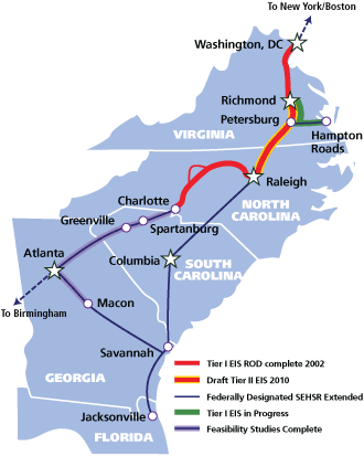
High speed rail talk is back! It has been just over a year since the last major update on the plans to run high speed rail from Raleigh to Richmond, Va. This time, a new alternative has been released, called the NC5 alternative, and SEHSR.org has a massive map that you can download to see this proposal.
First, let me plug the meeting about this update.
The public is invited to attend a Project Update Meeting to learn about a new rail alternative developed for the SEHSR [Southeast High Speed Rail] corridor in downtown Raleigh, NC. The meeting will be held Tuesday, Sept. 27, 2011, from 4 to 7 p.m. at the Raleigh Convention Center.
For some history on the project, you can dive into the older RalCon posts here. The short of the story is that in the summer of 2010, three plans were on the table for the portion of the rail line running from Whitaker Mill Road to the future station in Downtown Raleigh’s Boylan Wye. Comments from all three plans were taken in and now a fourth alternative is on the table. By the way for the mathematically gifted, an NC4 alternative was a real idea last year but didn’t gain much ground, hence the NC5 naming of this recent one.
The SEHSR site introduces this new alternative nicely:
Alternative NC5 was developed in response to strong public opposition to Alternative NC3, as well as to the City of Raleigh’s opposition to the disruption of traffic and pedestrian patterns in the area around Jones Street and Glenwood South presented by Alternatives NC1 and NC2. It was also developed to minimize impacts to the freight operations within the Norfolk Southern and CSX rail yards. Last, Alternative NC5 was developed to avoid impacts to historic resources listed in or eligible for the National Register of Historic Places. Along with the development of Alternative NC5, revisions have been made to Alternatives NC1, NC2, and NC3 based on comments on the DEIS. All alternatives have removed the bridge on Hargett Street over the railroad, and would instead close the Hargett Street railroad crossing. In addition, a pedestrian bridge along Jones Street over the railroad corridor was added to Alternative NC3 (as well as the new Alternative NC5) to mitigate the effects of the road closure.
If you want, you can download the pdf in its original form at this link, taken right off the SEHSR site.
However, if you happen to like maps that have north pointing straight up, like I do, I have cut, copied and rotated the same version with north pointing towards the top of your monitor. For smaller viewing, I’ve also included key sections of the map that show the major changes.
Rotated NC5 map full map (3605×4274)
Whitaker Mill elevated bridge (600×500)
Wade Avenue and bridge over Capital and West (600×500)
Jones Street pedestrian bridge (600×500)
UPDATE: 09-18-11
Steven Waters has made a mash up of the NC5 alternative and Google Maps. See the overlay at this link.
Walking Riding through NC5
Let me attempt to talk you through this route. Place yourself on Whitaker Mill road where it crosses the tracks between Wake Forest Road and Atlantic Avenue. This fictional train I’m putting you on is facing south and will be heading into downtown Raleigh.
The first change is that Whitaker Mill Road will go over the tracks. Not such a shocking change as all the alternatives propose this. It’s a requirement that high speed rail operate on dedicated tracks and not share with street traffic.
Next, starts the controversy that we went through last year. As the tracks move south to Capital Boulevard, there is a crossing between tracks owned by CSX and others owned by Norfolk-Southern. Should the high speed trains follow the CSX corridor or the Norfolk-Southern?
Under NC5, the high speed train continues south and will stay on the CSX train corridor, which are the set of tracks east of Capital Boulevard. This avoids the Norfolk-Southern railyard on the west side of Capital, something that they greatly opposed.
As the train moves southward, the next interesting piece comes around the Wade Avenue flyover. A bridge will be built over Capital and West Street allowing the trains to come out of the CSX corridor and then enter the Norfolk-Southern corridor on the west side of Capital.
The train then continues on into downtown to the future Union Station.
Now I mentioned earlier that streets must be closed for high speed rail and in Glenwood South, Jones Street is the only street where the train crosses at the same level of the tracks so by this rule, Jones would have to be closed at this point. That is the case here. Under NC5, Jones Street will be closed to vehicular traffic. However, the alternative includes a pedestrian bridge over the tracks where the other alternatives did not include that before.
A very interesting plan for sure. The pedestrian bridge over the tracks on Jones Street is a huge plus for downtown and I’m glad the idea of the elevated bridge for vehicles was essentially thrown out. With an ongoing Capital Boulevard corridor study going on, I wonder if this bridge over it will mesh well with a new corridor vision.
Enjoy the maps and provide your comments before October 27th.
Comments
Comments are disabled here. That's because we're all hanging out on the DTRaleigh Community, an online forum for passionate fans of the Oak City.
[…] drastic reductions in spending could adversely affect the fragile economy and stall future recovery.In an effort to create a catalyst for job creation, President Barack Obama is calling for a six-year…lion spending plan for high speed rail. Set to release Monday is Obama's budget plan and if Congress […]
I like Alternative 5 it seems to address all of the concerns listed. Although somewhat unrelated, and closing Jones St shouldn’t really cause too many problems… I have always had this idea of recreating the street grid in this area: Connect Lane St with a bridge over the two railroad tracks. Extend North St to Salisbury St and create a roundabout at the intersection with Capital Blvd. You could even do a express lane tunnel for the Dawson/McDowell traffic and the roundabout would serve the local traffic (ala Connecticut Ave in Dupont Circle in DC). Ok this is definitely a different discussion for a different time.
[…] High Speed Rail adds NC5 alternative […]
This seems like an acceptable option to me. It always keeps an existing railroad between the new tracks and any residential neighborhood, lessening the impacts.
An important but not immediately obvious benefit over NC3 is that Fairview will not be closed under NC5. An important benefit over NC1 and NC2 is that NC5 no longer crosses the Norfolk Southern freight line at a diamond (“Edgeton”).
The brunt of the impacts this time are borne by businesses along West Street. There is not too much of architectural interest here, mostly just metal or block warehouses – but hopefully the businesses themselves can relocate to somewhere nearby or otherwise well suited to their needs. Some impact will also be felt by
I hope the long viaduct along West Street can be built to allow usable space beneath. There are plenty of precedents all over the world for retail space beneath viaducts.
I would rather see a tunnel under the tracks at Jones than a bridge over them. A bridge is a huge pain in the ass since you have to climb up about 25 feet (3 floors) before you can go over the tracks, whereas with a tunnel, you only have to go down about 8 feet (1 floor). There is no precedent in Raleigh for a footbridge over railroad tracks, but there are plenty of heavily used precedents for a tunnel (see example: NCSU.) While they’re at it, a tunnel at Lane Street would be nice, too.
It’s important to note that between the High Speed Rail and the Light Rail, THREE railroad crossings would probably be lost downtown- Hargett, Harrington, and Jones. The crossings at West, Cabarrus, and the little stub on Martin would be the only ones to remains.
I also support NC5 as it avoids using elevated rail cutting across the important redevelopment area on the northeast end of Glenwood South – where they’ve now decided to site a light rail station.
There will still be some neighborhoods, albeit fewer under the NC5 proposal, that want the trains to stay on the east side of Capital Blvd, but there are just as many on that side who want the trains using the west side as it approaches downtown Raleigh.
This seems to be the best compromise with the fewest impacts on homes and businesses.
Owen E: I share your desire that the viaduct along West Street be open to allow usable space, but I have learned that this will not be the case with NC5 has currently proposed. In order to get Norfolk’s Southern buy-in, separate HSR tracks will be built alongside the NS tracks, meaning that the existing (low) Peace Street rail bridge will remain along with their ugly (kudzo collector) earth berm supported tracks that extend from Peace to North Street.
As far as the pedestrian overpass over Jones Street, I’m hoping a developer gets involved to create a second story landing with retail, rather than a simple bridge.
I read a an idea today that sounded intriguing. Why not have the HSR by-pass the downtown core and instead route it near the airport and develop a massive transportation hub there with air, rail, and bus – and be a base for an interconnecting rail of the triangle cities. You can still build the light rail in the DTR and have union station; and extend it to the airport.
Mike: No, that’s a bad idea. Perhaps the best thing about trains is that they can stop right in to the center of town. What’s the point of a train to New York City if it stops at Laguardia where you have to catch a bus downtown? Same for Washington DC; there’s no benefit to a train if it stops at Dulles and you have to take the bus to where you’re going.
Plus, do you think a high speed rail line to the airport would be cheap and have zero impacts? You’re mistaken, it would certainly have some impact to North Raleigh neighborhoods and it too would be extremely expensive, due to the complexity of building anything through the taxiways, runways, and roadways at the RDU terminal.
Jasdelaney, I did note that the existing Norfolk Southern line would be pretty much 100% untouched.
However, the way I see it, There’s no reason that only the area under the new viaduct (the space between the NS line and West Street) couldn’t have useable space underneath. There seems to be 80 feet between the NS right-of-way and West Street. That’s certainly more than wide enough for a useful building under the viaduct – maybe even a 2 story building in some places since the tracks are 32 feet above the street at Johnson.
Owen, I am not saying that the rail would stop at the airport and continue on. Their could/should be a connection from the airport to Raleigh still via rail. Most European cities have a similar approach. Their Hi-Speed line runs on a terminal outside the core and have a line bring in from that terminal to DT.
Having said that, I’ll concede the expense of that build out would be tremendous.
Just some thoughts:
1) high speed rail construction will create jobs
2) high speed rail will create income in the form of those jobs and in the form of ticket sales
3) adoption of a rail system that could get you from Raleigh to DC in a couple hours would be high given the volume of folks that visit that area from the Triangle for work each week
4) tourism in NC would prosper if a quick weekend get away from DC to the outer banks was possible (currently that’s a 6-7 hour trip that could be 3-4)
5) NC residents would benefit if the system were extended to CLT from RDU b/c you could make the trip in less than 2 hours. This would reduce the cost of travel between the two cities and open up even more commerce opportunities for small businesses.
After visiting Europe (specifically London and Paris), it becomes very evident that we are living in the dark ages with regards to transportation. There are so many ways to get off gas but we have to be willing to invest to make this happen. This one makes sense and Amtrack is not a viable comparison. We would need to look at the positive overall impact the EuroStar system has had on Europe and learn from their initial missteps.
[…] Recent Raleigh Connoisseur blog post […]