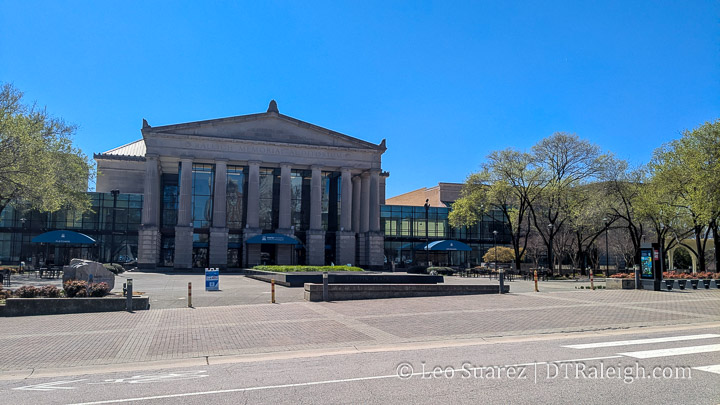
Lichtin Plaza, or the space in front of the performing arts center, will soon get a remake. Aimed at making the space more accessible, the plaza will make way for a drop-off lane and you can see what that might look like in the rendering below. This seems to make sense as South Street is jammed before large events at the performing arts center and an improved drop-off process helps groups access the area more easily.
Last week’s City Council meeting (watch on YouTube here) featured an important update on downtown Raleigh, covering public safety and ongoing improvements to our public spaces. The primary focus was on Fayetteville Street and security enhancements at GoRaleigh Station. There were some great takeaways, and overall, things seem to be moving in a positive direction.
What’s Been Done or Coming Soon
Downtown Businesses Holding Strong – Contrary to some concerns, (and TV news) more businesses are opening than closing. Get out there and support them.
Fayetteville Street Tree Lighting – Expect some fresh ambiance in May/June when new lighting is installed on the trees along Fayetteville Street.
City Plaza Enhancements – New shade structures, planter boxes, and “lookout” tables, all aimed at making the area more inviting, are coming this Summer.
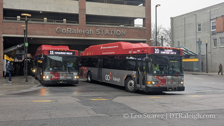
GoRaleigh Station Security Upgrades – The city has hired its first-ever safety director to oversee security at the transit hub.
Crime Trends – Violent crime in downtown is down 3%, while property crime has seen a significant 29% decrease.
More Active Patrols – Expect to see increased foot and e-bike patrols to improve visibility and safety. Also, Raleigh’s ACORNS unit is fully staffed.
On the Glenwood South front, Raleigh Police Department (RPD) is satisfied with its current strategy, and we’ve shifted from focusing on violent crime to managing noise issues. That, in itself, is a positive sign.
Looking further ahead, the Fayetteville Street Streetscape Plan is expected to be officially adopted by Winter 2026. What does that mean? I take it to mean that the plan is agreed upon and when looking into my crystal ball, I hope the following takes place:
Winter 2026: Plan adoption and cost estimation
Spring 2026: Budgeting process begins
Summer/Fall 2026: Procurement and request process
Beyond that: Implementation—hopefully aligning with the opening of major downtown developments like the Omni Hotel, Convention Center Expansion, and Red Hat renovations.
This week, we have a not so great photo of the new sign on the Union Station Transit Facility. I thought this would be significant as we are months away from the station opening. The area looks very unfinished and future development is still to come to the area.
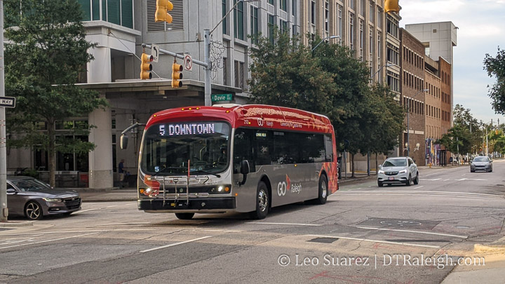
Have you ridden any GoRaleigh buses lately? It’s been about six months or so since fares have returned and at the same time, the number of ways to plan your trips and pay for your fare have increased. All those options are meant to help you, not confuse you, and so with lots of options out there, I wanted to take a second and get a list going of all the tech available for connoisseurs to get around Raleigh stress-free and fully informed.
Here’s a nice perspective I captured showing the Raleigh Union Station Bus Facility, or RUS Bus, that’s been under construction for the better part of this year. It’s not that clear from the street but from a higher vantage point, you can see the orientation of the bus station and the future location of high-rise developments. The bus station is planned to be in operation in 2025 but the site is nowhere close to being complete.
A new bus route, the #9 Hillsborough, started service in September of this year, offering 15-minute frequency between downtown and NC State seven days a week. This got me thinking about other bus routes that operate every 15 minutes—our definition of “high frequency” here in Raleigh.
I’m guessing you probably didn’t hear about this new route as you don’t use GoRaleigh. I feel confident with the claim as it’s estimated that only 2% of the Raleigh population uses the GoRaleigh bus system. (I may be off by a few percentage points but the point is, it’s pretty low) However, as Bus Rapid Transit grabs headlines these days, it’s the small details that are going unnoticed and there’s a case to reconsider GoRaleigh as part of your mobility toolkit.
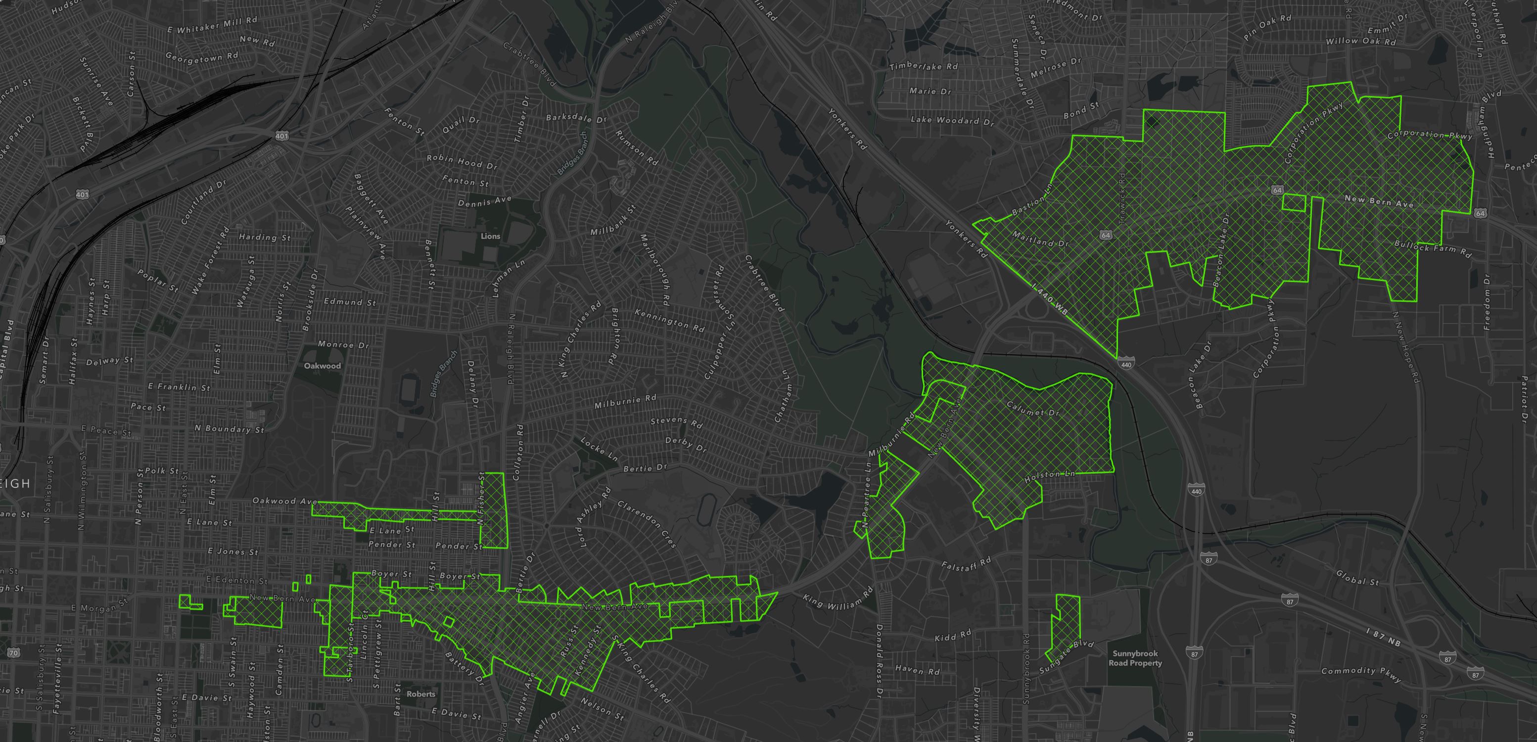
Rezoning case Z-92-22, or better The New Bern Avenue Transit-Oriented Development (TOD) case, is now in the books. Or “on the map” as I prefer to see these things. The final votes took place in July and I wanted to kind of wrap up these changes as the city council has been working it since January of this year. Above is a screen grab from iMaps where you can see the applied TOD zoning in East Raleigh.
Embedded above (direct link here) is the video from the June 4, 2024 Raleigh City Council meeting where the latest updates and discussion took place related to the Transit-Oriented Development (TOD) rezoning case for the New Bern Avenue corridor. We’ve been following this for awhile now and the rezoning case here, which sets to change the zoning for over 700 properties on or near the upcoming Bus Rapid Transit line for New Bern Avenue, is being worked on in phases. I wanted to share my notes and provide a summary of the latest.
Feel free to dive right into the video above, as it opens with a nice summary, and check out these resources on the city’s website: