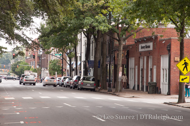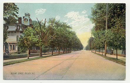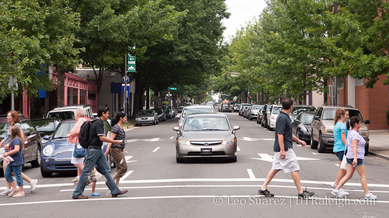
Blount Street at Hargett Street
On July 16, 2013, the Raleigh City Council approved the Blount/Person Street Corridor study. The project that includes the two streets from Capital Boulevard down to I-40 along Hammond Road has been ongoing since October 2012. The result could be more multi-modal streets that are phased in as funding becomes available.
There are well over 1000 pages of analysis, renderings, and overviews on the project, all available on the city’s website. I thought I’d take the time to skim through and put some highlights of the project here on the blog.
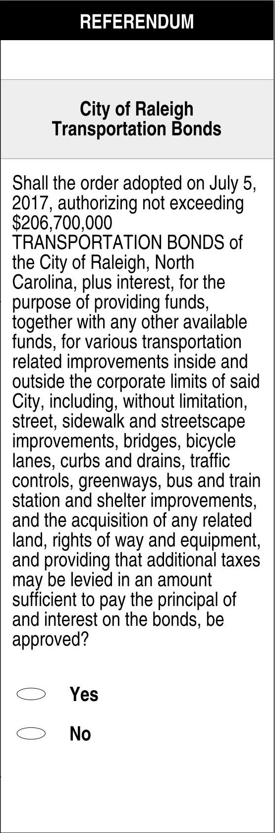
One important thing to be aware of is that funding for Phase 1 is included in the Transportation Bond coming to this October’s ballot. That will pay for a re-striping project of Blount and Person Streets that lays the foundation for the One-Way Road Diet plan.
Read on for more details.
Overview and Project Area
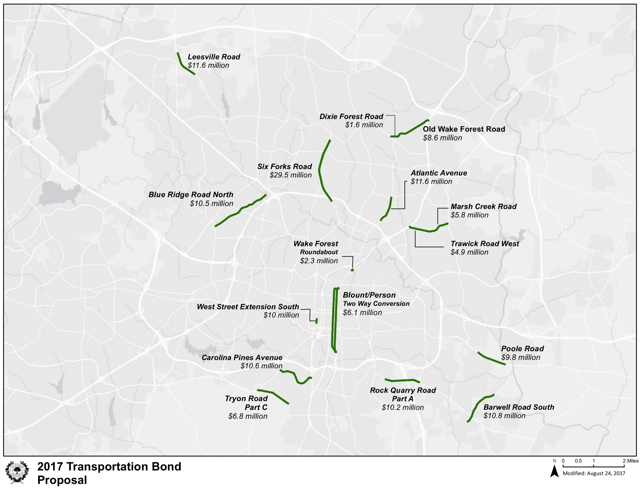
As mentioned earlier, the project area starts in the north along Atlantic Avenue near Capital Boulevard, continues down Wake Forest Road to the one-way pairs of Blount/Person Streets and ends at Hammond Road through I-40.
Below is map of the area taken from the documents. It’s a lengthy map so click to expand/collapse it.
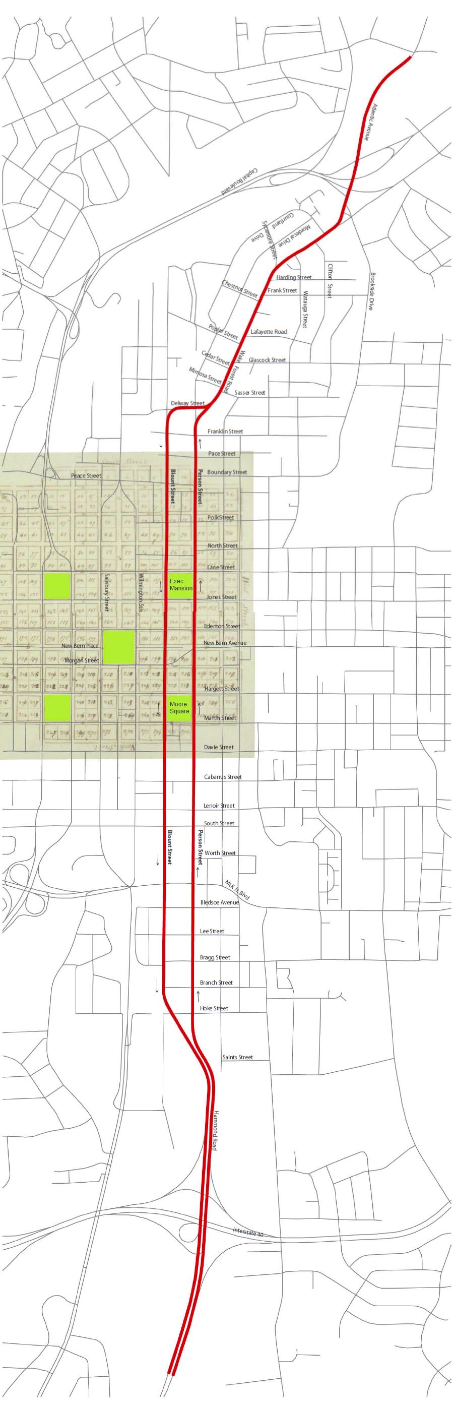
Map of the Blount/Person Street Corridor Study
During the July 16 city council meeting, Grant Meacci from city planning gave an overview to the council. You can watch it in the video below.
One-way versus Two-Way
The report’s findings are based around some high-level themes which include:
- A Complete Street – “The corridor has the potential to encourage and serve a wide range of users,”
- A Functional Street – “The corridor provides valuable and needed access to Downtown Raleigh, adjacent
neighborhoods, and major regional destinations”
- A Vibrant Street – “The community envisions a thriving corridor with a wide range of housing, shopping and working opportunities.”
- A Beautiful Street – “A beautiful street is the result of continued investment in streetscape, tree planting, and street character.”
With these themes in mind, two design alternatives have come out that could accomplish the goals of the study.
- One-Way Road Diet
- Two-Way Restoration
In addition to studying both of these alternatives, the report states that they should not be seen as mutually exclusive but rather steps towards achieving the vision for the corridor. So for example the one-way road diet could be put in now but later, after feedback from the community and further analysis, the two-way restoration could be implemented.
The report has a great one-page comparison chart that states the potential negative impacts as well as benefits of each approach. Click on it below to see it larger.
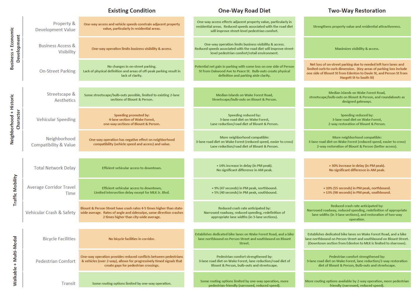
Alternatives of Blount/Person Street Corridor Study
To make this all happen, 3 phases are proposed.
- Road Diet Restriping – 4 sections along the corridor ~$730,000 (To be on the Oct 2013 Transportation Bond)
- Streetscape – 3 section along the corridor ~$7.47 million
- Two-Way restoration – 3 section along the corridor ~$4.17 million
The sections are broken out so it looks possible to fund them in even smaller steps if necessary.
Details and Renderings
Public participation was a key part of this project and hundreds of ideas and comments were submitted. The report has an exhaustive list of comments that were organized into themes, the ones that helped shape the ones mentioned above. Here are a sample.
Business & Economic Development
- Safe access to business
- Vibrant community business district
- Local Independent businesses
- Thriving businesses that are accessible by peds, bikes, and cars
- Support growth of small neighborhood (walk to businesses)
Traffic Mobility
- Slow traffic speeds
- Alternative parking solutions
- Connection to Downtown
- Ease of grid design between sections
- Easy access to BeltLine and I-40
Walkable & Multimodal
- Traffic Calming
- Ability to safely walk to venues
- Walkable to Downtown, safe for children to roam
- People Friendly environment
- Reduce traffic, increase bus service
The report then gets into showing the different “layers” around the corridor including existing land use, popular destinations, open space, parks, and current redevelopment plans. This really shows you the mix of neighborhoods and historic resources that are present in this area.
No report is complete without a traffic analysis and the report has a mountain of information including traffic counts, travel time, and level of service. Looks like most of the downtown intersections show pretty good marks with the data taken in 2011.
The street design here is a mixed-bag of offerings with streets that have sidewalks and good urban form while others are lacking proper sidewalks. The worst areas were to the south near Bragg and Branch Street as well as to the north near Wake Forest Road and Atlantic Avenue.
For reference, each section’s current street design within the corridor has an accompanying rendering. For example, below is Blount Street from Edenton to South Street.
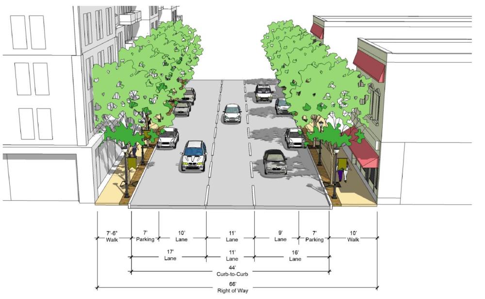
Current street cross-section.
Section 2 of the corridor study introduces us to some Street Design Guidelines. You don’t have to be an urban planner to follow this section but a lot of the proposed changes to the corridor will follow these principles. Topics include:
- Sidewalk Spatial Standards
- Green Streets – Techniques to transform typical street surfaces into stormwater collection system using carefully selected landscaping.
- Bulb-outs
- Street Furnishings
- Components of a Vehicular Corridor
- Components of a Intersection (including roundabouts)
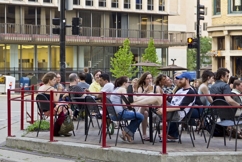
Outdoor cafe on bulb-out by Kaizer Rangwala, on Flickr
The next section of the report gets into the details of transitioning from current conditions to both the one-way road diet and/or the two-way restoration.
With roundabouts around Capital Boulevard to the north and improved intersections around Hoke Street to the south, there are also conceptual drawings of what the new Blount/Person streets could look like running through downtown Raleigh.
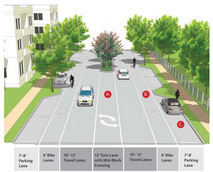
During the One-Way Road Diet plan, the following would be implemented on Blount/Person:
- “Maintains the one-way operation and proposes a ‘road diet’ eliminating one travel lane in each direction. The elimination of a travel lane allows the street to be reconfigured to include a bicycle lane in each direction (northbound on Person Street and southbound on Blount Street).”
- “Bicycle Facilities – The corridor-wide road diet allows space for a continuous bike lane in each direction from Hoke Street to Atlantic Avenue.”
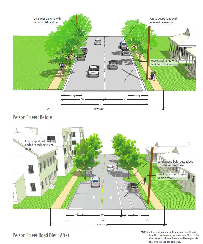
Before and after street cross-section.
The Two-Way Restoration plan has a lot going on. Refer to section 3 of the report to see the conceptual designs that include a few more roundabouts as well as possibly slimming down Person and Blount Streets to one-lane in each direction. I do want to re-iterate that further analysis is needed to get to that point but this report starts the conversation.
The study wraps up with the traffic analysis. You can dive even deeper into that with the over 1000+ page detailed traffic analysis report for the real municipal geeks out there. The analysis shows how a variety of intersections currently perform and how they are projected to perform under the proposed changes.