
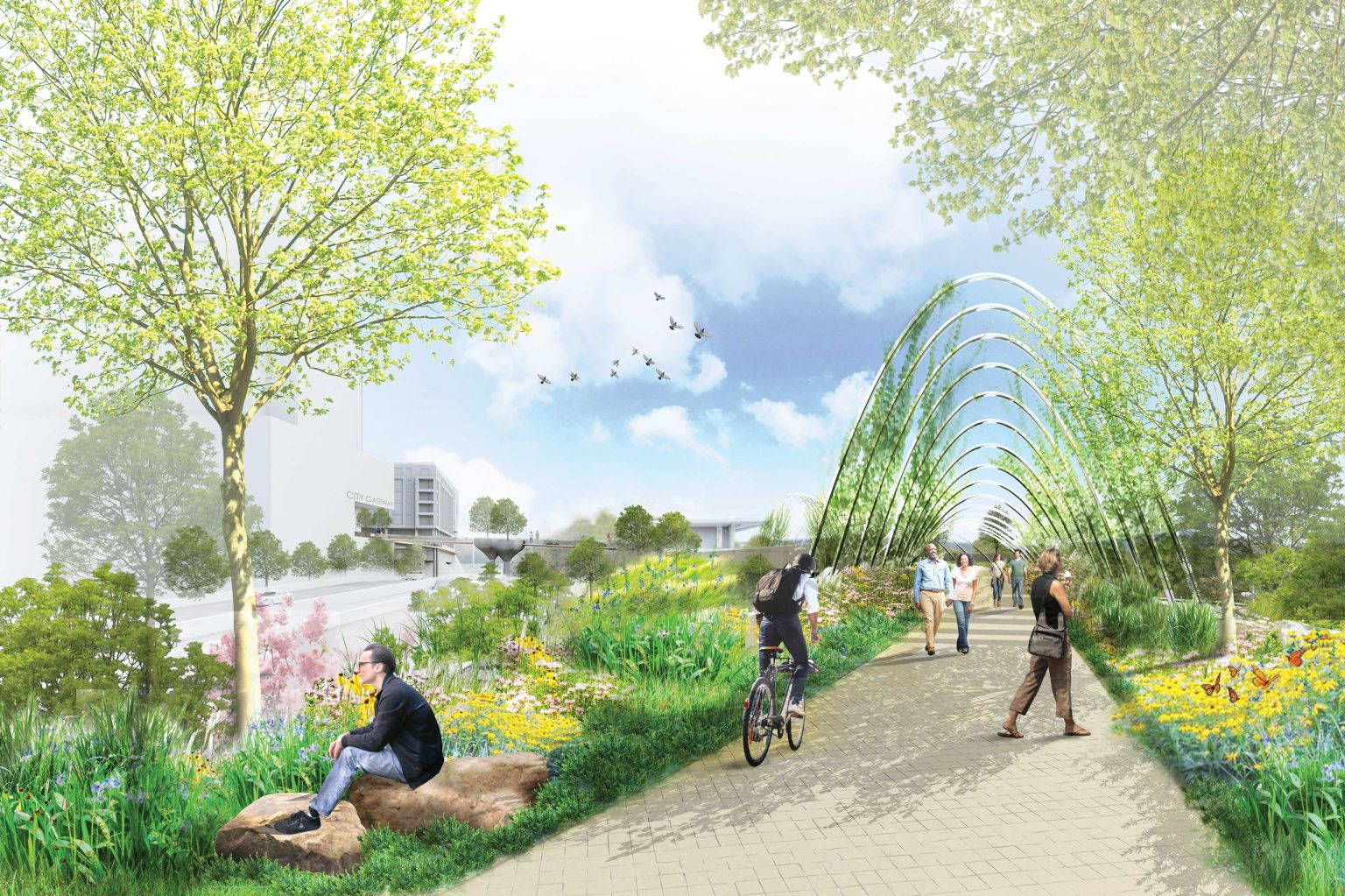
I heard about the announcement of The Oakline at the 2026 State of Downtown Raleigh meeting that took place in August. It’s quite a concept, and that’s got me pretty excited. The idea is to build a bridge alongside Martin Luther King Jr. Boulevard that creates a pedestrian and bicycle-only connection from the southern end of downtown to Dix Park. Now sure, you can walk from a variety of points in downtown to Dix Park today but there’s nothing special about it. While direction apps may say it’s only a 15-20 minute walk, I guarantee you it’ll feel longer in our warmer months. This is why a thoughtfully designed trail, embedded in and around our urban fabric, has the potential to make The Oakline a destination in and of itself.
If you want to dive right into it, check out the project’s website here: theoakline.org I’ll also mention early that this whole thing is just a concept and the city has yet to fund a feasibility study for it. The Oakline is proposed by SfL+a Architects, with Surface 678 (landscape architecture) and Preston Montague Studio.
First of all, this is not the Chavis to Dix Strollway and the map below highlights this alongside The Oakline. That project is more of a heritage trail, highlighting the history of the historic Third and Fourth Wards of southern Raleigh. Some of that has already started with the new signage and designation of the Fourth Ward Entertainment District. We’ll get into that as it comes along in the near future.
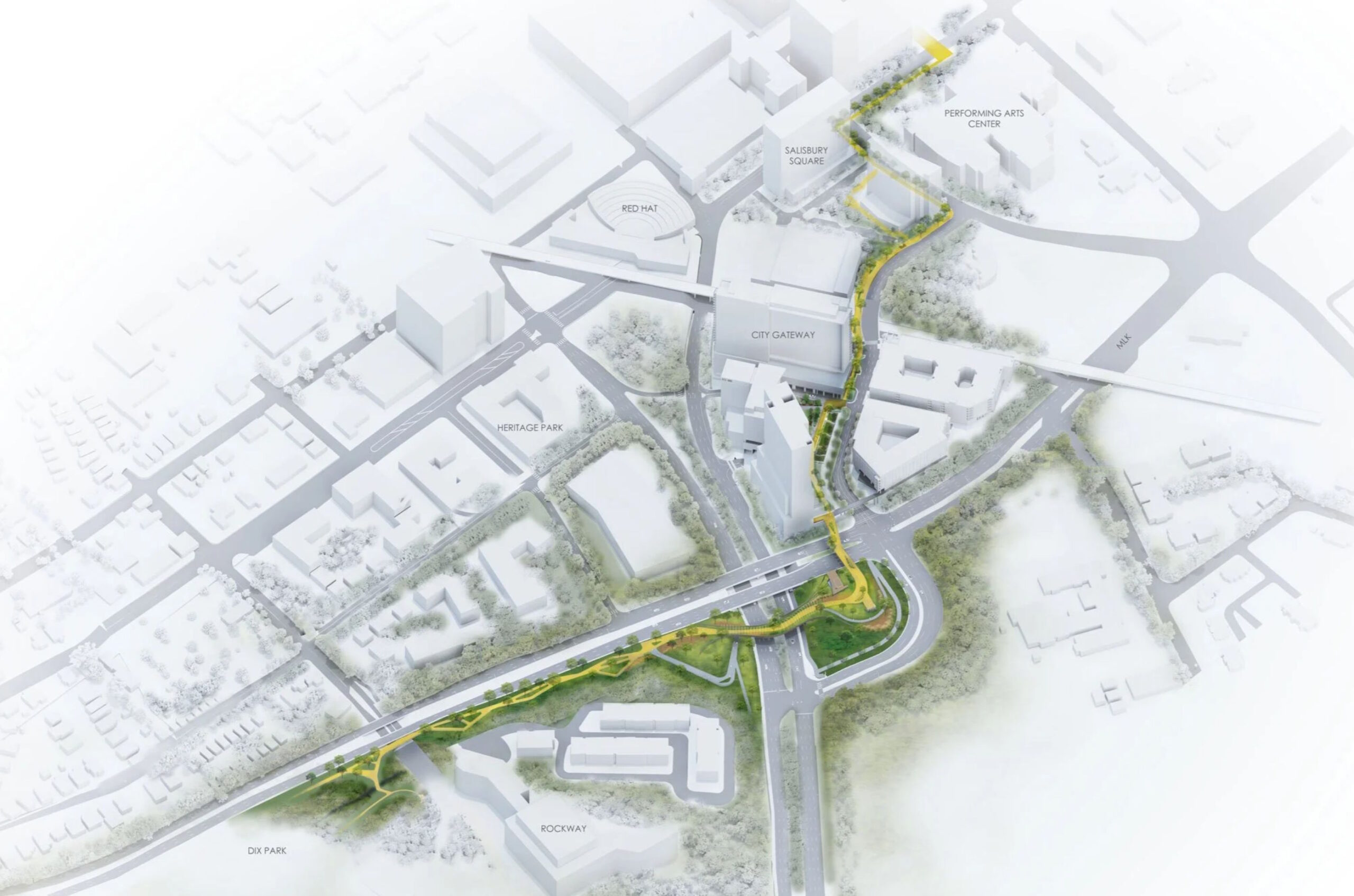
Looking at the map below, focus on the yellow trail that worms its way from the southern end of Fayetteville Street over to the northeast corner of Dix Park.
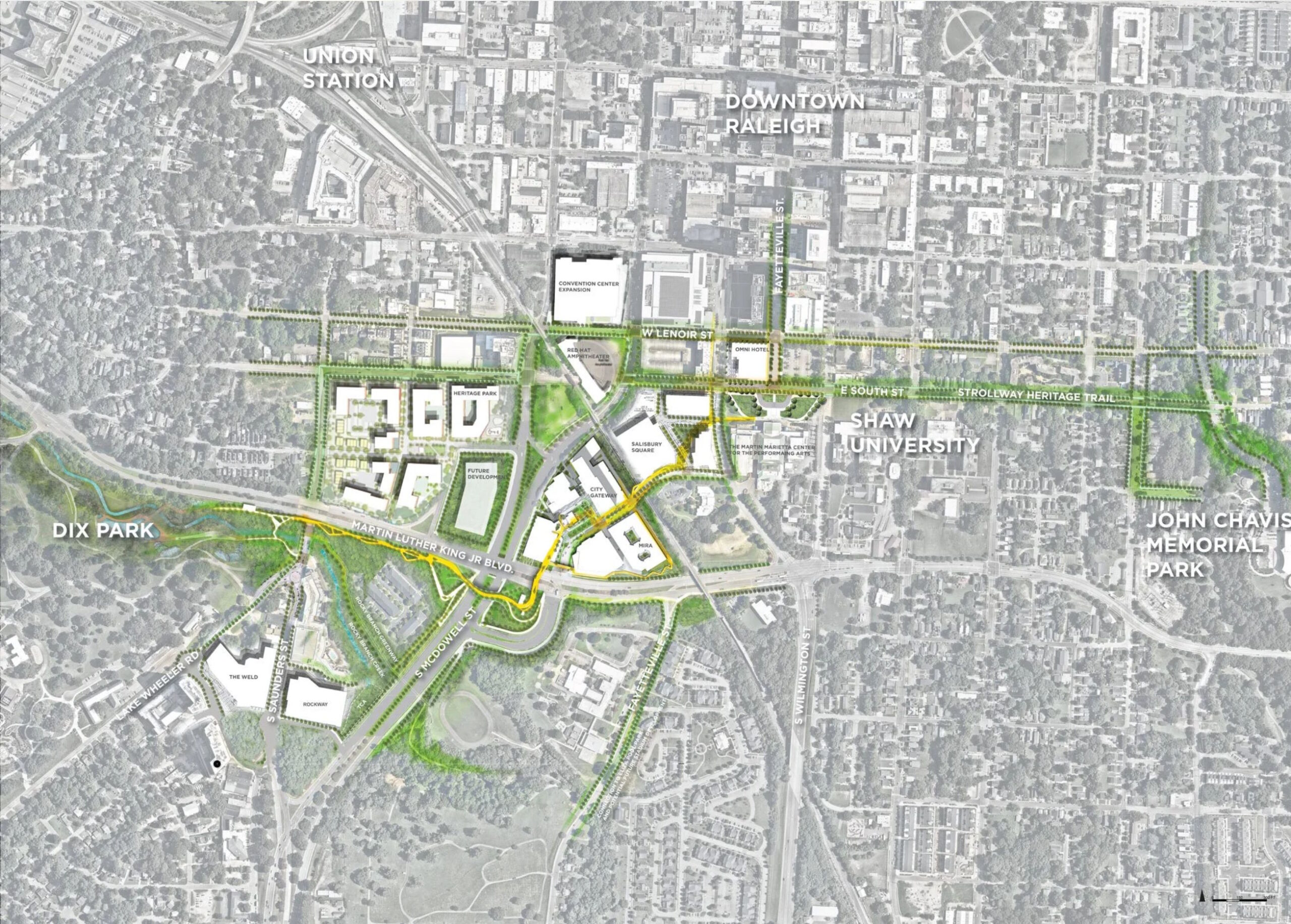
If we were walking from downtown to Dix, the path encourages you south down Fayetteville Street towards the Performing Arts Center. North of MLK Boulevard, The Oakline primarily runs along city-owned streets and private land. The City Gateway project would anchor this on the downtown side as the sidewalks of Salisbury and Kindley Street turn to plazas and walkways within the upcoming development. Parts of the future Salisbury Square development may also contribute. At this point, you could rest or pick up some provisions before continuing on as City Gateway plans for ground-floor restaurants and retail in the future.
You’d now be ready to cross MLK over an elevated bridge and into the beginning of The Oakline. Described as park-like, even as much as being an extension to Dix, you can see that the designers are using the space around the roads to transition you into nature. The MLK and McDowell Street cloverleaf may come apart for this project and the land within could look this rendering below.
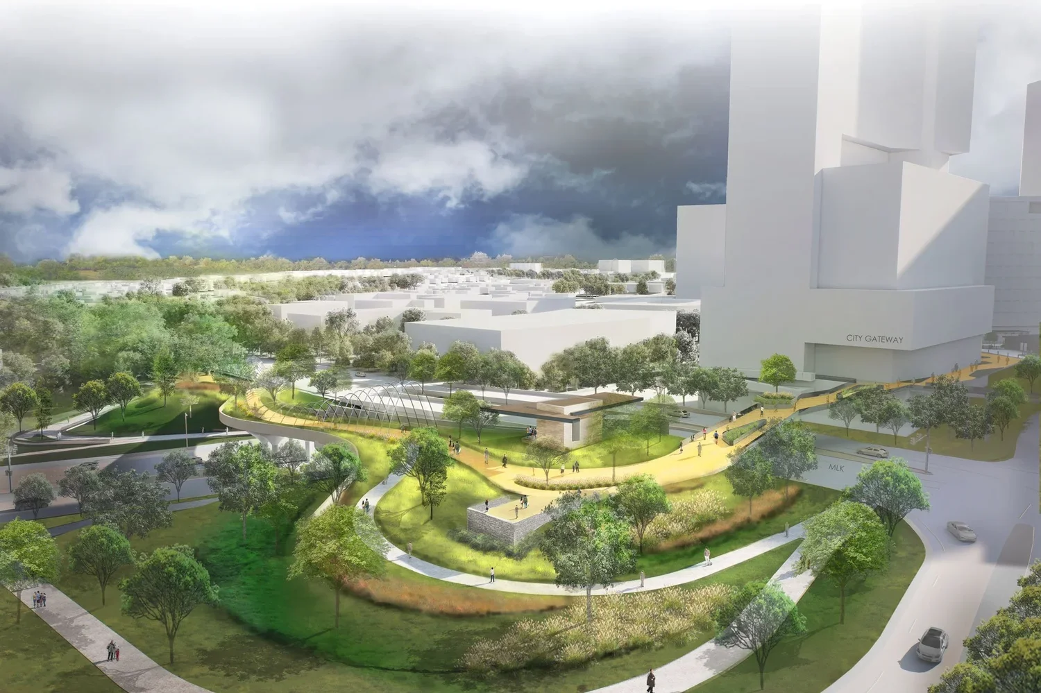
With shade, plants, and benches, I could already see this becoming a destination by itself. The rendering suggests paths elsewhere, like walking on the southern side of MLK but even down to McDowell, which would be fantastic if in the future there are places to go nearby. However in this hypothetical, we’re trying to get to Dix so the next step would be to cross the bridge that runs parallel to MLK and head west.
Now MLK has highway-like characteristics if we’re being honest. The speed limit is 45 but we all know people drive faster than that here so I’m skeptical of the designers’ talk about nature and tranquility while 20 feet away cars are rushing past. My hope is that with proper planting, or even elevating the walkway slightly higher than the MLK Boulevard bridge, we could at least block some of that noise from the vehicles whizzing by. You can see it in their rendering here.
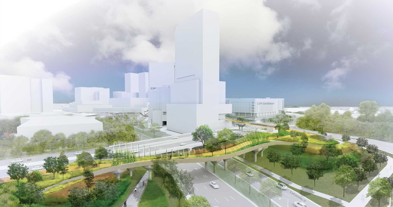
But I don’t want to be a hater. This still looks incredible and noise canceling headphones do exist. The walkway continues all the way to Saunders Street where you can continue toward Dix Park or rest and relax at the restaurants at Rockway. Leaders say the walk takes 15 minutes from the Performing Arts Center to the edge of Dix Park. If we set up dockless bikes and scooters at each end, I imagine everyone would take this instead of using Saunders and Lenoir to get back and forth.
One problem The Oakline seems to solve is the large elevation change between downtown and Dix. Walking between them on city sidewalks is fine, but it’s quite an urban hike. The Oakline takes this into account and flattens the walk as much as possible. That’s a great accessibility amenity for us to have, allowing all ages and abilities to experience The Oakline.
I’m also intrigued by these plans for further undoing of the MLK/McDowell/Dawson cloverleaf. City Gateway has already caused the removal of the north-bound vehicle lane from MLK to McDowell. The map renderings show possible development on the north west side of the interchange instead of that loop road. I couldn’t find any published NCDOT plan for this but I’m all for it.
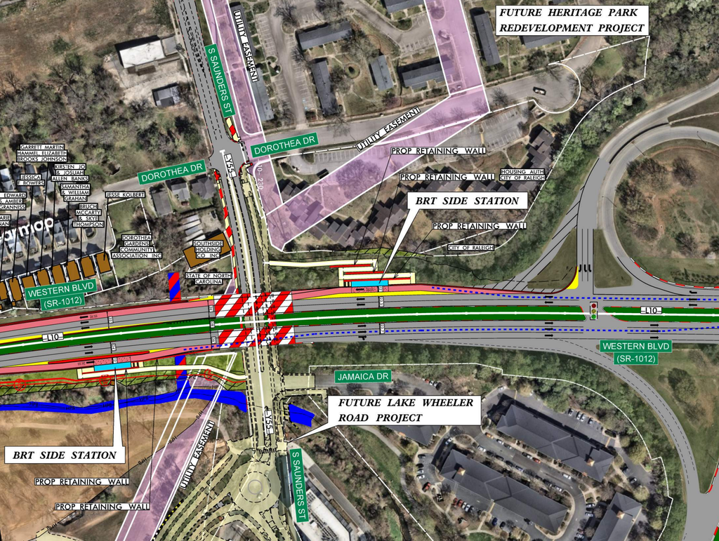
It’s also important to point out how much more important Western Boulevard and Saunders will be in the future. Today, one street crosses over the other and you can’t walk between them. (and there’s no reason to) When you take The Oakline and the future Western Bus Rapid Transit route into consideration, these two streets come more together for pedestrians. The Western BRT plans for a stop right at MLK and Saunders where riders can exit off Western and walk down to Saunders. The preliminary plans show it like this.
A destination connecting two destinations makes so much sense. I’m all for infill development between downtown and Dix which creates a lively walk between the two places but there’s no guarantee that we’ll get interesting retail on every block between Fayetteville Street and Saunders. That also doesn’t feel like Raleigh while this plan does. Greenways are a baseline that Raleigh knows well and the local culture embraces in addition to our parks. If successful, maybe the Oakline will get extended further west or in some other direction in the future.
Comments
Comments are disabled here. That's because we're all hanging out on the DTRaleigh Community, an online forum for passionate fans of the Oak City.