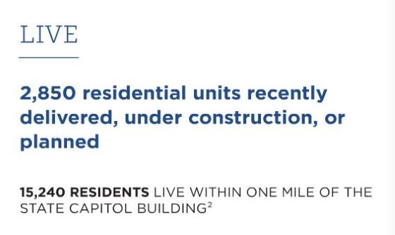
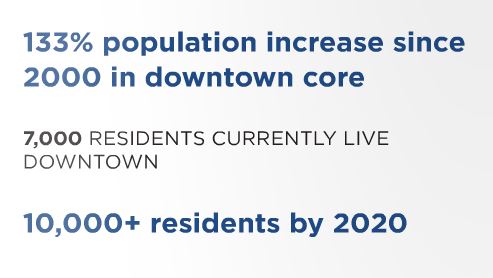
Here is some more data from the 2016 State of Downtown Raleigh report. This time, about downtown’s population numbers. We’re at an estimated 7,000 residents in the downtown area and projected to cross 10,000 in less than four years.
That’s between 1% and 2% of the overall city population, 3% and 4% if you bump out the boundaries to a mile-radius around the state capitol.
Glenwood South continues to be the most populated area, adding more units than any other district. However, Moore Square comes in at a close second.
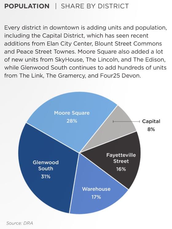
I imagine next year, the warehouse district will make a big jump with the apartments at The Dillon. Glenwood South will add units from the Greyhound Apartments and Fayetteville Street will gain numbers from the Charter Square North tower.
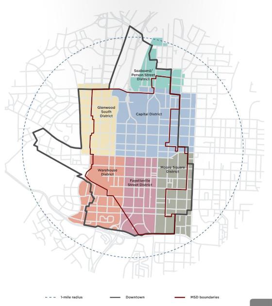
They also included a map to show the catchment area of this data.
Comments
Comments are disabled here. That's because we're all hanging out on the DTRaleigh Community, an online forum for passionate fans of the Oak City.
Leo , I am very excited about Charter Square North Tower , The N and O Site , 301 , 404 , Hillsborough St. Projects ! Love all the other projects , but these are my favorites !
I apologize for being lazy and/or an idiot….but can anyone provide a link for 404 Hillsborough? I don’t recall any info on it or remember seeing a rendering…thanks in advance.
The entirety of the DRA report is fascinating and a good read. Thanks for the link.
One of the things that jumps out to me is that DT map that shows the DT boundary, the districts, the 1 mile radius and the MSD boundary. I am scratching my head about that MSD boundary and can’t find what MSD means. Any help???
In any case, it seems to me that it’s time for the city to rethink the districts and the boundaries. For instance, does the Capital District really jump west across Capital and Dawson? That doesn’t make sense to me. Does Glenwood South really extend southward to Morgan or is the block between Hillsborough and Morgan really part of The Warehouse District? Should districts always be bounded by roads or sometimes by midblocks? To me, the way a district is engaged by a resident/visitor or branded doesn’t change from one side of a pedestrian oriented street to another. Both sides of those streets should be in one district. For example: the west side of Wilmington is the Fayetteville Street District while the East side is Moore Square. Both sides should be Fayetteville IMO and the N/S dividing line should be midblock between Wilmington and Blount.
Does the city really have areas within the DT boundary that should remain in limbo and without a neighborhood as it does now on its extreme north and west tentacles? Should the district boundaries that extend past the DT boundary cause the city to rethink the DT boundary?
MSD is Municipal Service District so basically, it’s where the DRA would operate.
Exciting info! Mark, good question – not much detail on those 4xx Hillsborough St projects yet.
Here’s a doc with some details on some of the newer and proposed towers:
http://www.godowntownraleigh.com/_files/docs/ed_1st_quarter_2016_full_report.pdf
@KenA, according to your link, the current DT boundary population is 8012 and the 7000 refers to the population within the MSD.
How are the boundaries determined? I’m only 2 1/2 blocks from Fayetteville but outside of the DT boundary but within the Moore Square colored area.
Thanks KenA. I always forget to go track this publication down. I have one beef with this particular issue…220 The Saint was announced as 17, very expensive townhouses…like averaging a million bucks or so. It was not apartments….I can’t imagine demolishing a small victorian house and a fairly large craftsman bungalow would make financial sense for 17 apartments to take their place. For that matter I doubt 17 ultra expense townhouses (I believe they were touted as having you know, everything a Glenwood goer could ever want) will not likely sell very well either, but I digress.
Thanks for linking that!
do they factor in the jail in the fayetteville street district numbers?
[…] Raleigh […]
[…] 2016 Downtown Raleigh Population Numbers (May 31, 2016, 10 Comments) […]