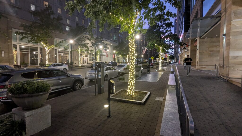
Have you seen the new lights on Fayetteville Street? All the trees, 88 of them, have been wrapped with white lights and they are lit each night, from Lenoir to Morgan Street. It’s a nice touch, adding some vibrancy to a kind of dull and gray streetscape. There’s more improvements on the way for the street which should elevate the area in order to really cement it as a key place to be when in downtown.
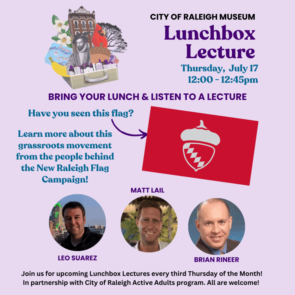
I’m pleased to join some fine folks next week as we’ll be talking about our city’s flag; past, present, and future. I hope to see some readers out there at the City of Raleigh Museum.
The next apartment building to open up in downtown Raleigh looks to be the Alexan Moto, located along both Harrington and West Streets. That’ll up the number of homes in Glenwood South, which is already the most dense area in the city, and perhaps one day start to transition the area as a highly residential-focused area rather than just “the nightlife spot.”
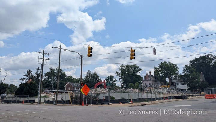
Well there goes the Bath Building. After a few months of work, the demolition of the State Government’s old space on Wilmington Street has been reduced to rubble. Now we’ll just watch it get picked up and scooped away. From what I’ve heard, the land will sit empty and hopefully just be a well-manicured lawn rather than surface parking.
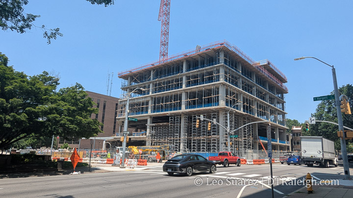
I pass by this project so often and it’s followed so closely on the Community that I didn’t realize I hadn’t posted a photo of the progress here on the blog. The city’s new civic tower, at the corner of McDowell and Hargett, has a few floors assembled as we head into the summer building season. Be sure to check out some interior photos posted here on the Community, including a look at the future council chambers.
With the base of the tower mostly complete, I imagine the rest of the floors will be a “pour, rinse, and repeat” process all the way to the top. That’s likely what we’ll be watching throughout the year, as the construction timeline currently runs into 2026.
If you’re new to this project, it’s called the East Civic Tower or simply the future City Hall. It’s set to replace all operations currently housed in the Raleigh Municipal Building next door. Several existing downtown office leases will not be renewed, and city departments will consolidate into this one central location. I’m not aware of plans for the rest of the city-owned block but I’m sure one new office tower will be enough for now.
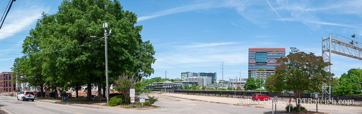
It’s still just a parking lot over at 320 West Cabarrus Street these days. If you didn’t know, this was the former location of our Amtrak Station before Raleigh Union Station opened up. The former train station here was demolished in 2018. Now, plans are moving forward for a small office building on the site which is still owned by the North Carolina Railroad.
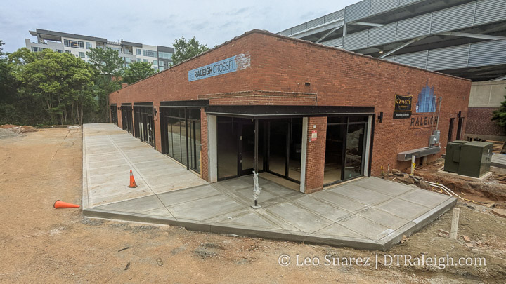
Did you catch the announcement about Garden West? The new renovation project taking place at the former Raleigh Crossfit, located at 15 North West Street, will be transformed into new restaurant space. This project looks particularly interesting as I see the former parking lot turned into a vast outdoor patio. The renderings really sell this thing.
Earlier this year, I took a family trip to Paris, and it’s easily one of my favorite cities that I’ve visited in my adult life. The sights, the food, the walking — all of it was fantastic. But with every trip I take, I typically find one small detail to hyper-analyze. It was one of those things that, once you notice it, you can’t unsee it.
I’m talking about the corners of buildings. Not the inside ones. The outside ones. The ones that meet at intersections. But in Paris — especially in the older parts of the city — they don’t just meet. They gracefully arrive at the corner with a flat or sometimes even curved face that greets the street like it’s welcoming you inside.