Embedded above (direct link here) is the video from the June 4, 2024 Raleigh City Council meeting where the latest updates and discussion took place related to the Transit-Oriented Development (TOD) rezoning case for the New Bern Avenue corridor. We’ve been following this for awhile now and the rezoning case here, which sets to change the zoning for over 700 properties on or near the upcoming Bus Rapid Transit line for New Bern Avenue, is being worked on in phases. I wanted to share my notes and provide a summary of the latest.
Feel free to dive right into the video above, as it opens with a nice summary, and check out these resources on the city’s website:
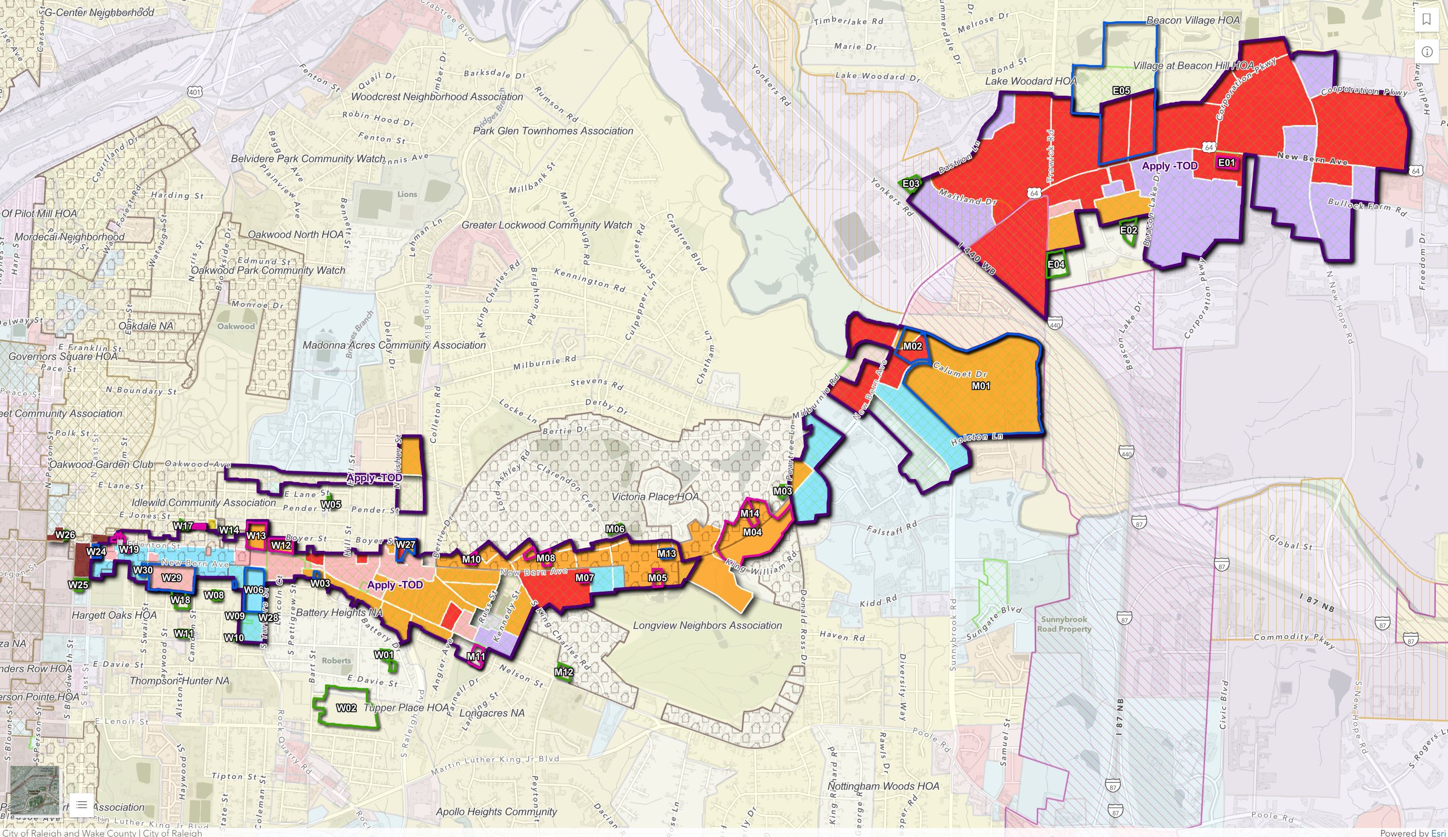
The rezoning case hit city council in January. Why is this rezoning case taking so long? Simply put, it’s just complicated. See the map above that shows all the affected properties and proposed changes to them. The built character is different along New Bern, stretching for about five miles. A one-size fits all approach won’t work here.
Juggling different priorities and breaking this case down into more digestible pieces, we can see that council is prioritizing affordable housing projects and sites with potential affordable housing outcomes. We can also break down this map into subsections, which we’ll review below in a kind of “checklist” to see what has been adopted so far and what is still left to discuss.
A couple of key sites have already been rezoned but generally speaking, the updates below are pretty accurate from what I have seen so far.
Eastern Stations
This is going to be an east to west kind of story.
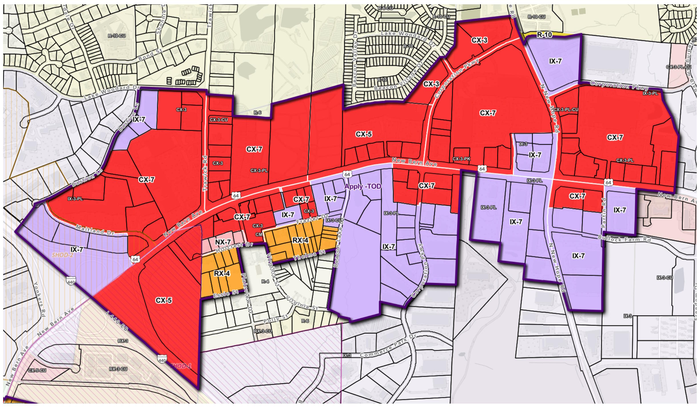
Starting with the eastern-most areas, the rezoning here is basically done. This would be described as everything outside of the I-440 beltline, or east of I-440. Places like the Tower Shopping Center and the Walmart, including all that surface parking, are now zoned for buildings up to five stories in height. We would also get the TOD overlay here which encourages less car-friendly development and encourages a more walkable, transit-complimenting urban form.
The original proposal was to make the height maximums at seven stories but council wants to see developers use the affordable housing height bonuses so they lowered the maximum height allowed to five to all but one property. The height bonuses, which could bring more affordable housing to market, would still allow taller buildings here.
Eastern Stations Status: DONE
Middle Stations 1
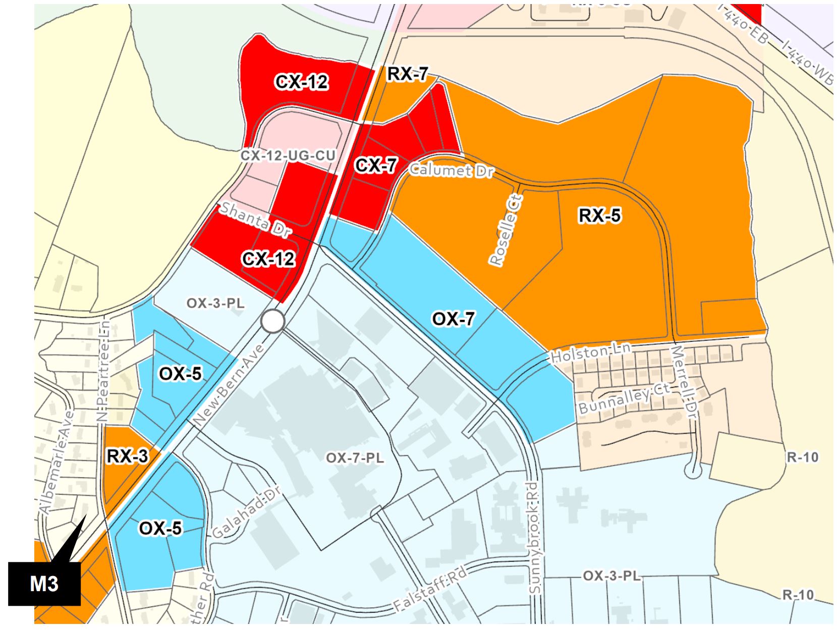
Discussed recently, see the video above, is the area around New Bern Avenue and Sunnybrook Road called “Middle 1 station area”. You could also call this the WakeMed district for obvious reasons. The proposal above was discussed and adopted with one small change. The area in Red above, marked CX-7 on the eastern side of New Bern had it’s height lowered to five. Other than that, most of the height here already matches the current zoning.
In the future, we may see a larger district of residential and offices around the hospital which is already a high trip generator of our GoRaleigh bus system.
Middle Stations 1 Status: DONE
Middle Stations 2
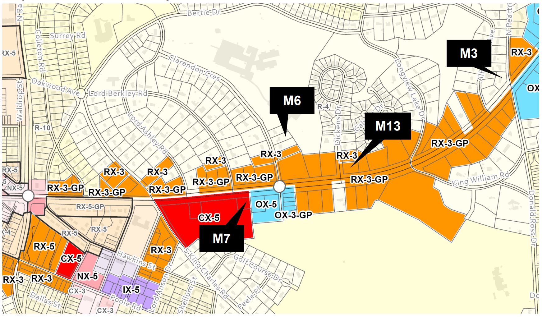
Discussed on May 7, 2024, “Middle 2 station area” has properties along New Bern Avenue between Raleigh Boulevard and the intersection with Peartree/Donald Ross. In short, all the properties here have been rezoned as proposed but some properties were removed from the case entirely.
Within this map, we have the King Charles Neighborhood Conservation Overlay District. (NCOD) Any property within that NCOD was removed except the ones fronting New Bern Avenue. That NCOD looks something like this.
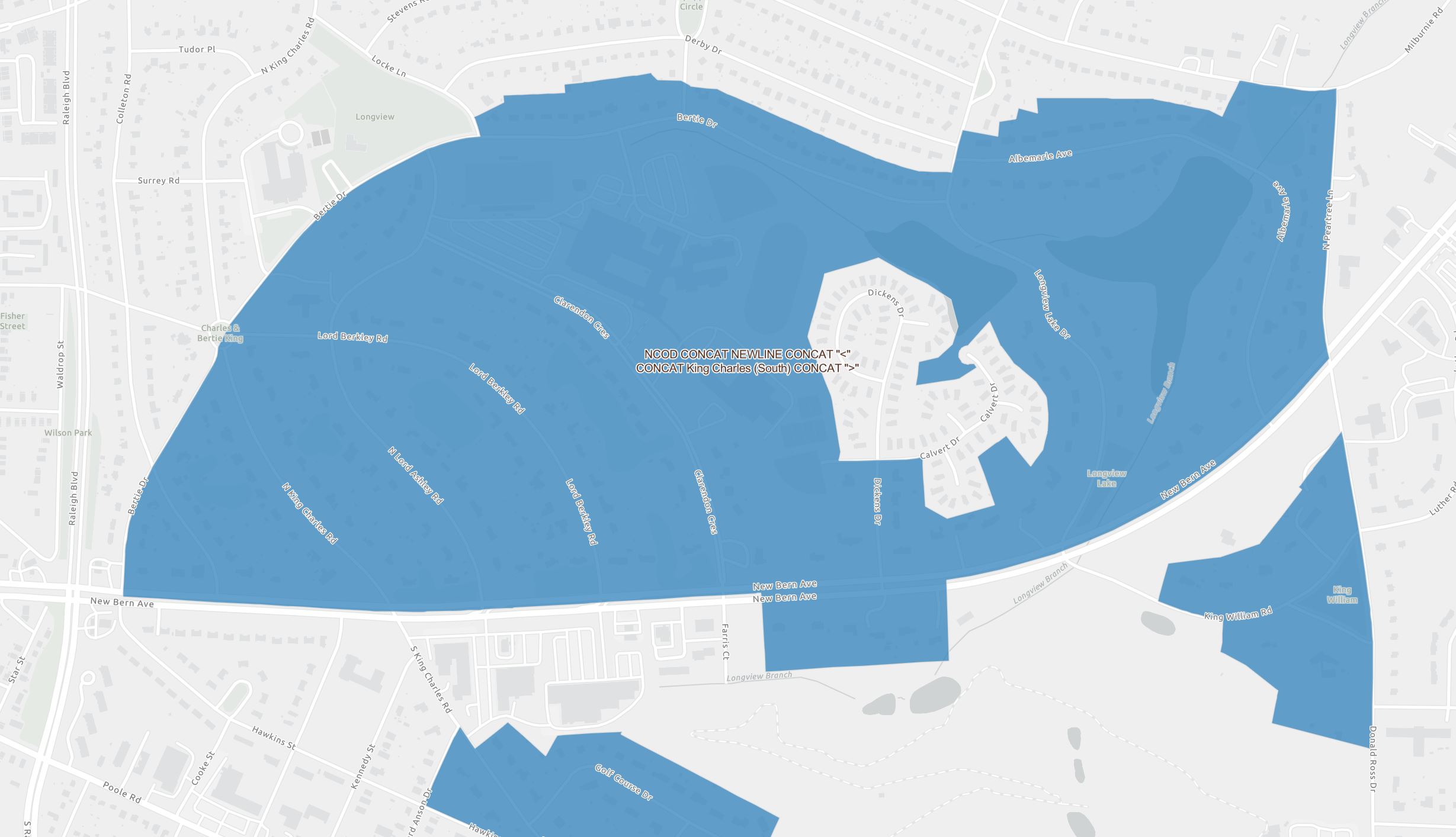
Creating another map with the two above on top of each other would be a nice side project but I’m going with the quick and easy route here in this explainer. In short term, if a property in the center of the map for Middle 2 doesn’t face New Bern, you were pulled from the rezoning case.
Middle Stations 2 Status: DONE
Oakwood Avenue Station Area
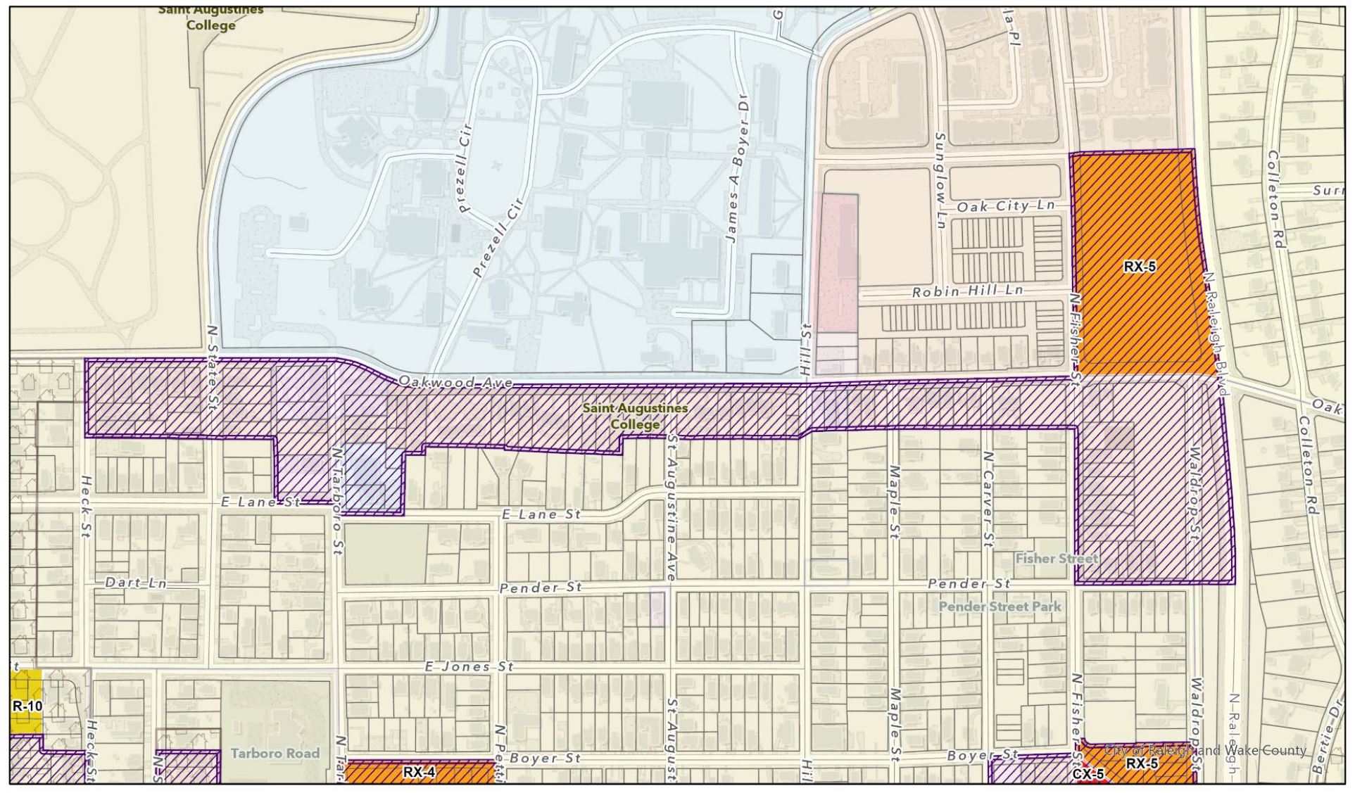
Close by, but not along New Bern Avenue, is a desire to encourage more housing along Oakwood Avenue. This piece shown above was adopted as proposed with more properties getting the TOD overlay applied. Again, this encourages transit-friendly urban forms over car-friendly uses.
Oakwood Avenue Status: DONE
Western Stations
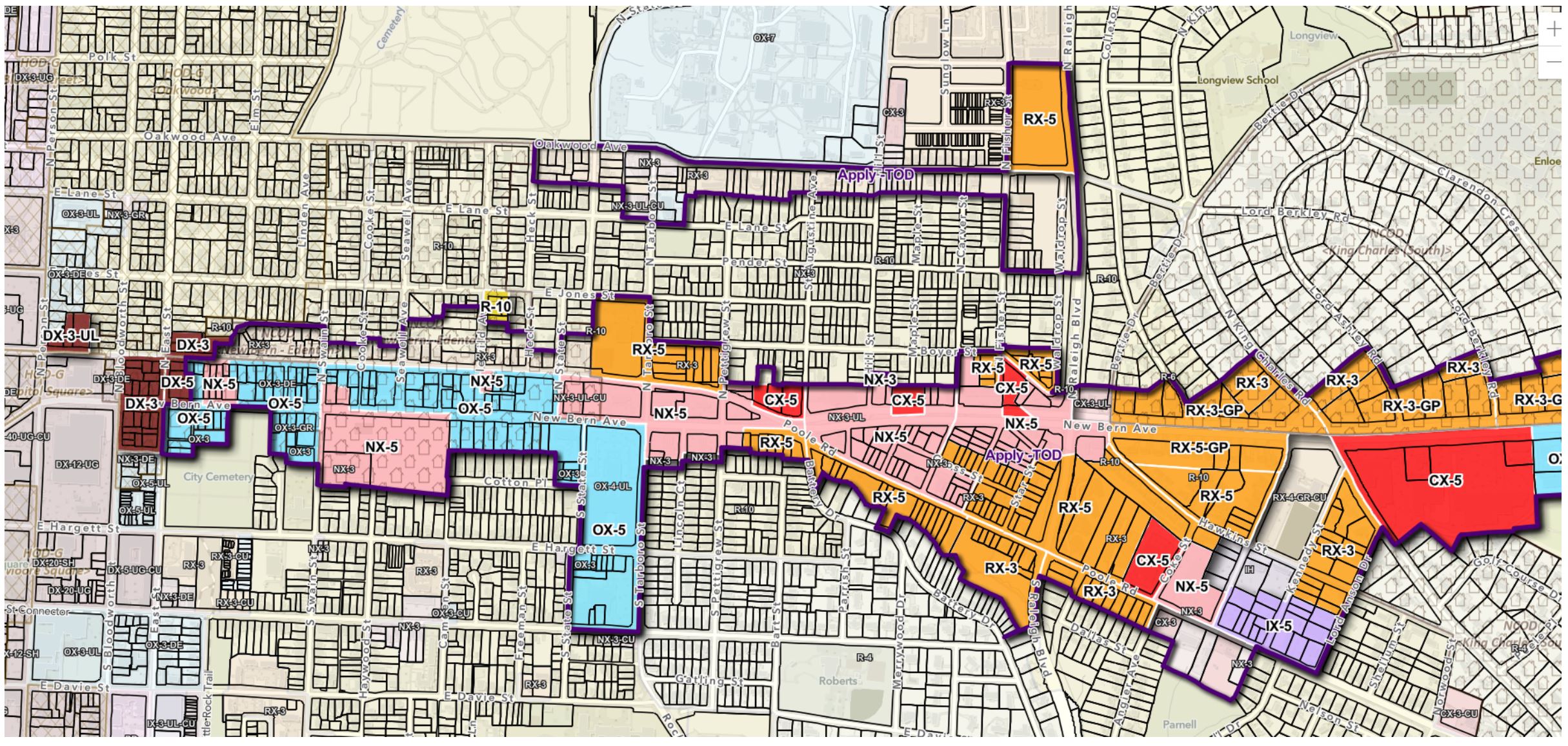
The western stations were saved for last as this is the most complex area and most of the public feedback, both for and against, seemed to come from this area. I’ll leave it short for now as we may see an update at the July 2, 2024 council meeting.
Western Stations Status: In Progress
To wrap up, most of the case seems to have been worked through and I’m definitely planning to follow this one as it keeps going.
Comments
Comments are disabled here. That's because we're all hanging out on the DTRaleigh Community, an online forum for passionate fans of the Oak City.