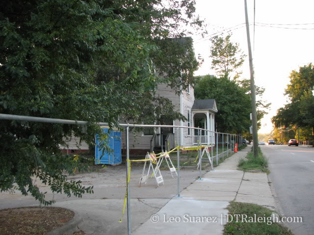
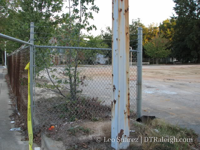
After checking out the historic Blount St. area, and taking pictures of some of the houses that are in this post, I remembered that there was a plan to revitalize this area over the next four years. The area desperately needs it; houses need to be spruced up, landscaping needs to be maintained, barren parking lots, some paved, others gravel, add nothing to the character of the area, and all the empty lots sit unused. Blount St. is a major entrance to the downtown area from the north and would be a great welcome mat to the core downtown district.
The city acquired about 23 acres for this project and the affected area is shown in the map below. They acquired the land and all the buildings on them. Currently the historic houses are being used as offices for small firms and government branches. They are all on a schedule and will be moved out of the coming years.
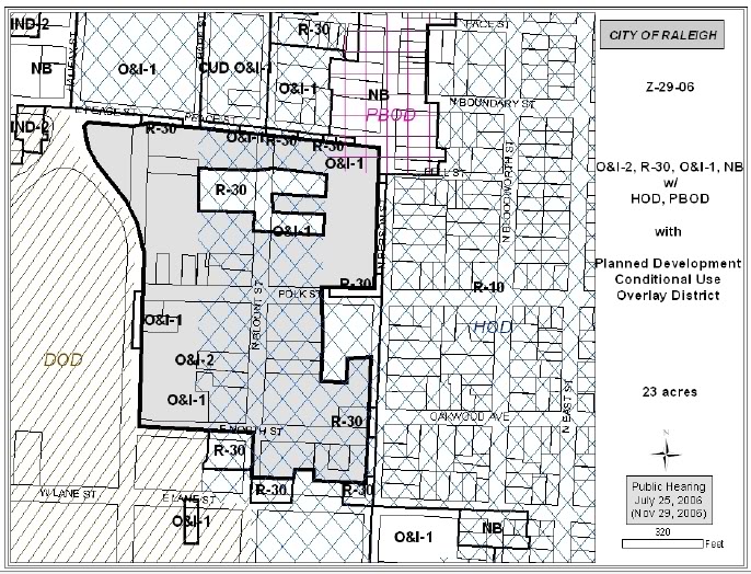
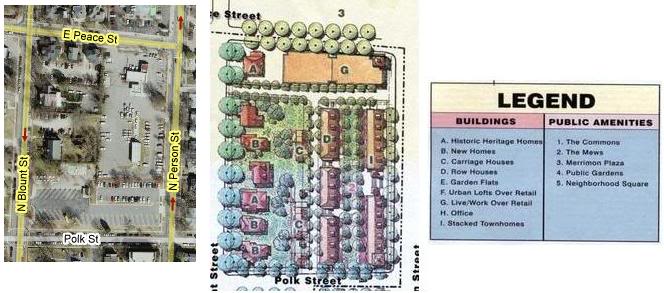
Target area of about 6 blocks
The area might not be as popular as the other livelier areas of downtown, since it is shadowed by most of the government buildings that become a ghost town at night and on the weekends. These two maps below show the area I’m talking about. There are 6 blocks around Blount St. that represent the target area. You can see on the map below that the area is very close to the Glenwood South and Fayetteville St. (south of the capitol building) districts. The area is also south of Peace College, West of Oakwood and Mordecai neighborhoods, east of the Government complex, and North of the downtown core. It is obvious that this is an important area to downtown Raleigh.
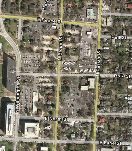
Parking lots are plenty in the area now, but will be all gone soon enough
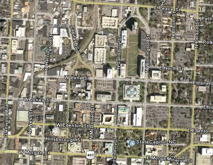
Glenwood South and Fayetteville St. distrcits are close by
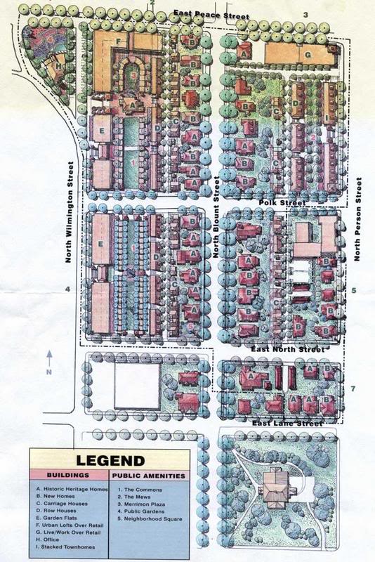
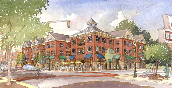
The overall plan is shown in the following map. It includes revitalization of the historic homes along Blount St., filling in the empty lots with new homes, and selling them all to be used as residential rather than commercial. The area will also be filled with dense development including row houses, carriage houses, and flats. Some of the denser developments will include 3 or 4 story mixed-use buildings with on street retail. Wilmington and Peace St. will include the densest developments. I’ve also included some of the building renderings below.
Notice the Krispy Kreme sign

You can see Peace college in the background, this is Wilmington St.
I think this is one of the most important revitalization projects in the downtown area. It is not on everyone’s radar and I believe the work will be slow on this one, like I mentioned earlier, it will take 4 years to complete. The work will be done in phases and before you know it there will be a very unique area of downtown with dense, smart development and a street with rich, historic houses that the city can be proud of.
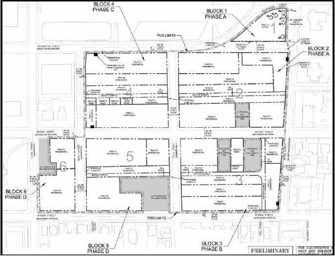
Each block will be revitilized one at a time in phases.