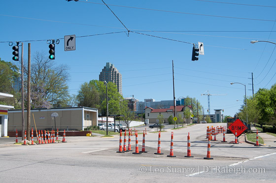
South Street at South Saunders Street
The two-way conversion of South and Lenoir Streets have begun. You could loosely call this a phase 2 project as parts of Lenoir and South were converted to two-way years ago when the Raleigh Convention Center opened. Now, the city is finishing the conversion so that the streets operate as two-way from end-to-end.
For all the details, jump over to the Lenoir & South Street Two-Way Conversion project page on the city’s website.
Going west to east, South Street is two-way in Boylan Heights but flips to one-way (east bound) at South Saunders. Shown in the photo above, utility work is taking place and throughout the year the street in this area will contain bike lanes, landscaped medians, and travel lanes going in both directions (of course) up to Dawson. At Dawson is where South flips back to two-way.
Along South through downtown, the street flips back to one-way (east bound) at Wilmington Street. There will be one travel lane in each direction from here all the way to East Street. The traffic light at Bloodworth Street will be removed and replaced with a four-way stop.
Lenoir Street looks less complicated. No conversion work is needed on the west side of downtown and the work begins at Wilmington Street. The east bound one-way street between Wilmington and East will be converted to one-lane in each direction. The traffic lights at both East and Bloodworth will be replaced with four-way stops.
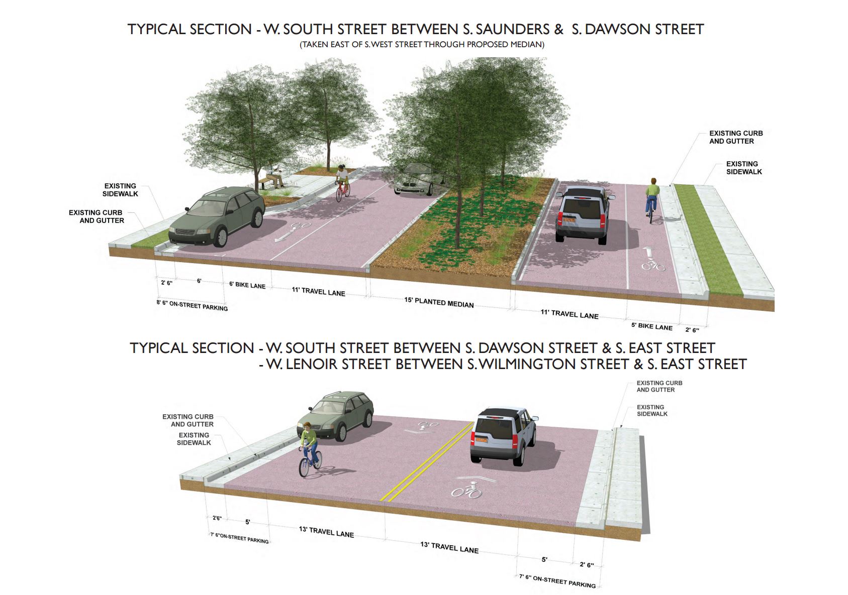
Click for larger
As someone who travels in this area by car and bicycle, this conversion is very much welcomed. It’ll also be a nice alternative when Fayetteville Street is completely closed during event season.
 It is a Raleigh tradition to drive downtown and lose your way at least once in your lifetime. I still remember a drive downtown many years ago. I was trying to find