 It is a Raleigh tradition to drive downtown and lose your way at least once in your lifetime. I still remember a drive downtown many years ago. I was trying to find the Lincoln Theatre, not knowing that east and west Cabarrus Streets do not actually join. When I did realize this, I still had trouble getting over to the west side when on the east. I mean whose great idea was it to build One and Two Hannover where a street should be? I was just a youngling back then and now know the downtown Raleigh streets.
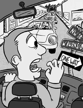
One of the biggest complaints I hear about downtown is how hard it is to navigate and find your way around. I honestly have not been to any city, of significant size, where the downtown area was ‘easy’ to navigate so this complaint does not quite make as much noise too me. However, downtown is changing and is trying to improve this, which is good for any visitor to the area. The plan is to change many one-way streets to a two-way design. We have already seen this occur with Martin and Hargett St. in 2006. Later this year, Lenoir and South Street will be converted as well.
The initiative for this change is outlined on the city’s Livable Streets website:
One-way pairs were at one time an innovative way to increase the traffic-carrying capacity of dense urban streets, but in the age of ring highways and major thoroughfare corridors, the need for traffic capacity on secondary downtown streets is not as great as in the mid-20th Century when most of these one-way pairs were implemented. One-way systems also increase traffic speed at the expense of pedestrian safety and also make it more difficult for the first-time visitor to navigate. Several pairs of streets are under consideration for return to two-way travel, and each will be re-designed as this change is implemented to maximize the efficiency of the street while emphasizing the comfort and convenience of the pedestrian.
Once these changes have taken place, Salisbury St. opens back up, and Fayetteville St. is finished up to Lenoir, we will have a solid street network for visitors to roam around.
I’d also like to point out a little flaw within our streets that I do not see any plans for change. What is up with the one-way to two-way to one-way fiasco on Morgan St.? It is dominantly one-way with a five block two-way stretch between St. Mary’s and Dawson St. Does anyone know how this came to be?
Comments
Comments are disabled here. That's because we're all hanging out on the DTRaleigh Community, an online forum for passionate fans of the Oak City.
For the W. Morgan Street madness, it came about when they replaced the bridges that Morgan and Hillsborough had over the railroad tracks….when one bridge was being replaced, traffic was diverted onto the other. And Vice Versa. (The plan is to eventually make W. Morgan two-way all the way to Hillsborough—thus, you have that proposed roundabout issue that has been talked about.)
As for navigating downtown, I’ve never found it to be that hard as long as you’ve looked at a map of it at least once. All the streets go either north-south or east-west. And the blocks are numbered from the State Capital. 300 West Jones Street is 3 blocks west of the capital….400 South Wilmington is 4 blocks south of the capital, etc etc. Not too hard once you figure it out. They do need to do a better job of informing the public of this—it’s amazing the number of people in Raleigh who still have never heard that.
But I agree some weird parts screw things up like East Cabarrus separated from West Cabarrus by the skyscrapers, as you mention. East & West North Streets are separated by the state government complex in a similar fashion. And don’t get me started about how the railroad cut Lane, West, and other streets in half.
My biggest pet peeve for navigating downtown is lack of good signage. It’s amazing the number of intersections there that only have one small street sign on the corner. Every intersection should by now have those big “hanging” street signs on the stopsignal by now, but they don’t. Maybe half do. I don’t get that.
I’ll admit that whenever I leave Raleigh I usually make a wrong turn and end up on the other end of downtown, but that’s usually attributable to a hangover. It is possible to have an efficient system of one-way streets, but you need good city planning for it. It’s difficult to get lost in NYC north of Houston because of the perfect grid. The city planners built it to accommodate millions of people when only 100,000 lived there. It takes a lot of foresight and thorough planning to do something like that.
Morgan Street is a constant nightmare for me. I don’t understand what provoked the City of Raleigh to screw that up. Raleigh doesn’t necessarily need to go back to 2-way streets, it just needs to have a more expansive grid.
I couldn’t agree with raleighrob more about downtown being easy to navigate. One of the greatest problems in my opinion are the two speed veins that run through downtown and are each 4 lanes wide: Dawson and McDowell. Walking across these daily is horrible, especially when every other street in downtown is no larger than 2 lanes. It’s a wonder that so many people speed through downtown and don’t stop.
Also, I think the fact that East, West, North and South Streets are the grid boundaries is an important point to note. These are great markers in my opinion.
^Yeah, jed, I hear you on Dawson and McDowell. But I doubt those will get any better anytime soon. They are, afterall, US Highways oddly enough. (US 70 & US 401).
I bet, historically, the high traffic coming down McDowell/Dawson has really held back much pedestrian activity and stores with their front door right on the street here. There are exceptions however.
Here’s a visionary idea. If these two streets become ridden with traffic and very dangerous for downtown pedestrians, we’ll need a way to fix this without slowing down traffic and creating gridlock. McDowell and Dawson could be sunk into the ground and the former intersections could become bridges. The current 4 lanes of highway will then be 3 lanes of non-stop flow with a single on/off ramp up to street level. Downtown is built on a hill and when you approach downtown from McDowell, you are at a low point, we could start the ‘tunnel’ at south street since the current street heads uphill, then back down, slightly, after Hillsborough St. This would eliminate streetlights on that highway also. Heading south, with some rush hour priority on the few street lights, it would be an easy drive to I-40. Heading North, no stoplights at all.
Just thinking outside the box….
[…] One-way Street Madness (January 5, 2013, 5 Comments) […]
[…] One-way Street Madness (January 5, 2013, 6 Comments) […]