Renderings of City Gateway Show 10-Story, Energy Positive Building

Renderings come courtesy of SfL+a Architects/Firstfloor.

Renderings come courtesy of SfL+a Architects/Firstfloor.

We have the first renderings, provided here on the blog with permission, of what is called City Gateway, the office and campus building planned for the Southern Gateway area of downtown Raleigh. For a quick recap, jump back to this December 2016 post.

City Gateway will be home to the Exploris K-8 charter school and a number of other businesses. The building comes to us from SfL+a Architects who have worked on a few other projects including energy positive schools. That means City Gateway will “on average over the year produce more energy from renewable energy sources than it imports from external sources,” according to the Global Buildings Performance Network.

According to the Triangle Business Journal, City Gateway should break ground this July with completion about a year and half later. (or whatever Winter 2018 means to you)

For clarification, let’s define a few “gateway” terms:

  • City Gateway is this upcoming energy positive building.
  • Gateway Center is what the city has defined as the area on the southern side of downtown. Explore more on that in this post.
  • The Southern Gateway is a much larger area from the southern end of downtown towards I-40 and ending around Tryon Road. There’s a study on that ongoing and you can dive into that project on the city’s website.

Renderings come courtesy of SfL+a Architects/Firstfloor.

Renderings come courtesy of SfL+a Architects/Firstfloor.

Renderings come courtesy of SfL+a Architects/Firstfloor.

Renderings come courtesy of SfL+a Architects/Firstfloor.

Renderings come courtesy of SfL+a Architects/Firstfloor.

Renderings come courtesy of SfL+a Architects/Firstfloor.

Renderings come courtesy of SfL+a Architects/Firstfloor.

Renderings come courtesy of SfL+a Architects/Firstfloor.

Renderings come courtesy of SfL+a Architects/Firstfloor.

Renderings come courtesy of SfL+a Architects/Firstfloor.

Renderings come courtesy of SfL+a Architects/Firstfloor.

Renderings come courtesy of SfL+a Architects/Firstfloor.

Site Plans Show 10-Story Building for Gateway Center

The end of Kindley Street, 3D view from Google.

The end of Kindley Street, 3D view from Google. Click to see on Google Maps.

Back in the summer of 2016, we took a look at the Gateway Center, the area along Salisbury Street near the performing arts center and Raleigh Convention Center.

I’m guessing few of us have had any real interactions with this property as it used to be a fenced in building owned by Duke Energy. The property has since been sold to Exploris and now submitted site plans show us of what could come to the area.

SR-099-16, called Gateway Southeast AKA Exploris School, shows a 10-story building consisting of parking, office space, and the consolidated K-8 charter school. The property doesn’t consist of the entire Gateway Center, just the portion across the Norfolk-Southern railroad tracks. (highlighted in orange in the map below)

Here is the site plan. The first is a screenshot from the plan, the second is the same thing but turned so that North points up. (approximately anyway)

Site plan for Exploris Charter School

Site plan for Exploris Charter School

As you can see from the plan, all the parking, offices, and school are contained inside the building. There will be a large courtyard and sidewalks around the building. The northern end of the “campus” will also retain some of the existing field as well as turn the old Duke Energy building into a lawn, perhaps for outdoor activities.

Development fans may find hope that in the future, there is room for more buildings here. Exploris has a track record of supporting innovative ideas and initiatives and their expansion to grades K-8 now may not be the end so you never know what long-term plans might come at the Gateway Center.

This is a good 2017 project to watch rise up and hopefully it applies a little pressure for the suburban-style campuses on the other side of the tracks to go urban in the coming years.

Revisiting The Gateway Center

The end of Kindley Street, June 2016

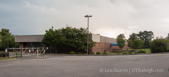
The end of Kindley Street, June 2016. Click for a larger, wider view of the site.

I wanted to turn our attention today to what is being called downtown’s Gateway Center. The Downtown Plan calls out the area around the Performing Arts Center and the Raleigh Convention Center as a possible “catalytic project area” and sums it up as:

Coined the “Gateway Center,” this area is the only part of downtown capable of accommodating multiple blocks of large-footprint mixed-use development. Its proximity to the Convention Center and Duke Energy Center for the Performing Arts will naturally lend its future to expanding tourism and entertainment-related uses, such as a large-scale sports and/or cultural facility, additional hotels, or a campus of related businesses.

*Raleigh Downtown Plan

Regular readers are probably familiar with this already because of the plan’s two concepts for this area, one of them includes a sporting arena. Let’s revisit those two concepts from the plan.
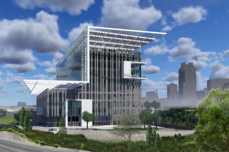
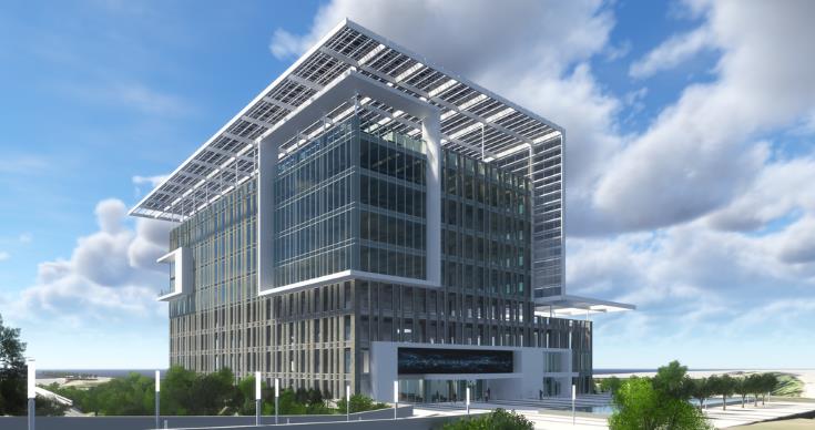
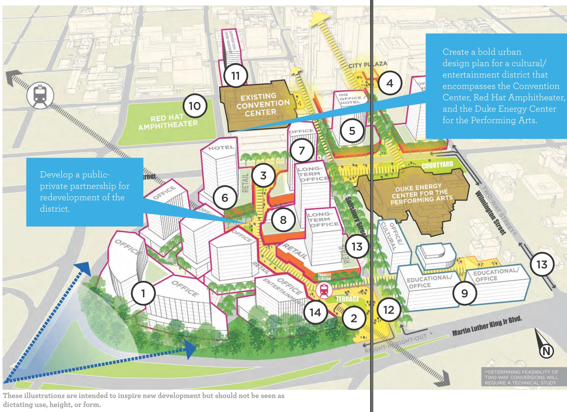
Concept 1
Gateway Center Concept 1

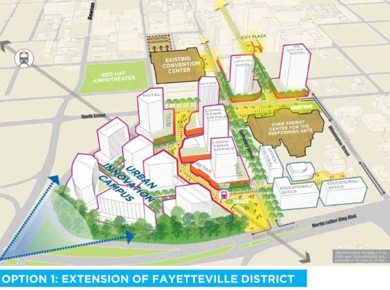
Click for larger and more info.

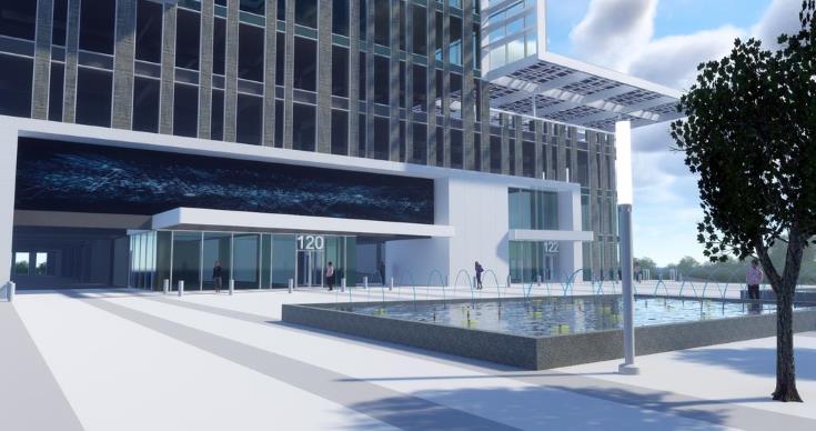
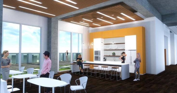
This concept imagines space to develop an Urban Innovation Campus for a new anchor employer or cluster of businesses. With easy access to several forms of transportation and close proximity to Fayetteville Street, the Warehouse District, and the heart of downtown Raleigh, this location has much to offer. New landmark structures provide the missing link between the Duke Energy Center for the Performing Arts and the rest of Fayetteville Street. These buildings could be linked to the Urban Innovation Campus, home to another employer, or even a hotel.

Concept 2
Gateway Center Concept 1

Click for larger

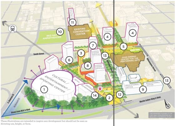
In this concept, the heart of the district is a new citywide destination. Either cultural, entertainment, or sporting in nature (or a mix of all three), the center anchors the district and provides a new draw for the city as a whole. The specific location for this use in the southwest corner
of the district is advantageous for several reasons. Positioning any large-footprint building towards the southwest corner of the district allows its architecture to frame the new southern gateway. The rest of the site is arranged into walkable city blocks that link the new district back to Fayetteville Street. In this way, a single entertainment or cultural use acts as a magnet to draw visitors to and through the district without becoming a barrier to walkability. Siting the largest development at the edge also capitalizes on the site’s natural topography, allowing the potential for underground parking easily accessed from main roads around downtown. Throughout the district, active ground-floor uses and building setbacks help break down the scale of larger buildings.

There’s more in the Downtown Plan which I recommend you download and take a look.

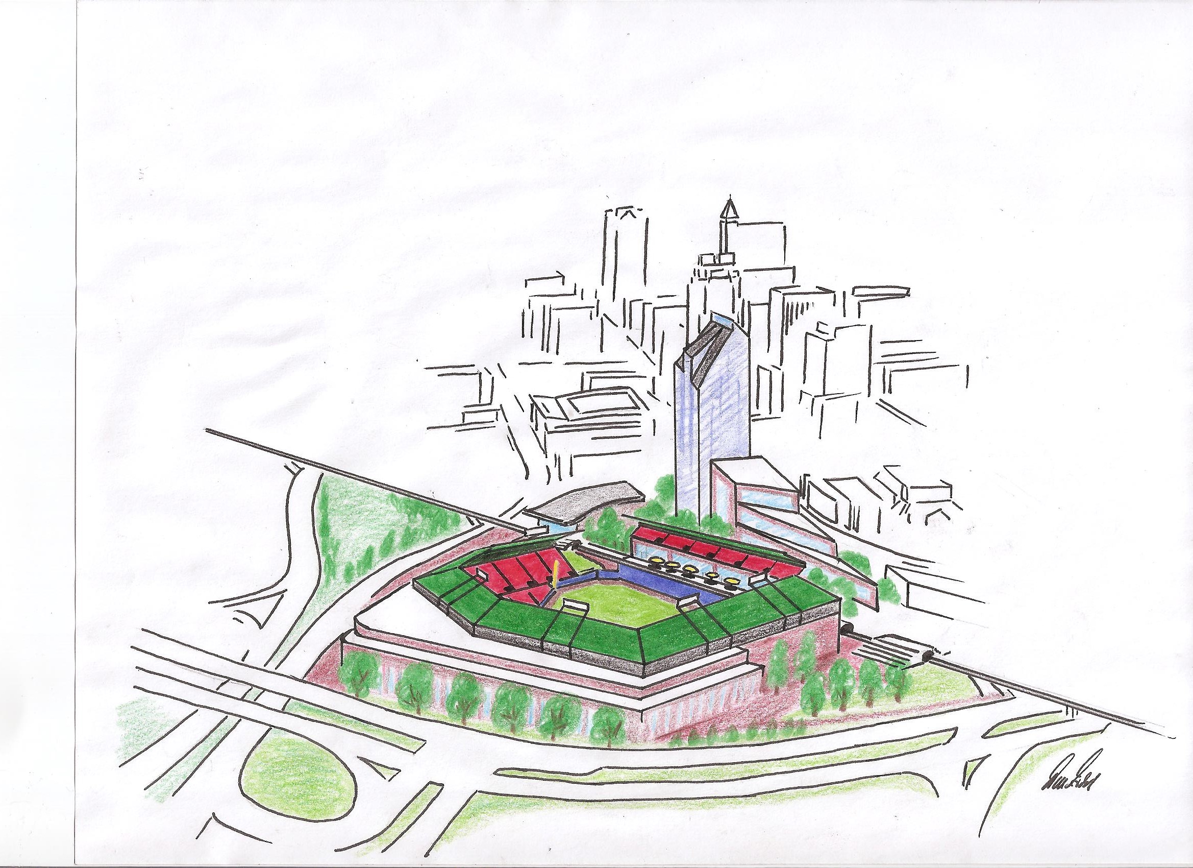
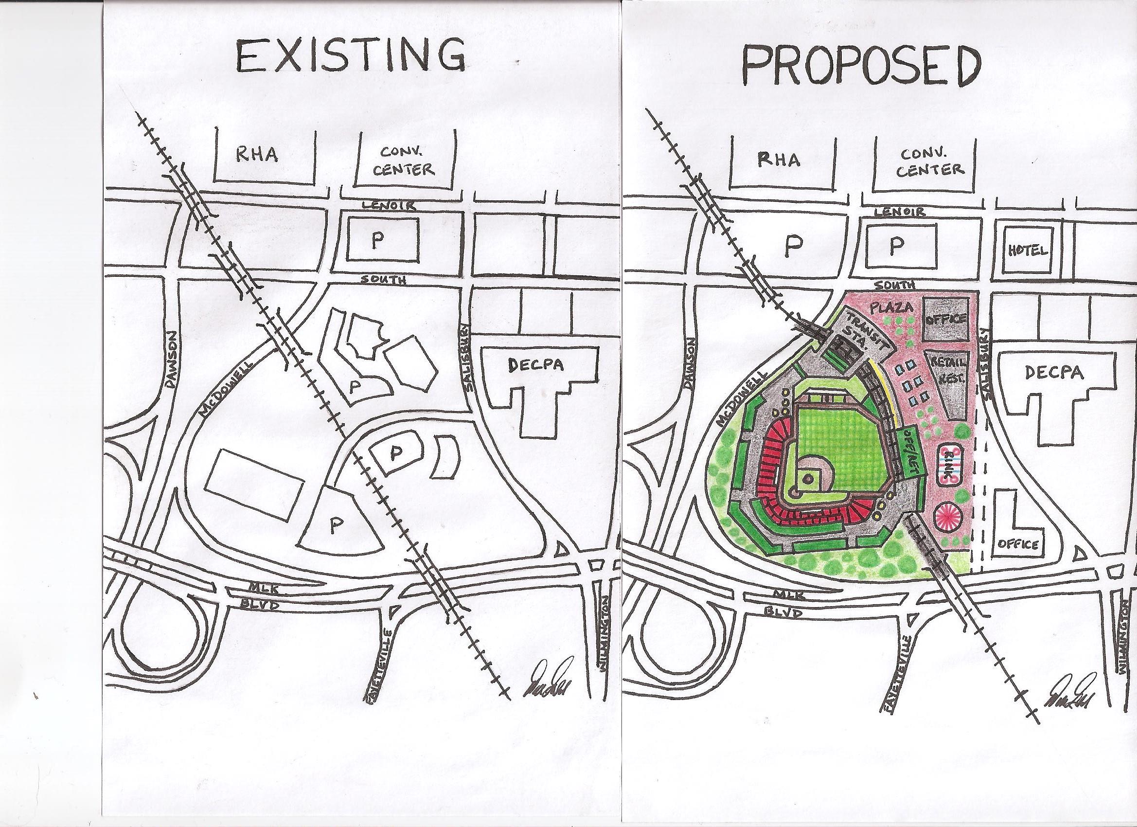
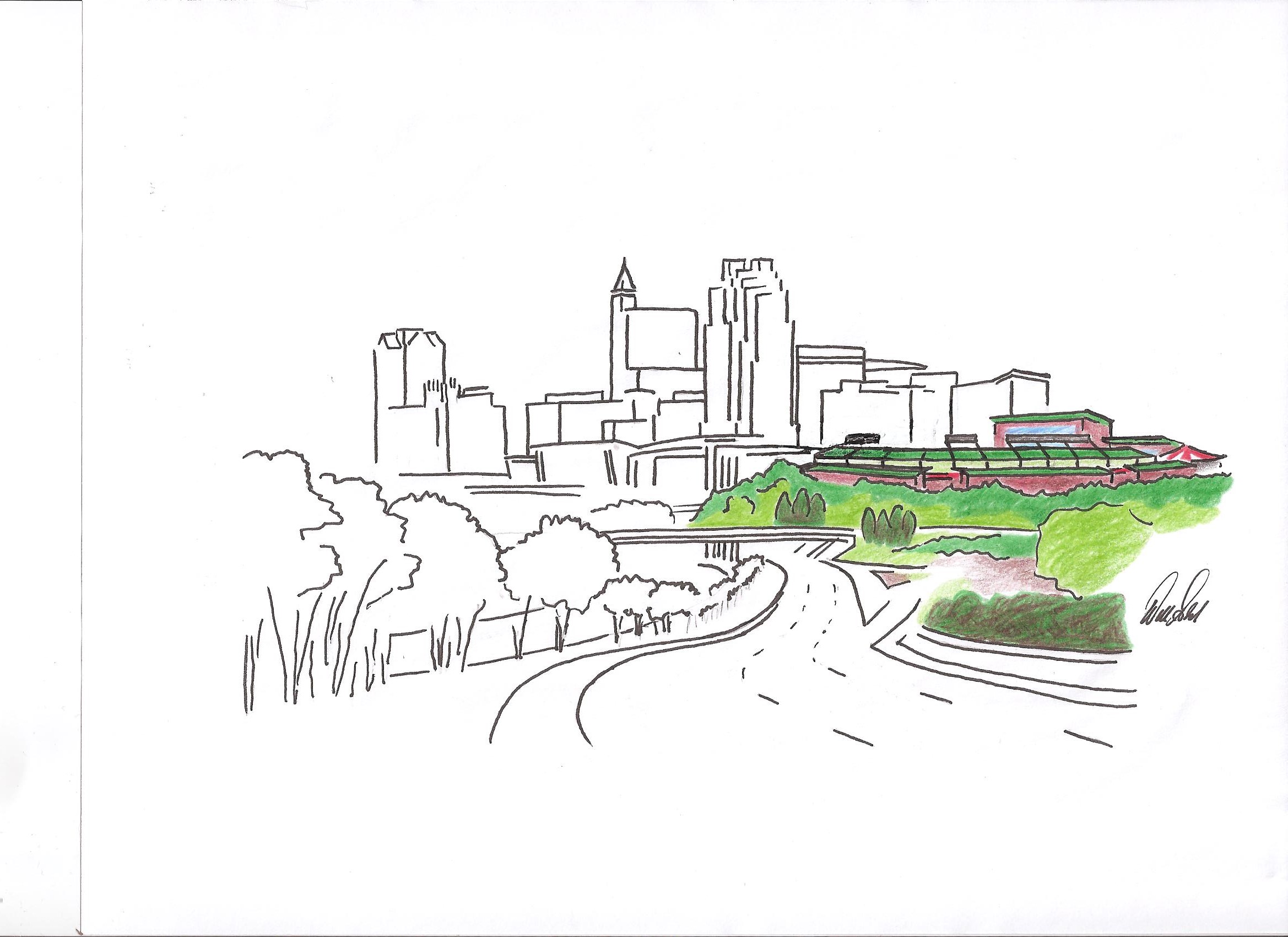
I also want to give some love to one of the most popular posts here on the blog. Reader Will imagined a baseball stadium in the Gateway Center and submitted some sketches. Check them out once again.

It’s important to note that the focus in the Gateway Center, at least according to internet chatter, is around where this possible stadium could go, the southwestern tip. The actual focus area does include the convention center, performing arts center, and the southern end of Fayetteville Street.

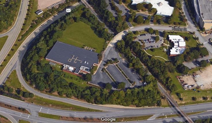
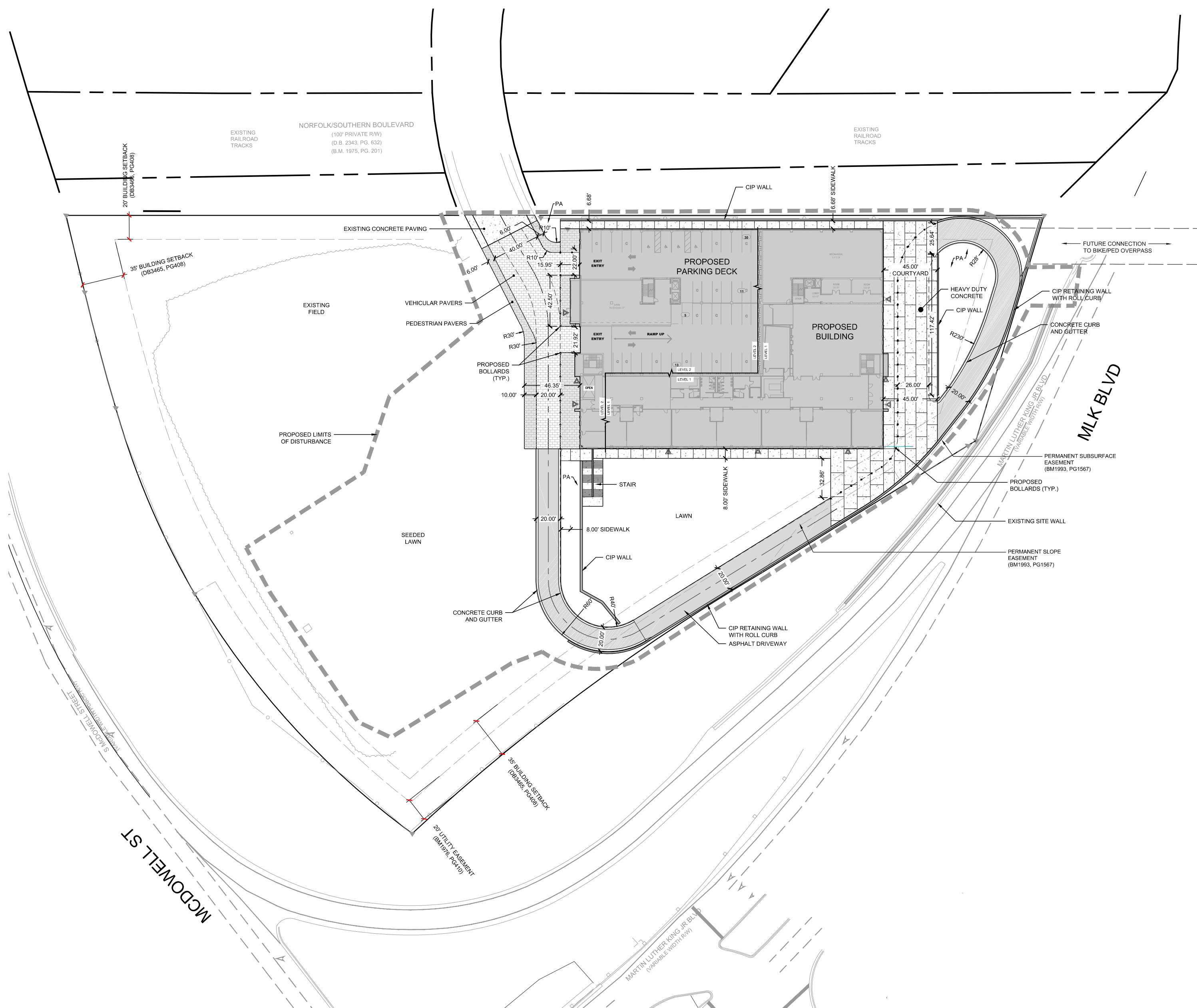
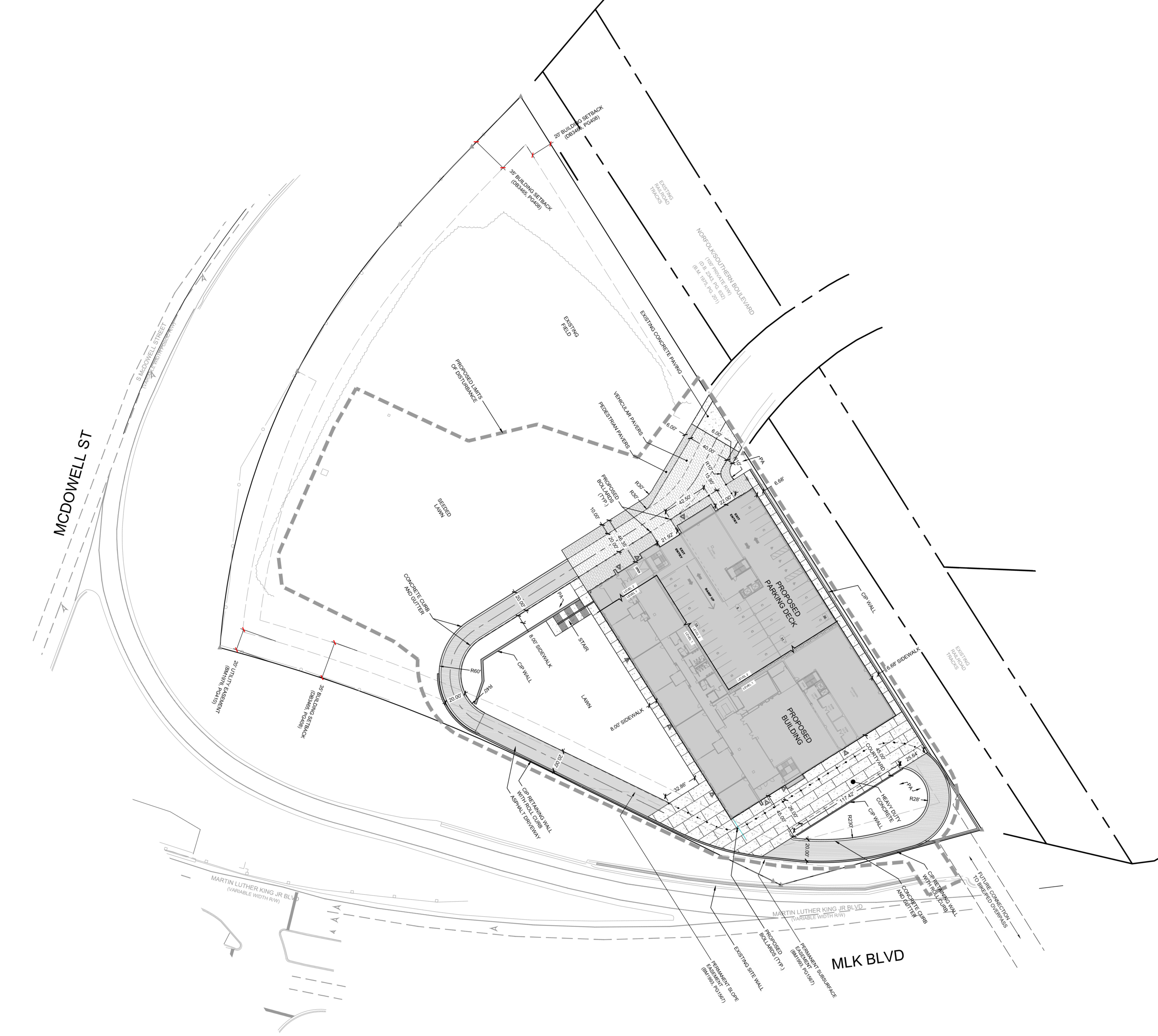
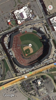
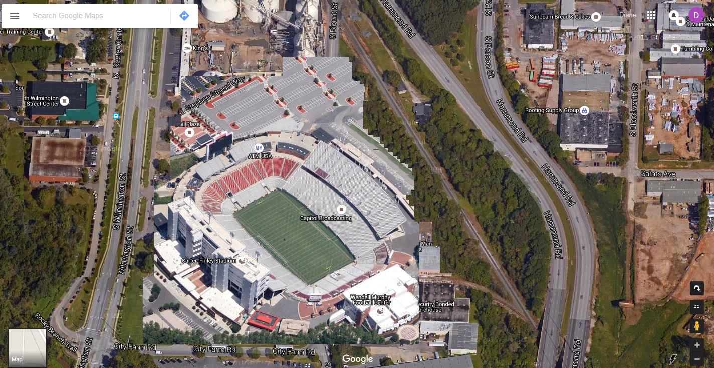
However, it’s that southwest tip that I want to zoom in on with a Google map showing the four properties there.

A bit of related news for the Gateway Center. The Exploris School, a charter school in downtown Raleigh, has purchased one of the properties that make up the Gateway Center. (highlighted in orange in the map)

Exploris has been a middle school for some time, located on Hillsborough Street. Two years ago, the elementary school opened in a temporary home on New Bern Avenue. The school has been looking for space to consolidate it all.

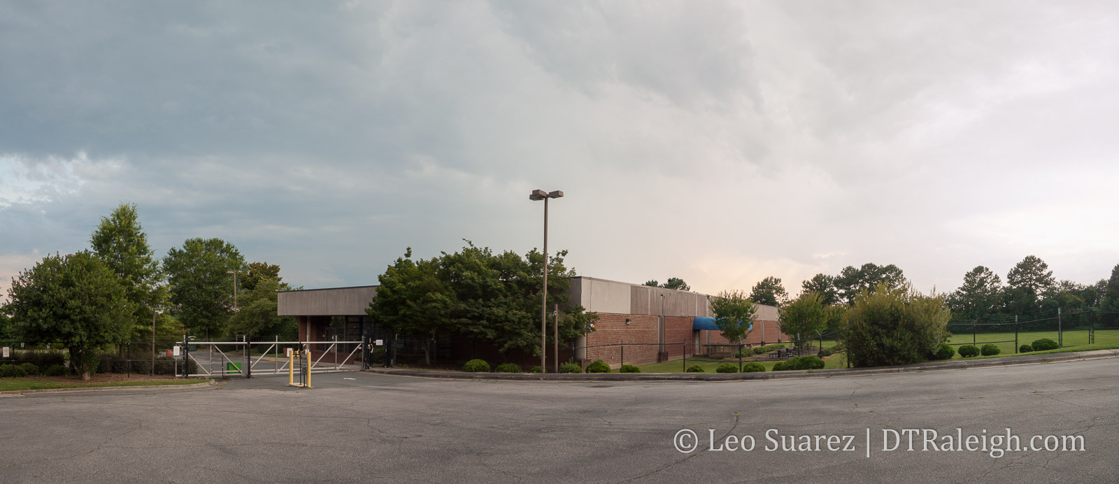
The former home of a data center for Duke Energy, the property actually looks perfect for a school campus. The lot has surface parking, an open field, and more room than Exploris needs. Plans call to renovate the extra space and lease it out as office space.

At this point, you, especially the skyscraper fans, may be noticing an incompatibility. This doesn’t seem to match the vision laid out in the Downtown Plan. It may stifle dense development in this area of downtown.

I think you are right but I’d like to lay out a different, more positive perspective.

Let’s look at the timing of things. The Downtown Plan was adopted in late 2015. Exploris has been looking for space since 2014, maybe even earlier. With the plan being a 10-year vision, we shouldn’t expect announcements for multi-building clusters in the south of downtown not even one-year into the plan.

We have until 2025 to really see the Gateway Center blossom and we can’t assume that Exploris is going to stay in this space forever. Like any other business or institution, they may outgrow the space or move into the new development of the future.

For me, I’ll take a progressive school like Exploris here than a monolithic infrastructure company like Duke Energy any day. I see Exploris “cracking the mold” to that site in a way.

One factor that I believe greatly ties into Gateway Center is Dix Park. These two areas are so close and Gateway Center could really be the connection between downtown Raleigh and Dix Park. Planning is in the infant stages as this year’s city budget, recently approved, starts the purchasing process for the land.

The MLK/Western interchange with McDowell and Dawson Street limits connectivity but it could be a great challenge for the future with respects to tying Dix into the downtown fabric.

The city also has a Southern Gateway Corridor Study underway with a final plan expected by this Fall. This is the area from MLK/Western to about I-40.

The City is exploring ideas for land use and transportation improvements along the corridor that will benefit businesses, residents, motorists, transit riders, pedestrians, and bicyclists.

The study even highlights Gateway Center in their map!

With more development taking place back in downtown, there are a lot of moving parts here. The Gateway Center and the vision laid out in the downtown plan still have a great shot at coming to life.

Baseball in Downtown Sketch

[UPDATE #5: Another submit by Will]

Click for larger

[UPDATE #4: Will has submitted another round of sketches.]

Click for larger

  • Railroad tracks remain unmoved, serve as backdrop for center field and soccer goal. (“Railhawks” takes on a new meaning)!
  • Single stadium provides for both baseball and MLS while fitting nicely into the footprint.
    -Dual-purpose stadium provides building funds from two teams instead of one.
  • I’ve measured, and both fields are regulation size. The soccer field is exactly the same dimensions as WMSP.
  • Multi-modal transit station–train and bus–serving stadium, Red Hat Amp, Convention Center, DECPA, and plaza.
  • Baseball stadium is inspired by an amalgamation of other parks: “Boxy” shape (Citizens Bank Park, Philadelphia), sweeping outfield upper decks (Polo Grounds, NYC), home plate rotunda (Ebbets Field, Brooklyn), rooftop stands beyond tracks (Wrigley Field, Chicago).
  • Above CF/goal wall will be the tracks. Above and behind the tracks will be restaurants/bars with porch seating. On top of those restaurants/bars is stadium seating a la Wrigley Field.
  • Field itself could be artificial turf, as well as the dirt areas. Artificial infields are becoming popular in newer baseball parks (WFU, Duke, Holly Springs), and would make for easy transitioning between sports.
  • Backstop netting would also protect spectators from kicked soccer balls.
    -Outfield plaza features office and apartment high-rises, restaurants/bars, grocery, retail, and yes, the displaced rink!!

Click for larger

A big thanks to reader Will who submitted this sketch of how to convert the southern gateway site, called Gateway Center in the downtown plan, into a possible baseball stadium. Will adds the following bullets:

  • New transit station @ South and McDowell to serve the ballpark, the convention center, RHA, DECPA, new hotels.
  • Parking at Union Station or Dillon with some kind of “tram” shuttle service from Union Station to new transit station.
  • Utilization of other existing nearby decks a la DBAP in Durham.
  • Railroad tracks would be wrapped around ballpark but integrated into the structure itself…imagine the tracks abutting the right field wall just above the fence…”hit train, win steak!”
  • Ballpark (capacity 6,000 – 7,000?) is drawn to same scale as other minor league parks, so it would fit here. It would, however, be “cozy” to fit in existing footprint and maximize fan proximity to field and players.
  • Grandstands wrap the infield, large patio area down 3rd base line, upper deck luxury boxes would wrap 1st base line for best skyline views.
  • Grass berm behind left field bullpens enhance fan access (HR balls, close to warming relief pitchers).
  • Outfield plaza would be zoned for restaurant/bar, retail, office (for those offices that would be displaced), and would include other family attractions: ground-based fountains, carousel, and the wintertime skating rink that will be displaced by Charter Square North.
  • City’s desired extension of Salisbury St. could still be achieved.

What do you think?

[UPDATE #1: Will has submitted another sketch with the view from South Saunders]

Click for larger

[UDPDATE #2: Will has submitted a revised sketch based on your comments]

Click for larger

-Stadium was moved toward the SW, allowing for the tracks to remain unmoved.
-Stadium was expanded to show what a MLB park might look like in this space.
-I removed the MLK-McDowell on-ramp to make room. Traffic would be re-routed in the following way: westbound MLK traffic wishing to go north on McDowell would instead turn left at the existing light onto the existing ramp, wrapping under the MLK overpass. You see the same configuration in Cary where westbound Walnut St. traffic turns left onto a ramp to enter US-1 north.
-The “home plate” corner would be snug against the MLK/McDowell intersection, a la the new Busch Stadium configuration in St. Louis (picture below).
-Plaza enlarged, more retail, restaurants, new parking deck, and a grocery store.

[UPDATE #3: Reader Stew has submitted an overlay of Carter-Finley stadium over the Cargill site, called “Cargill-Finley Stadium. This is similar to an overlay I did awhile back with the PNC Arena over the state jail site. Thanks Stew!]

Click for larger