Project to Save Historic Homes Could Bring Cohousing to Downtown Raleigh

Houses on West Street

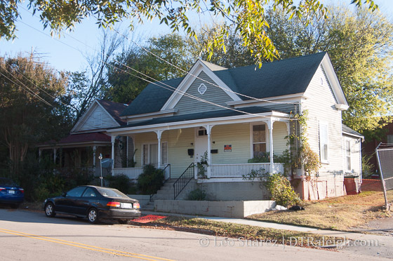
Houses on the 500 block of South West Street

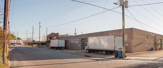
During the November 21, 2017, council meeting, a proposal to sell two city-owned lots on Bloodworth Street was pitched as a way to save two homes that are planned to be demolished. The folks behind The Fairweather will have to remove the two homes shown in the photo above that are located on West Street.

With the Raleigh Historic Development Commission’s help, the houses would be located on these lots with certain restrictive covenants on them and a piece of Raleigh history could be saved. The houses fit well in the Prince Hall Historic District as they date to the historic Fourth Ward, a predominantly African-American neighborhood in the early 1900s.

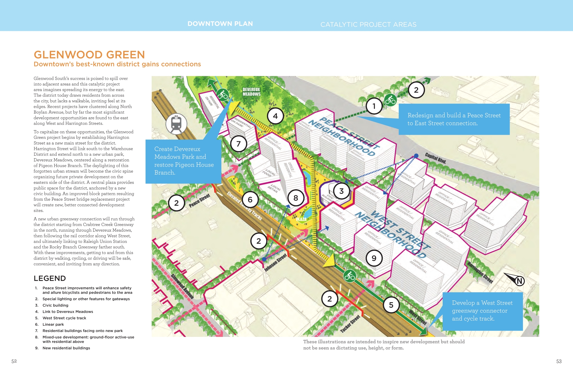
The move seems to make sense from a preservation aspect. Below is a map of the current location and the proposed new location, lots the city currently owns.

Map showing current location of the houses and proposed new location

Click for larger

To sweeten the pitch, Matt Tomasulo, the brains behind the project, talked to the council about the preservation of the homes and how he wants to use the houses for a cohousing project, a concept that would provide affordable living for service workers in downtown.

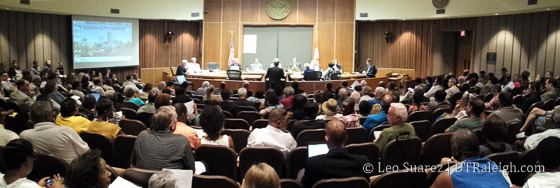
For me, this council video is a must watch for readers. At 20 minutes (you could probably just jump to the 2-minute mark and start from there) it’s an easy watch or listen. If you can’t see the video, watch it here on YouTube.

The idea has a lot of merit in my opinion but when you watch the video, you get a sense that creative problem-solving isn’t welcome to some of our councilors.

The motion to sell the properties was denied because there was not the 60% majority needed to approve the sale of the land. Council members Kay Crowder, Dickie Thompson, and David Cox voted against. (Branch was absent)

I don’t want this post to be about politics but this one just doesn’t sit well. I’m not sure who might lose in this scenario and am curious as to what kind of council we will have for the next two years.

Councilor Crowder and Thompson had concerns that approving a sale of city-owned property to a current sitting planning commissioner (Tomasulo) “doesn’t pass the sniff test” or wouldn’t be seen positively from the public’s perspective. There were also concerns that the properties should be open to public bid rather than a direct sale.

However, it was made clear that no public bid was needed when it was used for historic preservation. This process has been used in the past as a way to save historic structures when the alternative is demolition.

It was also made clear that planning commission members are volunteers and get no compensation for their work.

Corner of Bloodworth and Cabarrus Streets.

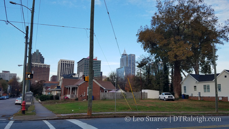
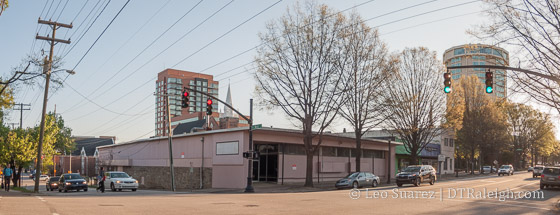
Corner of Bloodworth and Cabarrus Streets where the houses would go.

You can clearly see the lacking ability of objective decision-making during this exchange by some council members. In my opinion, the council should have no business in the end user here. If the Raleigh Historic Development Commission OKs the sale (they are the experts here) then it is in the public’s interest to sell city-owned land for preservation. (it is in a historic district after all)

I always try to consider the alternative but this is an example of creative problem-solving that institutional forces sometimes can’t appreciate. The only counter I can think of is if other needs are a higher priority than historic preservation. The councilors against didn’t voice any other concerns though with the land’s end use.

They used emotional “feelings” to deny something.

It should be seen as a bonus that they were able to ask questions about the end use, meet the eventual owner, etc. Tomasulo is just as much a Raleighite as you and I and the vote was carried out with an obvious bias.

The houses are set to be demolished in a few months. It is possible for the party behind this effort to come back in January to try again. I’d like to keep an eye on this one and see if RalCon readers can let their councilors know how they feel about an effort like this.

Strategy Forming Over Uses of City-owned Land in Downtown Raleigh

Downtown Raleigh skyline

The city has been moving forward with plans on how best to utilize the land they own in downtown Raleigh. Sell? Develop? To whom and for what?

The idea is to utilize the land that has now increased in value over the last few decades and put it towards supporting some policy goals in the city’s comprehensive plan, downtown plan, and other plans for example. The latest output of this study is the July 14, 2017 Downtown Land Disposition Strategy report which is the meat of today’s blog post.

Dive into the whole thing on the city’s website here.

The July 2017 report was prepared by HR&A Advisors and they are attempting to help the city figure out how to let go or repurpose eleven properties in and around downtown. The report offers possible reuse options, suggestions on how best to sell them, and projects of revenue generated.

The properties, some currently with active buildings and others as surface parking, are mapped below.

Map of city-owned properties, July 2017.

Map of city-owned properties, July 2017. Click for larger

To figure out what’s on the books, what goals the city is striving for, the following policy docs were reviewed:

  • City of Raleigh Strategic Plan (2015)
  • The 2030 Comprehensive Plan (2009)
  • The Downtown Plan (2015)
  • The System Plan for Parks, Recreation, and Cultural Resources
  • The Affordable Housing Improvement Plan (FY 2016-2020)
  • The Raleigh Arts Plan

HR&A was then able to pull some general goals from all this including:

  • Expand housing with emphasis on affordable/workforce housing
  • Encourage econonic development through recruiting business, promote tourism, and leverage transit
  • Enhance and expand parks and green space
  • Promote retail
  • Provide resource for community facilities like police, fire, libraries, and public parking
  • Preserve arts and culture

With the general goals defined, the next step is to prioritize and gauge the public on these. Through community meetings, attendees were asked to rank the importance of each one against the other. This chart sums up those findings.

Chart of Use Priorities Communicated by Community  Meeting Attendees, July 2017.

Use Priorities Communicated by Community Meeting Attendees. Click for larger

If you’ve been paying attention even for a little while, it would be easy to guess the top priority. Housing has been an increasing concern for the city as a whole and downtown’s revitalization is shaking up the former housing dynamic.

It’s listed as a clear top priority from the community feedback sessions with economic development being a second priority and community facilities being third.

So much for downtown retail and park space, right?

The report then goes into suggestions and projections for each of the eleven sites in downtown. To make it easier to digest, I’ve taken a snapshot of the report and embedded it into a google map for each parcel which you can see below.

I actually recommend you click through to the Google map itself to see the properties and their pop-ups which include the graphic with additional details. Clicking on the graphic there makes it bigger and easier to read. See it here.

Some quick highlights:

  • For the parking lots at the end of Fayetteville Street, major economic development with towers for office and hospitality.
  • The sites east of Moore Square should have housing along Bloodworth with mixed-use office and hospitality facing the square.
  • The City Market parking lot along Person Street could either stay the same or the parking lot be developed into housing.
  • The fire station facing Nash Square and adjacent properties would be repurposed into more offices or rezoned for higher density offices.

Finally, for those wondering what kind of revenue we’re talking about, the final page of the report gets into it. See it below.

Net City Revenue Impact, July 2017.

Net City Revenue Impact. Click for larger

It’s a big project for sure. There’s a push for consolidating city offices with a new campus on the current City Hall block. The offloading of these properties could help pay for that, some being very underutilized.

It’ll be interesting to see the next step although I feel this will be a long and carefully thought out process.

Saying Goodbye To 2016 and Looking Out Towards 2017

View from the Boylan Avenue Bridge, December 2016

View from the Boylan Avenue Bridge, December 2016

I’m always struggling to find a way to wrap up another year of downtown Raleighing that simply describes what took place. There’s just too much going on to do that.

There are things in planning, under construction, and being completed all the time. Shops and restaurants close and new ones open up.

For 2016, the development talks were the same as previous years. New residential, specifically apartment low-rises, came online or started construction. Toss in some new office and hotel spaces and that kind of rounds out the “2016 action.”

These projects are nice to follow and from my point-of-view, new apartment buildings for downtown Raleigh becoming the norm means we’ve hit a new level.

“Another apartment building with 200+ units? Not again.” said everyday in Raleigh 2016.

The way I see it, the novelty of new downtown apartments is wearing off and in a way, that means the momentum is still high.

Consider apartment buildings as just the details but the real projects that were worth following in 2016 involved transit. Raleigh Union Station and the GoRaleigh Transit Station (formerly the Moore Square Station in case you haven’t heard) were being worked on in 2016. More bike lanes popped up all around the city with a bike share plan in the works.

Finally, the county voted to raise the sales tax in order to pay for expanded transit options for Raleigh and surrounding municipalities. The first benefits of this should probably be seen in about two years and downtown Raleigh will be at the core of that expanded system.

Transit compliments downtown Raleigh in a huge way and if implemented well, we may just have even more apartment building projects, to follow in years to come.

2016 Highlights

As I just mentioned, transit was a huge topic in 2016. We followed the progress of Raleigh Union Station in 2016, will watch it take shape in 2017 to its opening in 2018.

If that’s too long to wait, the GoRaleigh Transit Station will be completed in 2017. Additional amenities and an updated design await for the 30-year-old bus station now being worked.

West South Street, August 2016

West South Street, August 2016

More transportation than transit, the two-way conversion of South Street and Lenoir is seeing some big impacts. The West South Street area is seeing huge changes and in 2017, we’ll follow a slew of new residential and renovation projects in that area.

For more on that, you can revisit a post from my Walk series on South Street.

In 2016, cranes were spotted in downtown Raleigh. There’s a lot of action taking place at The Dillon, an upcoming 17-story office tower for the warehouse district.

The Residence Inn hotel was under construction for practically the entire year, with foundation work taking place about a year ago today.

We’re also watching the latest apartment building rise up, The Metropolitan, at the former site of the Greyhound Bus Station on Jones Street. At the pace that these things go up, my guess is that it opens in 2017.

Back to transportation, 2017 will see huge impacts from the Capital Boulevard bridge replacement project. The flyover bridge at Wade Avenue and Capital is being worked on now but we should see the work for the Peace Street bridge and upcoming square loop redesign start in 2017. I cannot recommend the following video enough to get you familiar with this project.

See Capital Boulevard Bridge Replacements on YouTube.

2017 Action

In 2017, here’s what downtown Raleigh has in the pipeline.

  • Still in the planning stages, the Smokey Hollow project plans for a 400-unit apartment tower at the corner of Peace and West Street. The biggest rumor in downtown is that a Publix grocery store is planned for this location but it has not been confirmed publicly as of yet.
  • The city is working on a plan for a new municipal campus for their block to the north of Nash Square. Today, city departments are spread out across multiple locations and this new campus is an effort to bring departments closer together. The city is currently looking for a consultant on the plan.
  • We’ve touched on the plans for Gateway Southeast, or the Exploris School, at Gateway Center already and in 2017, it’s possibly we’ll see dirt moving in this area.
  • After a huge announcement of the sale of the N&O block, perhaps plans for new development here will surface in 2017. One of the first things that have to happen is a new home for the newspaper so some kind of office component should be released soon.
  • One Glenwood is still being planned but could start in 2017.
  • We spotted plans for 301 Hillsborough Street, the highly mixed-use project for Hillsborough Street, recently and 2017 may be the year that the surface parking lots are torn up for cranes.
  • *Broken record* South Street will transform!
  • Stone’s Warehouse may start their renovations in 2017 as well.
  • After the GoRaleigh Transit Station completes its work, the redesign of Moore Square may just (finally) begin in 2017.
  • Could we also see the start of the long-awaited Charter Square North tower in 2017?

Finally, for this blog, I’ll be writing, photoing, coding right into its tenth year.

Happy new year, everyone!

Raleigh Agenda: The City of Raleigh wants to improve the Southern Gateway

I’m contributing to a new online site called Raleigh Agenda. They launched earlier this month and I’m hoping to expand on some greater Raleigh development and other topics there as an addition to the blog. I recommend you check it out and subscribe to the email newsletter.

I have a post up there now about the city’s southern gateway and the vision plans around invigorating this tired, neglected area of the city. From the article:

It may be ironic then that this area, the Southern Gateway, is lacking the same kind of investment that other areas of the city are experiencing. An extremely vehicle-accessible area with roads like Saunders, Wilmington, MLK Boulevard, and the behemoth, I-40, are actually negatively impacting new investment.

*The City of Raleigh wants to improve the Southern Gateway via Raleigh Agenda.

Revisiting The Gateway Center

The end of Kindley Street, June 2016

The end of Kindley Street, June 2016. Click for a larger, wider view of the site.

I wanted to turn our attention today to what is being called downtown’s Gateway Center. The Downtown Plan calls out the area around the Performing Arts Center and the Raleigh Convention Center as a possible “catalytic project area” and sums it up as:

Coined the “Gateway Center,” this area is the only part of downtown capable of accommodating multiple blocks of large-footprint mixed-use development. Its proximity to the Convention Center and Duke Energy Center for the Performing Arts will naturally lend its future to expanding tourism and entertainment-related uses, such as a large-scale sports and/or cultural facility, additional hotels, or a campus of related businesses.

*Raleigh Downtown Plan

Regular readers are probably familiar with this already because of the plan’s two concepts for this area, one of them includes a sporting arena. Let’s revisit those two concepts from the plan.

Concept 1
Gateway Center Concept 1

Click for larger and more info.

This concept imagines space to develop an Urban Innovation Campus for a new anchor employer or cluster of businesses. With easy access to several forms of transportation and close proximity to Fayetteville Street, the Warehouse District, and the heart of downtown Raleigh, this location has much to offer. New landmark structures provide the missing link between the Duke Energy Center for the Performing Arts and the rest of Fayetteville Street. These buildings could be linked to the Urban Innovation Campus, home to another employer, or even a hotel.

Concept 2
Gateway Center Concept 1

Click for larger

In this concept, the heart of the district is a new citywide destination. Either cultural, entertainment, or sporting in nature (or a mix of all three), the center anchors the district and provides a new draw for the city as a whole. The specific location for this use in the southwest corner
of the district is advantageous for several reasons. Positioning any large-footprint building towards the southwest corner of the district allows its architecture to frame the new southern gateway. The rest of the site is arranged into walkable city blocks that link the new district back to Fayetteville Street. In this way, a single entertainment or cultural use acts as a magnet to draw visitors to and through the district without becoming a barrier to walkability. Siting the largest development at the edge also capitalizes on the site’s natural topography, allowing the potential for underground parking easily accessed from main roads around downtown. Throughout the district, active ground-floor uses and building setbacks help break down the scale of larger buildings.

There’s more in the Downtown Plan which I recommend you download and take a look.

I also want to give some love to one of the most popular posts here on the blog. Reader Will imagined a baseball stadium in the Gateway Center and submitted some sketches. Check them out once again.

It’s important to note that the focus in the Gateway Center, at least according to internet chatter, is around where this possible stadium could go, the southwestern tip. The actual focus area does include the convention center, performing arts center, and the southern end of Fayetteville Street.

However, it’s that southwest tip that I want to zoom in on with a Google map showing the four properties there.

A bit of related news for the Gateway Center. The Exploris School, a charter school in downtown Raleigh, has purchased one of the properties that make up the Gateway Center. (highlighted in orange in the map)

Exploris has been a middle school for some time, located on Hillsborough Street. Two years ago, the elementary school opened in a temporary home on New Bern Avenue. The school has been looking for space to consolidate it all.

The former home of a data center for Duke Energy, the property actually looks perfect for a school campus. The lot has surface parking, an open field, and more room than Exploris needs. Plans call to renovate the extra space and lease it out as office space.

At this point, you, especially the skyscraper fans, may be noticing an incompatibility. This doesn’t seem to match the vision laid out in the Downtown Plan. It may stifle dense development in this area of downtown.

I think you are right but I’d like to lay out a different, more positive perspective.

Let’s look at the timing of things. The Downtown Plan was adopted in late 2015. Exploris has been looking for space since 2014, maybe even earlier. With the plan being a 10-year vision, we shouldn’t expect announcements for multi-building clusters in the south of downtown not even one-year into the plan.

We have until 2025 to really see the Gateway Center blossom and we can’t assume that Exploris is going to stay in this space forever. Like any other business or institution, they may outgrow the space or move into the new development of the future.

For me, I’ll take a progressive school like Exploris here than a monolithic infrastructure company like Duke Energy any day. I see Exploris “cracking the mold” to that site in a way.

One factor that I believe greatly ties into Gateway Center is Dix Park. These two areas are so close and Gateway Center could really be the connection between downtown Raleigh and Dix Park. Planning is in the infant stages as this year’s city budget, recently approved, starts the purchasing process for the land.

The MLK/Western interchange with McDowell and Dawson Street limits connectivity but it could be a great challenge for the future with respects to tying Dix into the downtown fabric.

The city also has a Southern Gateway Corridor Study underway with a final plan expected by this Fall. This is the area from MLK/Western to about I-40.

The City is exploring ideas for land use and transportation improvements along the corridor that will benefit businesses, residents, motorists, transit riders, pedestrians, and bicyclists.

The study even highlights Gateway Center in their map!

With more development taking place back in downtown, there are a lot of moving parts here. The Gateway Center and the vision laid out in the downtown plan still have a great shot at coming to life.

Consolidating City Offices Into a New Downtown Campus

Corner of McDowell and Hargett Streets

Corner of McDowell and Hargett Streets

The City of Raleigh has around 1,100 employees and in downtown, you can find them in a variety of places. One Exchange plaza on Fayetteville Street, behind the old Raleigh Union Depot facing Nash Square, and the City Hall block are just a few of them. In May, the city started discussing the possibility of consolidating those spaces, possibly others, into a downtown municipal campus.

The idea is to plan for new growth in a cost-effective way. The process to get there might involve selling off some city-owned properties. Right now, the thinking is to build this new campus on the current site of City Hall, the block bounded by Hargett/Morgan and McDowell/Dawson Streets. It would be paid for, partially, by selling some of the properties mentioned above and possibly others.

By looking at data from iMaps, I created this map of city-owned property in the downtown area.

For completeness, I searched for two terms, “City of Raleigh” and “Raleigh city of” to get those properties. There may be more but this covers a good amount. I combined a few together where it made sense and did not add some individual properties that I would consider to be in the East Downtown neighborhoods.

It’s interesting to see how much land there is but some of it makes sense with all the parking decks and cultural places like the Performing Arts Center and the Convention Center. The city owns, basically, zero properties in Glenwood South.

At this time, the city will work on landing a consultant to help with the process.

Long time readers may be experiencing Déjà vu here as the city has gone through a similar approach in recent history. Consolidating offices into a downtown tower, the Clarence E. Lightner Public Safety Center, was a big controversy in 2010. It eventually was scrapped as the cost, around $225 million, was seen as too high, among other concerns.

Rendering of the Lightner Tower

2010 rendering of the Clarence E. Lightner Public Safety Center

In the rendering, you can see that the 17-story tower would have replaced the Raleigh Police Department Headquarters building at the corner of Hargett and McDowell Streets. Since about that time, the RPD building has been empty and temporary offices set up elsewhere. (the downtown district offices are on Cabarrus Street)

Here we are in 2016 and a similar proposal is on the table with some differences. Rather than the term “tower” the term “campus” is being used. I cringe when I hear this term as “campus” reminds me of an office park with short, expansive buildings set back way too far from the street. Or worse, it reminds me of the state government “campus.”

I’m open to it though as the Downtown Raleigh plan makes a few recommendations for this area.

Hargett Street Should be a Pedestrian-oriented Street

  • “continue to evolve as key pedestrian-oriented retail streets”
  • “MA-3 Focus on downtown streets like Hargett and Martin Streets to create a great walking and retail environment from Raleigh Union Station to Moore Square and beyond.”
  • “a renovated Nash Square will seek to keep its center a peaceful respite, instead focusing energy and programming on the Hargett and Martin Street edges.”
  • “prioritizing Hargett and Martin as locations for restaurants and shops.”
  • “A new vision for existing city facilities located on the block north of Nash Square will bring a more vibrant mix of uses and street level activity to Hargett Street.”

That last one brings it home. In fact, the entire idea of redeveloping the City Hall block is right in the plan itself.

Hopefully, the consultant is shown this plan and can create active edges, especially along the Hargett Street side. Office space and parking will most likely be a part of the “campus” plan so to create more active streets and sidewalks, ground-floor retail space and an interior parking deck would be great elements of the plan.

A Walk Up North West Street

Staring down North West Street at Hillsborough Street

On an early morning weekday, I went for a walk up North West Street to check out a few projects and take photos of the current state of the street. West Street is an important street in my opinion as it is a direct connection from the Warehouse District to Glenwood South. Right now, it is more of a go-through street (by vehicle or bike) as opposed to a pedestrian hub of activity. That doesn’t mean there isn’t potential for a different face in the future.

There isn’t much to look at but the potential for new projects here is huge. There isn’t much retail or commercial right now. Some blocks of West are even lacking sidewalks.

While Glenwood Avenue is the primary pedestrian corridor of Glenwood South, West Street might do the heavy lifting with higher density projects in the near future as well as provide better connectivity in and out of the area.

Below is a map I made of highlights up and down North West Street. Let me know if a nearby project is missing and I can add it for completeness.

Open up the map yourself here.

At West and Hillsborough Street, you can already see the empty spaces ready for new uses. The mid-1900s storefronts along Hillsborough and the almost empty block at the corner of Hillsborough and West have been waiting for years. Would you consider this Glenwood South? I feel like this intersection doesn’t belong to either Glenwood South or the Warehouse District so the revitalization of those districts haven’t hit here yet.

Corner of West Street and Hillsborough Street

What could get this area moving are two, big nearby projects. One Glenwood and 301 Hillsborough are about two blocks along Hillsborough in each direction. Those two “bookend” projects could invigorate the street between them.

Heading north, the intersection of West and Jones could be much livelier in the near future. The Link Apartments has recently been finished at the Northeast corner and more residential units are planned at the Greyhound Apartments one block to the east.

The Link Apartments are now open at West and Jones.

The Raleigh Electric Company Power House building is an icon on Jones Street and we’re still waiting to see what comes of the space after Natty Greene’s lease was pulled last summer.

At the end of the block, we’re also waiting for the future offices of Google to open. It’s a high-profile company for sure but I still have mixed feelings against Google taking a great looking building and using it for offices and not something more active, especially in Glenwood South. We’ll see how it turns out.

Moving on, we pass multiple surface parking lots. I hope one-day that these lots will be replaced with more buildings that support more active uses.

The first example of when this could happen is at West and Tucker Street. The east side of West Street has had plans for years for more apartments. The West Apartments and West II Apartments have been in planning for awhile. I haven’t seen big changes to the plans but we’ve known about these projects since 2012. Hopefully, things will move on that in the near future as it is a big infill project as you can see on the map.

The West Apartments are planned for this surface lot.

A project that has been talked about for years, and is always worth highlighting, is not one around the street but under it. The Pigeon House Branch creek is buried below the area around North West Street. You can catch a glimpse of the creek about mid-block between Tucker and Johnson Street.

Creek to the left, street to the right.

Talks of opening up the creek have come and gone for awhile and it could be an asset in the newest Downtown Plan. The Glenwood Green district shows a plan for redevelopment in this area with a greenway that follows the creek path. It could be one of the most unique areas in downtown around that natural water feature.

Screenshot from the latest Downtown Plan.

West Street becomes more desolate around Johnson Street with the west side lacking sidewalks and more surface parking nearby.

Recently, news came out about the purchase of the buildings at 600 North West Street, the current location of Southland Ballroom and Themeworks. It was purchased by a joint effort involving Kane Realty and Williams Realty & Building Co.

No plans are out yet for the site. Once the replacement of the Capital Boulevard Bridge is finished, the area will see a reconfigured Harrington Street that connects to Peace rather than bending over to connect to West Street. Those plans may have played a factor in the area’s attractiveness to invest.

600 North West Street, current home of Themeworks and Southland Ballroom.

Hitting Peace Street, the walk has to continue northward. I hadn’t noticed before but the pedestrian amenities are much improved at West and Peace.

North of Peace Street, West Street doesn’t resemble the straight-as-an-arrow urban street but changes to a swerving street as it edges up against the Pigeon House Branch Creek. This light industrial and commercial area is seeing some signs of new activity.

Renovation almost complete at the corner of West and Peace.

At the Northwest corner of Peace and West, the renovation of the building where Lighting Inc used to be looks to be almost completed. The Lundy Group has come in here and bought this building and a few behind it for future redevelopment. Technology companies will be moving in here soon once the former Lighting Inc. building is finished.

While the area gets less urban the more north you go, there is something to be said about the view. Best view of downtown, in my opinion. Who can build a condo here for me?

The land topography may prove to be more challenging for a new development but with a possible park to the south called Devereux Meadows (see the Glenwood Greens plan above) it’s just a matter of time before this area gets built up.

Along the 800 “block”, a fantastic warehouse renovation has taken place. At this time, Morehead Capital is the current tenant.

There are also plans for the house next door. Each are shown in this photo below.

Old house at 713 North West Street, next to the warehouse renovation at 801 North West Street.

Development plans are on the city’s website for The Cardinal (SR-20-16), a bar and lounge planned for the house there at 713 North West Street. The lot next to it will be paved for surface parking.

I finished my walk once I hit 1000 North West Street and decided that was good enough. It’s all industrial at this point and with West ending at Wade, there isn’t much traffic. That could change if, as part of the Capital Boulevard Corridor, West Street is extended northward to connect to Fairview Road.

It may not look like it but West Street could be poised for something big and the pieces just feel like they are coming together for this very important downtown street.

Municipography, Food Trucks and Raleigh Bikeshare

title

Municipography is a summary of current issues going through the Raleigh City Council and other municipal departments in the city. The point is to try to deliver any video, photos, and text associated with the discussions happening at City Hall or elsewhere. Since this is a downtown Raleigh blog, the focus is on the center of the city.

No embedded videos this week as for some reason, the city’s streaming video service is auto-playing the videos. I’m not into that.

Two long-talked topics were approved at this week’s city council meeting. The food truck debate has been a long one and a new pilot program will be rolled out to see how they operate on public property in and near downtown. Also, Raleigh will get its first bike share system in the coming years.

Food trucks

To watch/hear the discussion, click here.

The latest in the food truck saga is over the mobile food businesses operating in the public right-of-way. The plan is to designate five “zones” where the trucks can operate during the lunchtime hours. (10am-3pm) First Fridays will extend those hours to 8pm.

The five locations include:

  • The Warehouse District
  • Polk Street near the State Government Center
  • South State Street near the NC DMV
  • Bloodworth Street between Martin and Davie
  • The northern end of Moore Square

At this time, the Moore Square zone was dropped due to all the construction from the GoRaleigh Transit Station and Moore Square renovation.

The plan with the four zones passed unanimously and the new food truck pilot could be in place in 2-3 months.

Raleigh Bike share
To watch the video, click here and jump to around the 48th minute.

We talked about bike share in Raleigh recently and after a work session earlier in the day, the council decided to vote on it.

The plan was approved after a few brief comments. While councilors recognized that the city has needs outside of funding a bike share, the opportunity to have 80% of the installation costs covered by a federal grant was one they felt had to be taken. There was also lots of interest from the private sector to sponsor the system and the bike community was very vocal about their support.

“It’s up to you guys to use the system,” said Councilor Thompson. After three year, the system will be evaluated. It will most likely take two years to finalize the details and roll out the bike share system.